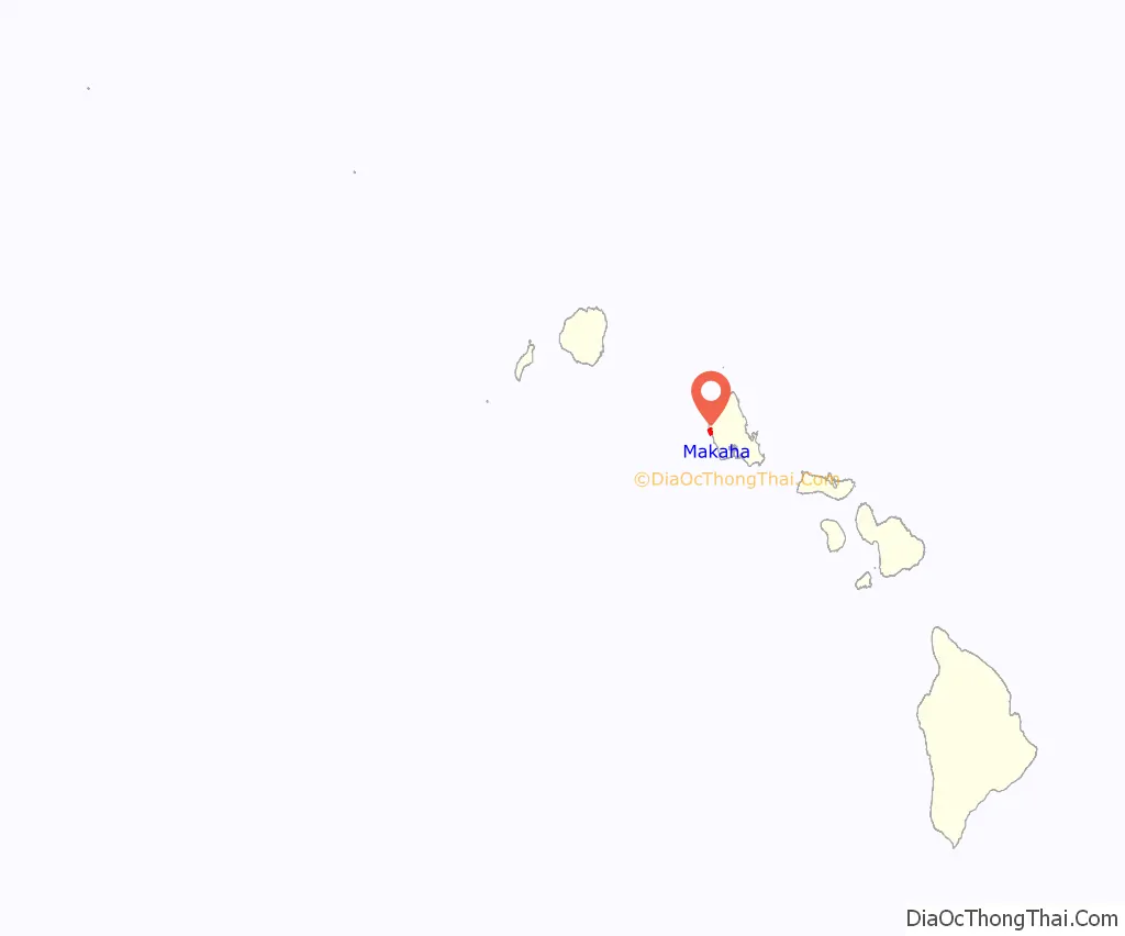
Mākaha (Hawaiian for “fierce”, or “savage”, pronounced [maːˈkɐhə]) is a census-designated place (CDP) in Honolulu County, Hawaiʻi, United States. It is a town located along the Pacific coast, west of the Mākaha Valley, and at the foot of Mt. Ka’ala in the Wai’anae Mountain Range. It is the last of the leeward towns on O’ahu. North of Mākaha there is no development, i.e. no towns, no gas stations, or restaurants. The population of Mākaha was 8,278 at the 2010 census. It is located 35 miles northwest of Honolulu, but is a part of Honolulu County.
In the Hawaiian language its name means “fierce” or “savage”, which refers to the group of bandits who were based in the Mākaha Valley. They would hide and wait for unsuspecting passersby to show up, and then plunder and pillage them. Mākaha has a higher percentage of Native Hawaiians and other Pacific islanders than most settlements on O’ahu; 26.2% of the population were Pacific Islanders in 2010. Mākaha Resort stages weekend traditional Hawaiian arts and crafts fairs and other Hawaiian cultural programs in order to preserve the Native Hawaiian traditions in Mākaha.
The town is particularly known for its surfing waves and surfing history, the Hawaiian temple Kāne’āki Heiau, and Mākaha Beach Park, which is a nesting place for several species of sea turtles. Aside from surfing, other water activities include diving, canoe-surfing, fishing, tandem surfing, bodysurfing, and other recreational water sports. Kāne’āki Heiau is Hawaii’s most thoroughly restored ancient heiau, it was excavated by Bishop Museum archeologists in 1970 and can now be visited Tuesdays-Sundays. It originated as an agricultural temple to the god Lono in the 15th century. 200 years later, it was converted into a luakini, where human sacrifices were dedicated to the god Kū – a typical progression indicating Mākaha now supported a large enough population to have its own chief.
| Name: | Makaha CDP |
|---|---|
| LSAD Code: | 57 |
| LSAD Description: | CDP (suffix) |
| State: | Hawaii |
| County: | Honolulu County |
| Elevation: | 20 ft (6 m) |
| Total Area: | 5.55 sq mi (14.39 km²) |
| Land Area: | 2.69 sq mi (6.97 km²) |
| Water Area: | 2.87 sq mi (7.42 km²) |
| Total Population: | 9,916 |
| Population Density: | 3,686.25/sq mi (1,423.25/km²) |
| ZIP code: | 96792 |
| Area code: | 808 |
| FIPS code: | 1547450 |
| GNISfeature ID: | 0362017 |
Online Interactive Map
Click on ![]() to view map in "full screen" mode.
to view map in "full screen" mode.
Makaha location map. Where is Makaha CDP?
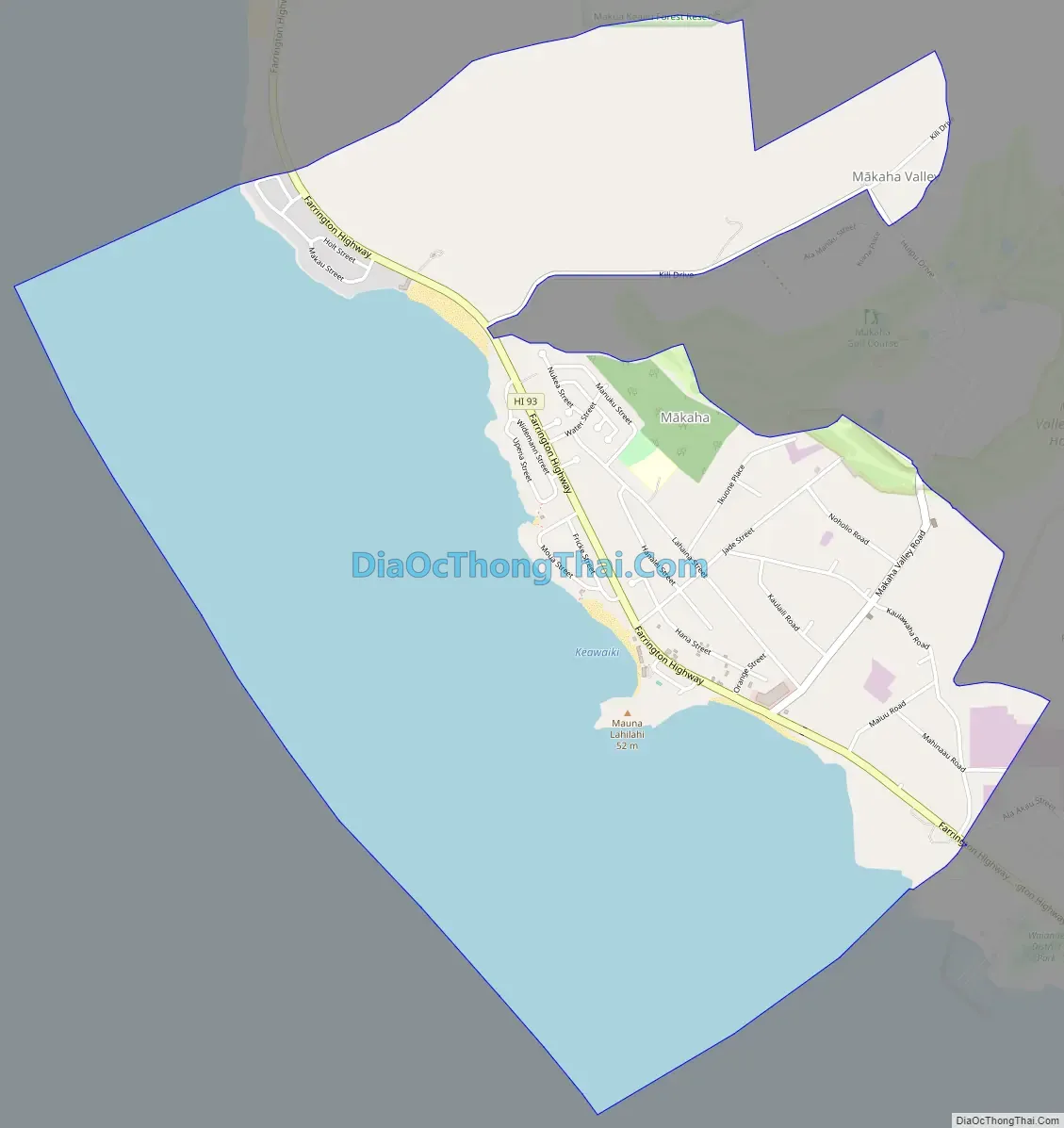
Makaha Road Map
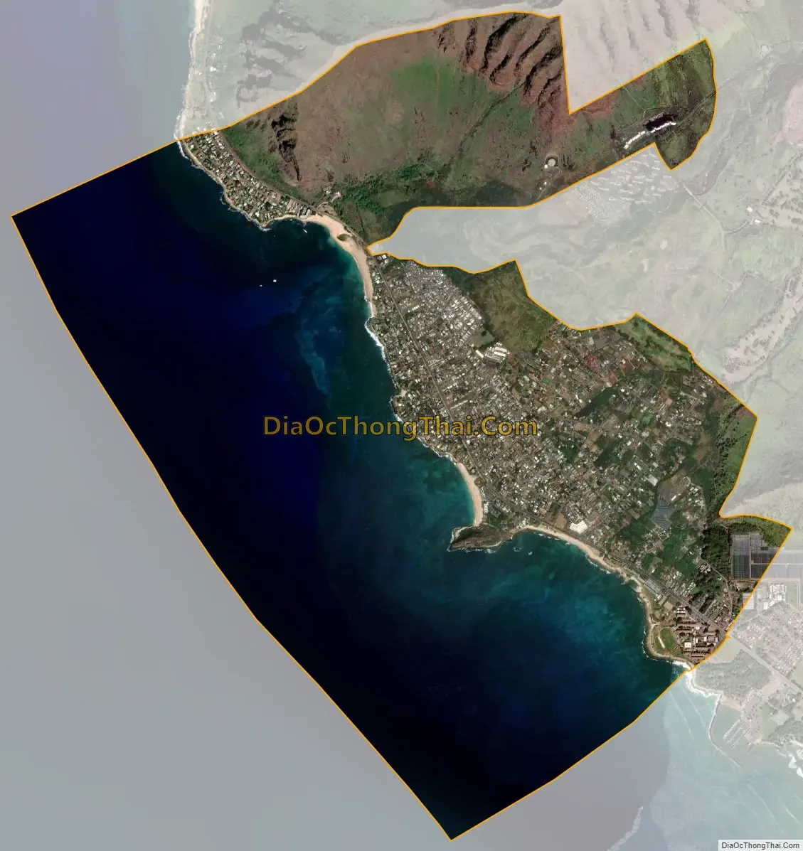
Makaha city Satellite Map
Geography
Mākaha is located at 21°28′14″N 158°12′51″W / 21.47056°N 158.21417°W / 21.47056; -158.21417 (21.470569, -158.214159). According to the United States Census Bureau, the CDP has a total area of 5.2 square miles (13 km), of which 2.3 square miles (6.0 km) is land and 2.9 square miles (7.5 km), or 55.53%, is water. Mākaha is the last town going northbound on the leeward side of O’ahu, and is a part of Honolulu County. It is located at the bottom of the Waianae Mountains, adjacent to the Pacific Ocean in the west and the Mākaha Valley to the east. It is located at the foot of Mt. Ka’ala, which is just east of Mākaha and is the highest point on the island of O’ahu at 4,020 feet.
To get here by public transportation, the express city bus C (Route C – Country Express) is the most direct option, as it stays along the coast. The Bus 40 goes up Mākaha Valley Road to the golf courses and then goes down Kili Drive to Mākaha Beach Park. It leaves daily from the Ala Moana Shopping Center in Downtown Honolulu. By car, you would want to follow Kamehameha Highway just north off Pearl Harbor, and then onto Farrington Highway (93) in the west. You would want to follow Farrington Highway northbound on Oahu’s west shore until you pass the neighboring town of Waiʻanae. The town of Mākaha is next, and the last one of the leeward towns on O’ahu. Mākaha Beach Park in the town center is located on 84-369 Farrington Hwy, Makaha HI 96792.
See also
Map of Hawaii State and its subdivision: Map of other states:- Alabama
- Alaska
- Arizona
- Arkansas
- California
- Colorado
- Connecticut
- Delaware
- District of Columbia
- Florida
- Georgia
- Hawaii
- Idaho
- Illinois
- Indiana
- Iowa
- Kansas
- Kentucky
- Louisiana
- Maine
- Maryland
- Massachusetts
- Michigan
- Minnesota
- Mississippi
- Missouri
- Montana
- Nebraska
- Nevada
- New Hampshire
- New Jersey
- New Mexico
- New York
- North Carolina
- North Dakota
- Ohio
- Oklahoma
- Oregon
- Pennsylvania
- Rhode Island
- South Carolina
- South Dakota
- Tennessee
- Texas
- Utah
- Vermont
- Virginia
- Washington
- West Virginia
- Wisconsin
- Wyoming


