Mililani (Hawaiian pronunciation: [miliˈlɐni]) is a city located near the center of the island of Oʻahu in Honolulu County, Hawaiʻi, United States. It consists of two census-designated places, Mililani Town, with a population of 28,121 at the 2020 census, and Mililani Mauka, with a 2020 census population of 21,075.
| Name: | Mililani Town CDP |
|---|---|
| LSAD Code: | 57 |
| LSAD Description: | CDP (suffix) |
| State: | Hawaii |
| County: | Honolulu County |
| Elevation: | 627 ft (191 m) |
| Total Area: | 6.6 sq mi (17.1 km²) |
| Land Area: | 6.6 sq mi (17.1 km²) |
| Water Area: | 0.0 sq mi (0.0 km²) |
| Total Population: | 48,668 |
| Population Density: | 7,400/sq mi (2,800/km²) |
| ZIP code: | 96789 |
| Area code: | 808 |
| FIPS code: | 1551050 |
| GNISfeature ID: | 2414101 |
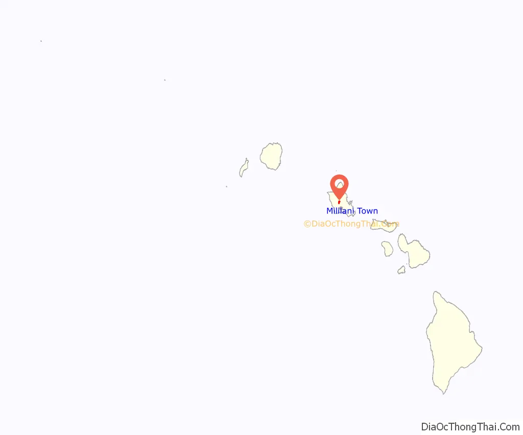
Online Interactive Map
Click on ![]() to view map in "full screen" mode.
to view map in "full screen" mode.
Mililani Town location map. Where is Mililani Town CDP?
History
Mililani sits on former plantation fields owned by Castle & Cooke, which began planning for its development in 1958 under its Oceanic Properties subsidiary. Castle & Cooke’s plan was to collaborate with planners and architects on making Mililani Town a satellite city that would satisfy Oʻahu’s pent-up demand for housing with a new affordable community. It was planned to eventually support a population of 75,000 people. Architect and developer Al Boeke, who would later create the planned community of Sea Ranch, California, was the development director of Mililani. The first homes in Mililani went on sale on June 23, 1968.
In 1976, Interstate H-2 opened for Mililani, cutting travel time from Mililani to Honolulu in half. In 1986, Mililani was named an All-America City in recognition of a community effort to clean up drinking water contaminated with agricultural pesticides. It is the only community in Hawaiʻi ever to receive this distinction.
On April 6, 1990, ground was broken for Mililani Mauka, a newer and more upscale community east of the Interstate H-2. The first homeowners moved into Mauka in 1992.
In 2003, Mililani was designated as the pilot site for the City and County of Honolulu’s curbside recycling program. In 2005, Money magazine named Mililani as one of the best places to live in the U.S. In 2006, Mililani ʻIke Elementary School first grade teacher Phyllis Nakama-Kawamoto was named Hawaiʻi’s American Star of Teaching by the U.S. Department of Education.
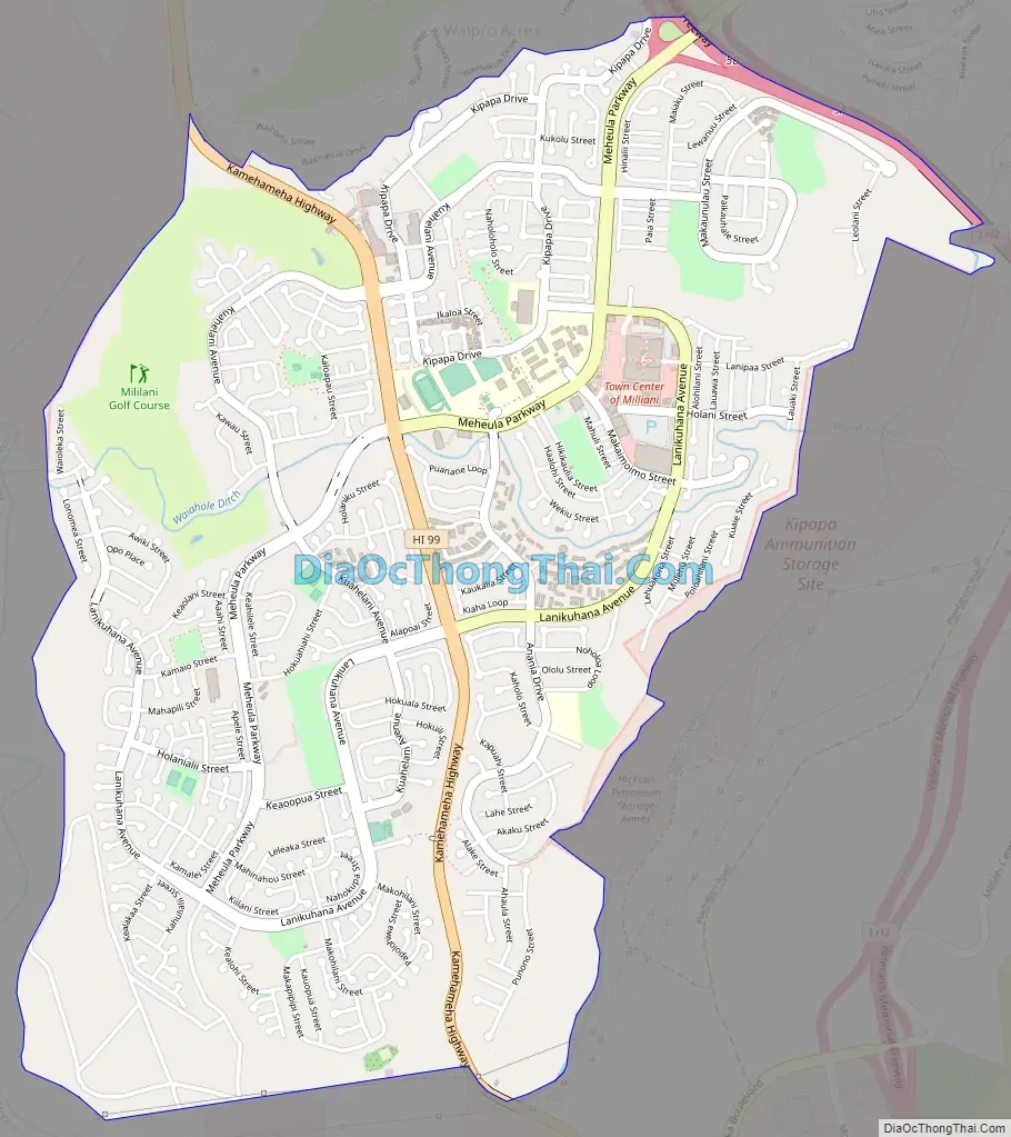
Mililani Town Road Map
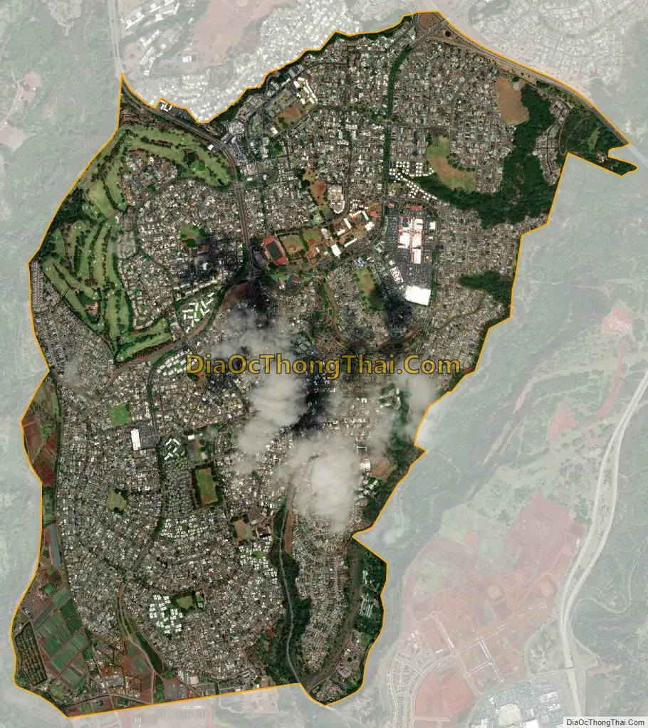
Mililani Town city Satellite Map
Geography
Mililani Town is located at 21°26′46″N 158°00′51″W / 21.4460°N 158.0142°W / 21.4460; -158.0142, near the center of Oʻahu Island, on the plateau or “central valley” between the two volcanic mountains that comprise the island. It is in the Central District and the City & County of Honolulu. The town is somewhat physically confined between the two large central Oʻahu gulches of Waikele and Kīpapa.
Travelling north on either Kamehameha Highway (State Rte. 99) or Interstate H-2 connects the traveller with Wahiawā. Travelling south on either of these arteries connects to Waipiʻo.
According to the United States Census Bureau, the Mililani Town CDP has a total area of 4.0 square miles (10.4 km), of which 7,386 square metres (79,500 sq ft), or 0.07%, is water.
The U.S. postal code for Mililani is 96789.
See also
Map of Hawaii State and its subdivision: Map of other states:- Alabama
- Alaska
- Arizona
- Arkansas
- California
- Colorado
- Connecticut
- Delaware
- District of Columbia
- Florida
- Georgia
- Hawaii
- Idaho
- Illinois
- Indiana
- Iowa
- Kansas
- Kentucky
- Louisiana
- Maine
- Maryland
- Massachusetts
- Michigan
- Minnesota
- Mississippi
- Missouri
- Montana
- Nebraska
- Nevada
- New Hampshire
- New Jersey
- New Mexico
- New York
- North Carolina
- North Dakota
- Ohio
- Oklahoma
- Oregon
- Pennsylvania
- Rhode Island
- South Carolina
- South Dakota
- Tennessee
- Texas
- Utah
- Vermont
- Virginia
- Washington
- West Virginia
- Wisconsin
- Wyoming


