Nānākuli (Hawaiian pronunciation: [naːnaːˈkuli]) is a census-designated place (CDP) on the west coast of the island of Oʻahu, City and County of Honolulu, Hawaii, United States. In Hawaiian, nānā kuli means literally “look at knee”. The population was 11,461 at the 2020 census.
| Name: | Nanakuli CDP |
|---|---|
| LSAD Code: | 57 |
| LSAD Description: | CDP (suffix) |
| State: | Hawaii |
| County: | Honolulu County |
| Elevation: | 10 ft (3 m) |
| Total Area: | 6.57 sq mi (17.01 km²) |
| Land Area: | 2.99 sq mi (7.74 km²) |
| Water Area: | 3.58 sq mi (9.26 km²) |
| Total Population: | 12,195 |
| Population Density: | 4,079.96/sq mi (1,575.27/km²) |
| Area code: | 808 |
| FIPS code: | 1553900 |
| GNISfeature ID: | 0362575 |
Online Interactive Map
Click on ![]() to view map in "full screen" mode.
to view map in "full screen" mode.
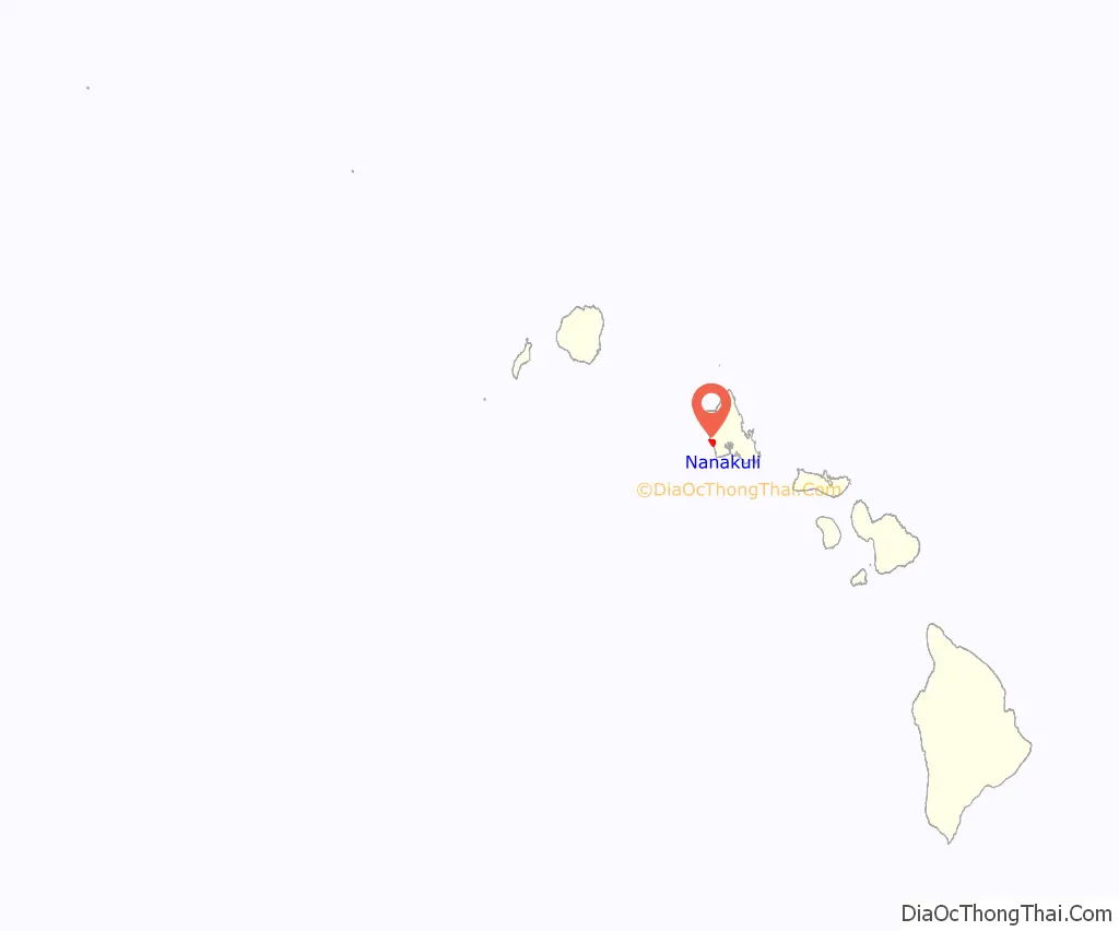
Nanakuli location map. Where is Nanakuli CDP?
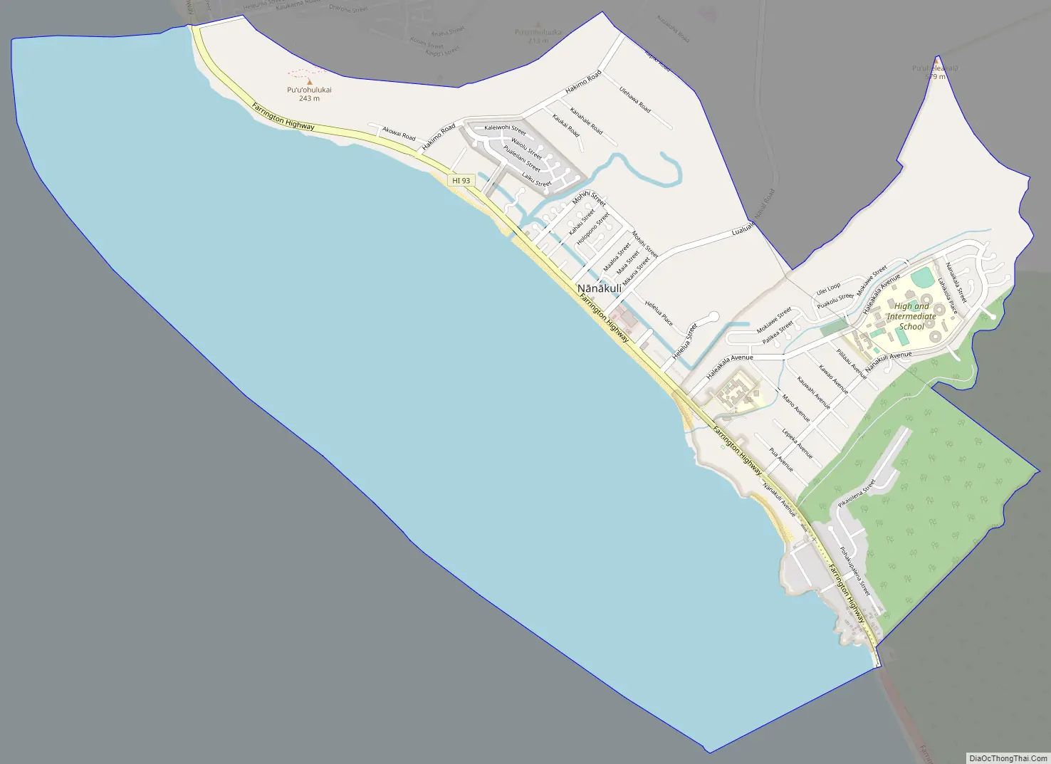
Nanakuli Road Map
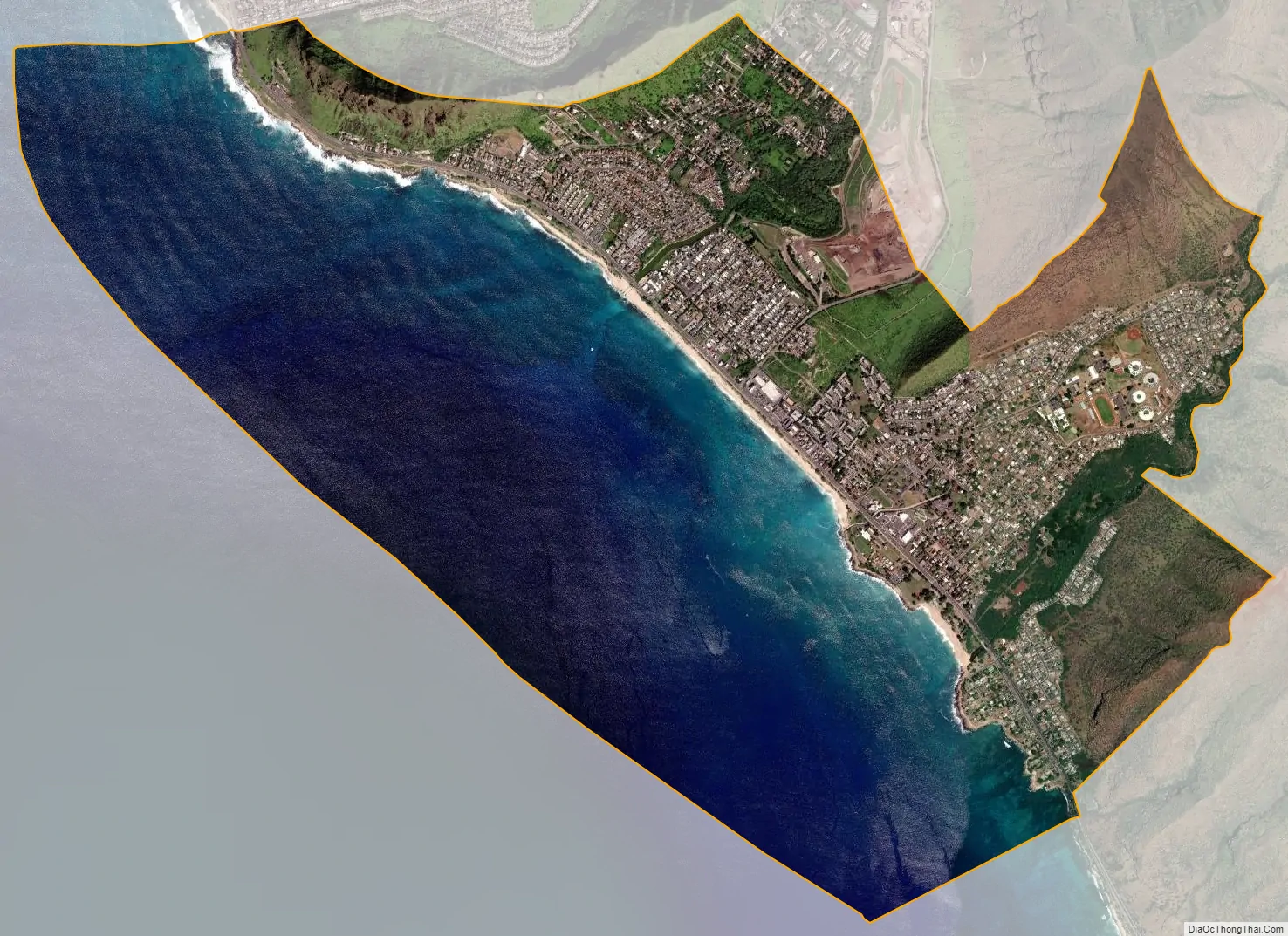
Nanakuli city Satellite Map
Geography
Nānākuli is 48 km (30 miles) away from Honolulu, and is located near the southern end of the Waiʻanae mountain. It is accessible from Farrington Highway, though most residents live in the valley. A popular park, Nānākuli Beach Park, is nearby.
See also
Map of Hawaii State and its subdivision: Map of other states:- Alabama
- Alaska
- Arizona
- Arkansas
- California
- Colorado
- Connecticut
- Delaware
- District of Columbia
- Florida
- Georgia
- Hawaii
- Idaho
- Illinois
- Indiana
- Iowa
- Kansas
- Kentucky
- Louisiana
- Maine
- Maryland
- Massachusetts
- Michigan
- Minnesota
- Mississippi
- Missouri
- Montana
- Nebraska
- Nevada
- New Hampshire
- New Jersey
- New Mexico
- New York
- North Carolina
- North Dakota
- Ohio
- Oklahoma
- Oregon
- Pennsylvania
- Rhode Island
- South Carolina
- South Dakota
- Tennessee
- Texas
- Utah
- Vermont
- Virginia
- Washington
- West Virginia
- Wisconsin
- Wyoming


