Royal Kunia is a census-designated place (CDP) on the island of Oʻahu in the City & County of Honolulu, Hawaiʻi, United States. As of the 2020 census,the population of the CDP was 14,896. The area was recorded as the Village Park CDP in prior censuses.
| Name: | Royal Kunia CDP |
|---|---|
| LSAD Code: | 57 |
| LSAD Description: | CDP (suffix) |
| State: | Hawaii |
| County: | Honolulu County |
| Elevation: | 440 ft (130 m) |
| Total Area: | 3.01 sq mi (7.80 km²) |
| Land Area: | 3.01 sq mi (7.80 km²) |
| Water Area: | 0.00 sq mi (0.00 km²) |
| Total Population: | 14,896 |
| Population Density: | 4,947.19/sq mi (1,910.28/km²) |
| ZIP code: | 96797 |
| Area code: | 808 |
| FIPS code: | 1568815 |
Online Interactive Map
Click on ![]() to view map in "full screen" mode.
to view map in "full screen" mode.
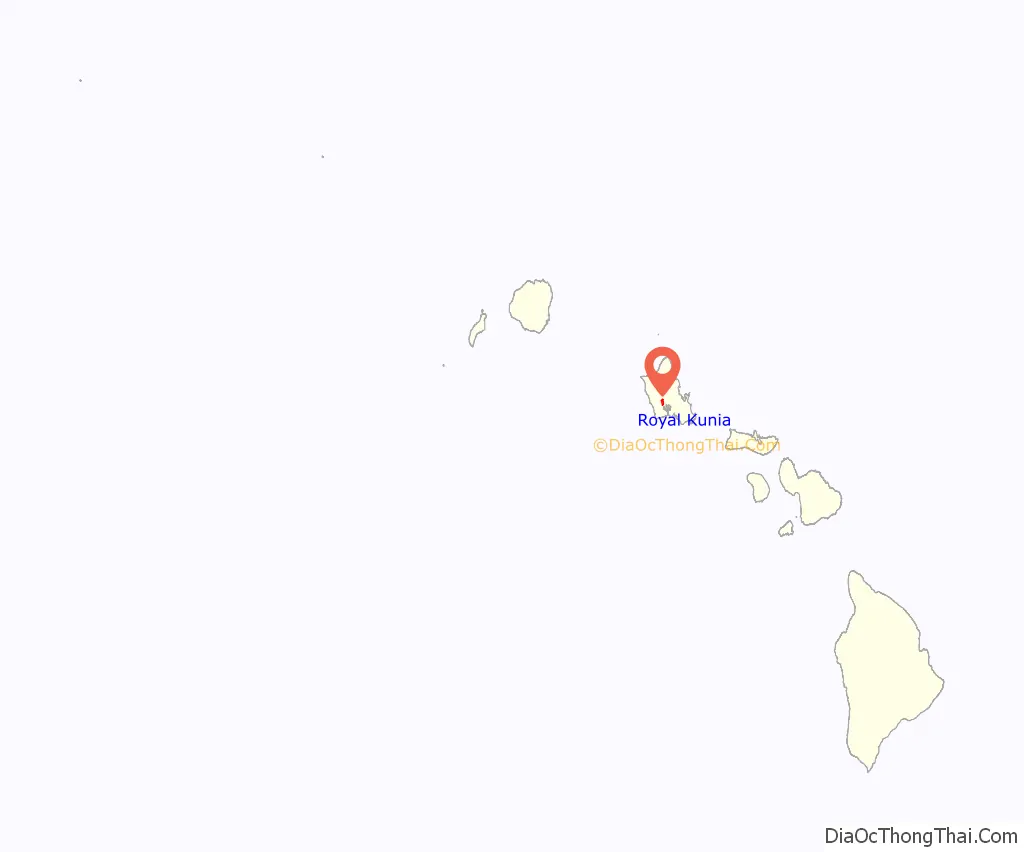
Royal Kunia location map. Where is Royal Kunia CDP?
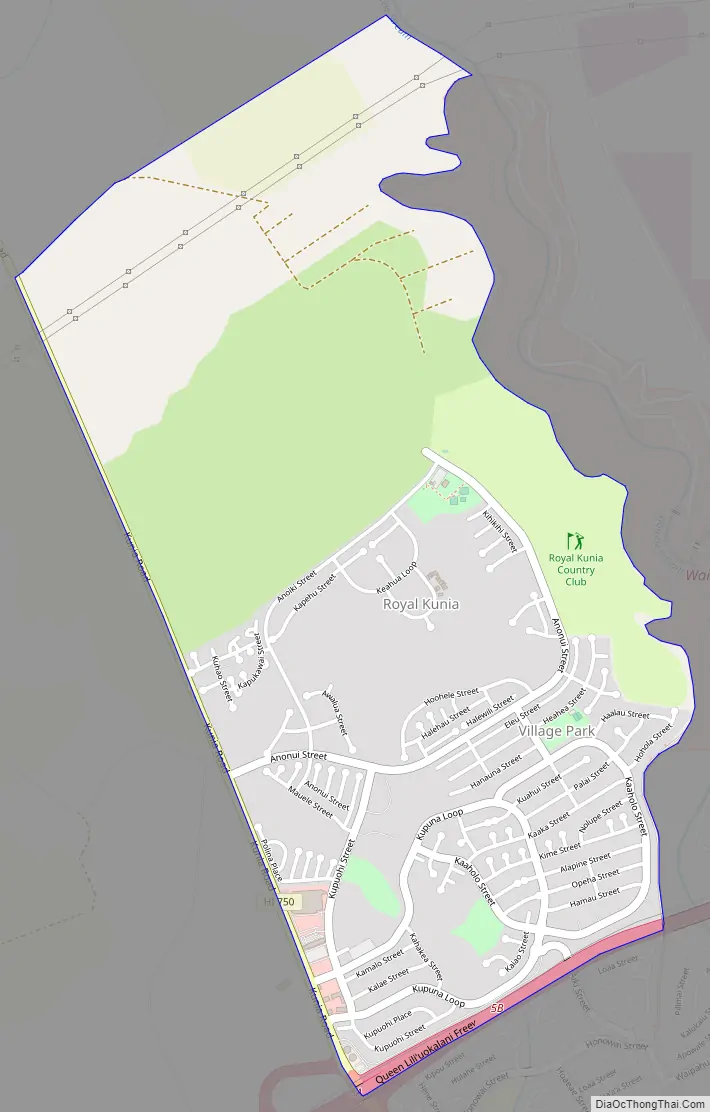
Royal Kunia Road Map
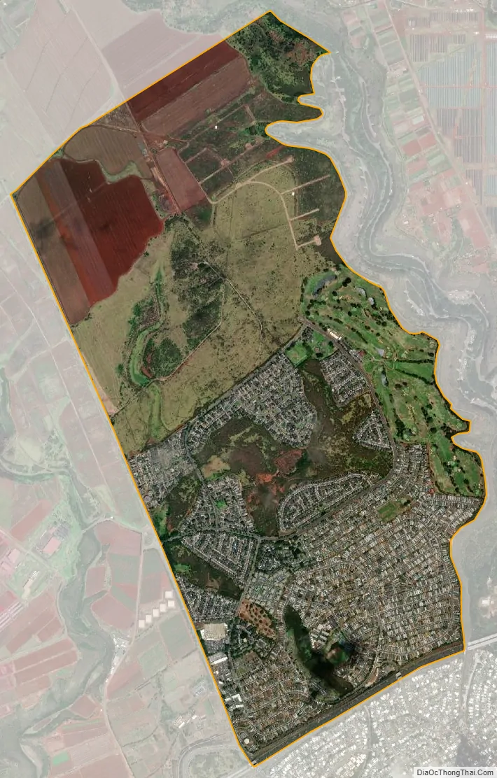
Royal Kunia city Satellite Map
Geography
Royal Kunia is located just north of Waipahu at 21°24′18″N 158°1′54″W / 21.40500°N 158.03167°W / 21.40500; -158.03167 (21.4052, -158.0318). It is bounded on the south by Interstate H-1 and on the west by Kunia Road (State Route 750).
According to the United States Census Bureau, the CDP has a total area of 3.0 square miles (7.8 km), all of it land.
See also
Map of Hawaii State and its subdivision: Map of other states:- Alabama
- Alaska
- Arizona
- Arkansas
- California
- Colorado
- Connecticut
- Delaware
- District of Columbia
- Florida
- Georgia
- Hawaii
- Idaho
- Illinois
- Indiana
- Iowa
- Kansas
- Kentucky
- Louisiana
- Maine
- Maryland
- Massachusetts
- Michigan
- Minnesota
- Mississippi
- Missouri
- Montana
- Nebraska
- Nevada
- New Hampshire
- New Jersey
- New Mexico
- New York
- North Carolina
- North Dakota
- Ohio
- Oklahoma
- Oregon
- Pennsylvania
- Rhode Island
- South Carolina
- South Dakota
- Tennessee
- Texas
- Utah
- Vermont
- Virginia
- Washington
- West Virginia
- Wisconsin
- Wyoming


