| Name: | Urban Honolulu CDP |
|---|---|
| LSAD Code: | 57 |
| LSAD Description: | CDP (suffix) |
| State: | Hawaii |
| County: | Honolulu County |
| FIPS code: | 1571550 |
Explore the streets of Honolulu with this interactive Google Map of Honolulu. Take a journey to the state capital and discover the many attractions and special places that make this a great place to live. From the world-famous volcano to the stunning beaches, you can learn about the many attractions and special places that make this a great place to live.
Online Interactive Map
Click on ![]() to view map in "full screen" mode.
to view map in "full screen" mode.
This interactive map of Honolulu is a great way to get an overview of the city, find your way around, and discover hidden gems. Search, plan and discover local attractions and businesses. This map will help you find your way through the most popular attractions, restaurants, hotels, and more in the city. Or you can just use it to find the best beaches, hiking trails, museums, and more. Whether you’re planning a vacation, visiting for work, or just looking for your next adventure, use this interactive map to find a Hawaii vacation adventure that is perfect for you.
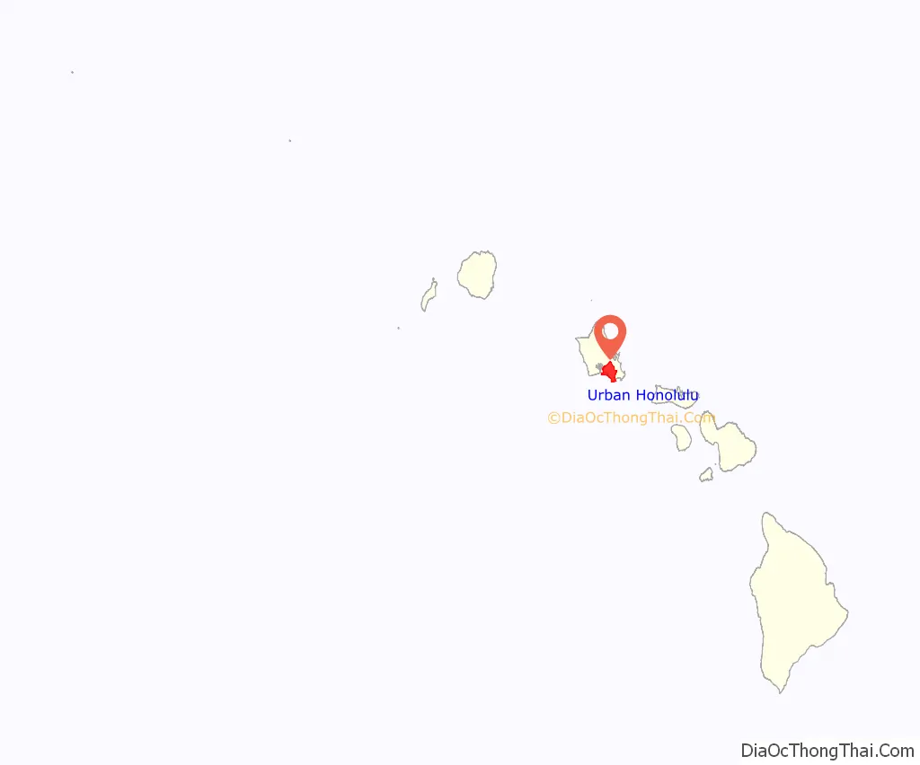
Urban Honolulu location map. Where is Urban Honolulu CDP?
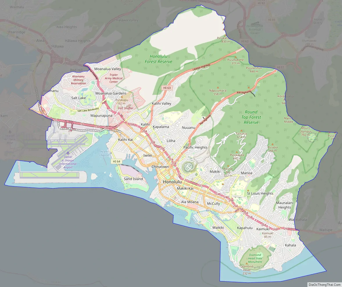
Urban Honolulu Road Map
Are you planning a trip to Hawaii? Make sure to check out our detailed map of the Hawaiian island to help you get the lay of the land and navigate the streets of Honolulu. With this map, you’ll have a better understanding of what to do when planning your trip to paradise. If you’re traveling outside Honolulu, don’t forget to check out our Hawaii road map for more information on interstate and US highways, as well as major roads like Ala Moana Blvd, Dillingham Blvd, Halona St, Kalihi St, Kalakaua Ave, Kalihi St, Kapiolani Blvd, Liliha St, Olomea St, Punchbowl St, School St, and Vineyard Blvd. With the help of this map, you’ll be able to explore the island and make the most of your trip to Hawaii!
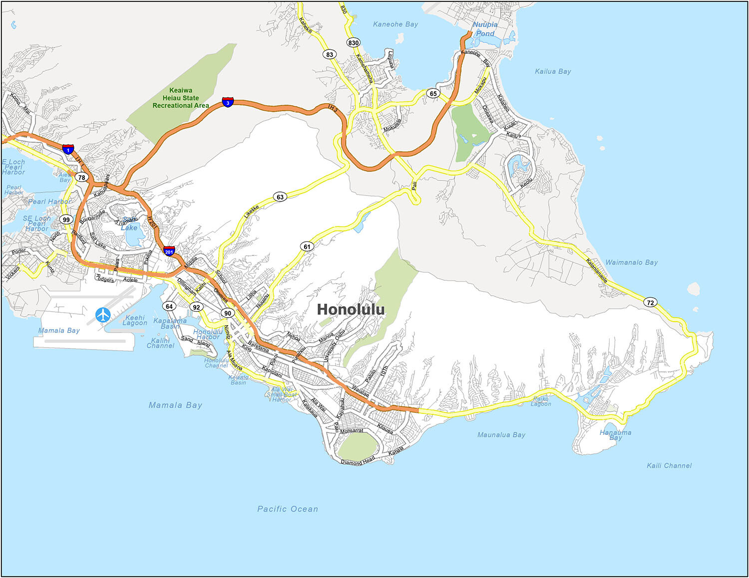
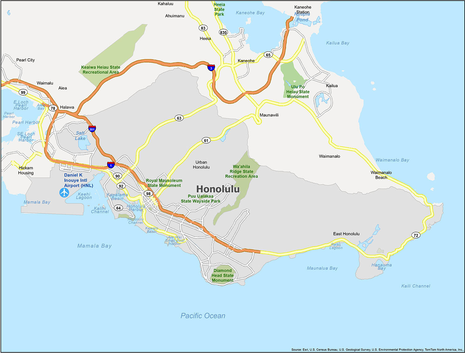
Explore Honolulu like never before with our detailed reference map. From the unique cultural and natural attractions of Hawaii to the vibrant city life, this map will help you plan your trip and get around with ease. You can easily see the airport, census-designated places, and water features that make Honolulu such a special place. With our reference map of Honolulu, you can explore the city and surrounding areas with incredible detail.
10 things to do in Urban Honolulu city
The city of Honolulu offers an abundance of things to do and places to explore. Explore Honolulu with our map and discover the best of the city. Whether you want to plan a vacation, find a place to explore, or just find out what’s around the corner, this map is your best bet. From historic landmarks and museums to sandy beaches and nature trails, the city of Honolulu has something for everyone.
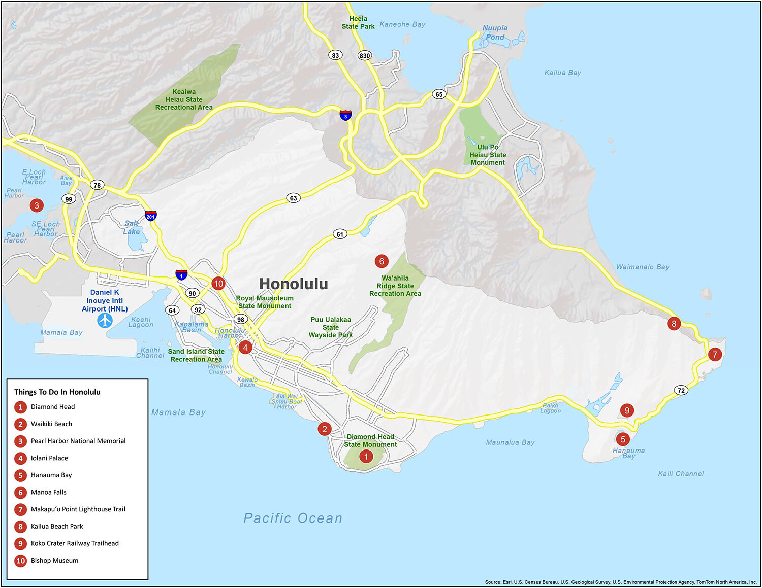
Our map of Honolulu will help you plan your trip and pinpoint the best places to visit like Diamond Head, Waikiki Beach, and Pearl Harbor National Memorial. With this map, you will be able to find the best places and marvel at the wonders of Honolulu.
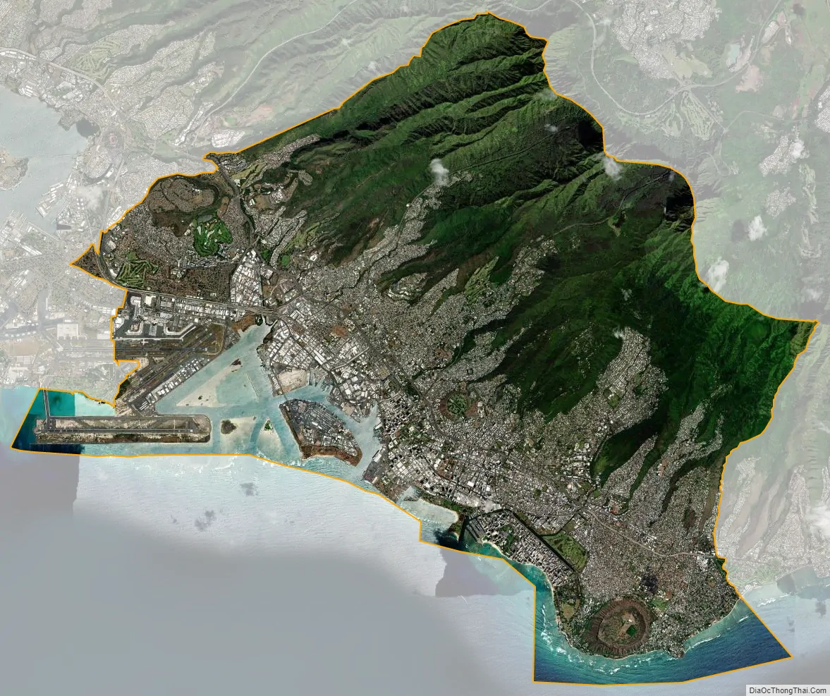
Urban Honolulu city Satellite Map
See also
Map of Hawaii State and its subdivision: Map of other states:- Alabama
- Alaska
- Arizona
- Arkansas
- California
- Colorado
- Connecticut
- Delaware
- District of Columbia
- Florida
- Georgia
- Hawaii
- Idaho
- Illinois
- Indiana
- Iowa
- Kansas
- Kentucky
- Louisiana
- Maine
- Maryland
- Massachusetts
- Michigan
- Minnesota
- Mississippi
- Missouri
- Montana
- Nebraska
- Nevada
- New Hampshire
- New Jersey
- New Mexico
- New York
- North Carolina
- North Dakota
- Ohio
- Oklahoma
- Oregon
- Pennsylvania
- Rhode Island
- South Carolina
- South Dakota
- Tennessee
- Texas
- Utah
- Vermont
- Virginia
- Washington
- West Virginia
- Wisconsin
- Wyoming


