Wahiawa (Hawaiian: Wahiawā, pronounced [wəhijəˈvaː]) is a census-designated place (CDP) in Honolulu County, Hawaii, United States, on the island of Oahu. It is in the Wahiawa District, on the plateau or “central valley” between the two volcanic mountains that bookend the island. In Hawaiian, wahi a wā means “place of the wa people”. The population was 18,658 at the 2020 census.
Lakes and reservoirs are rare in Hawaii, and Wahiawa is unique in being surrounded on three sides by Lake Wilson (also known as Wahiawa Reservoir or Kaukonahua). The town must be reached by either of two bridges on Kamehameha Highway (State Rte. 80) across the reservoir’s narrow north and south arms. Outside of the reservoir, the town used to be surrounded by military bases and agricultural fields, but development is making its way up from the increasingly urbanized southern portion of the central plain. Still, there are significant U.S. Army facilities in the area, including Schofield Barracks, Wheeler Army Airfield, and East Range, an Army training area extending into the hills south and east of town. Schofield Barracks alone is larger than Wahiawa CDP. Wahiawa is also home to the United States Navy’s Naval Computer and Telecommunications Area Master Station Pacific and the housing community HMR.
The U.S. postal codes for Wahiawa are 96786 and 96857.
| Name: | Wahiawa CDP |
|---|---|
| LSAD Code: | 57 |
| LSAD Description: | CDP (suffix) |
| State: | Hawaii |
| County: | Honolulu County |
| Elevation: | 942 ft (287 m) |
| Total Area: | 2.54 sq mi (6.58 km²) |
| Land Area: | 2.29 sq mi (5.93 km²) |
| Water Area: | 0.25 sq mi (0.65 km²) |
| Total Population: | 18,658 |
| Population Density: | 8,151.16/sq mi (3,146.91/km²) |
| ZIP code: | 96786 |
| Area code: | 808 |
| FIPS code: | 1572650 |
| GNISfeature ID: | 0364420 |
Online Interactive Map
Click on ![]() to view map in "full screen" mode.
to view map in "full screen" mode.
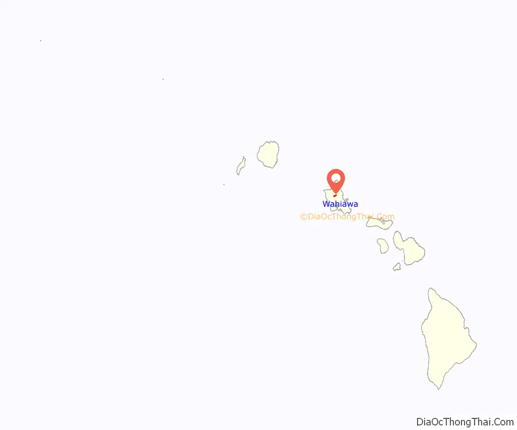
Wahiawa location map. Where is Wahiawa CDP?
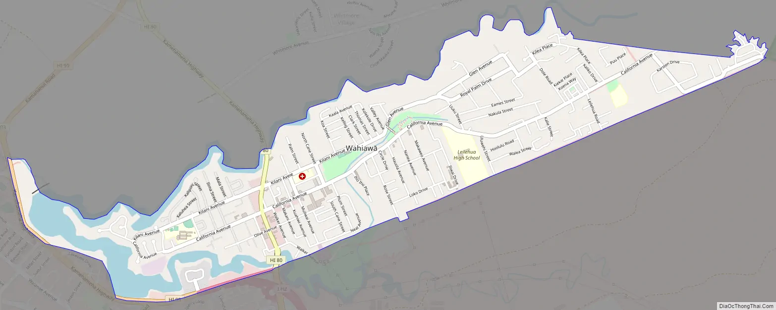
Wahiawa Road Map
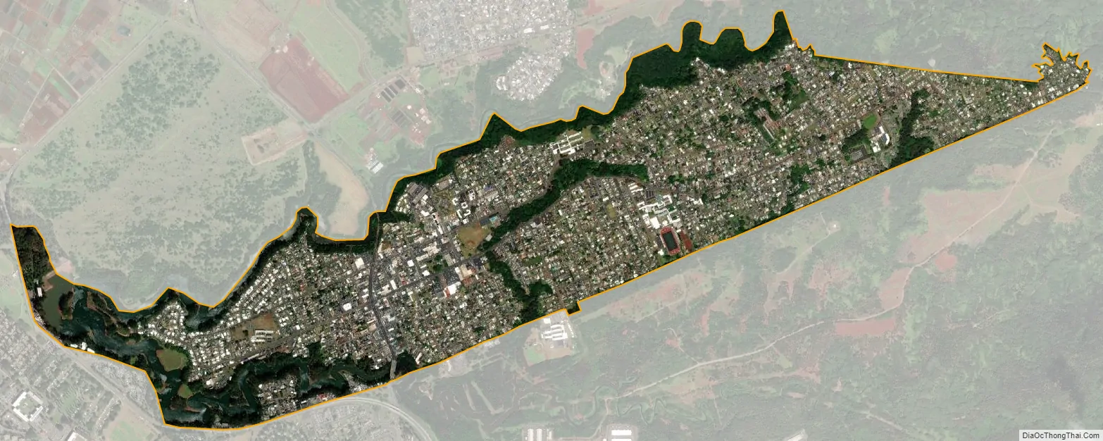
Wahiawa city Satellite Map
Geography
Wahiawa is located at 21°30′9″N 158°1′23″W / 21.50250°N 158.02306°W / 21.50250; -158.02306 (21.502574, -158.022938).
Vehicular routes to the North Shore from Wahiawa are Kamehameha Highway (State Rte. 80) to Haleiwa and Kaukonahua Road (State Rte. 801) to Waialua. Wheeler and Schofield are reached along Wilikina Drive (Wahiawa Bypass) (State Rte. 99), which bypasses Wahiawa from the south bridge, a road that eventually connects to both Kamehameha Highway and Kaukonahua Road northwest of town. Kamehameha Highway continues south (as State Rte. 99) past Wheeler to Mililani Town. Interstate H-2 terminates at Wilikina Drive near the Kamehameha Highway intersection, and is a less congested route southward to Mililani and beyond to Pearl City and Honolulu via Interstate H-1. Kunia Road (State Rte. 750) runs from Wilikina Drive, between Schofield and Wheeler (on the bypass), then southward along the mostly still agricultural western side of the plain to Kunia and Waipahu beyond.
According to the United States Census Bureau, the CDP has an area of 2.4 square miles (6.2 km), of which 2.1 square miles (5.5 km) is land and 0.27 square miles (0.7 km), or 11.34%, is water.
Kaʻala, the highest peak on Oahu (4,003 feet or 1,220 metres), is 5 miles (8 km) west of Wahiawa, overlooking Schofield Barracks.
Wahiawa Reservoir or Lake Wilson is Hawaii’s second-largest reservoir (302 acres (1.22 km)). It irrigates agricultural fields, including the Dole Pineapple Plantation fields at the northern part of Wahiawa, all the way to Oahu’s North Shore, where it empties.
See also
Map of Hawaii State and its subdivision: Map of other states:- Alabama
- Alaska
- Arizona
- Arkansas
- California
- Colorado
- Connecticut
- Delaware
- District of Columbia
- Florida
- Georgia
- Hawaii
- Idaho
- Illinois
- Indiana
- Iowa
- Kansas
- Kentucky
- Louisiana
- Maine
- Maryland
- Massachusetts
- Michigan
- Minnesota
- Mississippi
- Missouri
- Montana
- Nebraska
- Nevada
- New Hampshire
- New Jersey
- New Mexico
- New York
- North Carolina
- North Dakota
- Ohio
- Oklahoma
- Oregon
- Pennsylvania
- Rhode Island
- South Carolina
- South Dakota
- Tennessee
- Texas
- Utah
- Vermont
- Virginia
- Washington
- West Virginia
- Wisconsin
- Wyoming


