Waialua (Hawaiian pronunciation: [vɐjəˈluwə]) is a census-designated place and North Shore community in the Waialua District on the island of Oʻahu, City & County of Honolulu, Hawaii, United States. As of the 2020 census, the CDP had a population of 4,062.
Waialua was one of the six original districts of ancient Hawaii on the island, known as moku. Waialua is a former (sugar) mill town and residential area, quite different in its quiet ambiance from nearby Haleʻiwa, which is more commercial and tourist oriented. The Waialua Sugar Mill is the center of this town and the historical base of its plantation history.
The U.S. postal code for Waialua is 96791.
| Name: | Waialua CDP |
|---|---|
| LSAD Code: | 57 |
| LSAD Description: | CDP (suffix) |
| State: | Hawaii |
| County: | Honolulu County |
| Elevation: | 13 ft (4 m) |
| Total Area: | 2.39 sq mi (6.19 km²) |
| Land Area: | 2.19 sq mi (5.68 km²) |
| Water Area: | 0.20 sq mi (0.51 km²) |
| Total Population: | 4,062 |
| Population Density: | 1,853.95/sq mi (715.75/km²) |
| ZIP code: | 96791 |
| Area code: | 808 |
| FIPS code: | 1574000 |
| GNISfeature ID: | 0364543 |
Online Interactive Map
Click on ![]() to view map in "full screen" mode.
to view map in "full screen" mode.
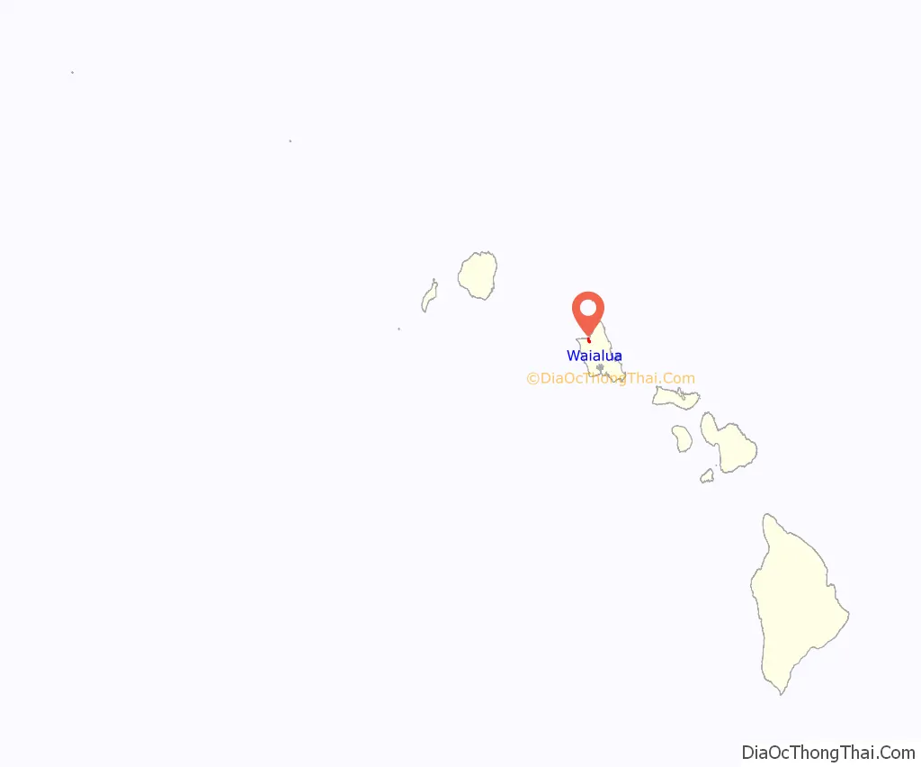
Waialua location map. Where is Waialua CDP?
History
Many of the current families living in Waialua are the results of agricultural industry which began in the early 20th century. There was an increased demand for workers as the industry grew, resulting in workers being brought in from China, Portugal, Japan, Korea, Puerto Rico, Philippines, Spain and other areas. Upon arriving in Hawaii, many of these workers were assigned to work in the sugarcane plantations in Waialua. During the late 1980s and into the 1990s, the sugar production decreased as increasing labor and production costs caused producers to move overseas. Many of the families brought to Waialua during the sugar rush remained here and many of their descendants reside there today.
During World War II the twin guns from USS Saratoga were installed 1.5 miles (2.4 km) off Kamehameha Highway near Waialua for use as gun batteries attached to Hawaiian Pineapple Company Camp Brodie 4.
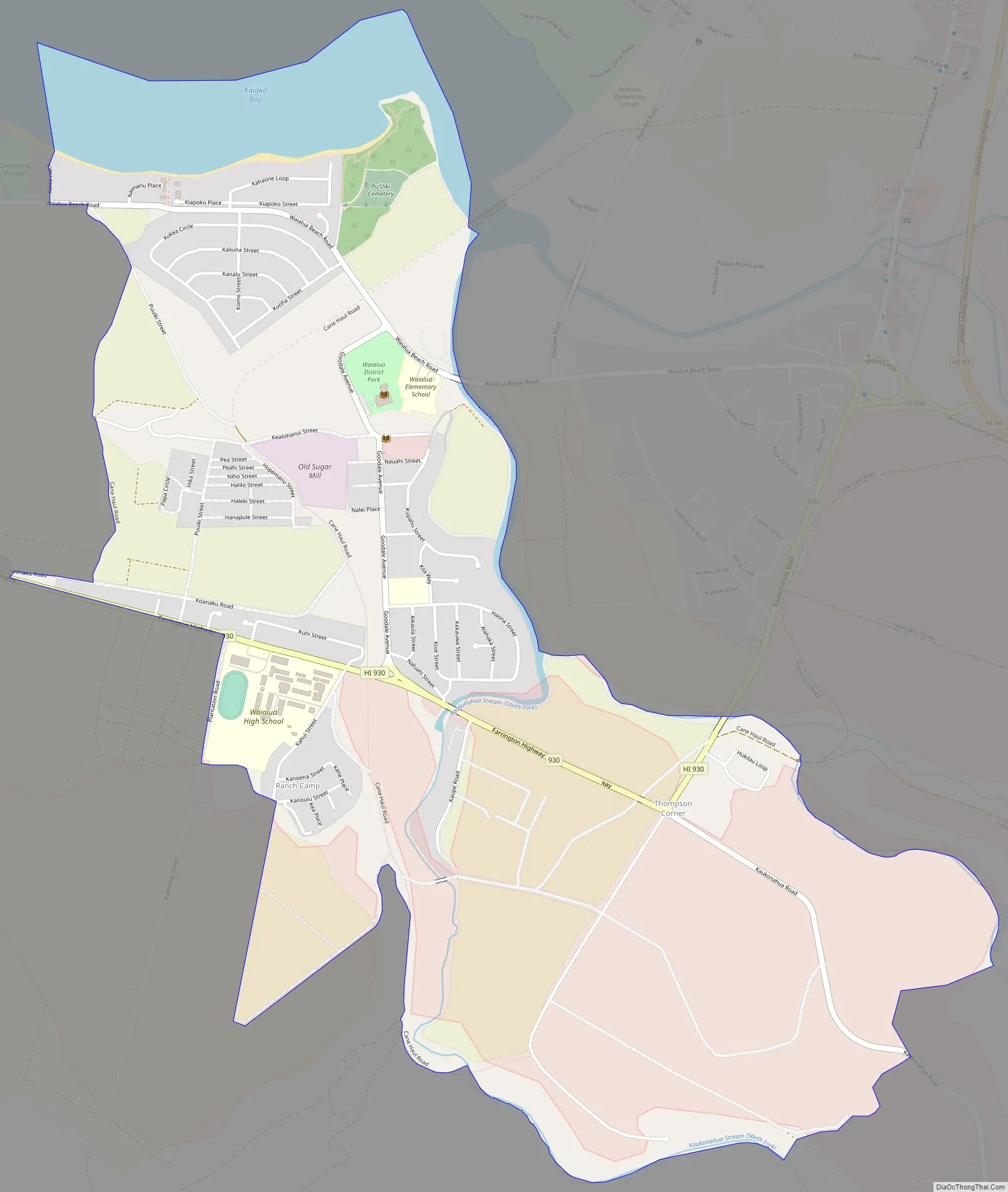
Waialua Road Map
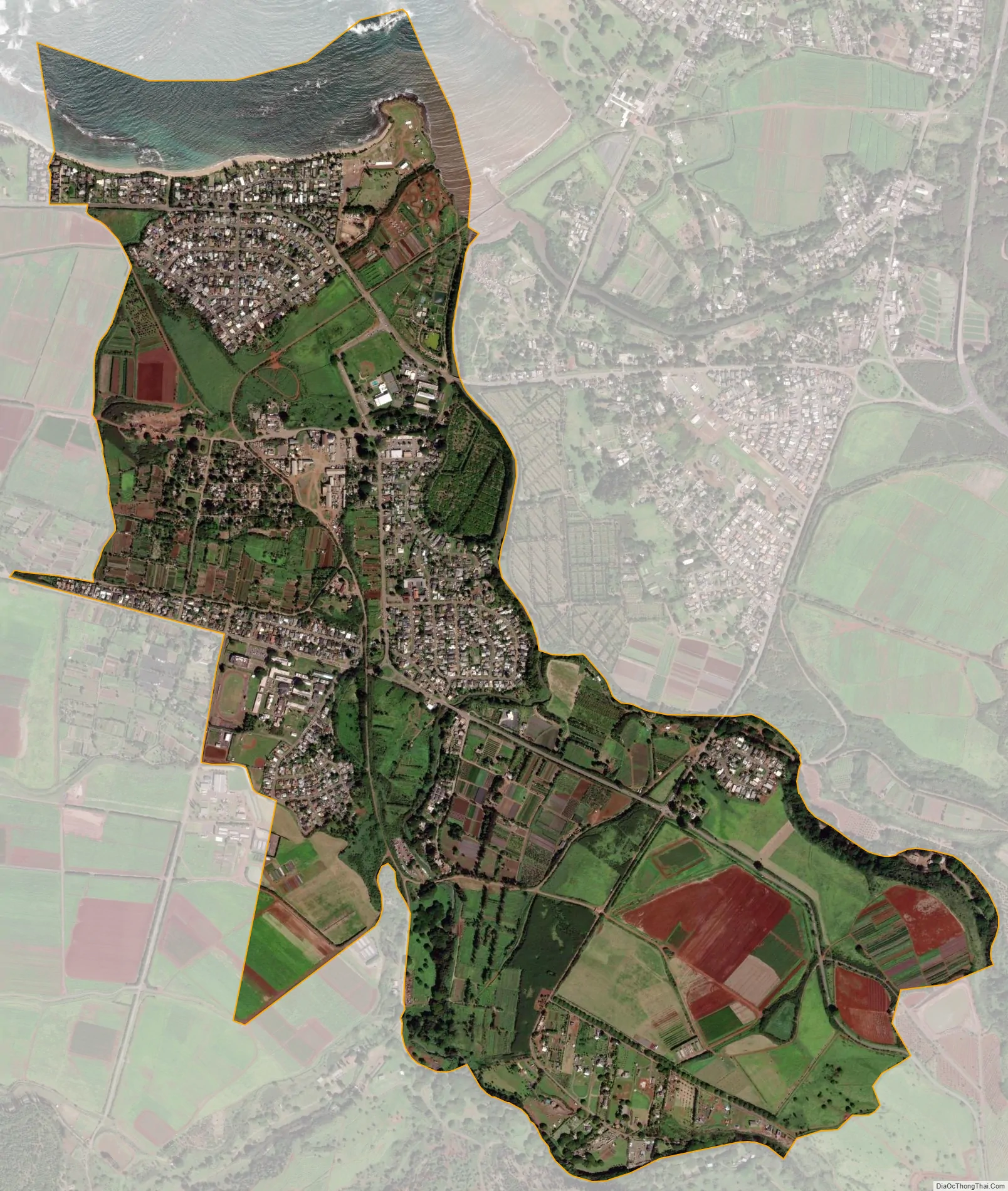
Waialua city Satellite Map
Geography
Waialua is located at 21°34’31” north, 158°7’46” west (21.575300, -158.129457), southwest of Haleʻiwa, reached on Waialua Beach Road (State Rte. 82) or Kaukonahua Road (State Rte. 830). Kaukonahua Road turns eastward and, as State Rte. 803 then 801 runs up into the central plateau of Oʻahu to Wahiawā or (as 803) to Schofield Barracks. Farrington Highway (State Rte. 930) runs westward to Mokulēʻia.
According to the United States Census Bureau, the CDP has a total area of 2.4 square miles (6.2 km), of which 2.2 square miles (5.7 km) is land and 0.19 square miles (0.5 km) is water. The total area is 8.30% water.
See also
Map of Hawaii State and its subdivision: Map of other states:- Alabama
- Alaska
- Arizona
- Arkansas
- California
- Colorado
- Connecticut
- Delaware
- District of Columbia
- Florida
- Georgia
- Hawaii
- Idaho
- Illinois
- Indiana
- Iowa
- Kansas
- Kentucky
- Louisiana
- Maine
- Maryland
- Massachusetts
- Michigan
- Minnesota
- Mississippi
- Missouri
- Montana
- Nebraska
- Nevada
- New Hampshire
- New Jersey
- New Mexico
- New York
- North Carolina
- North Dakota
- Ohio
- Oklahoma
- Oregon
- Pennsylvania
- Rhode Island
- South Carolina
- South Dakota
- Tennessee
- Texas
- Utah
- Vermont
- Virginia
- Washington
- West Virginia
- Wisconsin
- Wyoming


