Waimānalo Beach is a census-designated place (CDP) located in the City & County of Honolulu, in the District of Koʻolaupoko, on the island of Oʻahu in the U.S. state of Hawaiʻi. This small windward community is located near the eastern end of the island, and the climate is dry. As of the 2020 census, the CDP had a population of 4,823. This neighborhood is close to, but somewhat separate from Waimānalo, although the two form a single community.
Waimānalo Beach (the town) lies along the eastern half of Waimānalo Beach (the beach), with an overall length of nearly 5.5 mi (8.9 km), the longest stretch of sandy shoreline on Oʻahu. Waimānalo Beach has sparse commercial development along Kalanianaole Highway, and is noteworthy for its local flavor and proximity to Makapuʻu Beach and Sea Life Park, which lie closer to Makapuʻu Point at the east end of the island of Oʻahu. There are no hotels here.
The U.S. postal code for Waimānalo Beach and Waimānalo is 96795.
Kazuo Sakamaki, the first prisoner of war taken by U.S. forces during World War II, was captured on December 8, 1941, on Waimānalo Beach the day after the surprise attack on Pearl Harbor and surrounding targets in Honolulu by Imperial Japanese Navy forces.
The Anderson Estate, which was featured in the TV series Magnum, P.I. as “Robin’s Nest”, is located in Waimānalo Beach.
| Name: | Waimanalo Beach CDP |
|---|---|
| LSAD Code: | 57 |
| LSAD Description: | CDP (suffix) |
| State: | Hawaii |
| County: | Honolulu County |
| Elevation: | 16 ft (5 m) |
| Total Area: | 2.96 sq mi (7.68 km²) |
| Land Area: | 1.98 sq mi (5.12 km²) |
| Water Area: | 0.99 sq mi (2.56 km²) |
| Total Population: | 4,823 |
| Population Density: | 2,442.03/sq mi (942.83/km²) |
| Area code: | 808 |
| FIPS code: | 1578200 |
| GNISfeature ID: | 0364777 |
Online Interactive Map
Click on ![]() to view map in "full screen" mode.
to view map in "full screen" mode.
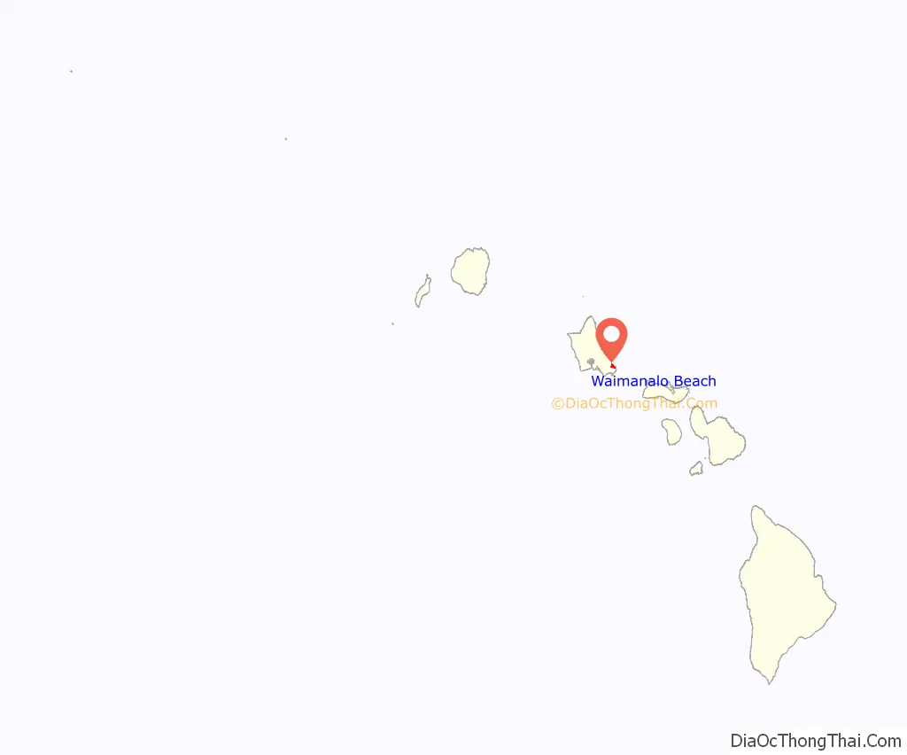
Waimanalo Beach location map. Where is Waimanalo Beach CDP?
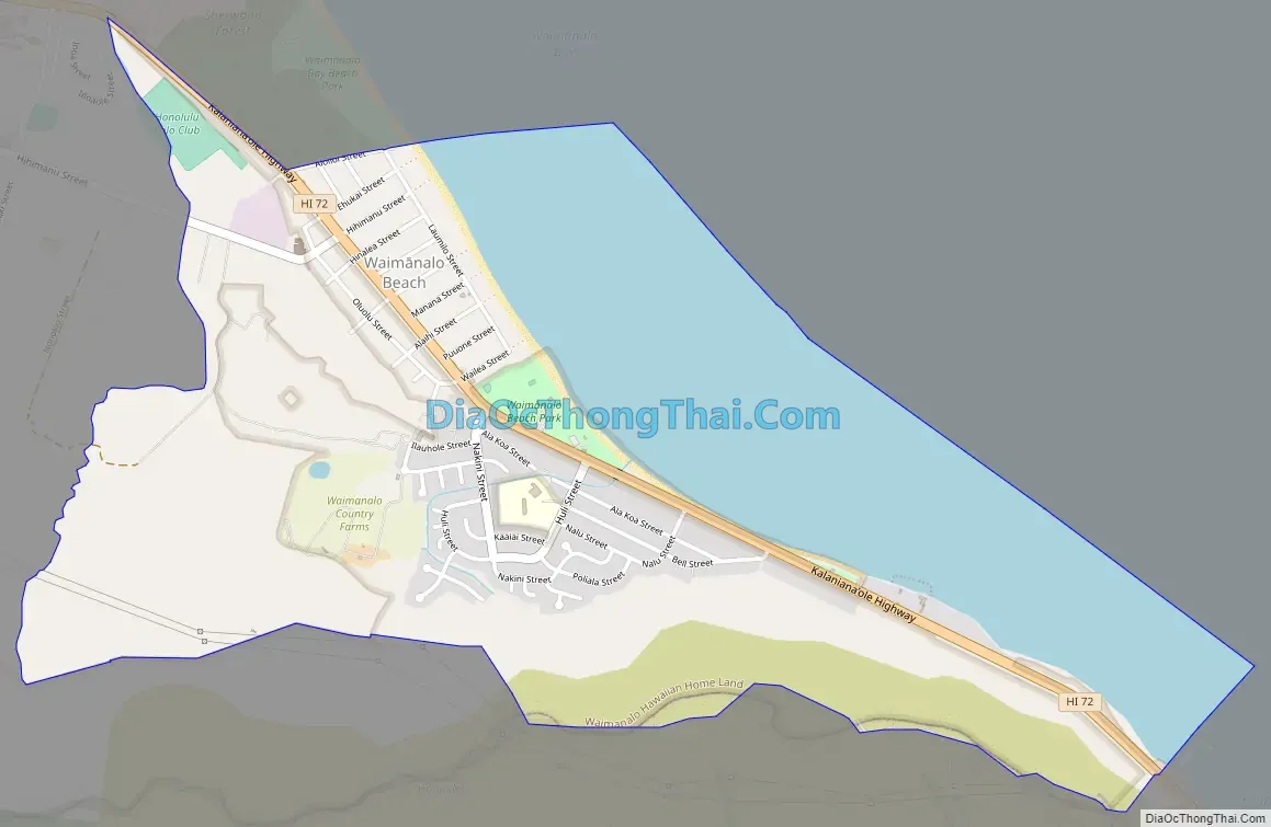
Waimanalo Beach Road Map
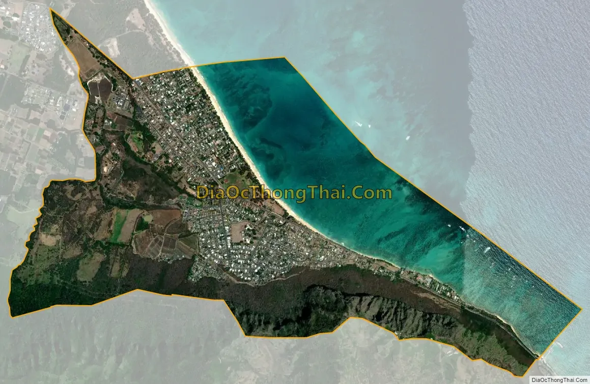
Waimanalo Beach city Satellite Map
Geography
Waimānalo Beach is located at 21°20′1″N 157°41′53″W / 21.33361°N 157.69806°W / 21.33361; -157.69806 (21.333657, -157.698055). The nearest town is Waimānalo to the west.
According to the United States Census Bureau, the town has a total area of 3.0 square miles (7.7 km), of which 2.0 square miles (5.1 km) is land and 1.0 square mile (2.6 km) is water. The total area is 33.45% water.
See also
Map of Hawaii State and its subdivision: Map of other states:- Alabama
- Alaska
- Arizona
- Arkansas
- California
- Colorado
- Connecticut
- Delaware
- District of Columbia
- Florida
- Georgia
- Hawaii
- Idaho
- Illinois
- Indiana
- Iowa
- Kansas
- Kentucky
- Louisiana
- Maine
- Maryland
- Massachusetts
- Michigan
- Minnesota
- Mississippi
- Missouri
- Montana
- Nebraska
- Nevada
- New Hampshire
- New Jersey
- New Mexico
- New York
- North Carolina
- North Dakota
- Ohio
- Oklahoma
- Oregon
- Pennsylvania
- Rhode Island
- South Carolina
- South Dakota
- Tennessee
- Texas
- Utah
- Vermont
- Virginia
- Washington
- West Virginia
- Wisconsin
- Wyoming


