Bogota is a borough in Bergen County, in the U.S. state of New Jersey. As of the 2020 United States census, the borough’s population was 8,778, an increase of 591 (+7.2%) from the 2010 census count of 8,187, which in turn reflected a decline of 62 (−0.8%) from the 8,249 counted in the 2000 census.
Bogota was formed on November 14, 1894, from portions of Ridgefield Township, based on the results of a referendum held that day. The borough was formed during the “Boroughitis” phenomenon then sweeping through Bergen County, in which 26 boroughs were formed during 1894 alone. Portions of Bogota were taken in 1895 to form part of the newly created Township of Teaneck. Bogota was named in honor of the Bogert family, which had been the first European settlers to occupy the area, and may also be a blend of Bogert and Banta, another early family, with an “O” added to ease pronunciation.
The borough’s name is pronounced /bəˈɡoʊtə/ buh-GOH-tə, unlike Bogotá, capital city of Colombia, which is accented on the final syllable.
| Name: | Bogota borough |
|---|---|
| LSAD Code: | 21 |
| LSAD Description: | borough (suffix) |
| State: | New Jersey |
| County: | Bergen County |
| Incorporated: | November 14, 1894 |
| Elevation: | 43 ft (13 m) |
| Total Area: | 0.80 sq mi (2.06 km²) |
| Land Area: | 0.76 sq mi (1.95 km²) |
| Water Area: | 0.04 sq mi (0.11 km²) 5.25% |
| Total Population: | 8,778 |
| Population Density: | 11,626.5/sq mi (4,489.0/km²) |
| ZIP code: | 07603 |
| Area code: | 201 |
| FIPS code: | 3406490 |
| GNISfeature ID: | 0885163 |
| Website: | www.bogotaonline.org |
Online Interactive Map
Click on ![]() to view map in "full screen" mode.
to view map in "full screen" mode.
Bogota location map. Where is Bogota borough?


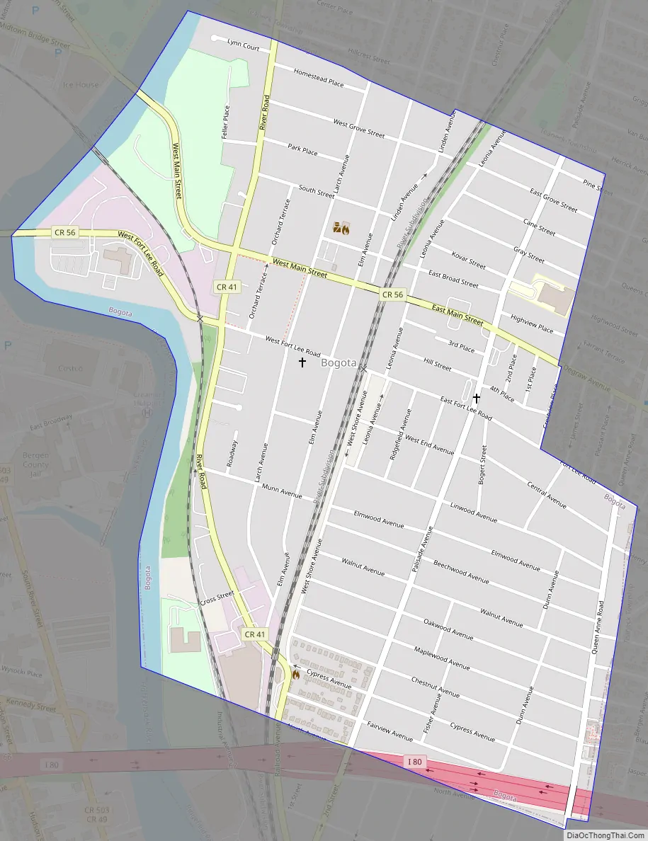
Bogota Road Map
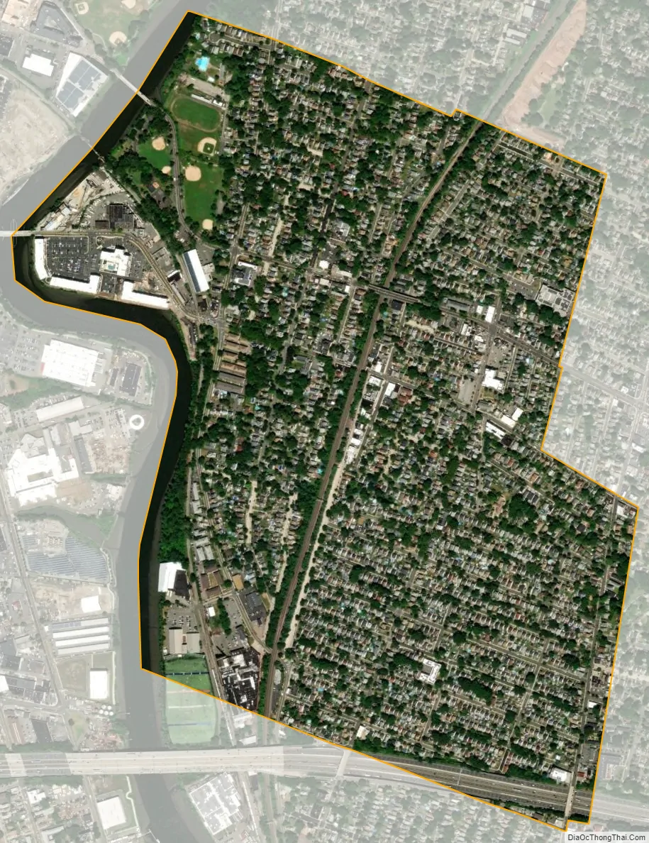
Bogota city Satellite Map
Geography
Bogota is located on the east shore of the Hackensack River. According to the United States Census Bureau, the borough had a total area of 0.80 square miles (2.06 km), including 0.76 square miles (1.95 km) of land and 0.04 square miles (0.11 km) of water (5.25%).
The borough borders Hackensack to the west, Ridgefield Park to the south and Teaneck on the north and east.
Bogota is bisected by the CSX River Line, which divides the borough into an eastern and western portion. The eastern half is highly industrial, with more busy roads. The western half is mainly suburban, with the exception of storefronts on West Main Street, River Road, and a development on West Fort Lee Road.
See also
Map of New Jersey State and its subdivision: Map of other states:- Alabama
- Alaska
- Arizona
- Arkansas
- California
- Colorado
- Connecticut
- Delaware
- District of Columbia
- Florida
- Georgia
- Hawaii
- Idaho
- Illinois
- Indiana
- Iowa
- Kansas
- Kentucky
- Louisiana
- Maine
- Maryland
- Massachusetts
- Michigan
- Minnesota
- Mississippi
- Missouri
- Montana
- Nebraska
- Nevada
- New Hampshire
- New Jersey
- New Mexico
- New York
- North Carolina
- North Dakota
- Ohio
- Oklahoma
- Oregon
- Pennsylvania
- Rhode Island
- South Carolina
- South Dakota
- Tennessee
- Texas
- Utah
- Vermont
- Virginia
- Washington
- West Virginia
- Wisconsin
- Wyoming


