River Edge is a borough in Bergen County, in the U.S. state of New Jersey. As of the 2020 United States census, the borough’s population was 12,049, an increase of 709 (+6.3%) from the 2010 census count of 11,340, which in turn reflected an increase of 394 (+3.6%) from the 10,946 counted at the 2000 census.
The community was originally incorporated as the borough of Riverside by an act of the New Jersey Legislature on June 30, 1894, from portions of Midland Township, based on the results of a referendum held the previous day. On December 1, 1930, the borough’s name was changed to River Edge. The borough was formed during the “Boroughitis” phenomenon then sweeping through Bergen County, in which 26 boroughs were formed in the county in 1894 alone. The borough was named for its location along the Hackensack River.
| Name: | River Edge borough |
|---|---|
| LSAD Code: | 21 |
| LSAD Description: | borough (suffix) |
| State: | New Jersey |
| County: | Bergen County |
| Incorporated: | June 30, 1894 |
| Elevation: | 49 ft (15 m) |
| Total Area: | 1.88 sq mi (4.86 km²) |
| Land Area: | 1.83 sq mi (4.75 km²) |
| Water Area: | 0.04 sq mi (0.12 km²) 2.39% |
| Total Population: | 12,049 |
| Population Density: | 6,573.4/sq mi (2,538.0/km²) |
| ZIP code: | 07661 |
| Area code: | 201 |
| FIPS code: | 3463360 |
| GNISfeature ID: | 0885372 |
| Website: | www.riveredgenj.org |
Online Interactive Map
Click on ![]() to view map in "full screen" mode.
to view map in "full screen" mode.
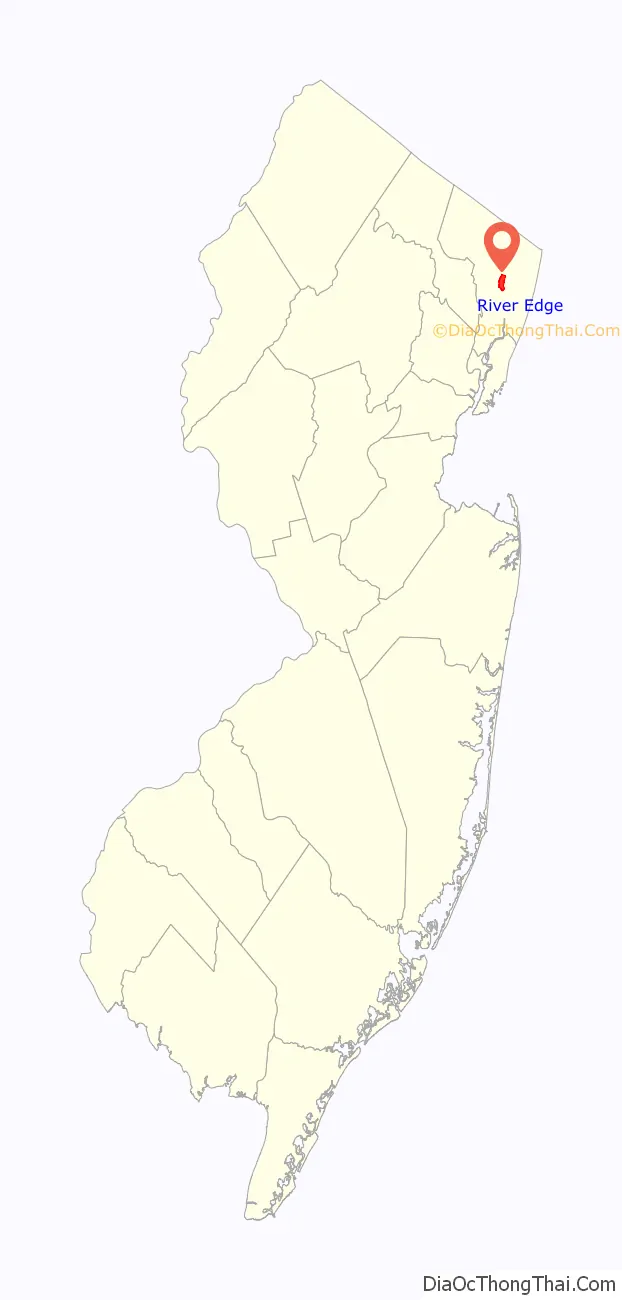
River Edge location map. Where is River Edge borough?

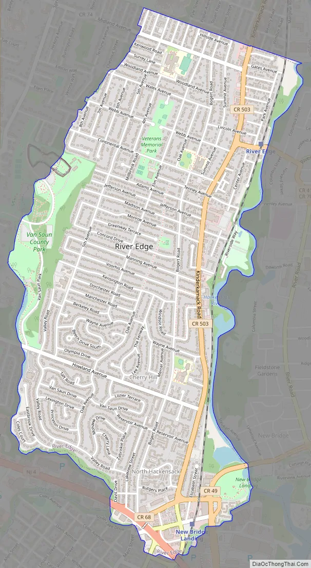
River Edge Road Map
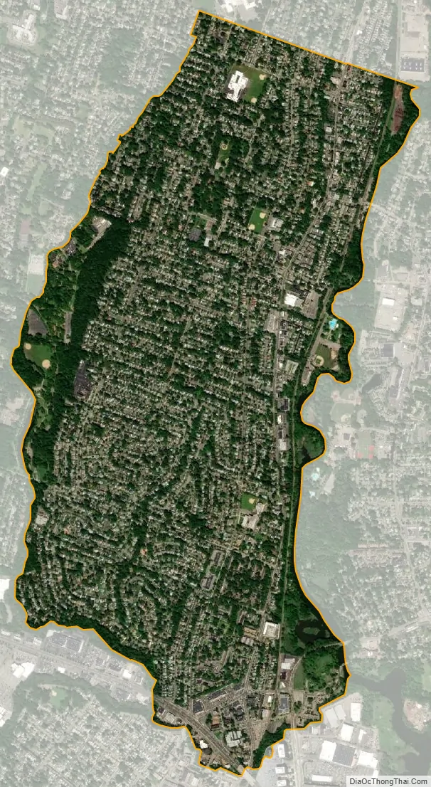
River Edge city Satellite Map
Geography
According to the United States Census Bureau, the borough had a total area of 1.88 square miles (4.86 km), including 1.83 square miles (4.75 km) of land and 0.05 square miles (0.12 km) of water (2.39%).
A suburb of New York City, River Edge is located approximately 8 miles (13 km) west of Upper Manhattan.
Cherry Hill and North Hackensack are unincorporated communities located within River Edge.
The borough is bordered by the Bergen County municipalities of Hackensack, New Milford, Oradell, Paramus and Teaneck.
See also
Map of New Jersey State and its subdivision: Map of other states:- Alabama
- Alaska
- Arizona
- Arkansas
- California
- Colorado
- Connecticut
- Delaware
- District of Columbia
- Florida
- Georgia
- Hawaii
- Idaho
- Illinois
- Indiana
- Iowa
- Kansas
- Kentucky
- Louisiana
- Maine
- Maryland
- Massachusetts
- Michigan
- Minnesota
- Mississippi
- Missouri
- Montana
- Nebraska
- Nevada
- New Hampshire
- New Jersey
- New Mexico
- New York
- North Carolina
- North Dakota
- Ohio
- Oklahoma
- Oregon
- Pennsylvania
- Rhode Island
- South Carolina
- South Dakota
- Tennessee
- Texas
- Utah
- Vermont
- Virginia
- Washington
- West Virginia
- Wisconsin
- Wyoming


