New Milford is a borough in Bergen County, in the U.S. state of New Jersey. As of the 2020 United States census, the borough’s population was 16,923, an increase of 582 (+3.6%) from the 2010 census count of 16,341, which in turn reflected a decline of 59 (−0.4%) from the 16,400 counted in the 2000 census.
New Milford was authorized to be incorporated as a borough on March 11, 1922, from what remained of Palisades Township, subject to approval in a referendum (which took place on April 18, 1922). With the creation of New Milford, Palisades Township (which had been created in 1871) was dissolved. The borough is believed to have been named for Milford, Pennsylvania.
| Name: | New Milford borough |
|---|---|
| LSAD Code: | 21 |
| LSAD Description: | borough (suffix) |
| State: | New Jersey |
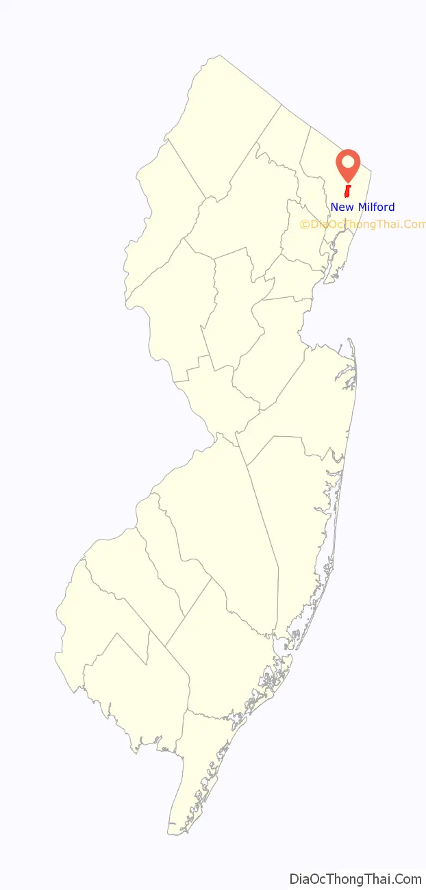
| County: | Bergen County |
| Incorporated: | March 11, 1922 |
| Elevation: | 30 ft (9 m) |
| Total Area: | 2.32 sq mi (6.02 km²) |
| Land Area: | 2.28 sq mi (5.91 km²) |
| Water Area: | 0.04 sq mi (0.11 km²) 1.77% |
| Total Population: | 16,923 |
| Population Density: | 7,412.9/sq mi (2,862.1/km²) |
| ZIP code: | 07646 |
| Area code: | 201 |
| FIPS code: | 3451660 |
| GNISfeature ID: | 0885320 |
| Website: | www.newmilfordboro.com |
Online Interactive Map
Click on ![]() to view map in "full screen" mode.
to view map in "full screen" mode.
New Milford location map. Where is New Milford borough?

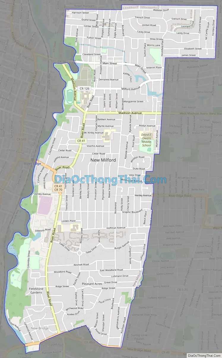
New Milford Road Map
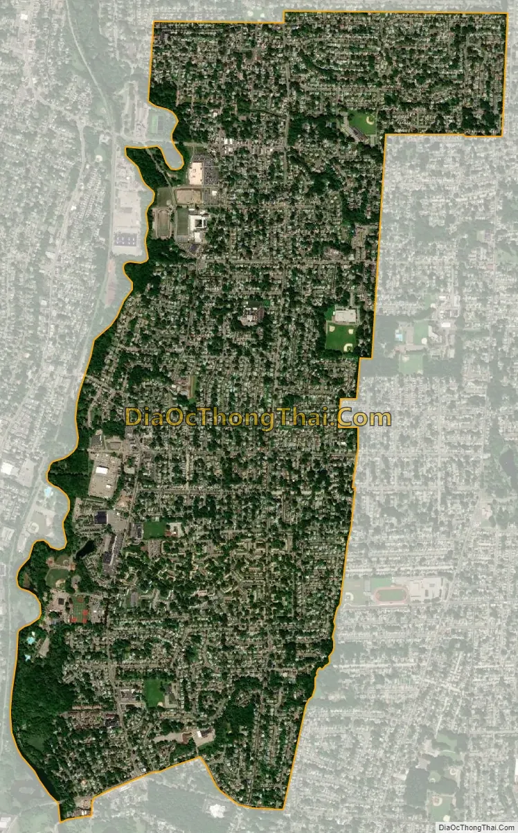
New Milford city Satellite Map
Geography
According to the United States Census Bureau, the borough had a total area of 2.32 square miles (6.02 km), including 2.28 square miles (5.91 km) of land and 0.04 square miles (0.11 km) of water (1.77%).
The borough borders the Bergen County municipalities of Bergenfield, Dumont, Oradell, River Edge and Teaneck.
New Milford—together with River Edge and Teaneck—is home to historic New Bridge Landing.
New Bridge, Old Bridge and Peetzburgh are unincorporated communities located within New Milford.
During Hurricane Irene on August 28, 2011, the Hackensack River crested at 11.84 feet (3.61 m), the second-highest recorded height and almost 6 feet (1.8 m) above flood stage, forcing flooding homes to be evacuated. The record height at the New Milford flood gauge is 12.36 feet (3.77 m) set during a storm on April 16, 2007, and the previous second-highest level of 11.45 feet (3.49 m) had been set during Hurricane Floyd on September 16, 1999.
See also
Map of New Jersey State and its subdivision: Map of other states:- Alabama
- Alaska
- Arizona
- Arkansas
- California
- Colorado
- Connecticut
- Delaware
- District of Columbia
- Florida
- Georgia
- Hawaii
- Idaho
- Illinois
- Indiana
- Iowa
- Kansas
- Kentucky
- Louisiana
- Maine
- Maryland
- Massachusetts
- Michigan
- Minnesota
- Mississippi
- Missouri
- Montana
- Nebraska
- Nevada
- New Hampshire
- New Jersey
- New Mexico
- New York
- North Carolina
- North Dakota
- Ohio
- Oklahoma
- Oregon
- Pennsylvania
- Rhode Island
- South Carolina
- South Dakota
- Tennessee
- Texas
- Utah
- Vermont
- Virginia
- Washington
- West Virginia
- Wisconsin
- Wyoming


