Covering an area of 10,991 sq. km (4,244 sq mi), Jamaica is the 3rd largest island in the Caribbean, after Cuba and Hispaniola.
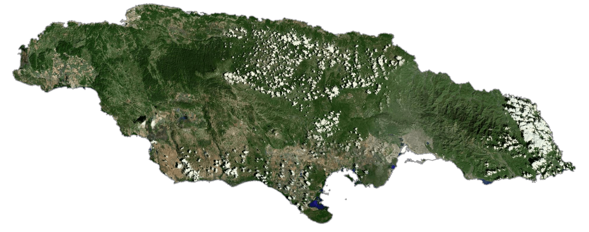
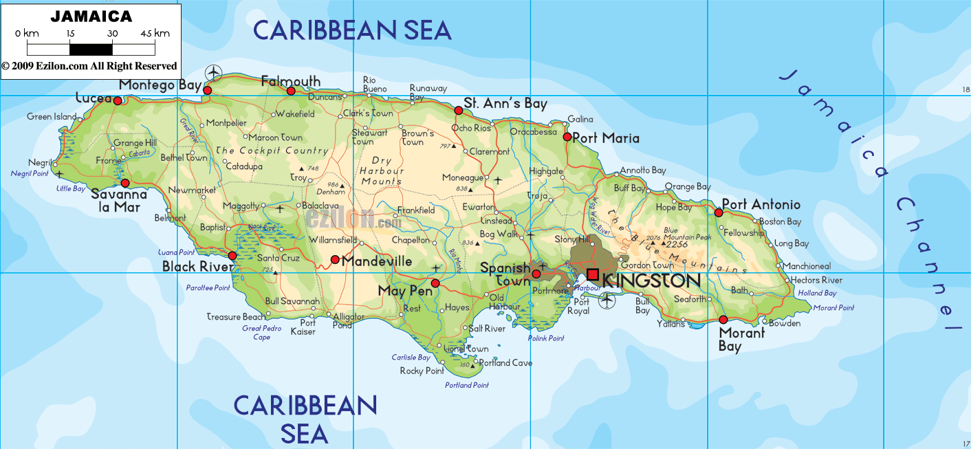
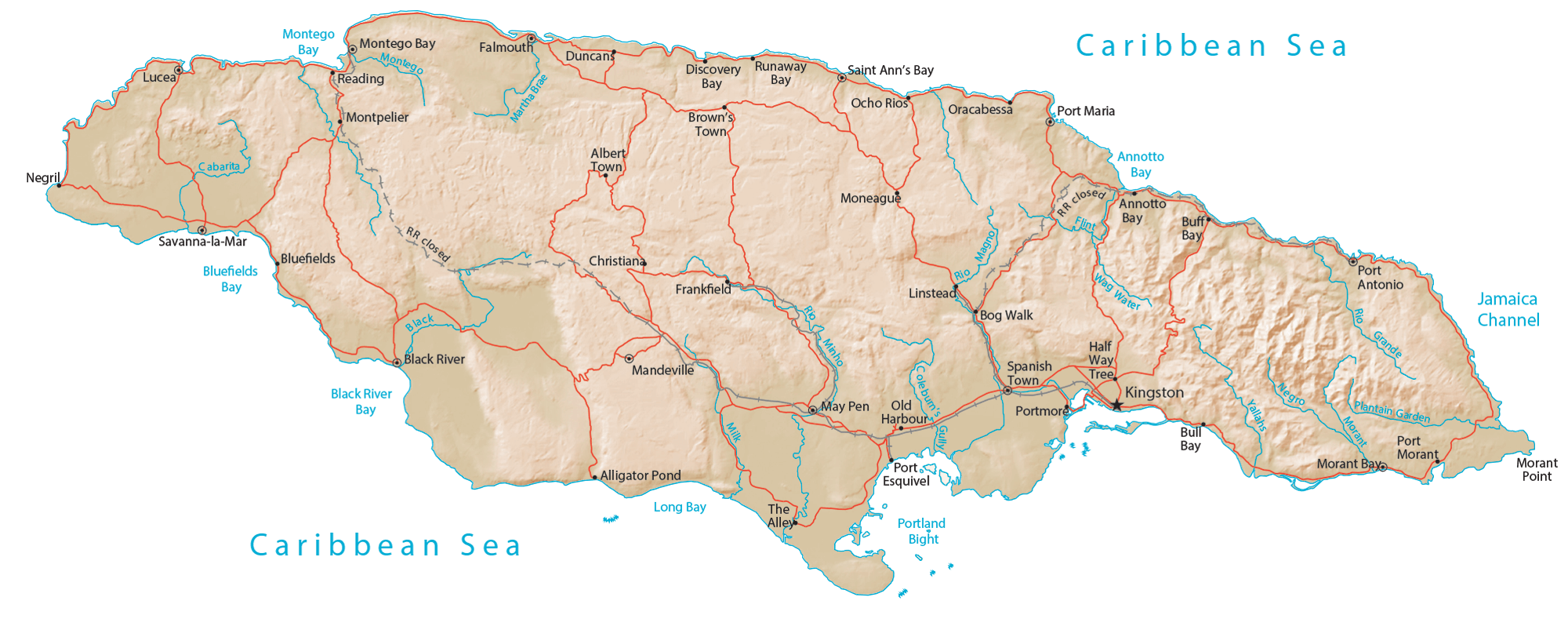
As observed on the physical map of Jaimaica, it is mostly mountainous, with a narrow, discontinuous coastal plain. The island is ringed by numerous bays, small cays and islands, and white-sand beaches stretch for miles in some areas.
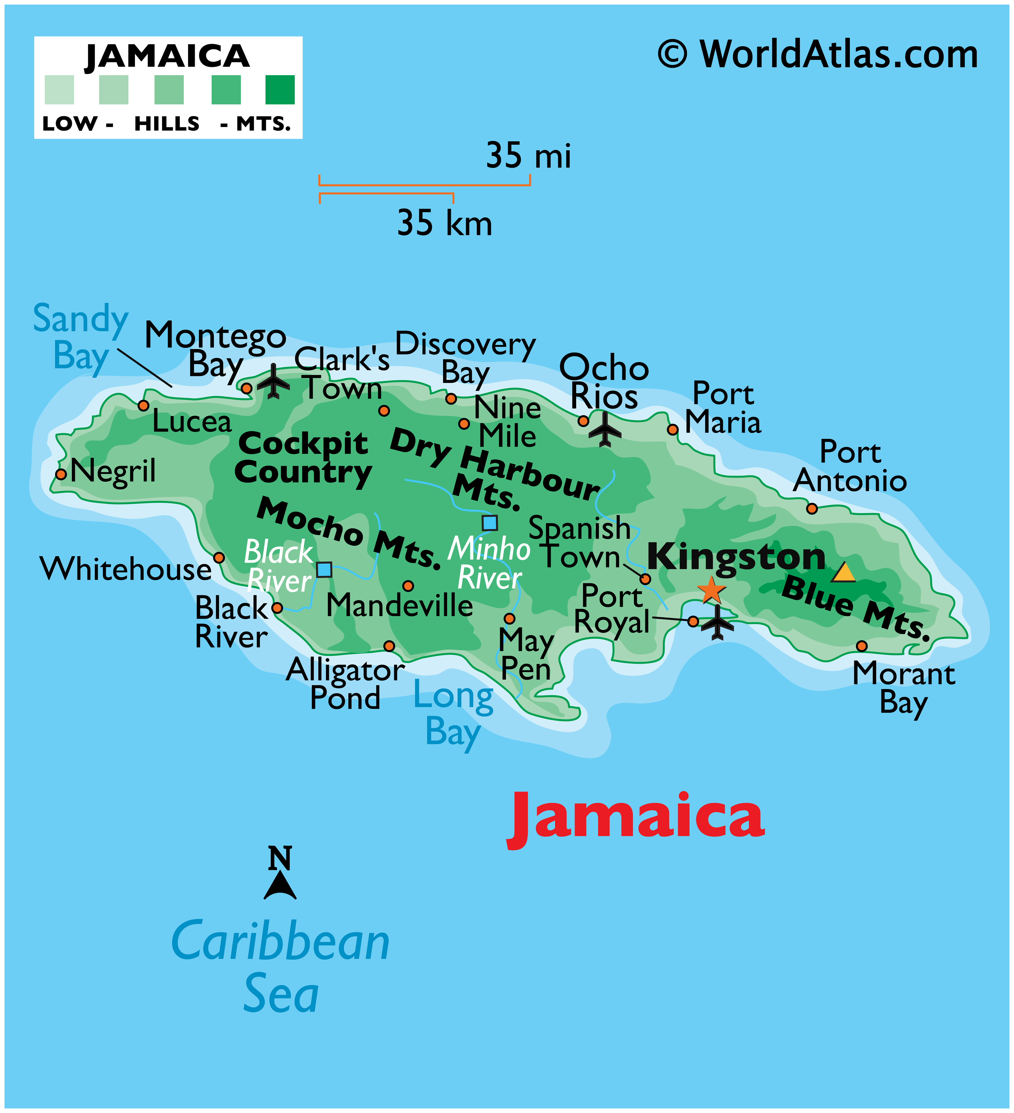
Volcanic in origin, Jamaica can be divided into 3 landform regions: the eastern mountains, the central valleys and plateaus, and the coastal plains. The most elevated area is the Blue Mountains in eastern Jamaica. The highest point is Blue Mountain Peak at 7,402 ft (2,256m). It has been marked on the map by a yellow triangle. Other mountain ranges of note include the John Crow, Dry Harbour and the Southern Manchester Plateau. The limestone plateau covers two-thirds of Jamaica, and there are caves, caverns, sinkholes and valleys and scattered about in large numbers. To the west of the mountains is the rugged terrain of the Cockpit Country. It is a harsh, dramatic landscape filled with endless hills.
As for rivers, there are over 100 in Jamaica. However, most are small, unexplored and not navigable, many are mostly underground rivers and run through the limestone region. The Black River is the largest (widest) river at 73km long. The Rio Minho is the longest river in Jamaica.
| Flag: |  |
|---|---|
| Legal Name: | Jamaica |
| Capital Value: | Kingston |
| Largest City: |
Kingston (590,940) |
| Official languages: | English |
| Demonym(s): | Jamaican |
| Government: | Unitary parliamentary constitutional monarchy |
| Legislature: | Parliament |
| Total Area: | 10,991 km² |
| Land Area: | 10,831 km² |
| Water Area: | 160 km² |
| Population: | 2,948,279 |
| Density: | 266/km (688.9/sq mi) |
| GDP: | $16.46 Billion |
| GDP Per Capita: | $5,582.26 |
| Currency Value: | Jamaican dollars (JMD) |
| Driving side: | left |
| Calling code: | +1-876 +1-658 (Overlay of 876) |
| Internet TLD: | .jm |
Explore Jamaica’s diverse and stunning landscapes with this detailed map. With its lush rainforests, white-sand beaches, and rugged mountain peaks, Jamaica is a paradise for nature lovers. From the capital city of Kingston to the remote reaches of the Cockpit Country, this map of Jamaica reveals the beauty of the Caribbean’s largest English-speaking island.
Discover the Natural Beauty of Jamaica with this Map
Jamaica is a Caribbean nation that is home to many natural wonders. From its majestic Blue Mountains to its crystal-clear waters, this map of Jamaica showcases the island’s breathtaking beauty. Learn more about the country’s cities, towns, highways, and islands with this interactive map. Whether you’re planning a vacation or just curious about the geography of the island, this map will give you a glimpse into the stunningly diverse landscapes of Jamaica.
Online Interactive Political Map
Click on ![]() to view map in "full screen" mode.
to view map in "full screen" mode.
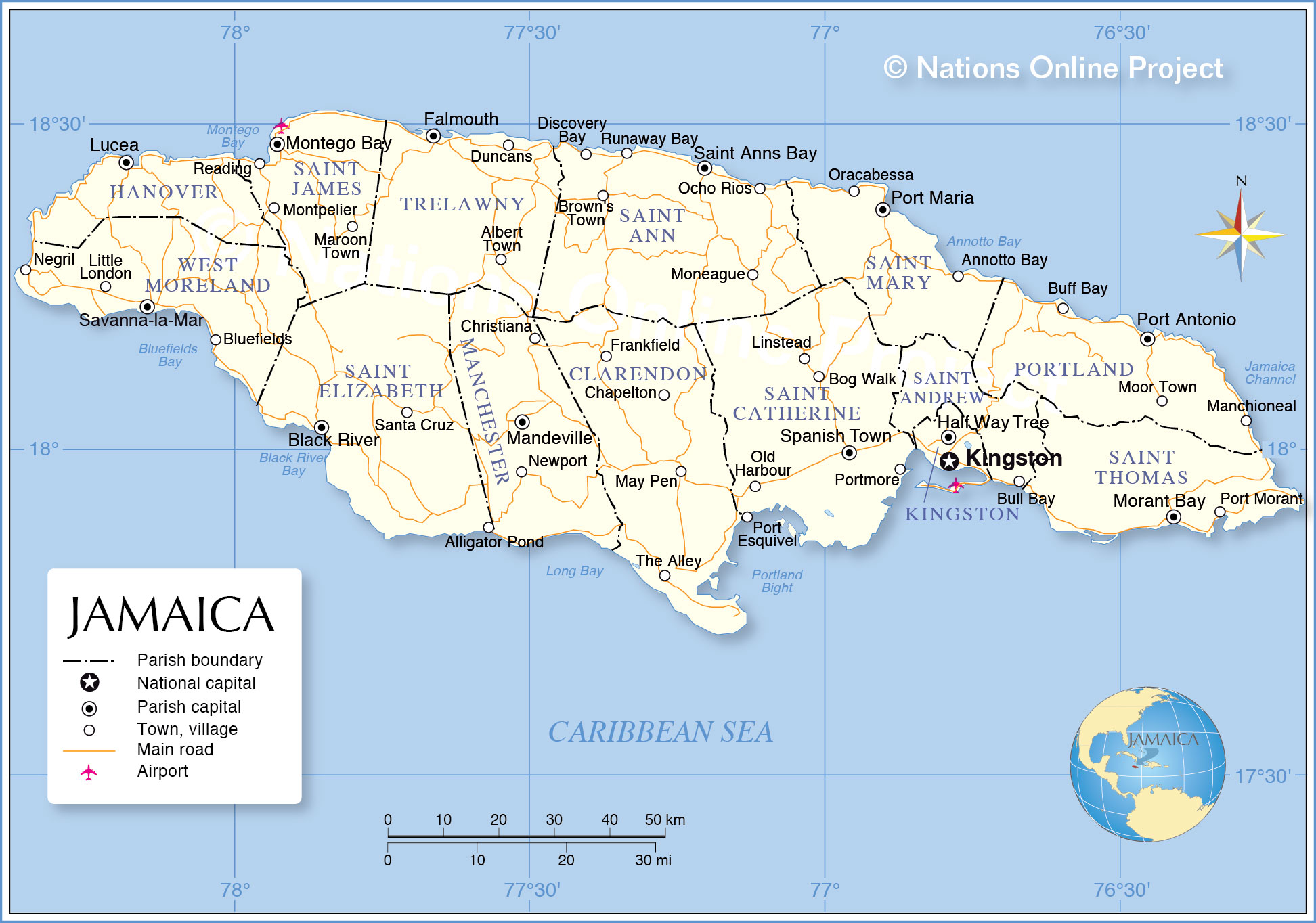
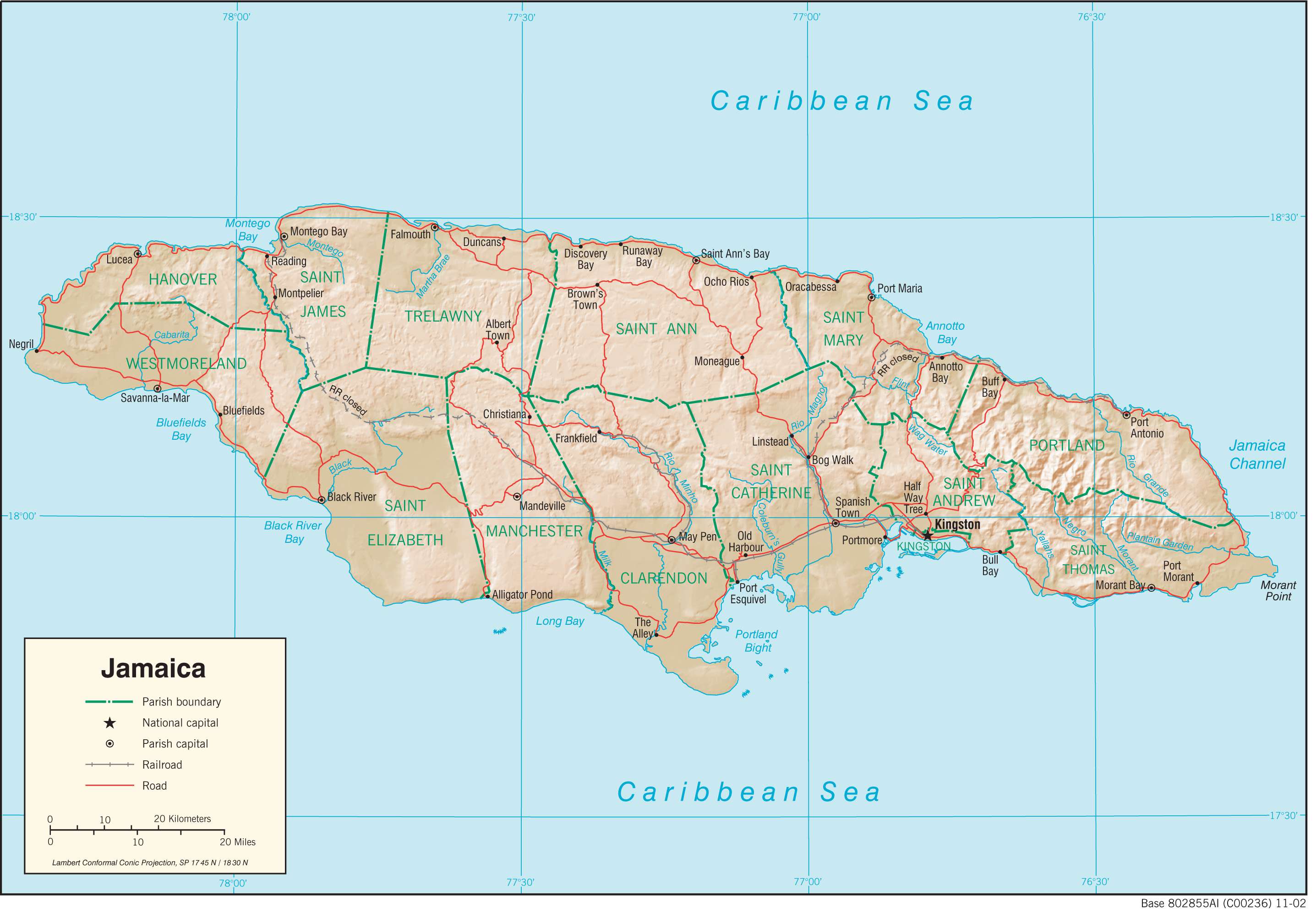
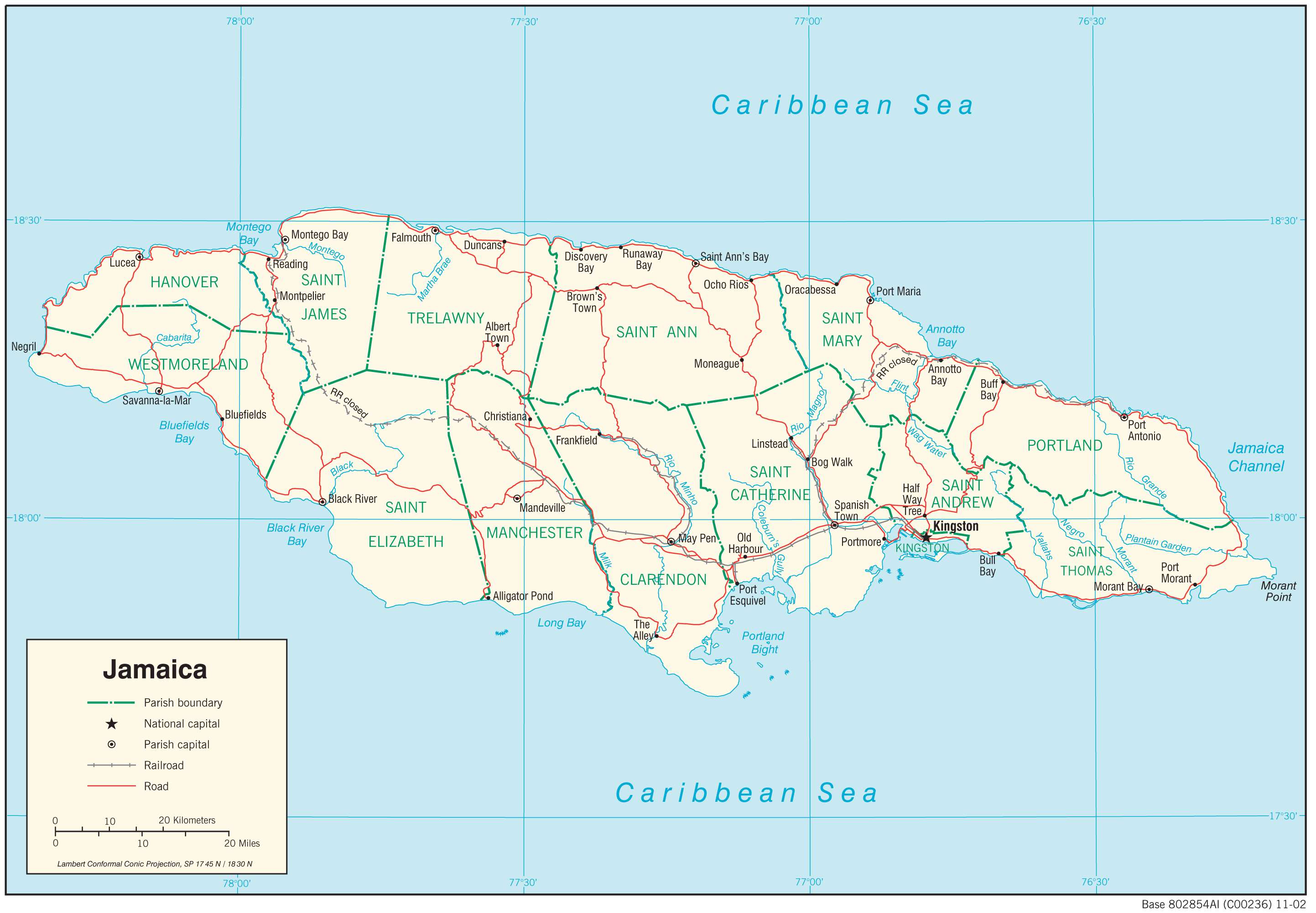
Jamaica is divided into 14 parishes. In alphabetical order, the parishes are: Clarendon, Hanover, Kingston, Manchester, Portland, Saint Andrew, Saint Ann, Saint Catherine, Saint Elizabeth, Saint James, Saint Mary, Saint Thomas, Trelawny and Westmoreland.
Covering an area of 10,990 sq. km, Jamaica is the 3rd largest Caribbean island. It is also the 3rd most populous country in America and the 4th most populous Caribbean nation. Located on the south eastern part of the island is Kingston – the capital and the largest city of Jamaica. It is a major port and an important business center of the country. The Kingston Harbour is the 7th largest natural harbour in the whole world.
Location Maps
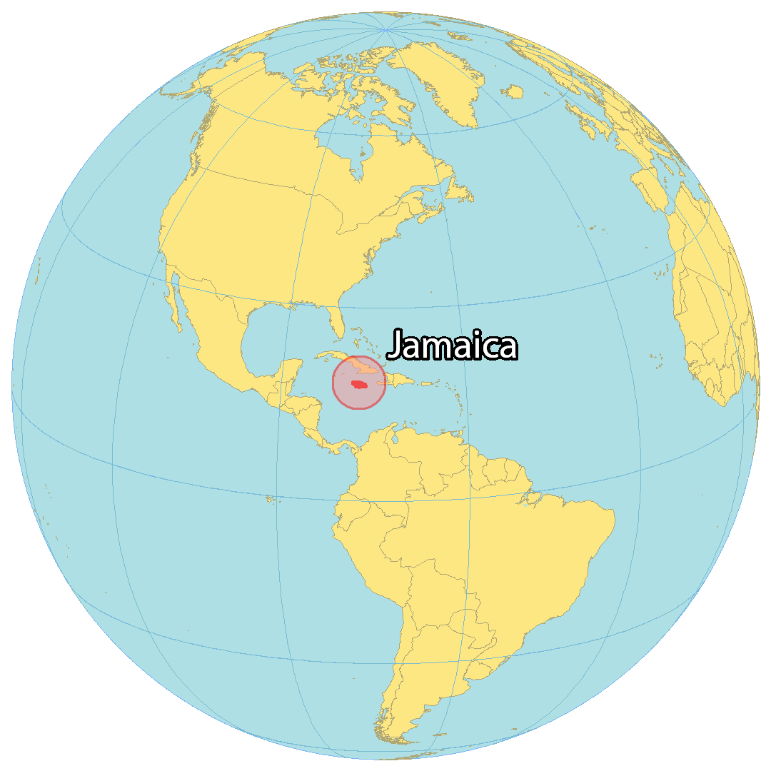
Where is Jamaica?
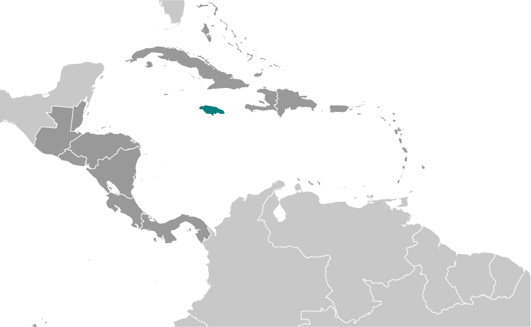
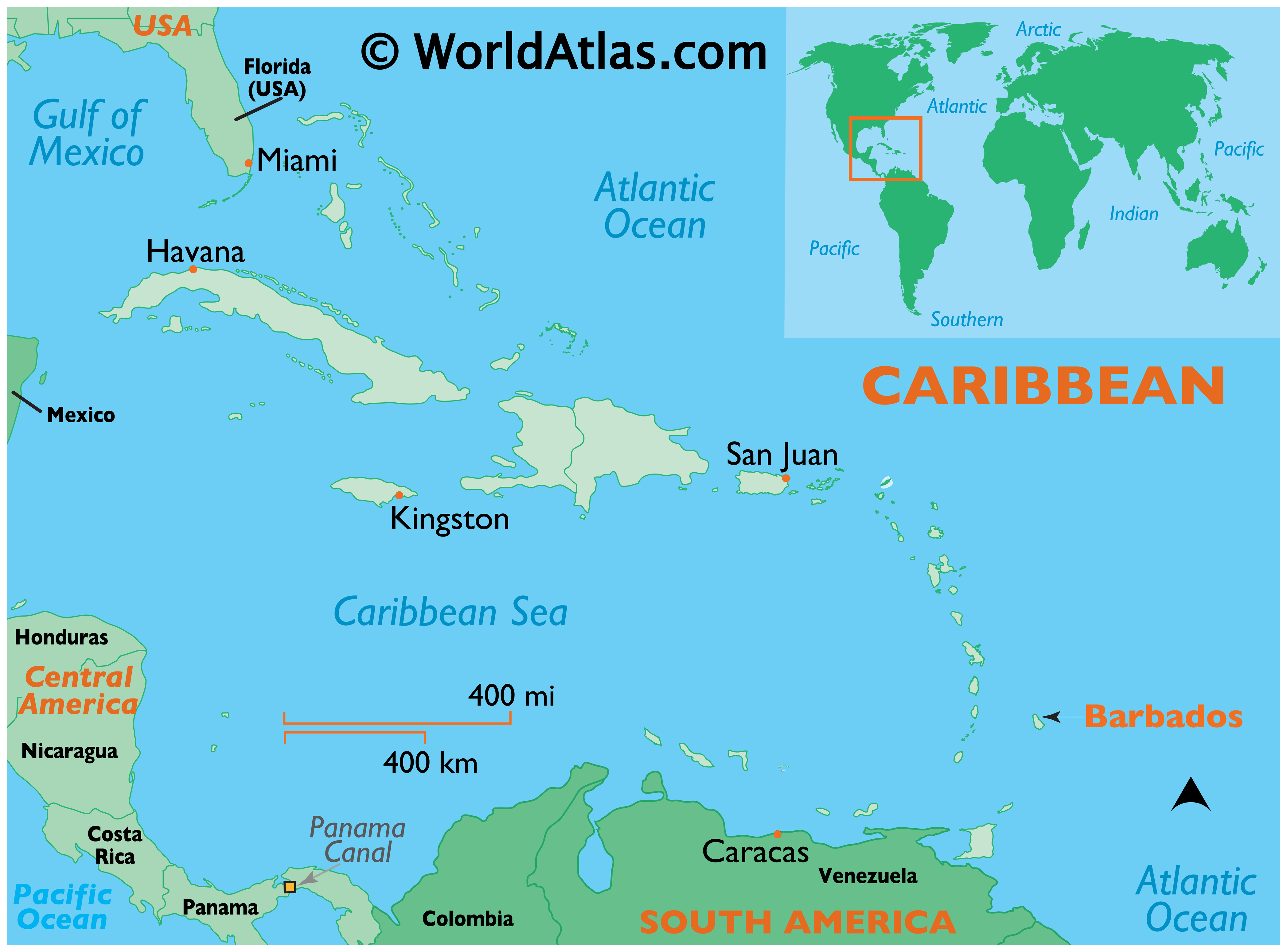
Jamaica is an island situated in the Caribbean Sea and part of the Greater Antilles. It is the third-largest island in the Caribbean, located south of Cuba and west of Haiti. The capital city of Kingston is located on the southeast coast and Montego Bay is a major tourist destination on the northwest coast. Other notable towns and cities in Jamaica include Port Antonio, Ocho Rios, Negril, and Falmouth.
Jamaica has a diverse geography, featuring a variety of landforms such as mountains, valleys, plains, rivers, and coastlines. Its coastline is dotted with bays and coves, as well as several natural harbors. Jamaica is known for its reggae music, sprinters, sandy beaches, and jerk food.
High Definition Political Map of Jamaica

Physical Map of Jamaica
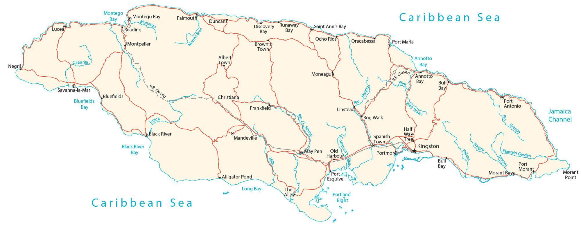
Transportation Map of Jamaica
Jamaica Satellite Map