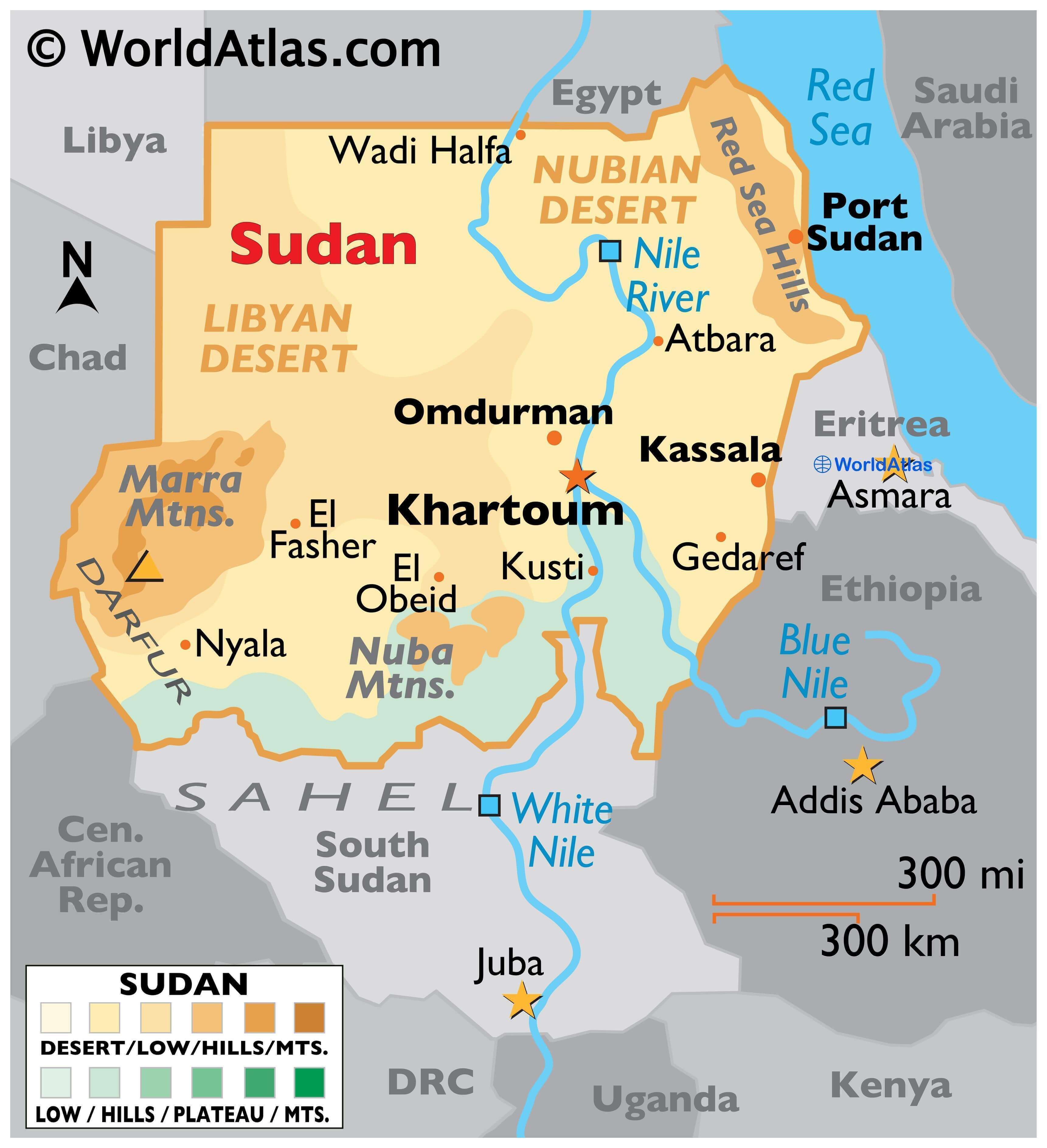
Sudan is a relatively large Northeast African country occupying an area of 1,886,068 sq. km.
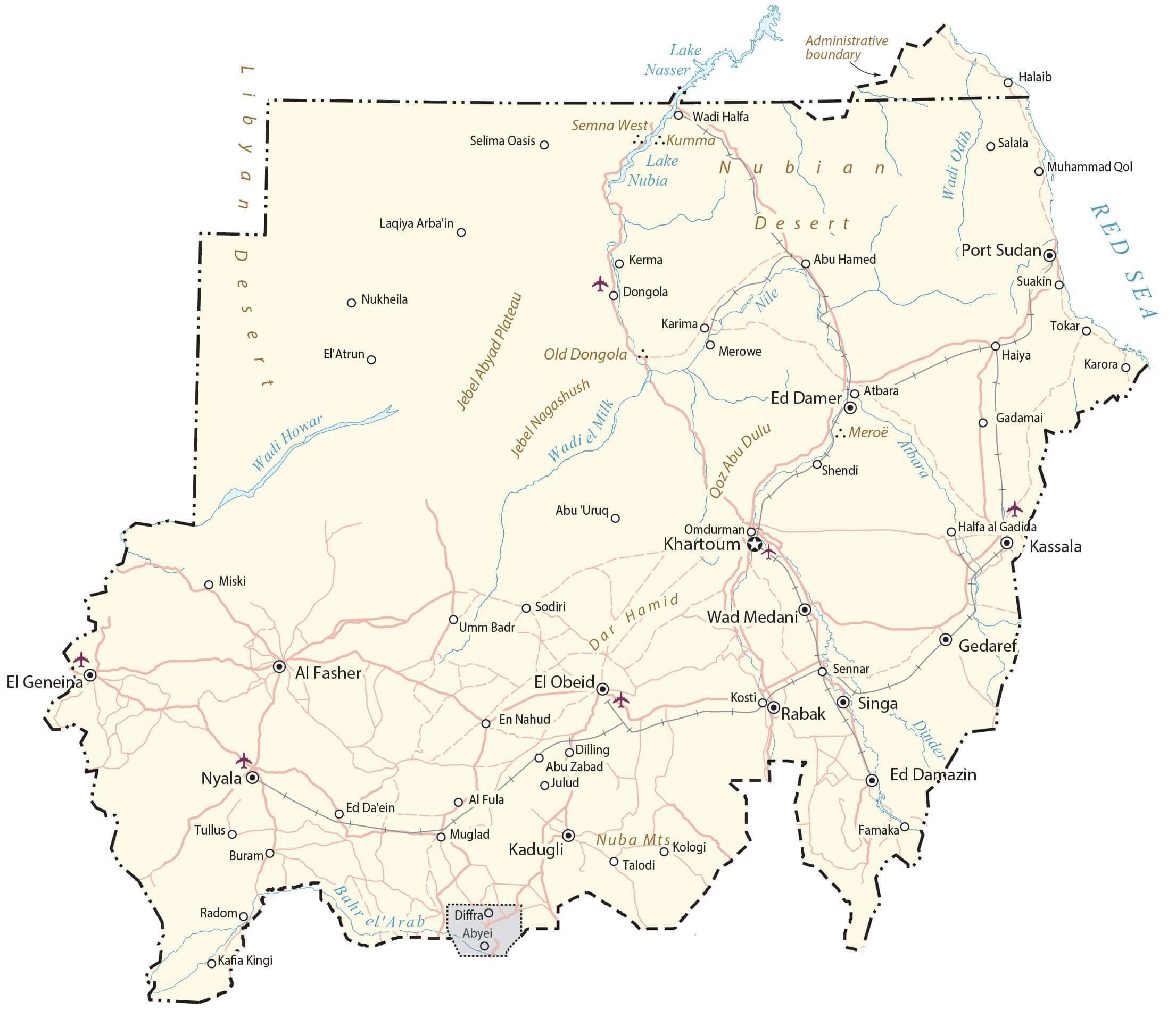
Massive plains and plateaus cover most of Sudan. The central plain of the country can be divided into three regions depending on topography. The northern part of this plain is a primarily rocky desert area called the Nubian Desert (as shown on the map). A central-southern part is a clay plain while the western part features desert area covered by sand dunes.
This vast stretch of plain land is flanked by the Darfur Plateau and Nile-Congo watershed to the west, and the Red Sea Hills and Ethiopian Plateau to the east
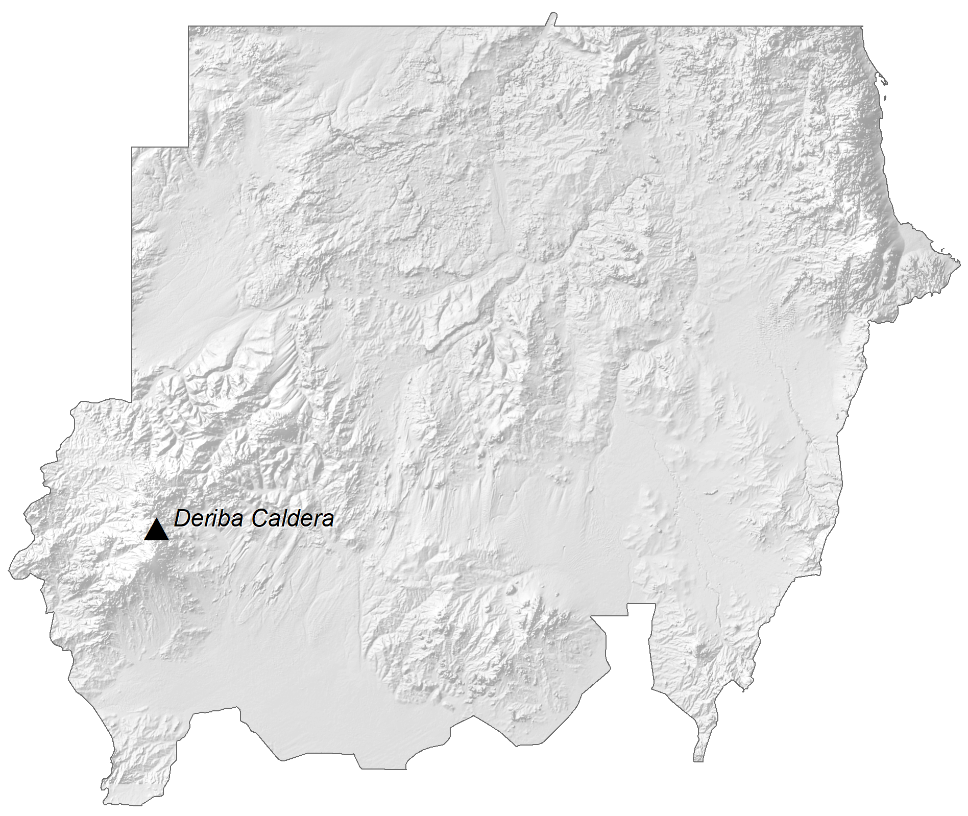
As displayed on Sudan’s physical map, the Marrah Mountains rising from the Darfur Plateau hosts the tallest peak in the country, the Deriba crater which is 3,042 m tall.
Sudan is mainly composed of vast plains and plateaus that are drained by the Nile River and its tributaries. This river system runs from south to north across the entire length of the east-central part of the country.
To the east of the plain, the Red Sea Hills is a region of rugged hills cut by fast-moving streams. A narrow coastal plain lies to the east of this hilly region along the Red Sea.
But nothing is said about the geography of Sudan without mentioning the Nile River and its tributaries flowing from south to north and draining most of the country. The River enters Sudan as the White Nile and then joins the Blue Nile (coming from the Ethiopian Plateau) at Khartoum to form the Nile River.
| Flag: |  |
|---|---|
| Legal Name: | Republic of the Sudan |
| Capital Value: | Khartoum |
| Official languages: |
|
| Demonym(s): | Sudanese |
| Government: | Federal republic under a military junta |
| Legislature: | Transitional Legislative Council |
| Total Area: | 1,861,484 km² |
| Land Area: | 1,731,671 km² |
| Water Area: | 129,813 km² |
| Population: | 42,813,238 |
| Density: | 21.3/km (55.2/sq mi) (202nd) |
| GDP: | $18.90 Billion |
| GDP Per Capita: | $441.51 |
| Currency Value: | Sudanese pounds (SDG) |
| Driving side: | right |
| Calling code: | +249 |
| Internet TLD: | .sd سودان. |
Explore the wonders of Sudan with this interactive map! This map of Sudan provides detailed information on its cities, roads, water, satellite imagery, and elevation. Take a tour down the Nile River, admire the beauty of the Red Sea, and experience the desert in the north of Sudan.
Online Interactive Political Map
Click on ![]() to view map in "full screen" mode.
to view map in "full screen" mode.
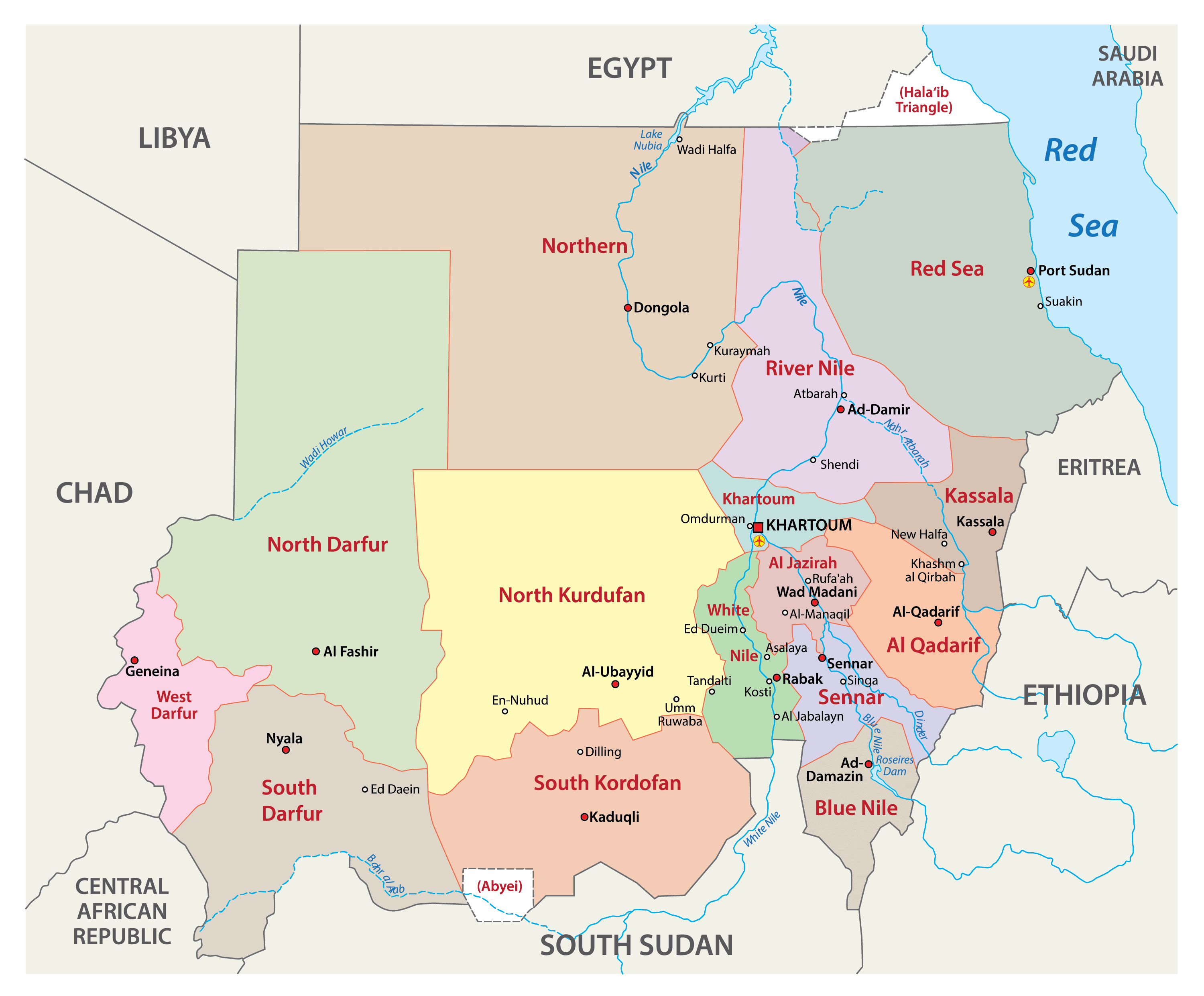
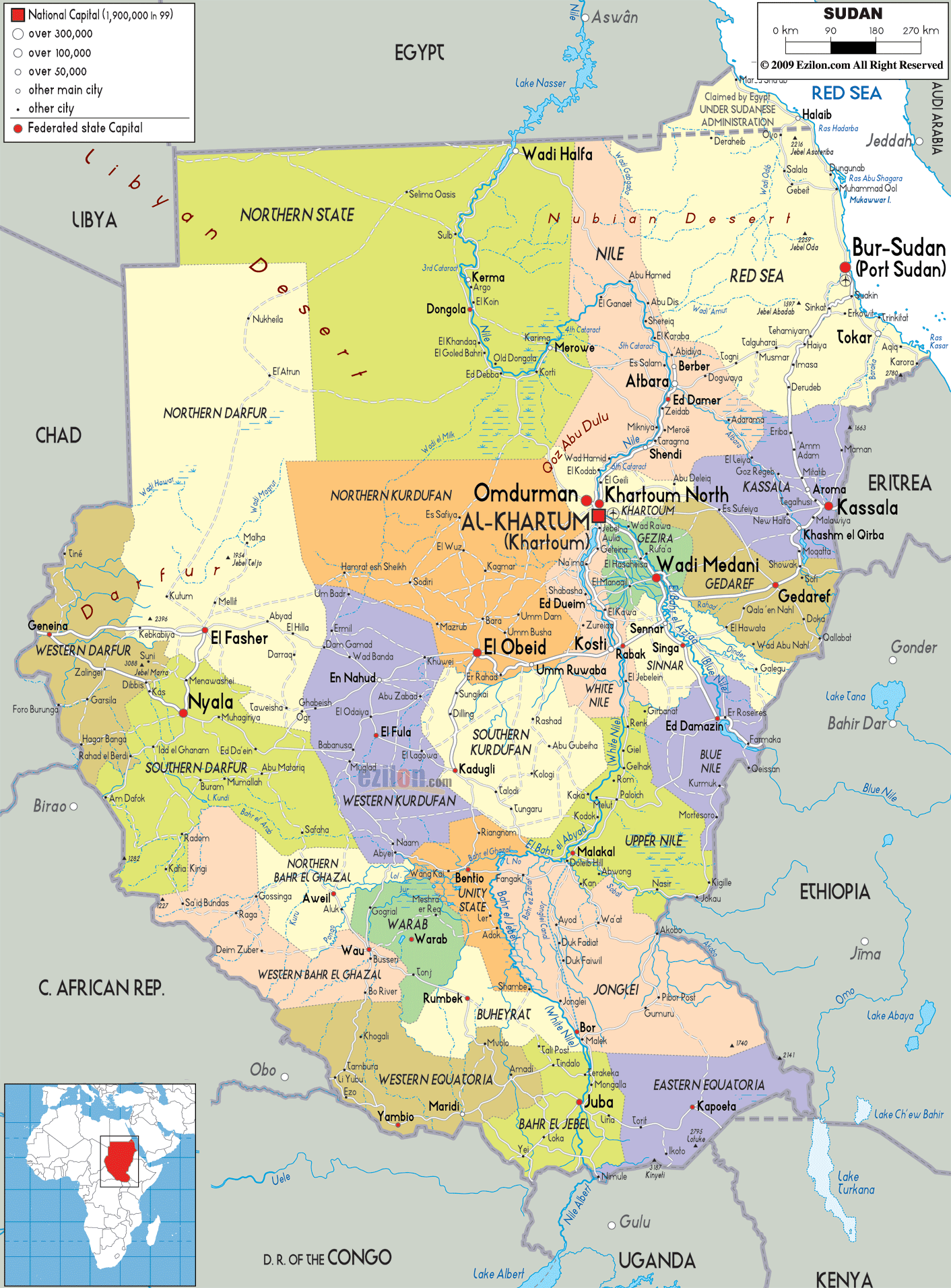
As observed on the map above, the Republic of Sudan has 18 states or 18 wilayat. In alphabetical order, these are Blue Nile, Central Darfur, East Darfur, Gedaref, Gezira, Kassala, Khartoum, North Darfur, North Kordofan, Northern, Red Sea, River Nile, Sennar, South Darfur, South Kordofan, West Darfur, West Kordofan, and White Nile.
Before July 9, 2011, Sudan was composed of 25 states. 10 of these states were ceded to the newly formed country of South Sudan resulting in Sudan having only 15 states. In 2012, two new states were created within the territory of Sudan and a third one was created in 2013. Thus, the total number of states in the country is now 18.
The country also has an area with a special administrative status called the Abyei Area. It is located on the border between Sudan and South Sudan.
Khartoum is the capital city of the country.
Location Maps
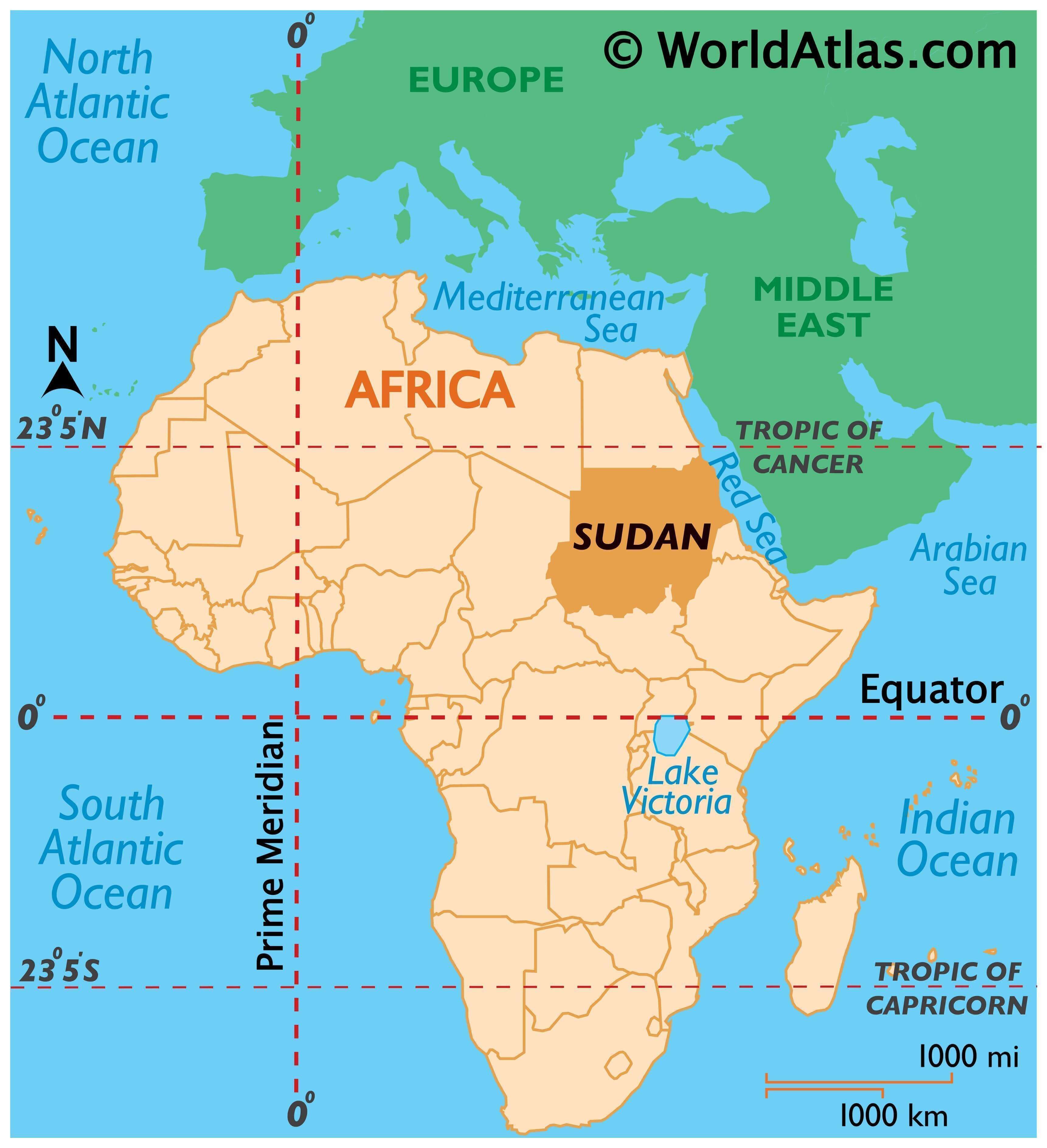
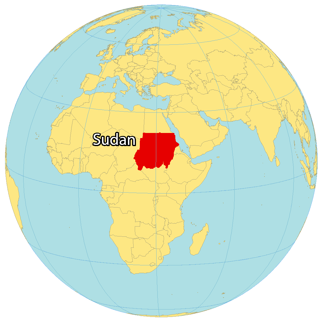
Where is Sudan?
Sudan is a country located in northeast Africa along the Red Sea. It’s renowned for its vast desert lands, majestic pyramids, and the Nile Valley.
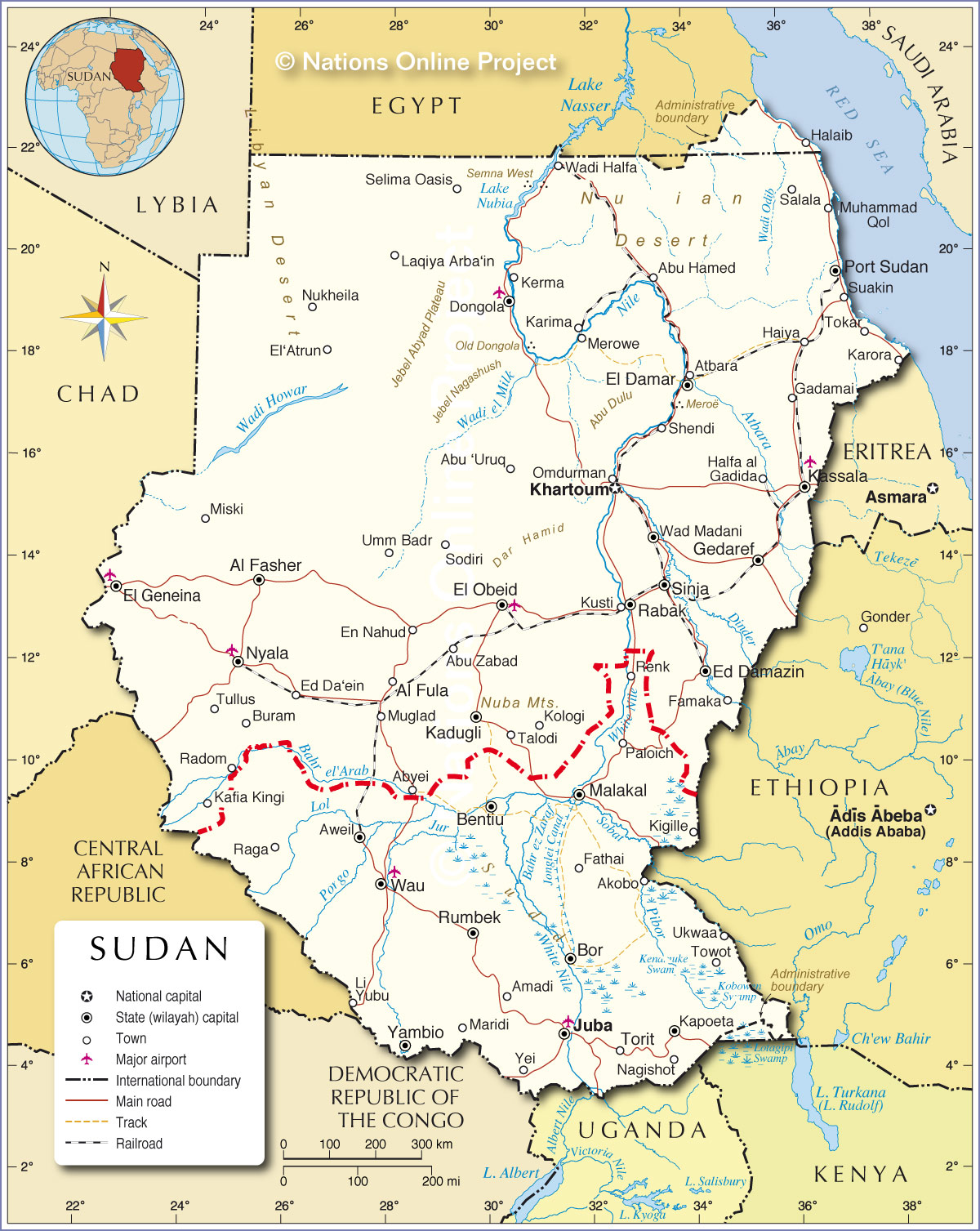
It is bordered by Egypt to the north, Libya to the northwest, Chad to the west, the Central African Republic to the southwest, South Sudan to the south, Ethiopia to the southeast, and Eritrea to the east.
The capital city of Sudan is Khartoum and its biggest city is Omdurman. Other major cities in the country are Nyala, Port Sudan, and Kassala.

High Definition Political Map of Sudan
Physical Map of Sudan
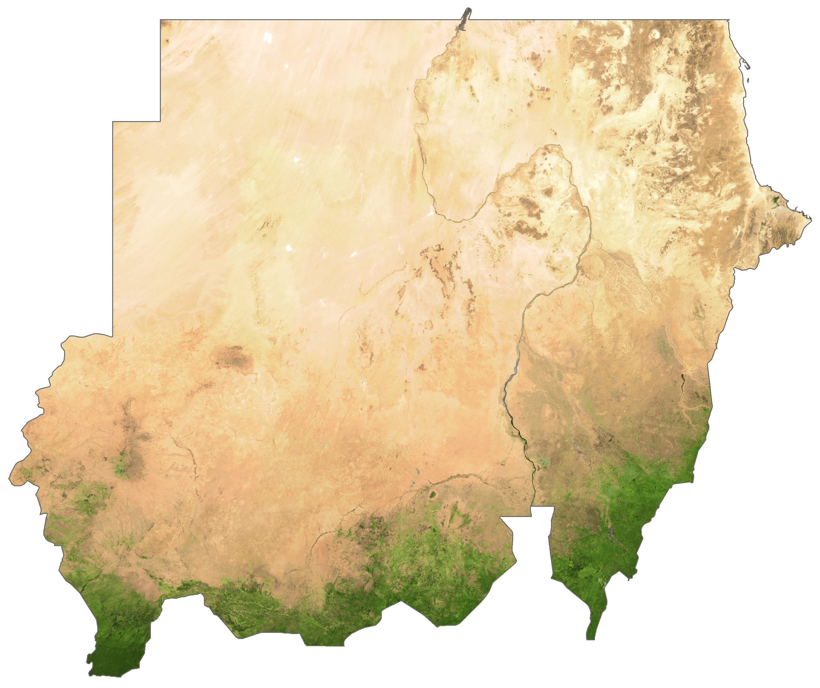
Sudan Satellite Map
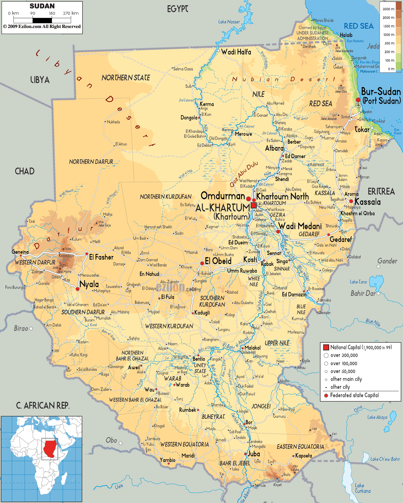
Elevation Map