| Name: | Bergen County |
|---|---|
| FIPS code: | 34-003 |
| State: | New Jersey |
| Founded: | 1683 |
| Named for: | Bergen, Norway or Bergen, North Holland |
| Seat: | Hackensack |
| Total Area: | 246.67 sq mi (638.87 km²) |
| Land Area: | 233.00 sq mi (603.49 km²) |
| Total Population: | 955,732 |
| Population Density: | 4,105.6/sq mi (1,585.2/km²) |
| Time zone: | UTC−5 (Eastern) |
| Summer Time Zone (DST): | UTC−4 (EDT) |
| Website: | www.co.bergen.nj.us |
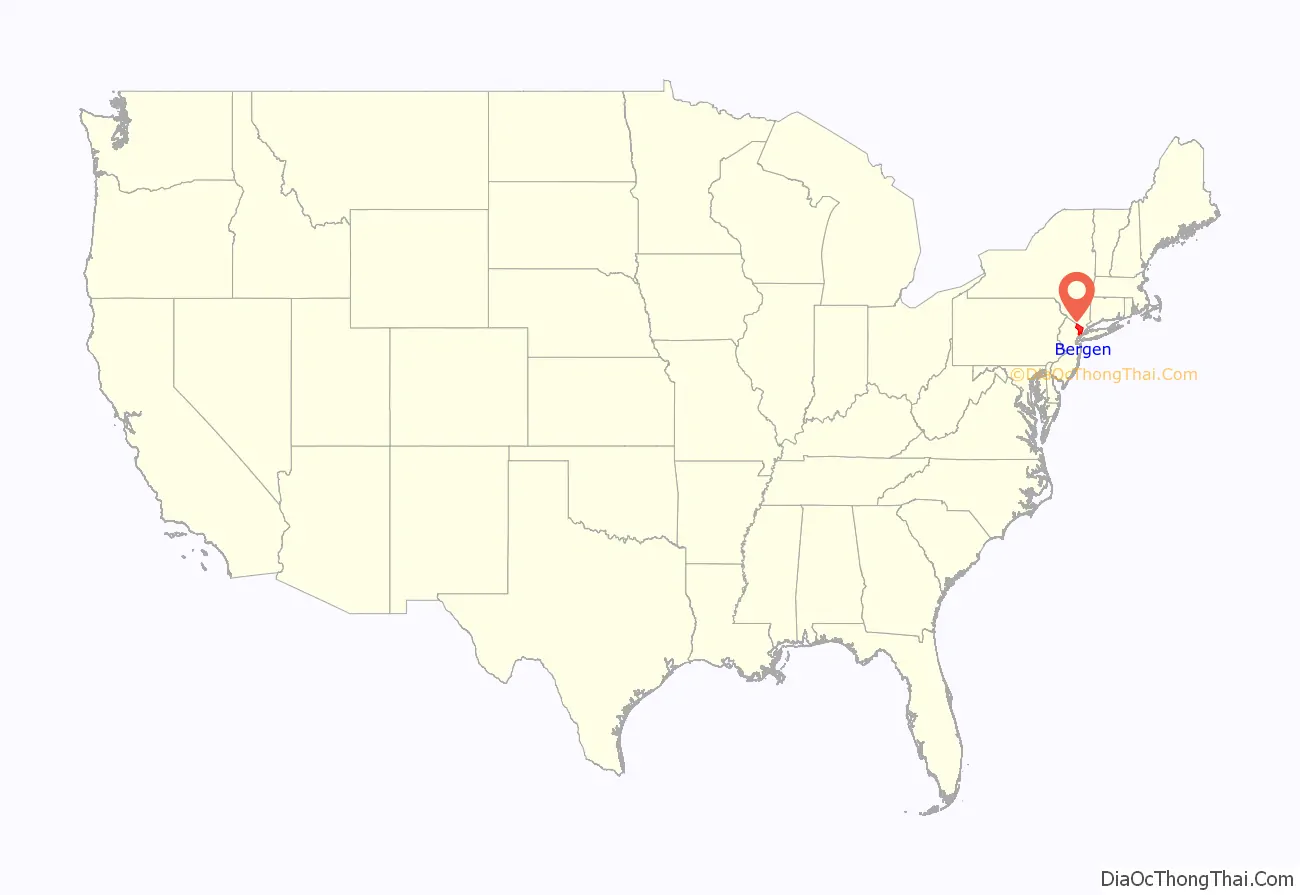
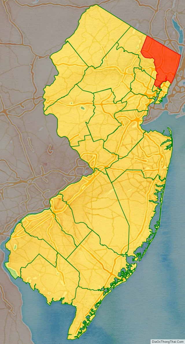
Bergen County location map. Where is Bergen County?
History
At the time of first European contact, Bergen County was inhabited by Native American people, particularly the Lenape Nation, whose subgroups included the Tappan, Hackensack, and Rumachenanck (later called the Haverstraw), as named by the Dutch colonists. Some of their descendants are included among the Ramapough Mountain Indians, recognized as a tribe by the state in 1980. Their ancestors had moved into the mountains to escape encroachment by Dutch and English colonists. Their descendants reside mostly in the northwest of the county, in nearby Passaic County and in Rockland County, New York, tracing their Lenape ancestry to speakers of the Munsee language, one of three major dialects of their language. Over the years, they absorbed other ethnicities by intermarriage.
In the 17th century, the Dutch considered the area comprising today’s Bergen and Hudson counties as part of New Netherland, their colonial province of the Dutch Republic. The Dutch claimed it after Henry Hudson (sailing for the Dutch East India Company) explored Newark Bay and anchored his ship at Weehawken Cove in 1609. From an early date, the Dutch began to import African slaves to fill their labor needs. Bergen County eventually was the largest slaveholding county in the state, with nearly 20% of its population consisting of slaves in 1800. The African slaves were used for labor at the ports to support shipping, as well as for domestic servants, trades, and farm labor.
Early settlement attempts by the Dutch colonists included Pavonia (1633), Vriessendael (1640), and Achter Col (1642), but the Native Americans repelled these settlements in Kieft’s War (1643–1645) and the Peach Tree War (1655–1660). European settlers returned to the western shores of the Hudson River in the 1660 formation of Bergen Township, which would become the first permanent European settlement in the territory of present-day New Jersey.
During the Second Anglo-Dutch War, on August 27, 1664, New Amsterdam’s governor Peter Stuyvesant surrendered to the English Navy. The English organized the Province of New Jersey in 1665, later splitting the territory into East Jersey and West Jersey in 1674. On November 30, 1675, the settlement Bergen and surrounding plantations and settlements were called Bergen County in an act passed by the province’s General Assembly. In 1683, Bergen (along with the three other original counties of East Jersey) was officially recognized as an independent county by the Provincial Assembly.
Initially, Bergen County consisted of only the land between the Hudson River and the Hackensack River, extending north to the border between East Jersey and New York. In January 1709, the boundaries were extended to include all of the current territory of Hudson County (formed in 1840) and portions of the current territory of Passaic County (formed in 1837). The 1709 borders were described as follows:
Bergen was the location of several battles and troop movements during the American Revolutionary War. Fort Lee‘s location on the bluffs of the New Jersey Palisades, opposite Fort Washington in Manhattan, made it a strategic position during the war. In November 1776, the Battle of Fort Lee took place as part of a British plan to capture George Washington and to resoundingly defeat the Continental Army, whose forces were divided and located in Fort Lee and Hackensack. After abandoning the defenses in Fort Lee and leaving behind considerable supplies, the Continental forces staged a hasty retreat through present-day Englewood, Teaneck, and Bergenfield, and across the Hackensack River at New Bridge Landing, one of the few sites where the river was crossed by a bridge. They destroyed the bridge to delay the British assault on Washington’s headquarters in the village of Hackensack. The next day, George Washington retreated to Newark and left Hackensack via Polifly Road. British forces pursued, and Washington continued to retreat across New Jersey. The retreat allowed American forces to escape capture and regroup for subsequent successes against the British elsewhere in New Jersey later that winter.
Soon after the Battle of Princeton in January 1777, British forces realized that they were not able to spread themselves thin across New Jersey. Local militia retook Hackensack and the rest of Bergen County. Bergen County saw skirmishes throughout the war as armies from both sides maneuvered across the countryside.
The Baylor Massacre took place in 1778 in River Vale, resulting in severe losses for the Continentals.
In 1837, Passaic County was formed from parts of Bergen and Essex counties. In 1840, Hudson County was formed from Bergen. These two divisions took roughly 13,000 residents (nearly half of the previous population) from the county’s rolls.
In 1852, the Erie Railroad began operating major rail services from Jersey City on the Hudson River to points north and west via leased right-of-way in the county. This became known as the Erie Main Line, and is still in use for passenger service today. The Erie later leased two other railroads built in the 1850s and 1860s, later known as the Pascack Valley Line and the Northern Branch, and in 1881 built a cutoff, now the Bergen County Line. There were two other rail lines in the county, ultimately known as the West Shore Railroad and the New York, Susquehanna, and Western.
In 1894, state law was changed to allow easy formation of municipalities with the Borough form of government. This led to the “boroughitis” phenomenon, in which many new municipalities were created in a span of a few years. There were 26 boroughs that were formed in the county in 1894 alone, with two more boroughs (and one new township) formed in 1895.
On January 11, 1917, the Kingsland Explosion took place at a munitions factory in what is today Lyndhurst. The explosion is believed to have been an act of sabotage by German agents, as the munitions in question were destined for Russia, part of the U.S.’s effort to supply allies before entrance into World War I. After the U.S. entry into the war in April 1917, Camp Merritt was created in eastern Bergen County for troop staging. Beginning operations in August 1917, it housed 50,000 soldiers at a time, staging them for deployment to Europe via Hoboken. Camp Merritt was decommissioned in November 1919.
The George Washington Bridge was completed in 1931, linking Fort Lee to Manhattan. This connection spurred rapid development in the post-World War II era, developing much of the county to suburban levels. Two lanes were added to the upper level in 1946 and a second deck of traffic on the bridge was completed in 1962, expanding its capacity to becoming the world’s only 14-lane suspension bridge. The bridge is the world’s busiest motor vehicle bridge, carrying 104 million vehicles in 2019.
In 1955, the United States Army established a Nike Missile station at Campgaw Mountain (in the west of the county) for the defense of the New York Metropolitan Area from strategic bombers. In 1959, the site was upgraded to house Nike-Hercules Missiles with increased range, speed, and payload characteristics. The missile site closed in June 1971.
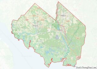
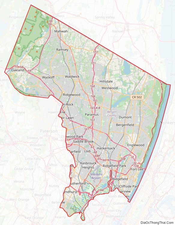
Bergen County Road Map
Geography
Bergen County is located at the northeastern corner of the state of New Jersey and is bordered by Rockland County, New York to the north; by Manhattan and the Bronx in New York City, as well as by Westchester County, New York, across the Hudson River to the east; and within New Jersey, by Hudson County as well as a small border with Essex County to the south, and by Passaic County to the west.
According to the United States Census Bureau, the county had a total area of 246.671 square miles (638.87 km), of which 233.009 square miles (603.49 km) (94.5%) was land and 13.662 square miles (35.38 km) (5.5%) was water.
Bergen County’s highest elevation is Bald Mountain near the New York state line in Mahwah, at 1,164 feet (355 m) above sea level. The county’s lowest point is sea level, along the Hudson River, which in this region is a tidal estuary.
The sharp cliffs of the New Jersey Palisades lift much of the eastern boundary of the county up from the Hudson River. The relief becomes less pronounced across the middle section of the county, much of it being located in the Hackensack River valley or the Pascack Valley. In the northwestern portion of the county, Bergen County becomes hilly again and shares the Ramapo Mountains with Rockland County, New York.
The damming of the Hackensack River and a tributary, the Pascack Brook, produced three reservoirs in the county, Woodcliff Lake Reservoir (which impounds one billion gallons of water), Lake Tappan (3.5 billion gallons), and Oradell Reservoir, which allows United Water to provide drinking water to 750,000 residents of northern New Jersey, mostly in Bergen and Hudson counties. The Hackensack River drains the eastern portion of the county through the New Jersey Meadowlands, a wetlands area in the southern portion of the county. The central portion is drained by the Saddle River and the western portion is drained by the Ramapo River. Both of these are tributaries of the Passaic River, which forms a section of the southwestern border of the county.
Climate
Southeastern Bergen County lies at the edge of the humid subtropical climate zone (Cfa) according to the Köppen climate classification because its coldest month (January) averages above 26.6 °F / -3 °C. In part due to Bergen’s coastal location, its lower elevation, and the partial shielding of the county from colder air by the three ridges of the Watchung Mountains as well as by the higher Appalachians, the climate of Bergen County is milder than in New Jersey counties further inland such as Sussex County. Bergen County has a moderately sunny climate, averaging between 2,400 and 2,800 hours of sunshine annually.
In recent years, average temperatures in the county seat of Hackensack have ranged from a low of 19 °F (−7 °C) in January to a high of 86 °F (30 °C) in July, although a record low of −15 °F (−26 °C) was recorded in February 1934 and a record high of 106 °F (41 °C) was recorded in July 1936. Average monthly precipitation ranged from 3.21 inches (82 mm) in February to 4.60 inches (117 mm) in July.
Average monthly temperatures at the interchange of Route 17 and MacArthur Boulevard in Mahwah range from 28.5 °F in January to 73.8 °F in July. Using the 0 °C January isotherm, most of Bergen has a hot-summer humid continental climate (Dfa) except for higher areas in the Ramapo Mountains which are Dfb and along the Hudson River from Fort Lee down where Cfa exists. [1] Due to its location and elevation span, Bergen is thus the only county in New Jersey to have all three of the state’s Köppen climate zones.
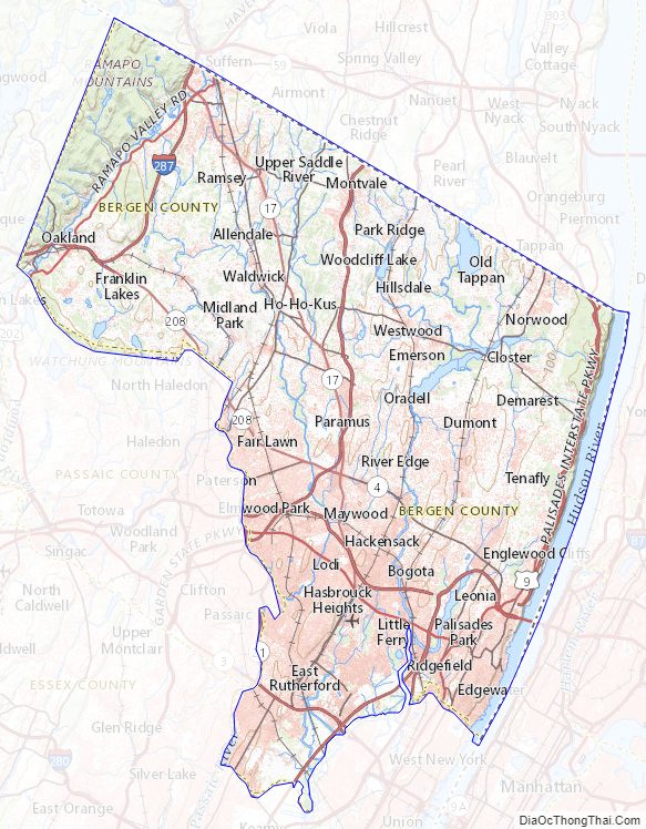
Bergen County Topographic Map
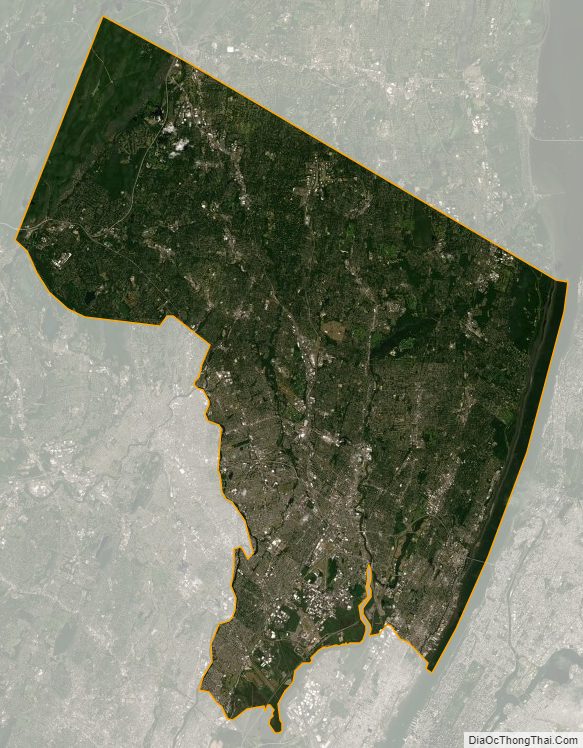
Bergen County Satellite Map
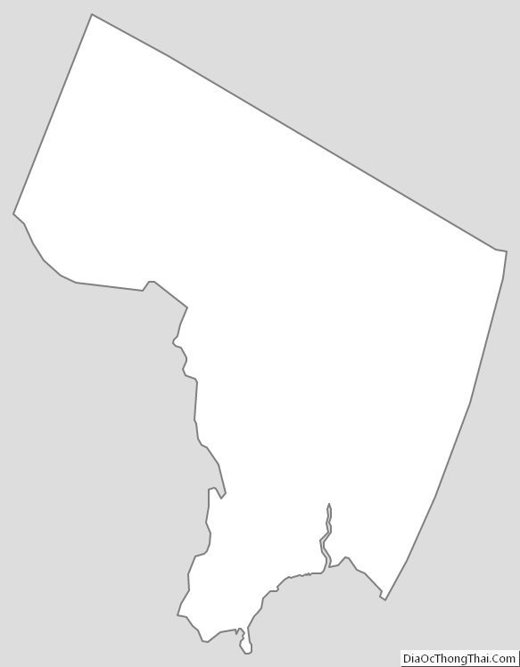
Bergen County Outline Map