Carlstadt is a borough in Bergen County, in the U.S. state of New Jersey. As of the 2020 United States census, the borough’s population was 6,372, an increase of 245 (+4.0%) from the 2010 census count of 6,127, which in turn reflected an increase of 210 (+3.5%) from the 5,917 counted in the 2000 census.
Carlstadt was originally formed as a village by an act of the New Jersey Legislature on March 12, 1860, within Lodi Township. Most sources indicate that the community was named for Carl Klein, the leader of a group of early German settlers who led the project to establish the community though Henry Gannett stated that the name derived from the city of Karlovac in Croatia, which was known as “Carlstadt” in German. The Borough of Carlstadt was incorporated on June 27, 1894, formally set off from Bergen Township. The borough was formed during the “Boroughitis” phenomenon then sweeping through Bergen County, in which 26 boroughs were formed in the county in 1894 alone.
| Name: | Carlstadt borough |
|---|---|
| LSAD Code: | 21 |
| LSAD Description: | borough (suffix) |
| State: | New Jersey |
| County: | Bergen County |
| Incorporated: | June 27, 1894 |
| Elevation: | 13 ft (4 m) |
| Total Area: | 4.21 sq mi (10.90 km²) |
| Land Area: | 3.95 sq mi (10.22 km²) |
| Water Area: | 0.26 sq mi (0.67 km²) 6.18% |
| Total Population: | 6,372 |
| Population Density: | 1,614.4/sq mi (623.3/km²) |
| ZIP code: | 07072 |
| Area code: | 201 |
| FIPS code: | 3410480 |
| GNISfeature ID: | 0885180 |
| Website: | www.carlstadtnj.us |
Online Interactive Map
Click on ![]() to view map in "full screen" mode.
to view map in "full screen" mode.
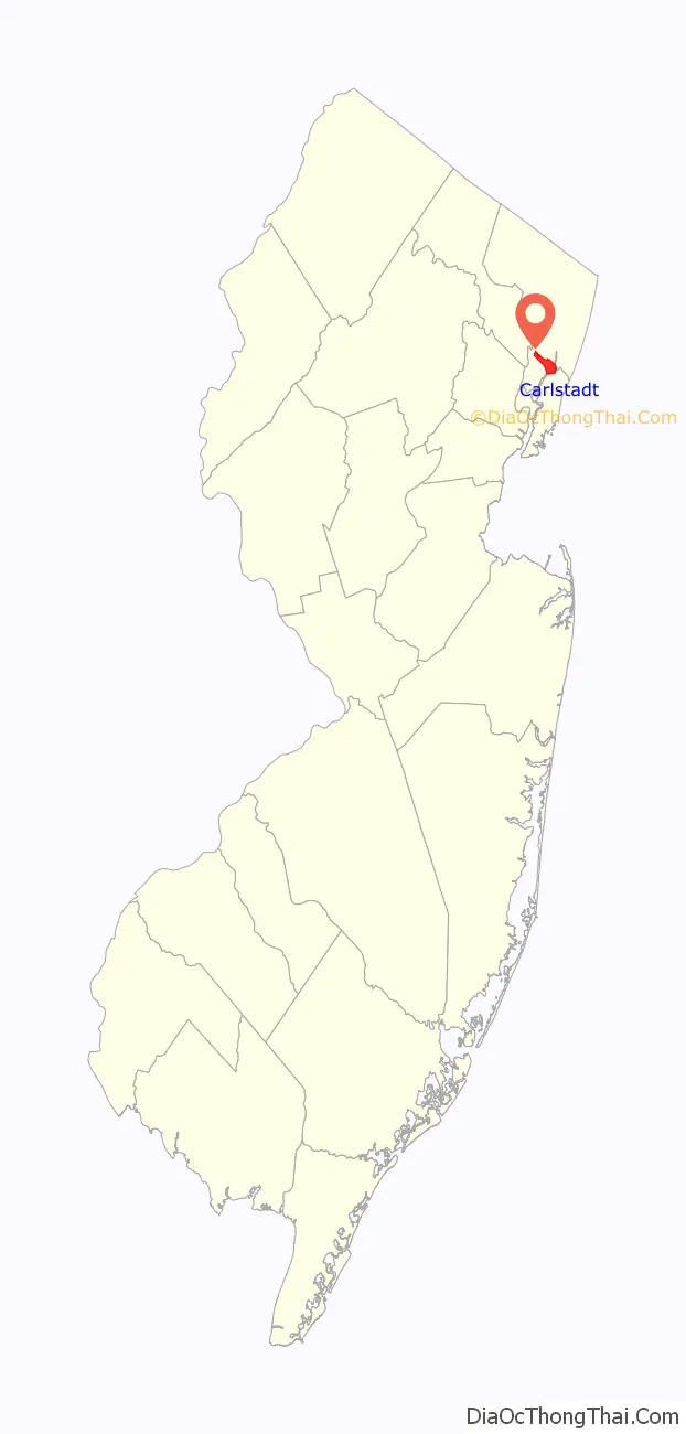
Carlstadt location map. Where is Carlstadt borough?

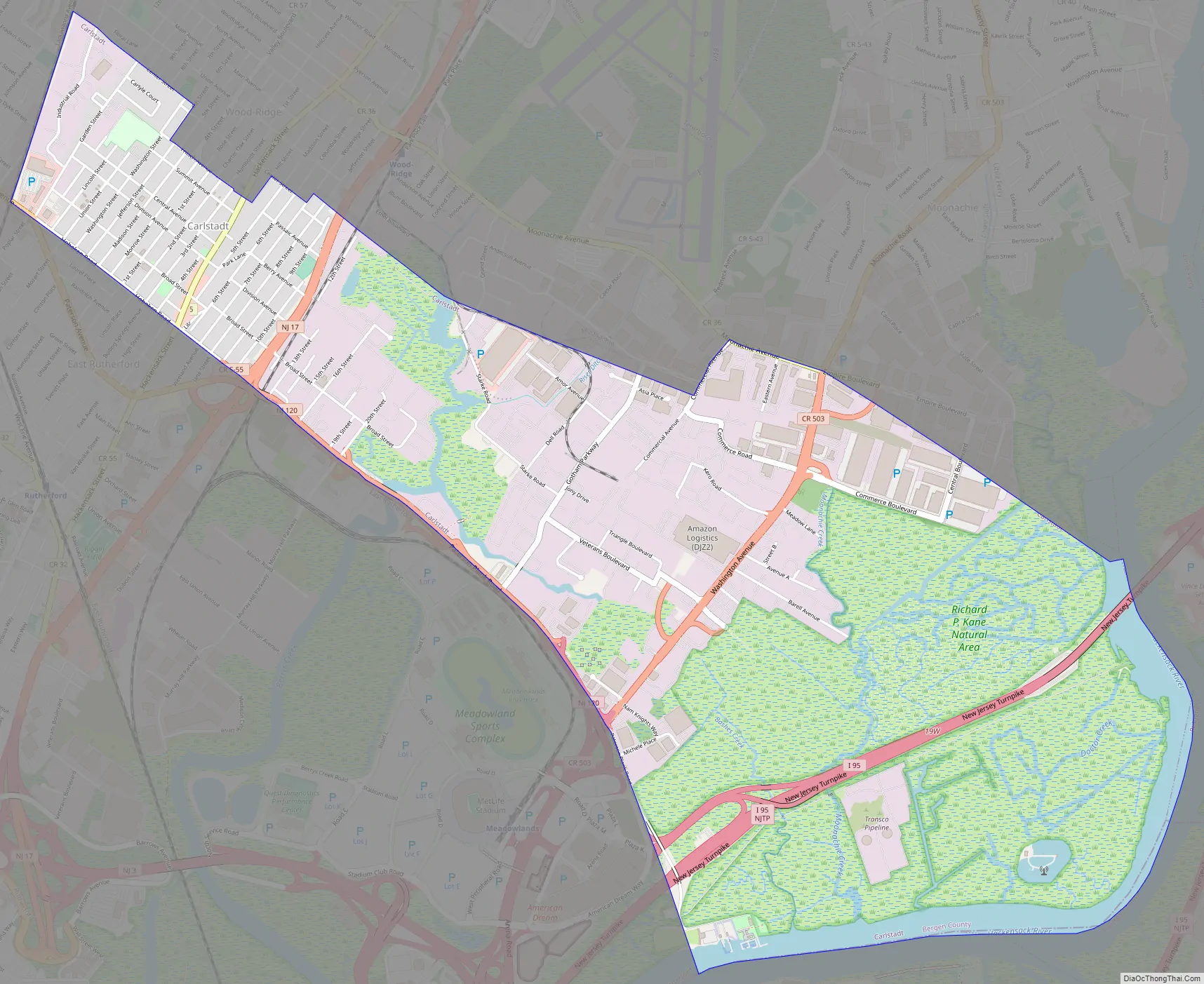
Carlstadt Road Map
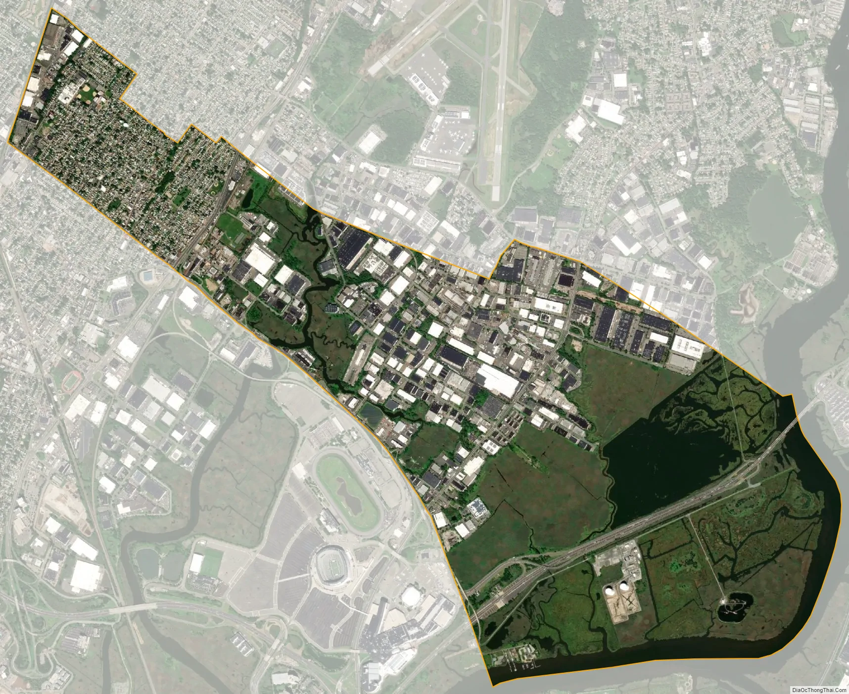
Carlstadt city Satellite Map
Geography
According to the United States Census Bureau, the borough had a total area of 4.21 square miles (10.90 km), including 3.95 square miles (10.22 km) of land and 0.26 square miles (0.67 km) of water (6.18%).
Carlstadt is bordered on the south by East Rutherford in Bergen County, Secaucus and North Bergen in Hudson County, on the north by Wood-Ridge and Moonachie (Bergen) to the east by Ridgefield and South Hackensack (Bergen), and to the northwest by Wallington (Bergen). The borough is approximately 8 miles (13 km) northwest of New York City and 95 miles (153 km) northeast of Philadelphia.
See also
Map of New Jersey State and its subdivision: Map of other states:- Alabama
- Alaska
- Arizona
- Arkansas
- California
- Colorado
- Connecticut
- Delaware
- District of Columbia
- Florida
- Georgia
- Hawaii
- Idaho
- Illinois
- Indiana
- Iowa
- Kansas
- Kentucky
- Louisiana
- Maine
- Maryland
- Massachusetts
- Michigan
- Minnesota
- Mississippi
- Missouri
- Montana
- Nebraska
- Nevada
- New Hampshire
- New Jersey
- New Mexico
- New York
- North Carolina
- North Dakota
- Ohio
- Oklahoma
- Oregon
- Pennsylvania
- Rhode Island
- South Carolina
- South Dakota
- Tennessee
- Texas
- Utah
- Vermont
- Virginia
- Washington
- West Virginia
- Wisconsin
- Wyoming


