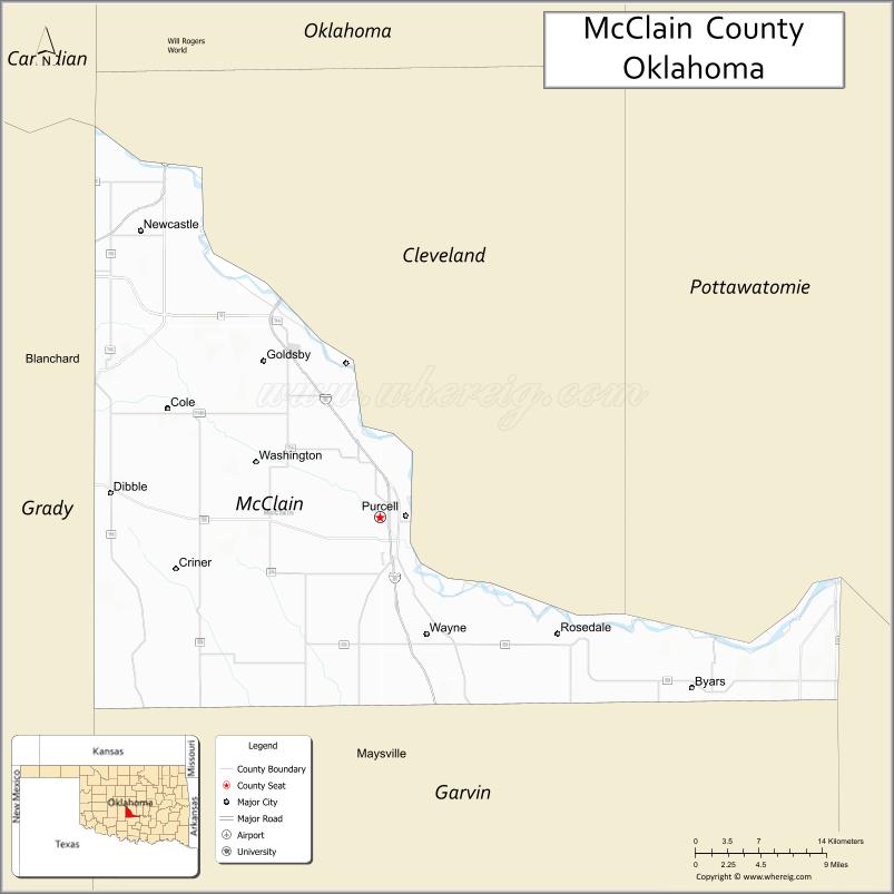
McClain County is a county located in south central Oklahoma. As of the 2020 census, the population was 41,662. Its county seat is Purcell. The county was named for Charles M. McClain, an Oklahoma constitutional convention attendee.
McClain County is part of the Oklahoma City, OK Metropolitan Statistical Area.
| Name: | McClain County |
|---|---|
| FIPS code: | 40-087 |
| State: | Oklahoma |
| Founded: | 1907 |
| Seat: | Purcell |
| Largest city: | Newcastle |
| Total Area: | 580 sq mi (1,500 km²) |
| Land Area: | 571 sq mi (1,480 km²) |
| Total Population: | 34,506 |
| Population Density: | 60/sq mi (20/km²) |
| Time zone: | UTC−6 (Central) |
| Summer Time Zone (DST): | UTC−5 (CDT) |
| Website: | mcclain-co-ok.us |
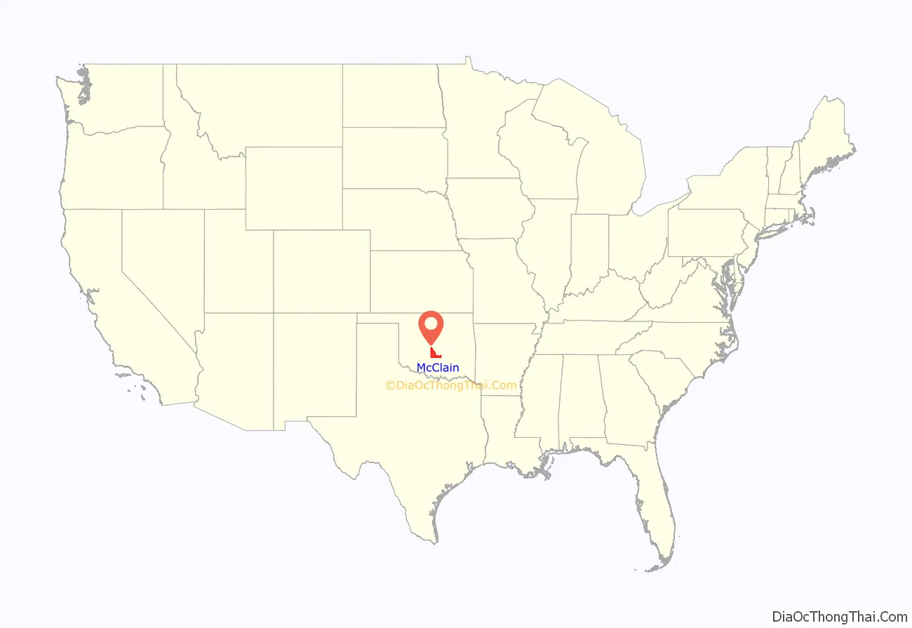
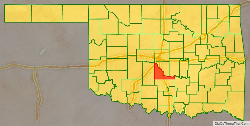
McClain County location map. Where is McClain County?
History
The Chickasaw tribe began moving into this area in 1837, when the land had already been assigned to the Choctaws by the U.S. government. In 1855, the area became part of the Chickasaw Nation, after the two tribes officially separated. The present McClain County became part of Pontotoc County, Chickasaw Nation and remained so until Oklahoma attained statehood. Few Chickasaws lived here because of hostilities with western tribes (e.g., Kiowa). Major Richard Mason established Camp Holmes (also called Camp Mason) in 1835, near the present city of Lexington, while negotiating a treaty between the western tribes and the newly arrived Choctaws. Federal troops abandoned the camp in August 1835, after the Treaty of Camp Holmes was signed.
Auguste Pierre Chouteau built a trading post at the Camp Holmes site, but it closed after Chouteau died in 1838. Randolph Marcy is credited with bringing the California Road through this area in 1849. The U.S. Army built Camp Arbuckle in 1850 to protect the road, but the troops were withdrawn to what is now Garvin County, Oklahoma in the following year.
Jesse Chisholm also operated a trading post in this area around 1850. A group of Delaware Indians occupied the former camp, then known as Beaversville, but left before the outbreak of the Civil War.
Montford T. Johnson, a rancher, moved to this area after the Civil War. He and Jesse Chisholm, who acted as the negotiator, obtained an agreement with the Chickasaw leaders to allow ranching on their land, provided no whites were employed. Thereafter, Johnson built a ranch and hired a Chickasaw freedman to operate it. He then established other ranches and hired another freedman to run those.
The Southern Kansas Railway built a line south from Kansas to present McClain County in 1886–7, and the Gulf, Colorado and Santa Fe Railway (both of which were controlled by the Atchison, Topeka and Santa Fe Railway, AT&SF) built a line north from Texas, meeting at and founding the town of Purcell. Eastern Oklahoma Railroad (later acquired by the AT&SF) laid tracks in 1900-04 from Newkirk to Pauls Valley, passing through eastern McClain County. In 1906 the Oklahoma Central Railway (sold to AT&SF in 1914) built a line that traversed McClain County from the southeast to the northwest. It ran through Byars and Purcell, and established Washington, Cole, and Blanchard.
Purcell was a starting point for the Land Run of 1889. It also was at the dividing line between Indian Territory, where alcohol could not be sold, and Oklahoma Territory, where alcohol sale was legal. The town of Lexington, across the river from Purcell, had numerous saloons. In 1899, the Purcell Bridge Company built a toll bridge across the river, profiting from the alcohol trade.
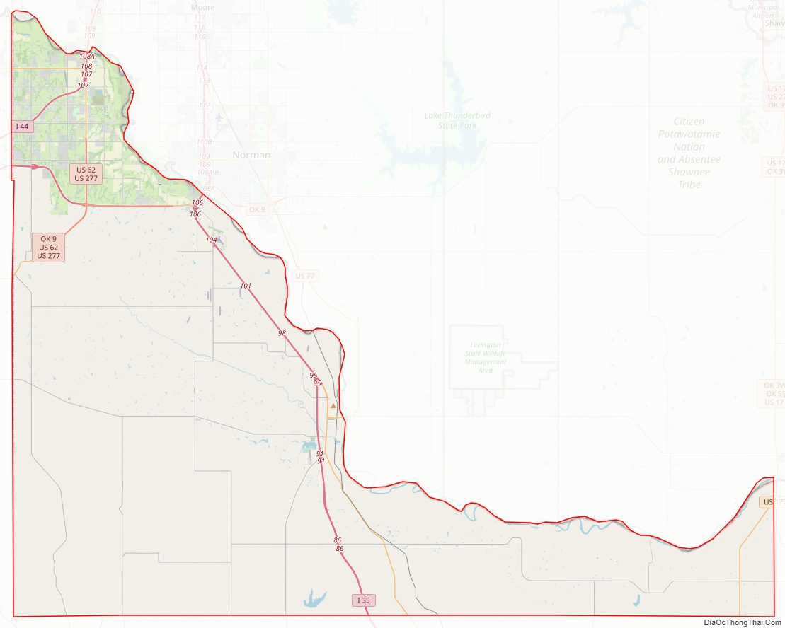
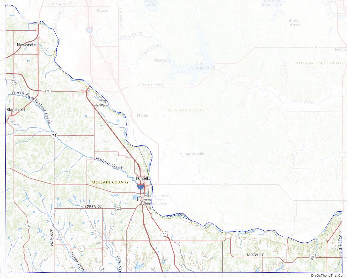
McClain County Road Map
Geography
According to the U.S. Census Bureau, the county has a total area of 580 square miles (1,500 km), of which 571 square miles (1,480 km) is land and 9.6 square miles (25 km) (1.6%) is water. The county lies largely in the Red Bed Plains region of the Osage Plains. The western part of the county is hilly and covered with black jack oak trees, while the eastern part is level lowlands. The South Canadian River forms the northern border, The Washita River flows through the southwestern corner, and is fed by several McClain County creeks.
Adjacent counties
- Cleveland County (north)
- Pottawatomie County (northeast)
- Pontotoc County (east)
- Garvin County (south)
- Grady County (west)
McClain County Topographic Map
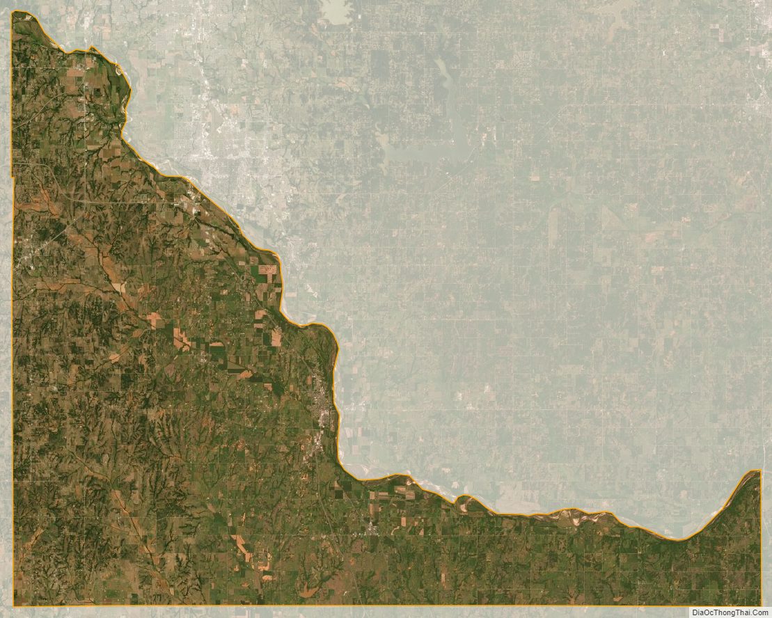
McClain County Satellite Map
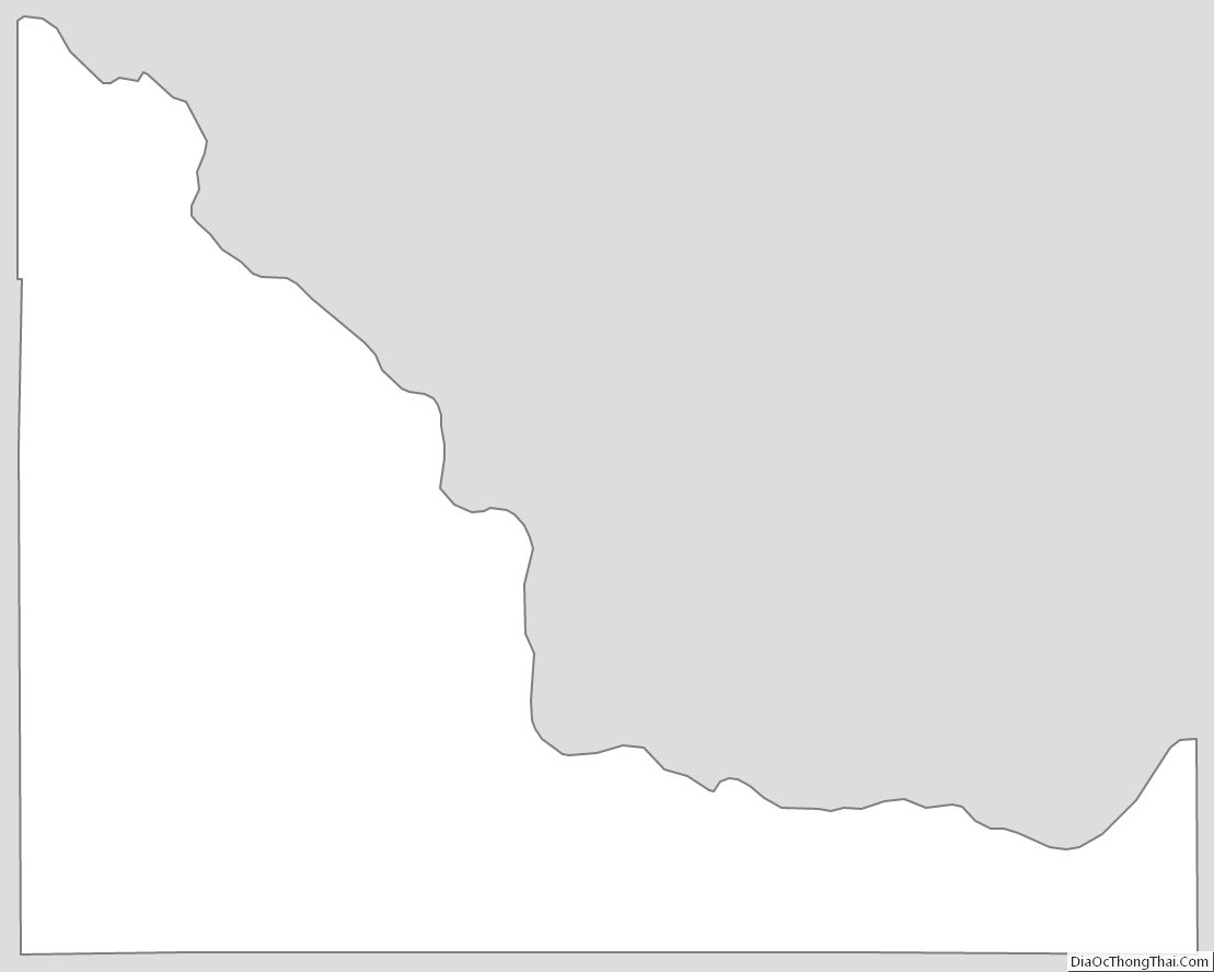
McClain County Outline Map
See also
Map of Oklahoma State and its subdivision:- Adair
- Alfalfa
- Atoka
- Beaver
- Beckham
- Blaine
- Bryan
- Caddo
- Canadian
- Carter
- Cherokee
- Choctaw
- Cimarron
- Cleveland
- Coal
- Comanche
- Cotton
- Craig
- Creek
- Custer
- Delaware
- Dewey
- Ellis
- Garfield
- Garvin
- Grady
- Grant
- Greer
- Harmon
- Harper
- Haskell
- Hughes
- Jackson
- Jefferson
- Johnston
- Kay
- Kingfisher
- Kiowa
- Latimer
- Le Flore
- Lincoln
- Logan
- Love
- Major
- Marshall
- Mayes
- McClain
- McCurtain
- McIntosh
- Murray
- Muskogee
- Noble
- Nowata
- Okfuskee
- Oklahoma
- Okmulgee
- Osage
- Ottawa
- Pawnee
- Payne
- Pittsburg
- Pontotoc
- Pottawatomie
- Pushmataha
- Roger Mills
- Rogers
- Seminole
- Sequoyah
- Stephens
- Texas
- Tillman
- Tulsa
- Wagoner
- Washington
- Washita
- Woods
- Woodward
- Alabama
- Alaska
- Arizona
- Arkansas
- California
- Colorado
- Connecticut
- Delaware
- District of Columbia
- Florida
- Georgia
- Hawaii
- Idaho
- Illinois
- Indiana
- Iowa
- Kansas
- Kentucky
- Louisiana
- Maine
- Maryland
- Massachusetts
- Michigan
- Minnesota
- Mississippi
- Missouri
- Montana
- Nebraska
- Nevada
- New Hampshire
- New Jersey
- New Mexico
- New York
- North Carolina
- North Dakota
- Ohio
- Oklahoma
- Oregon
- Pennsylvania
- Rhode Island
- South Carolina
- South Dakota
- Tennessee
- Texas
- Utah
- Vermont
- Virginia
- Washington
- West Virginia
- Wisconsin
- Wyoming