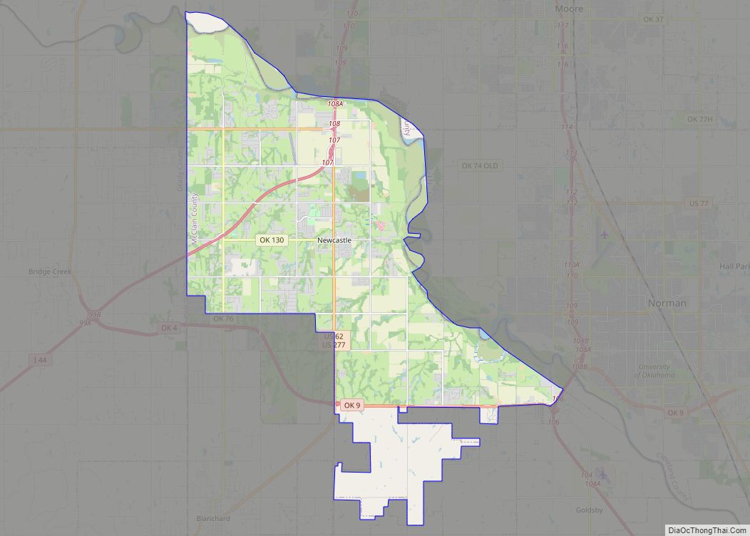
Newcastle is a city in McClain County, Oklahoma, United States, and part of the Oklahoma City Metropolitan Area. As of the 2020 Census, the population was 10,984, a 42.9% increase from 2010.
| Name: | Newcastle city |
|---|---|
| LSAD Code: | 25 |
| LSAD Description: | city (suffix) |
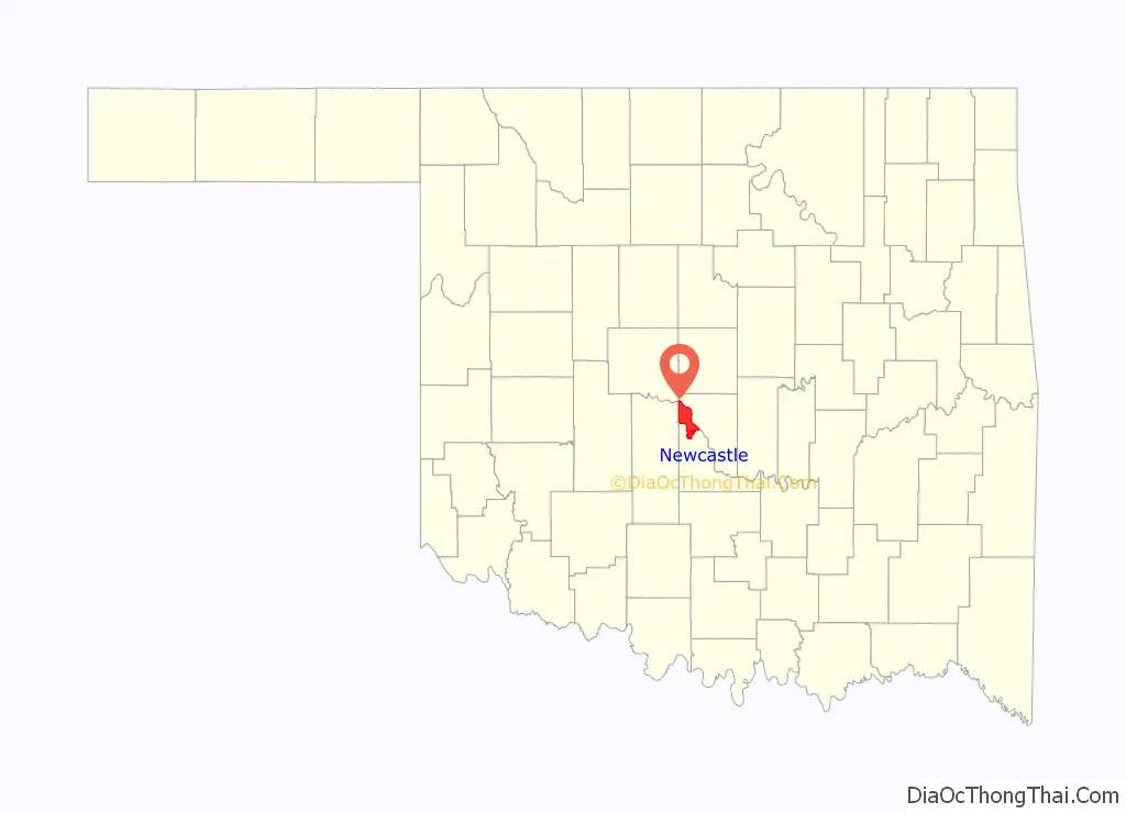
| State: | Oklahoma |
| County: | McClain County |
| Founded: | 1894 |
| Incorporated: | 1962, 1965 |
| Elevation: | 1,194 ft (364 m) |
| Total Area: | 61.21 sq mi (158.53 km²) |
| Land Area: | 60.06 sq mi (155.55 km²) |
| Water Area: | 1.15 sq mi (2.99 km²) |
| Total Population: | 10,984 |
| Population Density: | 182.89/sq mi (70.61/km²) |
| ZIP code: | 73065 |
| Area code: | 405 |
| FIPS code: | 4051150 |
| GNISfeature ID: | 1095853 |
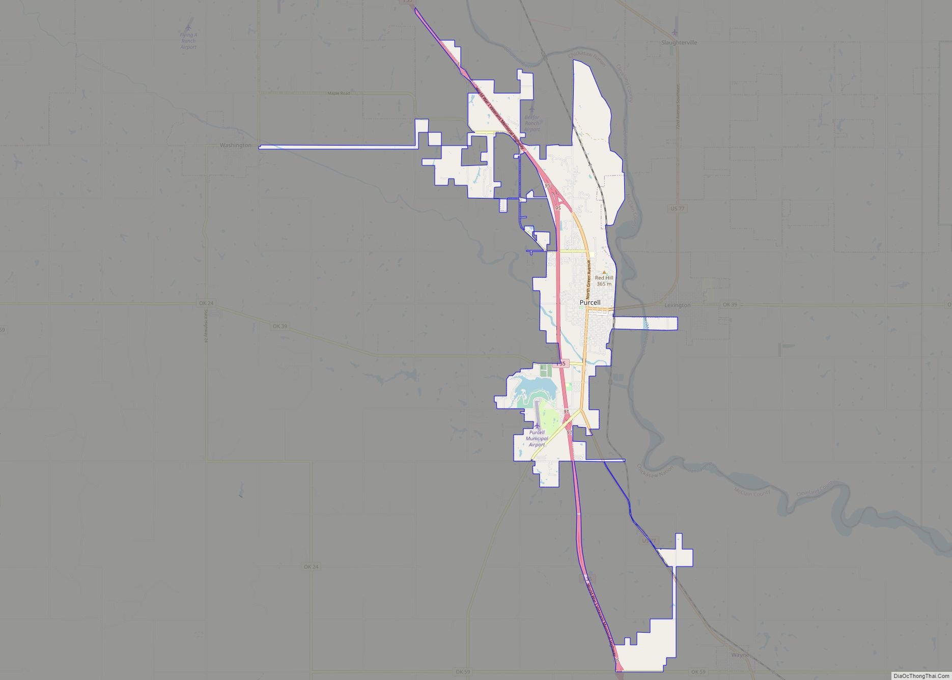
Online Interactive Map
Click on ![]() to view map in "full screen" mode.
to view map in "full screen" mode.
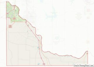
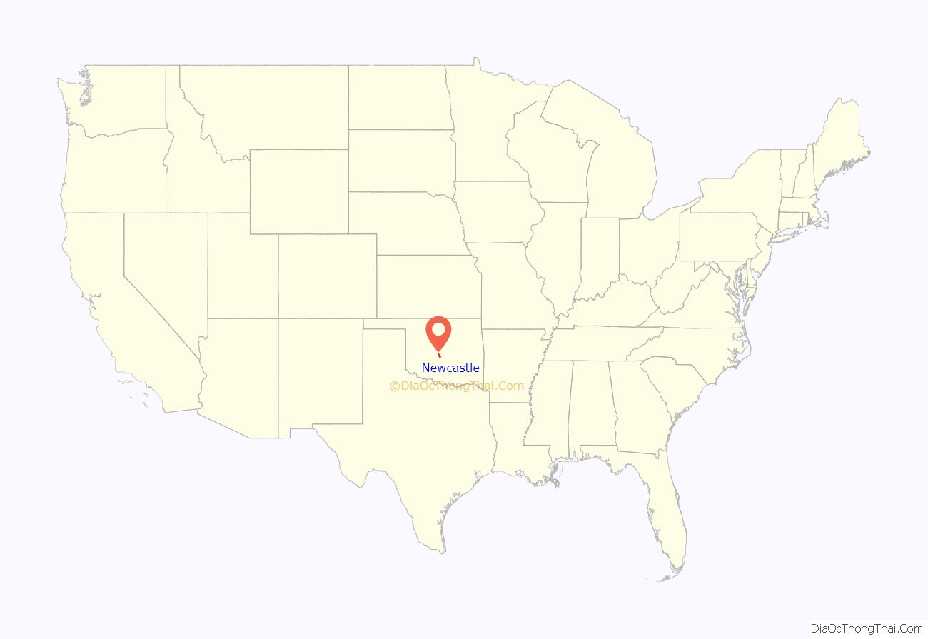
Newcastle location map. Where is Newcastle city?
History
Newcastle became a dot on the map with the opening of a new post office March 26, 1894 and a population of 25. The area had previously been served by the nearby William P. Leeper Post Office, opened in 1888, but closed in 1892 after Leeper was shot in a fencing dispute. The mail office was established on the Minco to Norman road in Section 11, Township 9 North, Range 4 West. Eulalie V. Kelley was the first postmaster. In 1905, postmaster Alonzo Haun moved the facility to his general store in Section 14, Township 9 North, Range 4 West.
Newcastle lay in the Chickasaw Nation. The community’s first residents included Choctaw, Chickasaw, and individuals who had married into those tribes. Many were involved in ranching. By 1907, the community had a subscription school, a cotton gin, two stores, and two blacksmiths.
Changes spurred Newcastle’s growth throughout the 1920s. In 1920 the town’s post office was relocated one mile east on land donated for a public school and a church. In 1922, work started on a South Canadian River bridge. The steel thru-truss bridge with timber flooring was Oklahoma’s first federal aid project and a part of the Ozark Trail that was to link Oklahoma City to Amarillo, Texas. Although the trail was never fully completed, the bridge stayed. It opened on April 23, 1923, and cost $321,393.38 to build. The bridge attracted businesses and allowed for the construction of Highway 62 through Newcastle in 1927.
Until the mid-twenties, there was a major river ford at May Avenue that was used whenever the water wasn’t too deep. Farmers from Newcastle forged the river with their horses and wagons and traveled up May Avenue on their way to the Oklahoma City Farmer’s Market by Western and Reno. Today, only a single section of the old Newcastle Bridge remains alongside the Interstate 44 bridge after having received significant damage during the 2013 tornado (see below).
During World War II, Newcastle’s population stood at approximately 100. During the war five local men gave their lives in defense of their country. Another was captured in the Philippines and spent more than three years as a Japanese prisoner. Soon after Japan surrendered, a tornado swept through Newcastle and destroyed the school and much of the business section. The twister touched down the evening of September 25, 1945, moving from the southwest to the northeast.
The limits of Newcastle essentially comprised the post office and school district until around 1960, when Oklahoma City began annexing huge chunks of land across the river. Incorporated January 18, 1962 as South Newcastle, it expanded its area to some 16,000 acres. Nearby Tuttle and Blanchard expanded as well to attempt to prevent Oklahoma City from trying to annex across the Canadian River. A petition to change the name to Newcastle followed in 1965.
Census records indicate a population of 1,271 in 1970, but by the mid-1970s, Oklahoma City had expanded past SW 74th Street, populating near the Interstate 44 corridor, which spurred growth in Newcastle. The population hit 3,076 in 1980 and 5,434 by 2000. In the 1980s, Newcastle annexed territory that lies near Norman, Oklahoma (north of State Highway 9).
Cotton, ranching, and the dairy industry, once important to the local economy, declined with subdivisions and commercial development taking over former agricultural lands. At the end of the twentieth century the public school system was Newcastle’s largest employer. The 2010 census recorded 7,685 residents and the population is estimated to be over 10,000 by 2020.
In January 2019, Newcastle was ranked 36th “Best City to Live” in the United States by 24/7 Wall St., which created a weighted index of over two dozen measures to identify the best city to live in each state.
Tornadoes
April 25, 1893, a massive tornado, reportedly over a mile and a quarter wide at one point, moved northeast along a 15-mile path from northwest of Newcastle through what now is part of Moore, and swept away at least 30 homes. Thirty-three people were killed with 11 people dying in one home, 6 in a second home and 4 in a third home. This tornado was one of at least 5 strong/violent tornadoes in central Oklahoma on this day, but the only one within the immediate Oklahoma City area. The local Norman paper reported that residents of Cleveland County were “scared… as they never have been scared before.” In addition, there was a “general scampering from all parts and a hunt for caves was generally inaugurated.”
On May 3, 1999, the F5 1999 Bridge Creek–Moore tornado struck parts of Newcastle and resulted in the destruction of several homes in the Newcastle city limits. Greater destruction occurred in Bridge Creek and Moore. This violent, long-lived tornado was the most infamous of nearly 60 tornadoes that struck central Oklahoma during an unprecedented outbreak.
On May 24, 2011, a tornado ripped through parts of Newcastle. There were an estimated 160 homes either damaged or destroyed and over 20 businesses damaged. However, there was no loss of life within the city.
On May 20, 2013, another violent tornado damaged parts of Newcastle, including the historic retired Ozark Trail Bridge, growing rapidly as it headed north crossing the Canadian River, and did a large amount of damage to neighboring Moore and southern Oklahoma City.
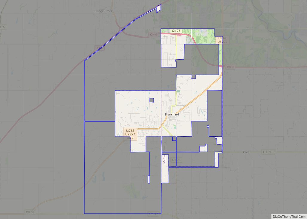
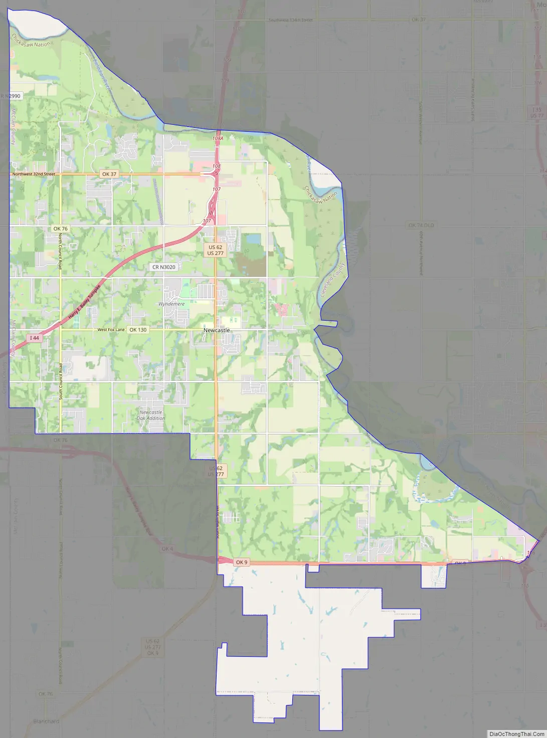
Newcastle Road Map
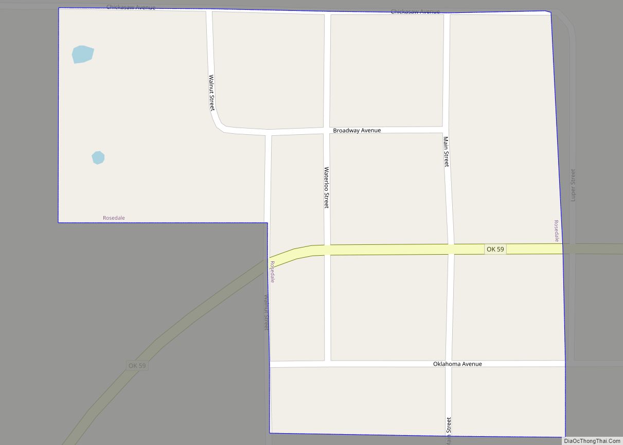
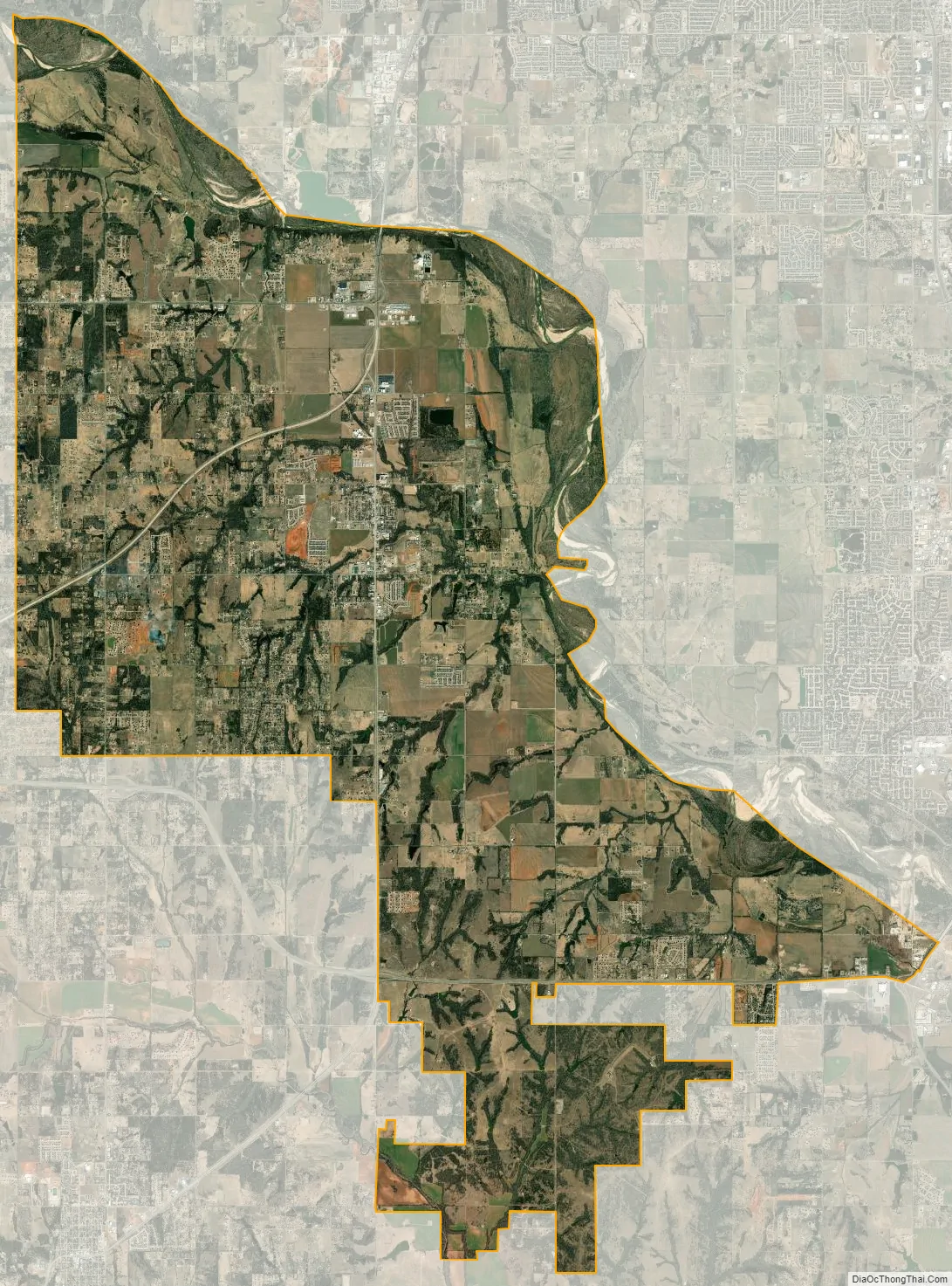
Newcastle city Satellite Map
Geography
Newcastle is located at 35°14′50.82″N 97°36′.22″W / 35.2474500°N 97.6000611°W / 35.2474500; -97.6000611 (35.145082, -97.360022). According to the United States Census Bureau, the city has a total area of 62.5 square miles (162 km), of which 55.8 square miles (145 km) is land and 6.7 square miles (17 km) (6.01%) is water.
Newcastle is considered to be part of a rapidly growing area of northern McClain and Grady counties. Newcastle also is a part of an area known as the “Tri-City Area” with Tuttle and Blanchard. Newcastle also serves as the largest incorporated community in McClain County.
See also
Map of Oklahoma State and its subdivision:- Adair
- Alfalfa
- Atoka
- Beaver
- Beckham
- Blaine
- Bryan
- Caddo
- Canadian
- Carter
- Cherokee
- Choctaw
- Cimarron
- Cleveland
- Coal
- Comanche
- Cotton
- Craig
- Creek
- Custer
- Delaware
- Dewey
- Ellis
- Garfield
- Garvin
- Grady
- Grant
- Greer
- Harmon
- Harper
- Haskell
- Hughes
- Jackson
- Jefferson
- Johnston
- Kay
- Kingfisher
- Kiowa
- Latimer
- Le Flore
- Lincoln
- Logan
- Love
- Major
- Marshall
- Mayes
- McClain
- McCurtain
- McIntosh
- Murray
- Muskogee
- Noble
- Nowata
- Okfuskee
- Oklahoma
- Okmulgee
- Osage
- Ottawa
- Pawnee
- Payne
- Pittsburg
- Pontotoc
- Pottawatomie
- Pushmataha
- Roger Mills
- Rogers
- Seminole
- Sequoyah
- Stephens
- Texas
- Tillman
- Tulsa
- Wagoner
- Washington
- Washita
- Woods
- Woodward
- Alabama
- Alaska
- Arizona
- Arkansas
- California
- Colorado
- Connecticut
- Delaware
- District of Columbia
- Florida
- Georgia
- Hawaii
- Idaho
- Illinois
- Indiana
- Iowa
- Kansas
- Kentucky
- Louisiana
- Maine
- Maryland
- Massachusetts
- Michigan
- Minnesota
- Mississippi
- Missouri
- Montana
- Nebraska
- Nevada
- New Hampshire
- New Jersey
- New Mexico
- New York
- North Carolina
- North Dakota
- Ohio
- Oklahoma
- Oregon
- Pennsylvania
- Rhode Island
- South Carolina
- South Dakota
- Tennessee
- Texas
- Utah
- Vermont
- Virginia
- Washington
- West Virginia
- Wisconsin
- Wyoming