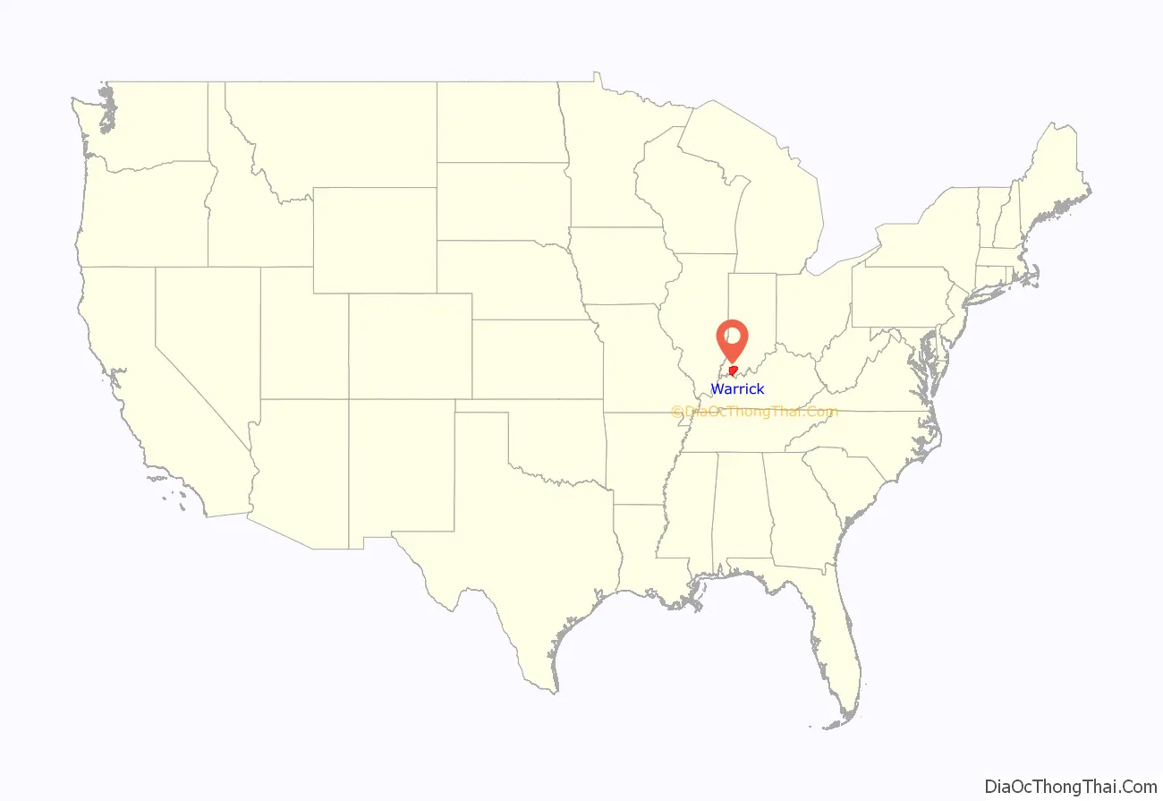
Warrick County is a county located in the U.S. state of Indiana. As of 2020, the population was 63,898. The county seat is Boonville. It was organized in 1813 and was named for Captain Jacob Warrick, an Indiana militia company commander killed in the Battle of Tippecanoe in 1811. It is one of the ten fastest-growing counties in Indiana.
Warrick County is the eastern part of the Evansville, IN–KY Metropolitan Statistical Area.
| Name: | Warrick County |
|---|---|
| FIPS code: | 18-173 |
| State: | Indiana |
| Founded: | April 30, 1813 |
| Named for: | Jacob Warrick |
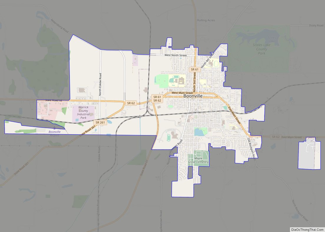
| Seat: | Boonville |
| Largest city: | Boonville |
| Total Area: | 391.05 sq mi (1,012.8 km²) |
| Land Area: | 384.82 sq mi (996.7 km²) |
| Total Population: | 63,898 |
| Population Density: | 160/sq mi (63/km²) |
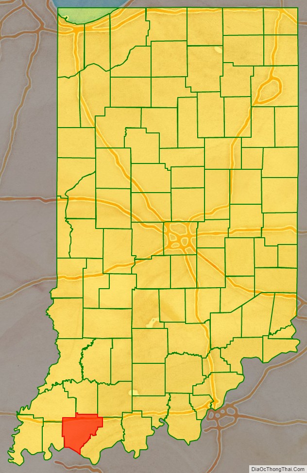
Warrick County location map. Where is Warrick County?
History
Warrick County was formed by statute, March 9, 1813, effective April 30, 1813. Knox County was affected by this formation and Warrick and Gibson Counties were both created out of this area of Knox County between the White River and the Ohio River. The boundaries of this area began at the mouth of the Wabash River; then up the Wabash River with the meanders thereof to the mouth of the White River; then up the White River with the meanders thereof to the Forks of the White River; then up White River East Fork to where the line between Sections 20 and 29, Township 1 North, Range 4 West, strikes the same; then with that line to the then Gibson County line; then with that line dividing Gibson and Knox Counties to the Ohio River; then down the Ohio River, to the place of beginning. The same was divided into two separate and distinct counties, by a line beginning on the Wabash River, known as Rector’s Base Line (was surveyed by William Rector on the line between Townships 4 South and 5 South, from New Harmony, Posey County, and Alton, Crawford County, Indiana), and with that line east until it intersects the then Gibson County line and that tract of land falling within the southern division thereof was Warrick County. However, because Gibson County organized a month earlier on April 1, this entire territory fell under Gibson County’s jurisdiction. Within Warrick County’s original jurisdiction included large portions but not entire portions of Crawford, Perry, Posey, Vanderburgh, and roughly 2/3s of Warrick County’s current jurisdiction. Evansville was the original county seat, followed by Yankeetown, Newburgh, and finally Boonville, the current seat.
Warrick County Road Map
Geography
According to the 2010 census, the county has a total area of 391.05 square miles (1,012.8 km), of which 384.82 square miles (996.7 km) (or 98.41%) is land and 6.24 square miles (16.2 km) (or 1.60%) is water.
Adjacent Counties
- Pike County – north (ET)
- Dubois County – northeast (ET)
- Spencer County – east
- Daviess County, Kentucky – southeast
- Henderson County, Kentucky – south & southwest
- Vanderburgh County – west
- Gibson County – northwest
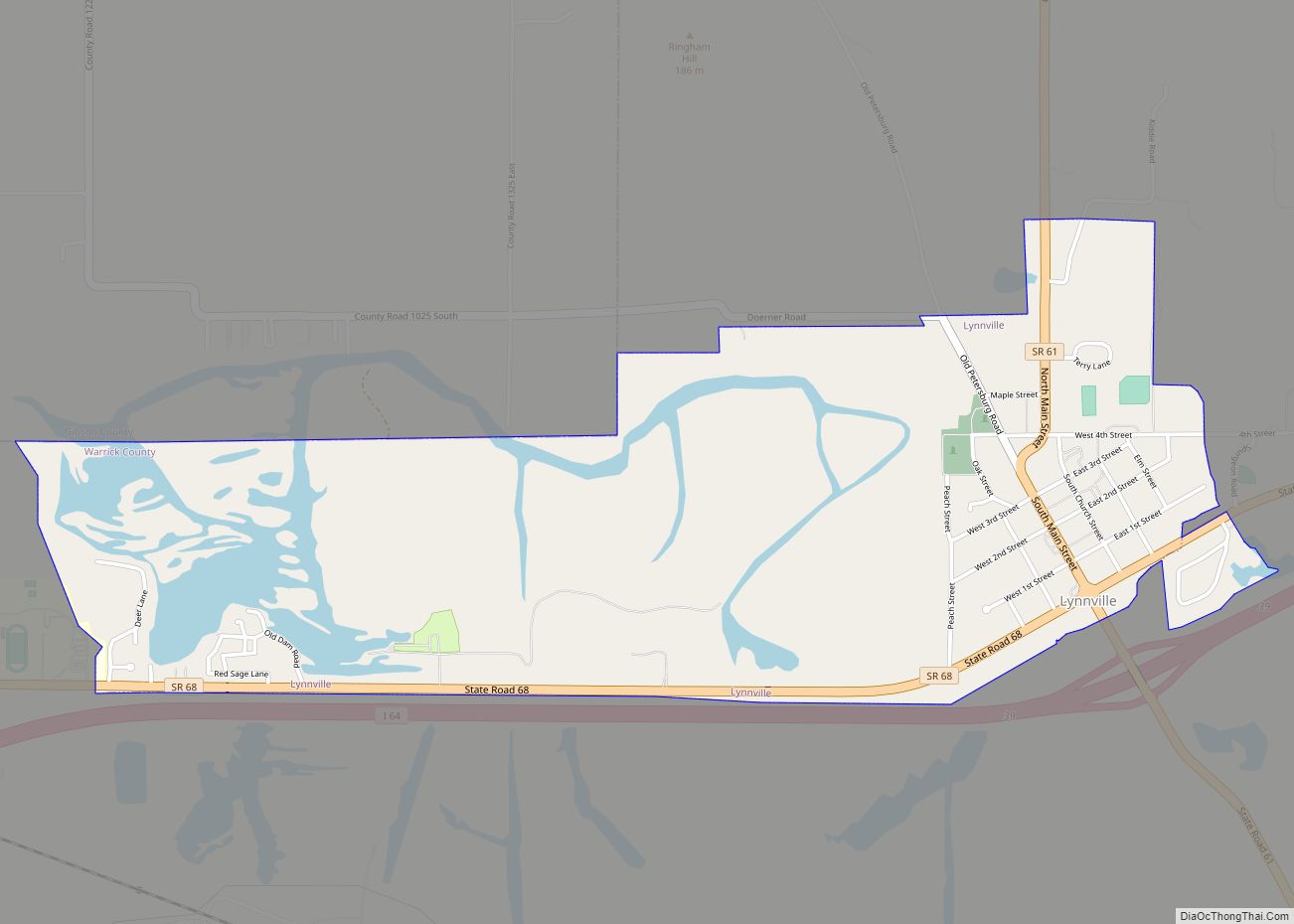
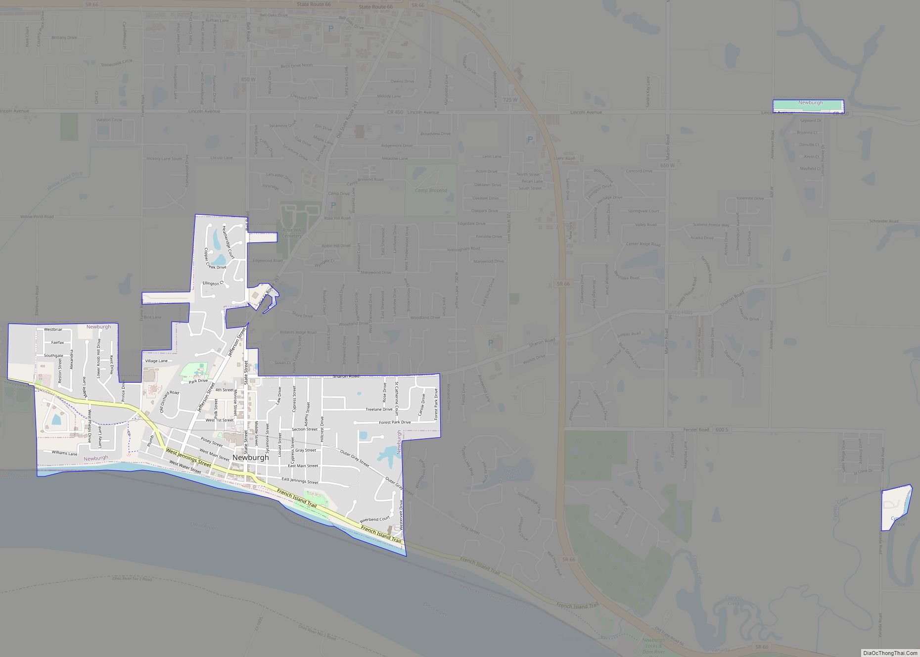
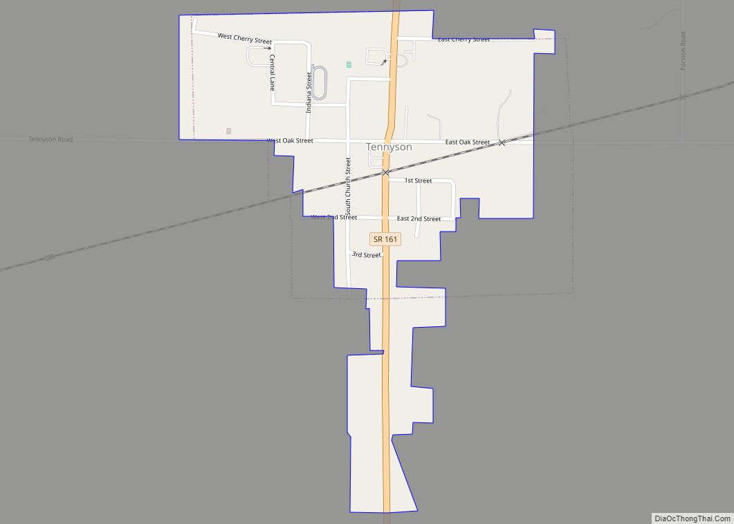
Cities and towns
Unincorporated towns
- Ash Iron Springs
- Baugh City
- Bullocktown
- Camp Brosend
- Center
- Dayville
- De Gonia Springs
- Dickeyville
- Eames
- Eby
- Fisherville
- Folsomville
- Graham Valley
- Greenbrier
- Heilman
- Hemenway
- Hillcrest Terrace
- Jarretts
- Jockey
- Loafers Station
- Millersburg
- New Hope
- Paradise
- Pelzer
- Red Bush
- Rolling Acres
- Rosebud
- Rustic Hills
- Saint John
- Scalesville
- Selvin
- Stanley
- Stevenson
- Turpin Hill
- Vanada
- Victoria
- Wheatonville
- Yankeetown
Townships
- Anderson
- Boon
- Campbell
- Greer
- Hart
- Lane
- Ohio
- Owen
- Pigeon
- Skelton
Major highways
- I-64
- I-69
- SR 57
- SR 61
- SR 62
- SR 66
- SR 68
- SR 161
- SR 261
- SR 662
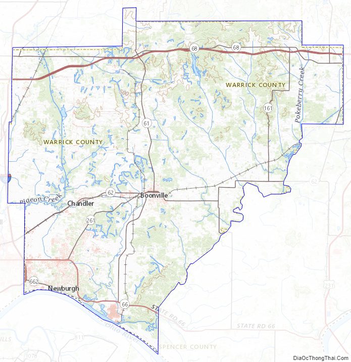
Warrick County Topographic Map
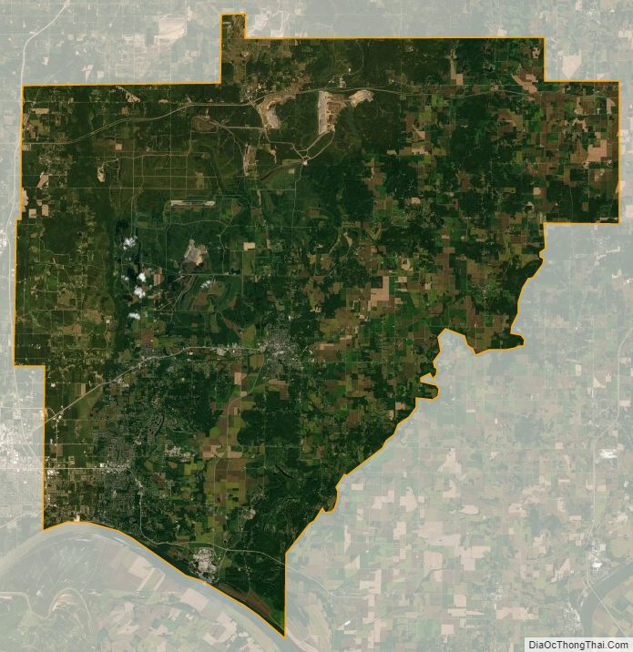
Warrick County Satellite Map
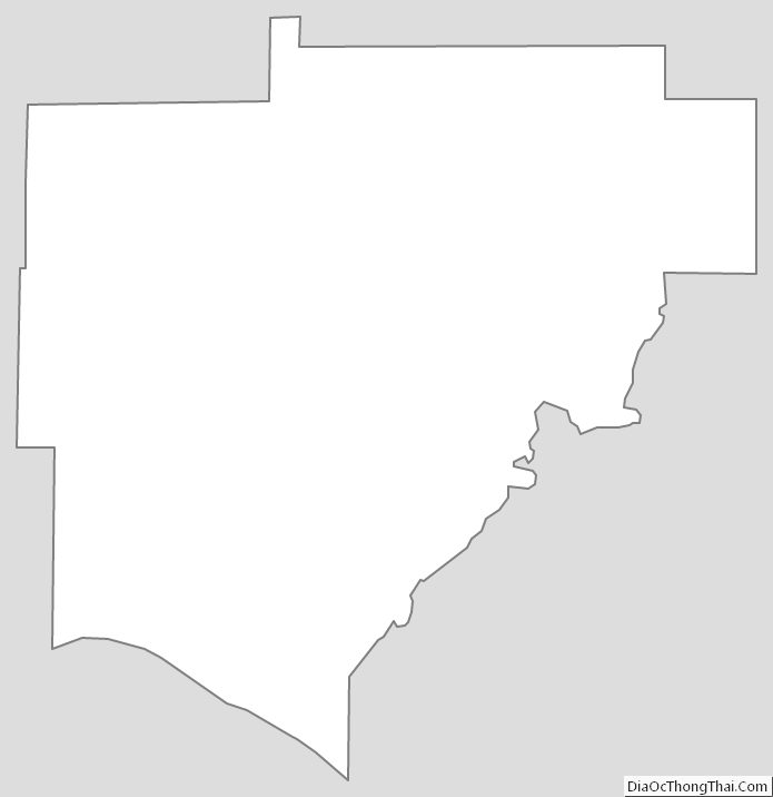
Warrick County Outline Map