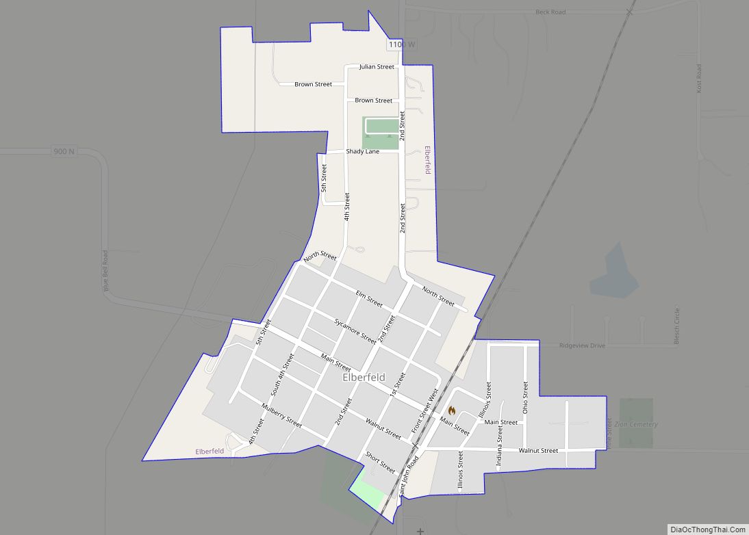
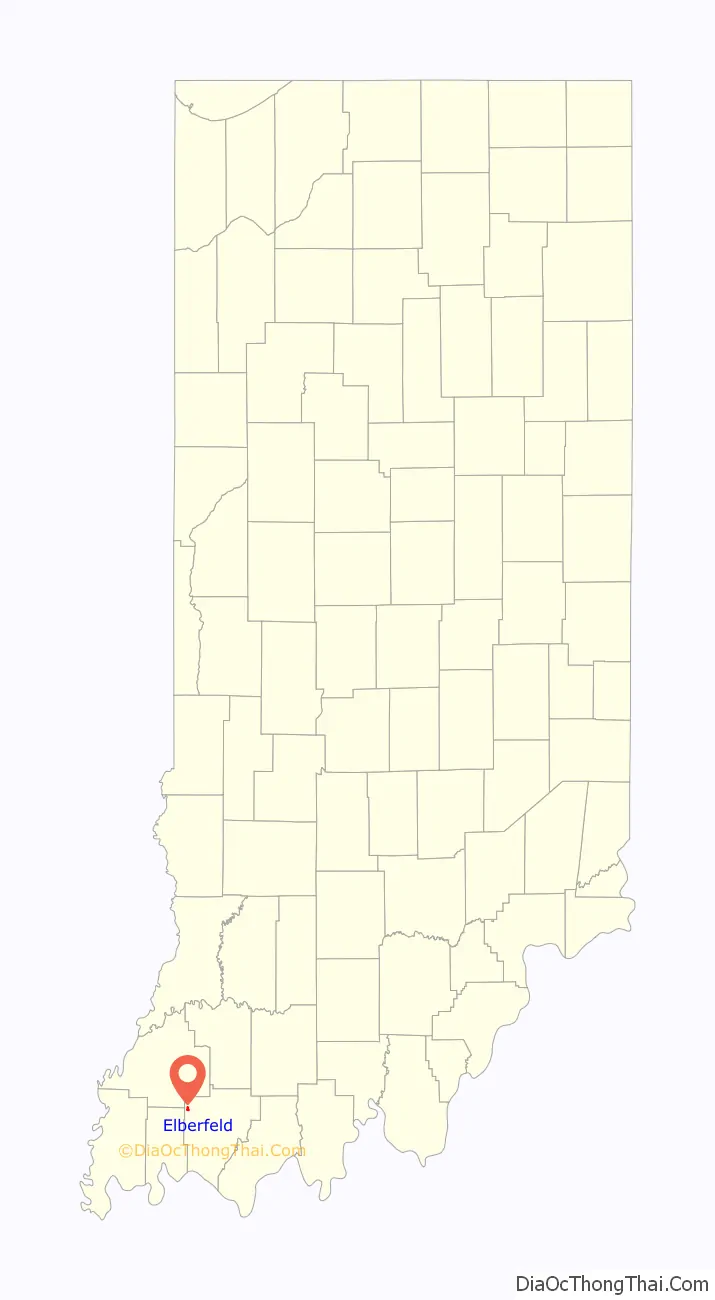
Elberfeld is a town in Greer Township, Warrick County, in the U.S. state of Indiana. The population was 625 as of the 2010 census.
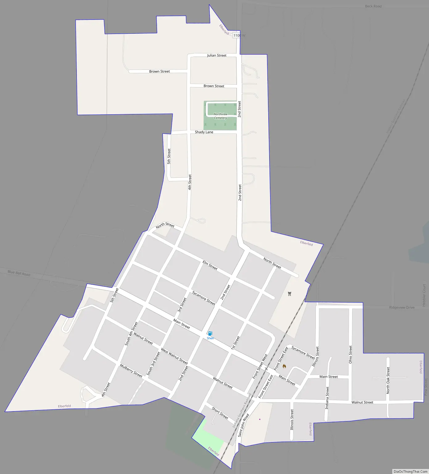
Elberfeld is one of a very few towns in Indiana of its size not to have any kind of main highway running through it or direct access to a major highway. Interstate 64 runs just north of the municipal boundary, but it has no exit linking to the town. Interstate 69 passes just west of the community, but it, too, lacks a direct access point, residents having to backtrack along two roads to reach the Indiana 57 interchange with the interstate. The nearest state road is Indiana 68, 2.5 miles north of town. The two interstates intersect roughly 2 miles northwest of the town in nearby Gibson County. The town is bisected by the Indiana Southern Railroad track.
| Name: | Elberfeld town |
|---|---|
| LSAD Code: | 43 |
| LSAD Description: | town (suffix) |
| State: | Indiana |
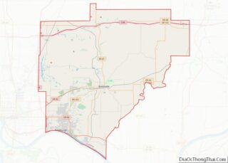
| County: | Warrick County |
| Elevation: | 479 ft (146 m) |
| Total Area: | 0.31 sq mi (0.79 km²) |
| Land Area: | 0.31 sq mi (0.79 km²) |
| Water Area: | 0.00 sq mi (0.00 km²) |
| Total Population: | 644 |
| Population Density: | 2,104.58/sq mi (812.79/km²) |
| ZIP code: | 47613 |
| Area code: | 812 |
| FIPS code: | 1820638 |
| GNISfeature ID: | 2396923 |
Online Interactive Map
Click on ![]() to view map in "full screen" mode.
to view map in "full screen" mode.
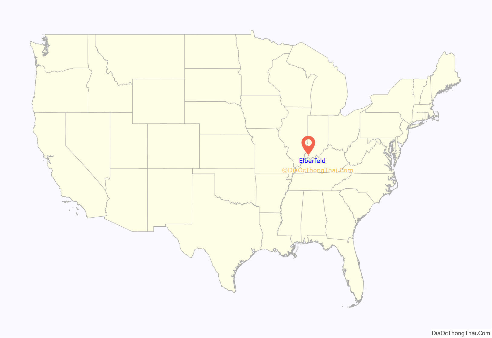
Elberfeld location map. Where is Elberfeld town?
History
A post office has been in operation at Elberfeld since 1868. The town was originally built up chiefly by Germans, who named their community after Elberfeld, in Germany. Elberfeld was officially platted in 1885.
Elberfeld Road Map
Elberfeld city Satellite Map

Geography
The town lies northeast of Evansville in the northwest corner of Warrick County.
According to the 2010 census, Elberfeld has a total area of 0.31 square miles (0.80 km), all land.
See also
Map of Indiana State and its subdivision:- Adams
- Allen
- Bartholomew
- Benton
- Blackford
- Boone
- Brown
- Carroll
- Cass
- Clark
- Clay
- Clinton
- Crawford
- Daviess
- De Kalb
- Dearborn
- Decatur
- Delaware
- Dubois
- Elkhart
- Fayette
- Floyd
- Fountain
- Franklin
- Fulton
- Gibson
- Grant
- Greene
- Hamilton
- Hancock
- Harrison
- Hendricks
- Henry
- Howard
- Huntington
- Jackson
- Jasper
- Jay
- Jefferson
- Jennings
- Johnson
- Knox
- Kosciusko
- LaGrange
- Lake
- Lake Michigan
- LaPorte
- Lawrence
- Madison
- Marion
- Marshall
- Martin
- Miami
- Monroe
- Montgomery
- Morgan
- Newton
- Noble
- Ohio
- Orange
- Owen
- Parke
- Perry
- Pike
- Porter
- Posey
- Pulaski
- Putnam
- Randolph
- Ripley
- Rush
- Saint Joseph
- Scott
- Shelby
- Spencer
- Starke
- Steuben
- Sullivan
- Switzerland
- Tippecanoe
- Tipton
- Union
- Vanderburgh
- Vermillion
- Vigo
- Wabash
- Warren
- Warrick
- Washington
- Wayne
- Wells
- White
- Whitley
- Alabama
- Alaska
- Arizona
- Arkansas
- California
- Colorado
- Connecticut
- Delaware
- District of Columbia
- Florida
- Georgia
- Hawaii
- Idaho
- Illinois
- Indiana
- Iowa
- Kansas
- Kentucky
- Louisiana
- Maine
- Maryland
- Massachusetts
- Michigan
- Minnesota
- Mississippi
- Missouri
- Montana
- Nebraska
- Nevada
- New Hampshire
- New Jersey
- New Mexico
- New York
- North Carolina
- North Dakota
- Ohio
- Oklahoma
- Oregon
- Pennsylvania
- Rhode Island
- South Carolina
- South Dakota
- Tennessee
- Texas
- Utah
- Vermont
- Virginia
- Washington
- West Virginia
- Wisconsin
- Wyoming