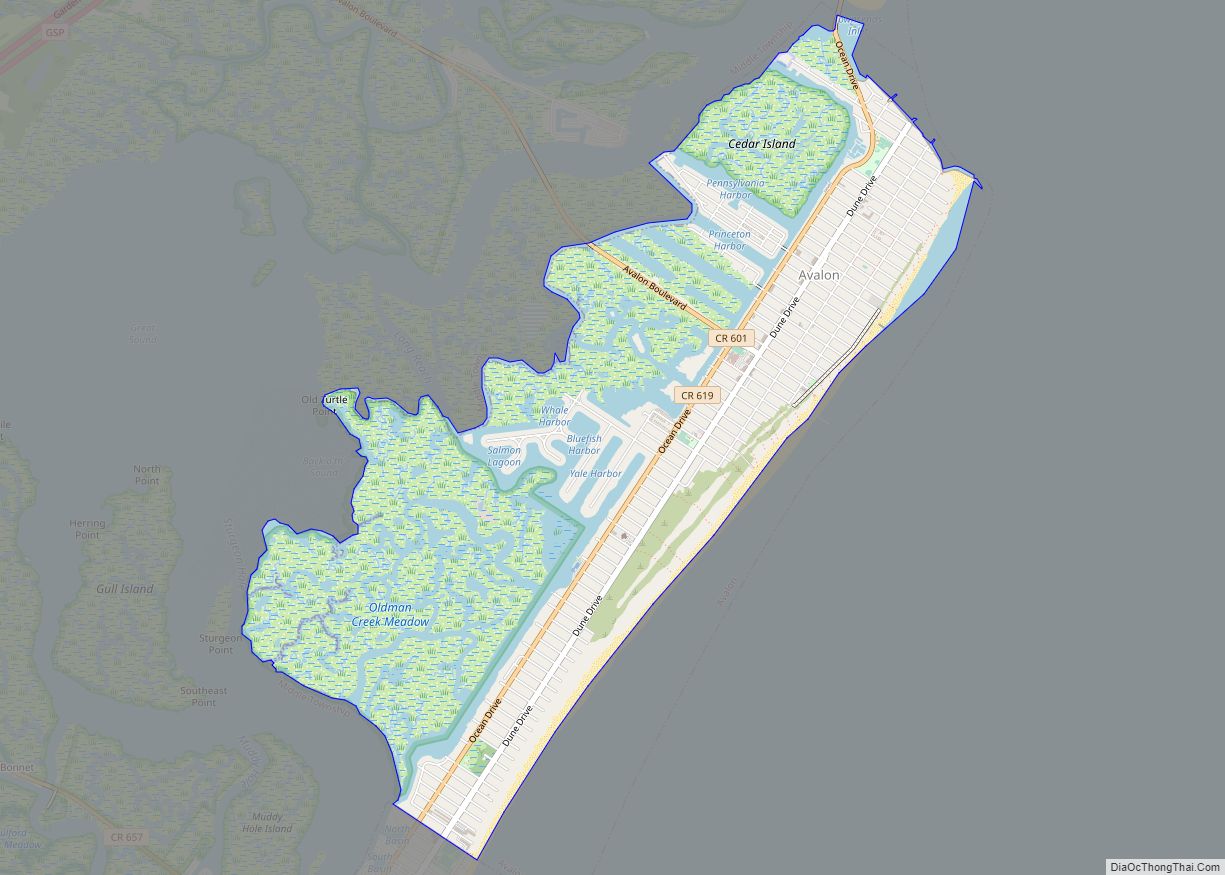
Avalon is a borough in Cape May County, in the U.S. state of New Jersey. It is located on Seven Mile Island. As of the 2020 United States census, the borough’s population was 1,243, a decrease of 91 (−6.8%) from the 2010 census count of 1,334, which in turn declined by 809 (−37.8%) from the 2,143 counted in the 2000 census. The borough’s population swells to as many as 45,000 during the summer.
Geographically part of the South Jersey region, the community is one of the most affluent communities along the Jersey Shore and is home to some of the most expensive real estate on the East Coast. In 2007, Forbes listed Avalon as the 65th most expensive ZIP Code in the United States. Washingtonian “named Avalon the ‘chicest beach’ in the mid-Atlantic, the place to see women in diamonds and designer swimwear.” A small portion of Avalon is not on Seven Mile Island. The borough, and all of Cape May County, is part of the Ocean City metropolitan statistical area, and is part of the Philadelphia–Wilmington–Camden, PA-NJ-DE–MD combined statistical area, also known as the Delaware Valley or Philadelphia metropolitan area.
Avalon is known as a South Jersey seashore resort and has the motto “Cooler by a Mile” since it juts out into the Atlantic Ocean about a mile farther than other barrier islands. Alternatively, the motto is because Avalon, at four miles long, is one mile longer than its neighboring town on the southern end of Seven Mile Island, Stone Harbor. It was ranked the seventh-best beach in New Jersey in the 2008 Top 10 Beaches Contest sponsored by the New Jersey Marine Sciences Consortium.
| Name: | Avalon borough |
|---|---|
| LSAD Code: | 21 |
| LSAD Description: | borough (suffix) |
| State: | New Jersey |
| County: | Cape May County |
| Incorporated: | April 18, 1892 |
| Elevation: | 10 ft (3 m) |
| Total Area: | 5.06 sq mi (13.09 km²) |
| Land Area: | 4.27 sq mi (11.06 km²) |
| Water Area: | 0.79 sq mi (2.04 km²) 15.53% |
| Total Population: | 1,243 |
| Population Density: | 291.1/sq mi (112.4/km²) |
| ZIP code: | 08202 |
| FIPS code: | 3402320 |
| GNISfeature ID: | 0885146 |
| Website: | www.avalonboro.net |
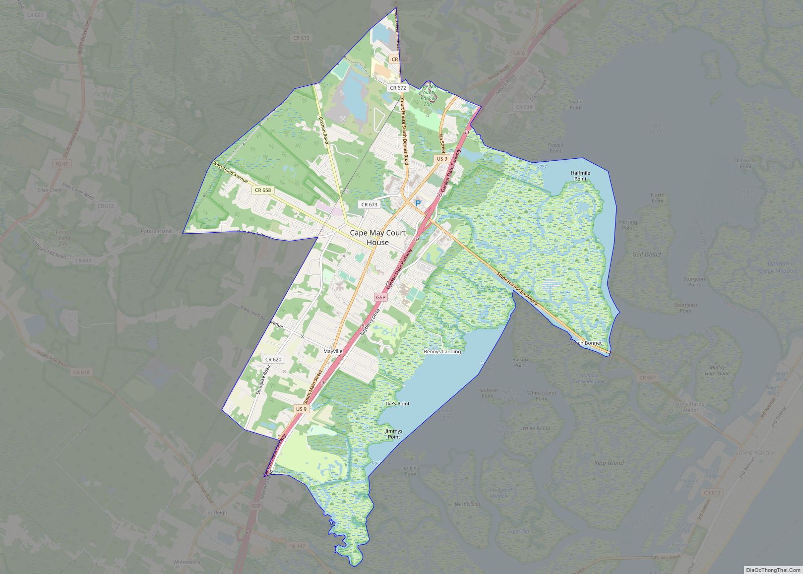
Online Interactive Map
Click on ![]() to view map in "full screen" mode.
to view map in "full screen" mode.
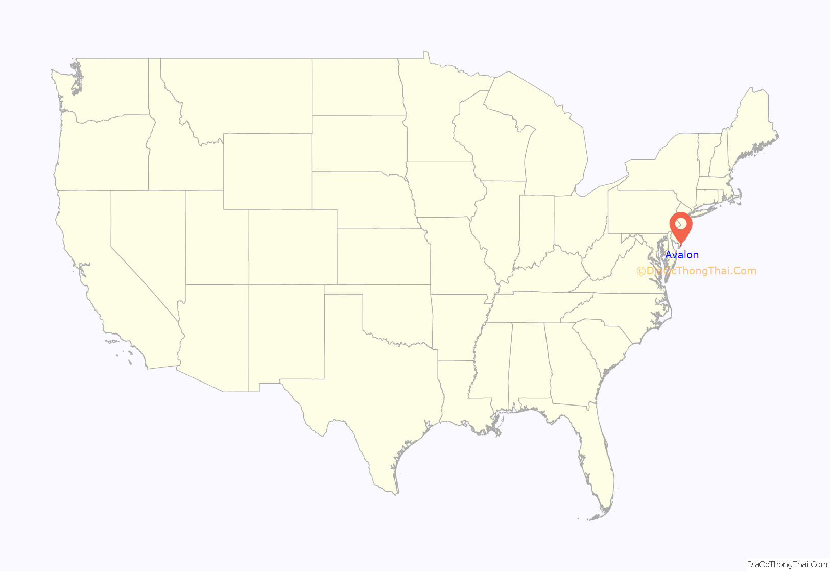
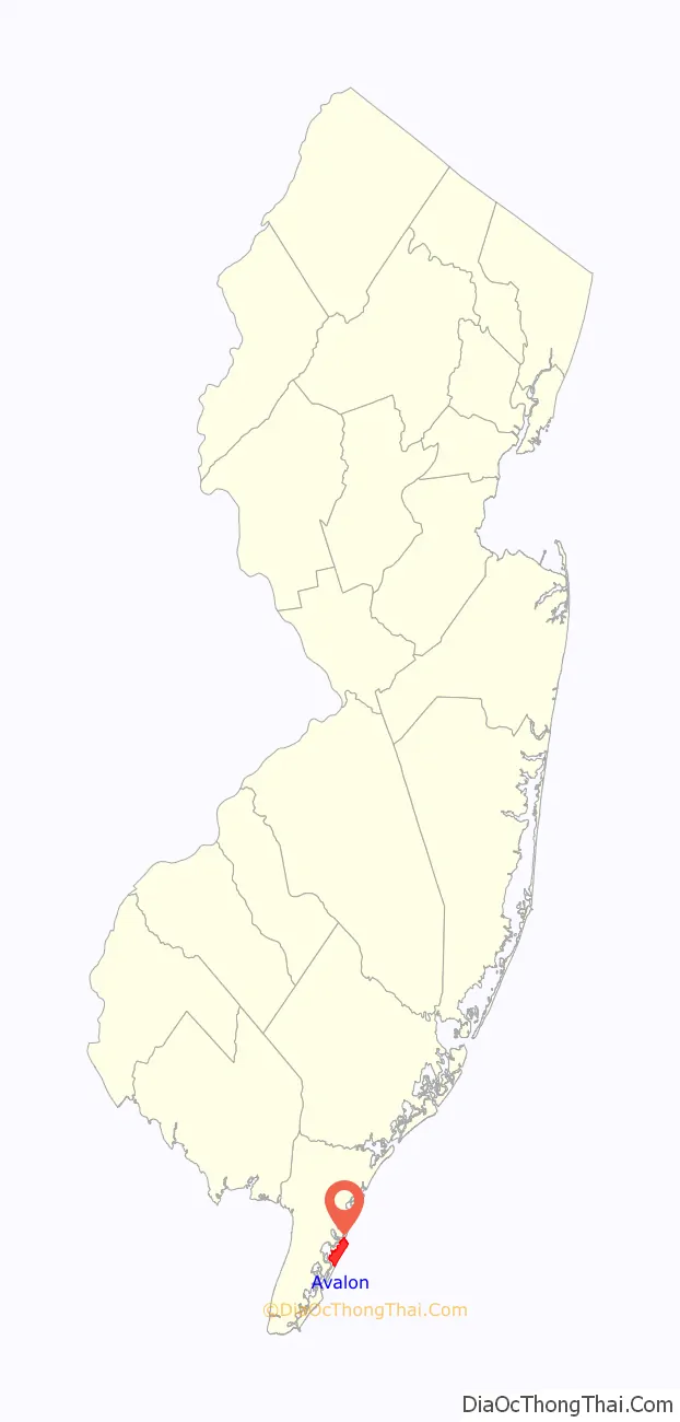
Avalon location map. Where is Avalon borough?
History
Around 14,000 years ago, the barrier islands of Cape May County formed, likely from spits and lines of dunes. Originally a thriving juniper forest occupied by Lenni Lenape Native Americans, the area was purchased by Aaron Leaming in December 1722 for 79 pounds. Known as Seven Mile Beach (which included present-day Avalon and Stone Harbor), it was owned and retained by the Leamings for approximately 100 years. Unconfirmed legends say that pirates buried their bounty on Seven Mile Island, and that Henry Hudson may have dropped anchor somewhere offshore. The island served as a cattle range and was also used for its plentiful timber. The Leamings eventually sold the land, and the island exchanged hands in a number of transactions afterwards. In April 1887, the Seven Mile Beach company was formed. As early as 1893, Avalon was advertised as a resort town. With this rapid development, homes and businesses were erected. The native juniper forest was graded and cut, and the sandy hills were leveled off, making the island mostly flat. Today it is extremely rare to see hills or native juniper in Avalon.
Avalon was incorporated as a borough by an act of the New Jersey Legislature on April 18, 1892, from portions of Middle Township, based on the results of a referendum held two days earlier. The borough was reincorporated on March 6, 1896, and again on May 4, 1897. Another portion of Middle Township was annexed in 1910. On December 27, 1941, portions of Avalon were ceded to Stone Harbor. The borough is named for Avalon of Arthurian legend.
On January 4, 1890, the Commonwealth, piloted by Captain W.S. Willets, sank. This 197-ton ship was en route from New York City to Philadelphia with a cargo of molasses, coffee, tobacco, tea, coconut oil, and camphor. Straying from its course in rough weather, the Commonwealth ran aground in Townsend’s Inlet. The crew was rescued and most of the cargo was salvaged. However, after a week trapped in the sandy bottom of the inlet, the ship began to come apart in the waves. Some of the remaining cargo washed ashore and most of it was taken by the early residents of Avalon. The wreck, unable to be recovered, was sold to John Townshend on February 2.
By the early 1900s, the Leaming Railroad bridge was constructed, allowing train connections into the town. This increased the traffic from nearby Philadelphia, Pennsylvania. Around 1944 the West Jersey and Seashore railroad lines merged with the Reading Railroad. This effectively ended the era of travel by train to the island. A hurricane took several streets and Avalon now has a north end beginning at 7th street. In the mid-1950s the Wolfington Family of Philadelphia purchased and operated the Puritan Hotel later enlarged and renamed the Whitebriar Hotel on the beach block at 21st Street. The Whitebriar was managed for two seasons in the mid-1950s, one of the future ‘great hosts’ of several hotels in the Greater Philadelphia area, Robert C. Bennett. He was the son of another ‘famous’ hotelier, Claude H. Bennett of the Bellevue Stratford Hotel in Philadelphia. Currently the most widely used method of transportation to and from Avalon is by car or boat; however, buses run on a regular schedule all over the shore towns.
Avalon Road Map
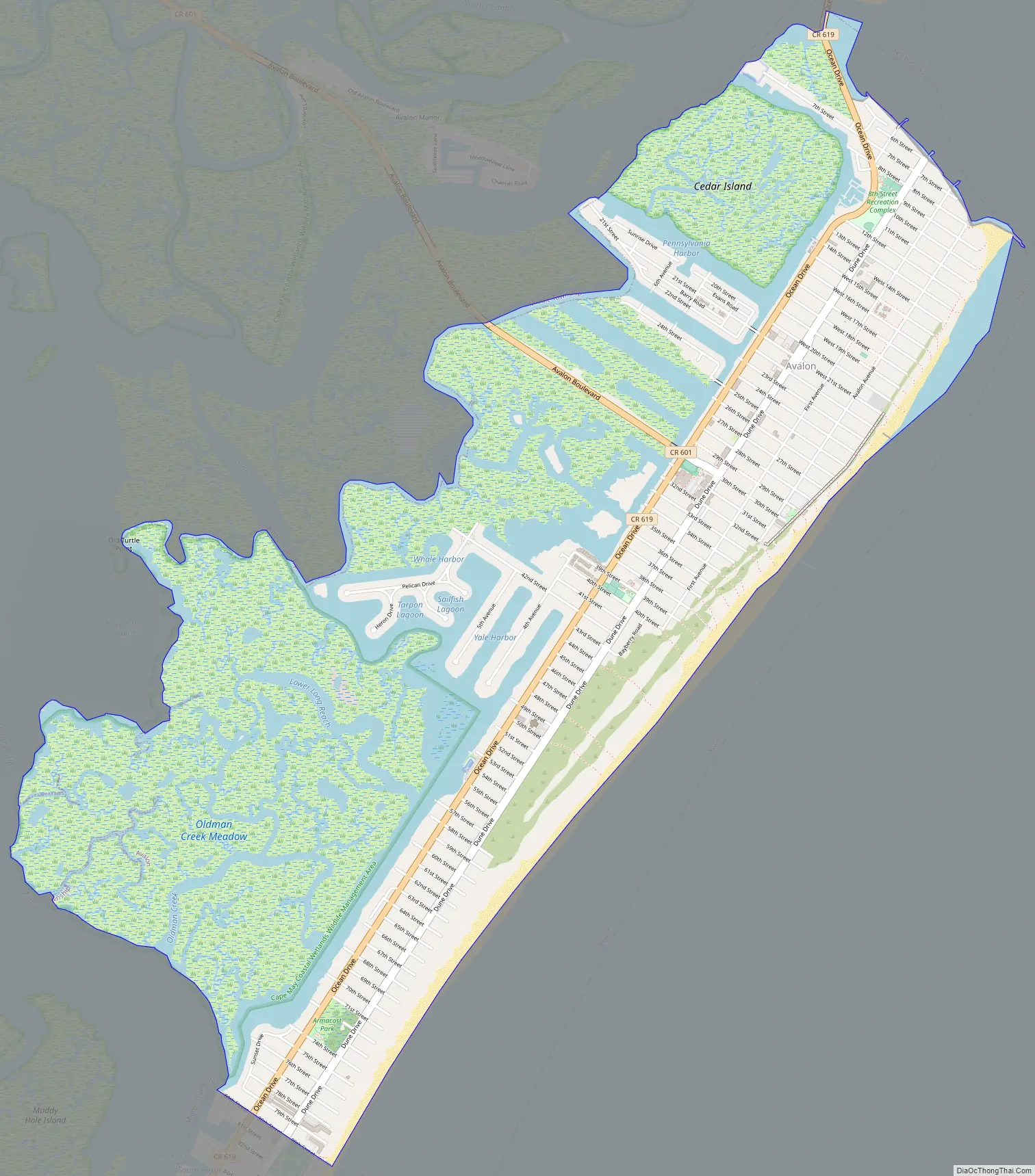
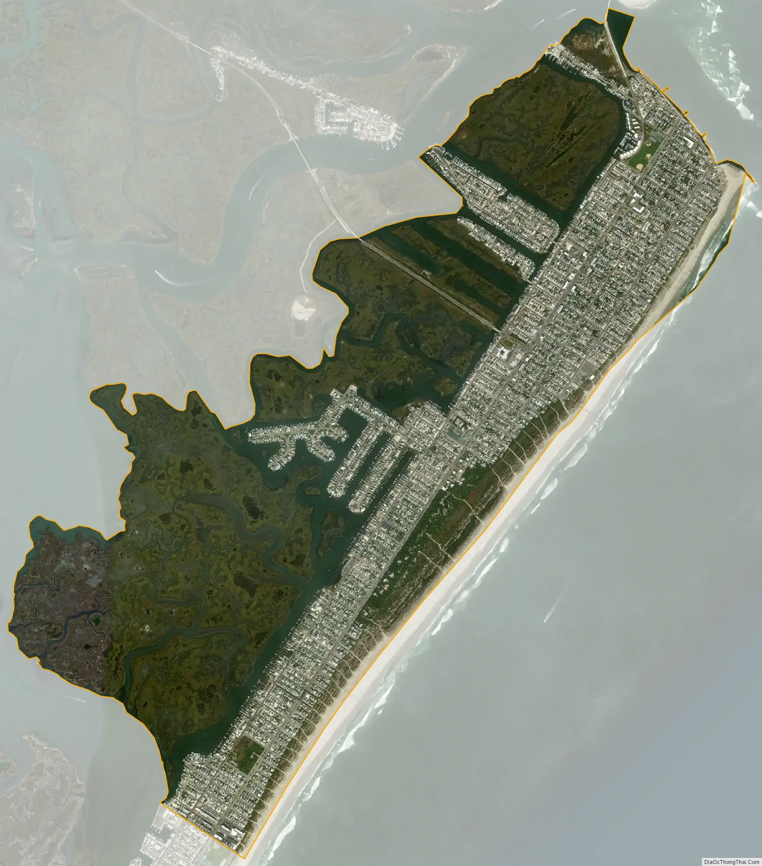
Avalon city Satellite Map
Geography
According to the U.S. Census Bureau, the borough had a total area of 5.06 square miles (13.09 km), including 4.27 square miles (11.06 km) of land and 0.79 square miles (2.04 km) of water (15.53%).
Unincorporated communities, localities and place names located partially or completely within the borough include Peermont.
The borough borders the Cape May County municipalities of Dennis Township, Middle Township, Sea Isle City and Stone Harbor, as well as the Atlantic Ocean.
See also
Map of New Jersey State and its subdivision: Map of other states:- Alabama
- Alaska
- Arizona
- Arkansas
- California
- Colorado
- Connecticut
- Delaware
- District of Columbia
- Florida
- Georgia
- Hawaii
- Idaho
- Illinois
- Indiana
- Iowa
- Kansas
- Kentucky
- Louisiana
- Maine
- Maryland
- Massachusetts
- Michigan
- Minnesota
- Mississippi
- Missouri
- Montana
- Nebraska
- Nevada
- New Hampshire
- New Jersey
- New Mexico
- New York
- North Carolina
- North Dakota
- Ohio
- Oklahoma
- Oregon
- Pennsylvania
- Rhode Island
- South Carolina
- South Dakota
- Tennessee
- Texas
- Utah
- Vermont
- Virginia
- Washington
- West Virginia
- Wisconsin
- Wyoming