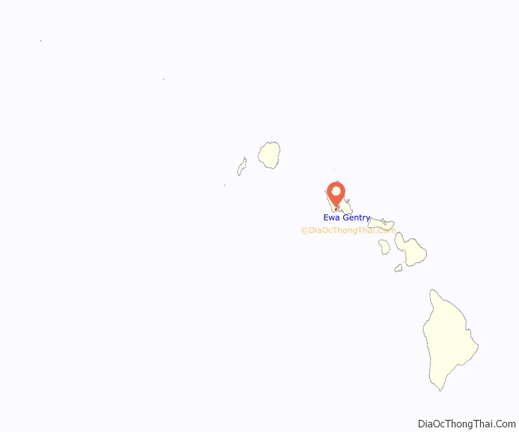
ʻEwa Gentry is a housing development and, as Ewa Gentry, a census-designated place (CDP) located in the ʻEwa District and the City & County of Honolulu on the leeward side of Oʻahu in Hawaiʻi about twelve miles (19 km) from Honolulu. As of the 2010 Census, the CDP had a total population of 22,690.
This area is also known as just ʻEwa (in Hawaiian, ʻewa means “crooked”). In the late 19th century to early 20th century, ʻEwa was one of the large population centers on the Island of Oʻahu, with industry focused around sugar cane production. The ʻEwa Mill, in ʻEwa was a major employer that set up residential villages. Sugar cane is no longer grown on the ʻEwa Plain and ʻEwa Gentry is now part of Oʻahu’s new suburban growth center—an area of substantial sprawl spreading unbroken to the south to ʻEwa Gentry, north to Honouliuli, and west to Kalaeloa and Kapolei. This area is now referred to as Oʻahu’s Second City, with a city center (downtown) located in Kapolei.
| Name: | Ewa Gentry CDP |
|---|---|
| LSAD Code: | 57 |
| LSAD Description: | CDP (suffix) |
| State: | Hawaii |
| County: | Honolulu County |
| Elevation: | 39 ft (12 m) |
| Total Area: | 2.13 sq mi (5.51 km²) |
| Land Area: | 2.13 sq mi (5.51 km²) |
| Water Area: | 0.00 sq mi (0.00 km²) |
| Total Population: | 25,707 |
| Population Density: | 12,074.68/sq mi (4,662.19/km²) |
| ZIP code: | 96706 |
| Area code: | 808 |
| FIPS code: | 1507470 |
| GNISfeature ID: | 1867249 |
Online Interactive Map
Click on ![]() to view map in "full screen" mode.
to view map in "full screen" mode.
Ewa Gentry location map. Where is Ewa Gentry CDP?
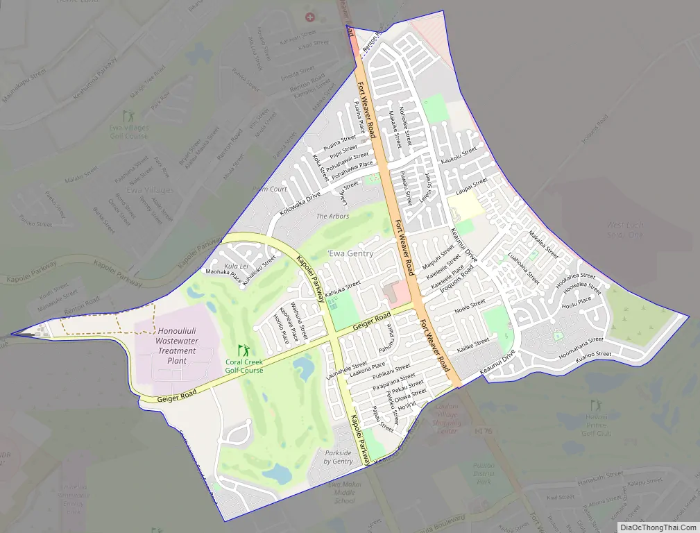
Ewa Gentry Road Map
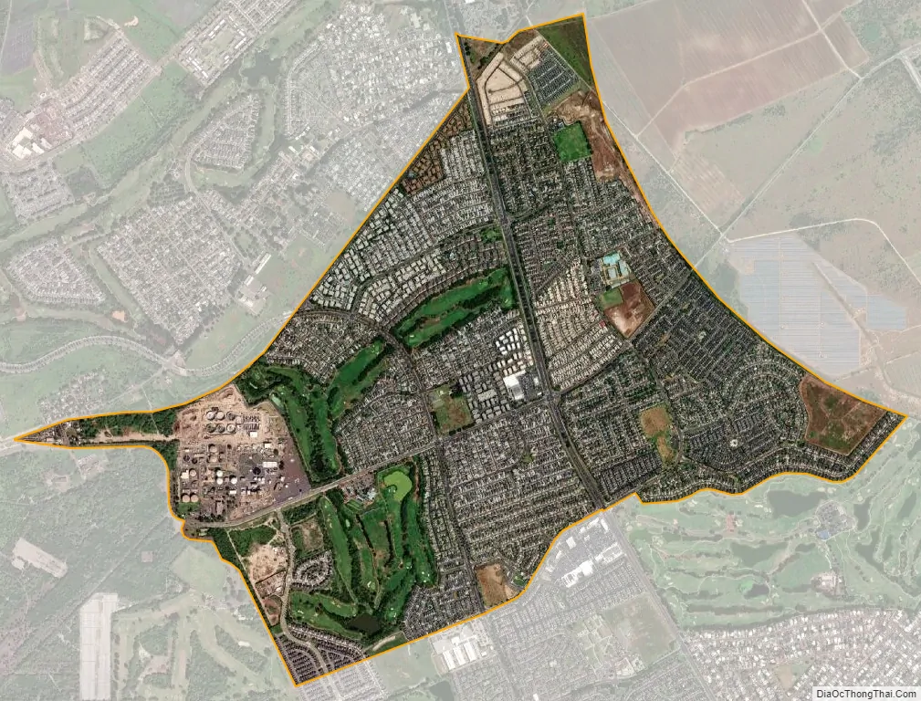
Ewa Gentry city Satellite Map
Geography
ʻEwa Gentry is located at 21°20’22” North, 158°1’47” West (21.339441, -158.029725), inland from ʻEwa Gentry on the west side of the main thoroughfare, Fort Weaver Road (State Rte. 76). This highway runs north past ʻEwa to Waipahu, connecting there to Farrington Highway (State Rte. 90) and the H-1 freeway. Major cross streets are Kapolei Parkway, which will eventually connect to Kapolei City Center and Geiger Road, which runs westward to Kalaeloa.
According to the United States Census Bureau, the CDP has a total area of 0.3 square miles (0.78 km), of which, 0.3 square miles (0.78 km) of it is land and none of it is covered by water.
See also
Map of Hawaii State and its subdivision: Map of other states:- Alabama
- Alaska
- Arizona
- Arkansas
- California
- Colorado
- Connecticut
- Delaware
- District of Columbia
- Florida
- Georgia
- Hawaii
- Idaho
- Illinois
- Indiana
- Iowa
- Kansas
- Kentucky
- Louisiana
- Maine
- Maryland
- Massachusetts
- Michigan
- Minnesota
- Mississippi
- Missouri
- Montana
- Nebraska
- Nevada
- New Hampshire
- New Jersey
- New Mexico
- New York
- North Carolina
- North Dakota
- Ohio
- Oklahoma
- Oregon
- Pennsylvania
- Rhode Island
- South Carolina
- South Dakota
- Tennessee
- Texas
- Utah
- Vermont
- Virginia
- Washington
- West Virginia
- Wisconsin
- Wyoming


