Kalaeloa (Hawaiian pronunciation: [kəlɐe̯ˈlowə]) is a census-designated place (CDP) in Honolulu County, Hawaii, United States. The population was 2,364 at the 2020 census. The community occupies the location of the former Naval Air Station Barbers Point, which was closed in 1999 and subsequently transferred to the State of Hawaiʻi. The geographical name, Ka lae loa, means “long point” in Hawaiian and is the native name for what has been called Barbers Point on Oʻahu. The area was known as Barbers Point because Captain Henry Barber wrecked his ship on a coral shoal at this location on October 31, 1796.
In 1993, after the federal government listed Barbers Point for closure, the state legislature established the Barbers Point Naval Air Station Redevelopment Commission (BPNAS-RC) to guide the redevelopment of the former military facilities comprising John Rodgers airfield and 3,700 acres (15 km) of land along the south shore of Oʻahu between the towns of ʻEwa, Kapolei, and Campbell Industrial Park. On July 1, 2002, the Hawaii Community Development Authority became the redevelopment authority for Kalaeloa. The former Naval Air Station runways and associated facilities are now Kalaeloa Airport.
Barbers Point Housing is that part of Kalaeloa retained temporarily by the U.S. Navy for housing.
| Name: | Kalaeloa CDP |
|---|---|
| LSAD Code: | 57 |
| LSAD Description: | CDP (suffix) |
| State: | Hawaii |
| County: | Honolulu County |
| Elevation: | 30 ft (9 m) |
| Total Area: | 6.10 sq mi (15.79 km²) |
| Land Area: | 6.10 sq mi (15.79 km²) |
| Water Area: | 0.00 sq mi (0.00 km²) |
| Total Population: | 2,364 |
| Population Density: | 387.73/sq mi (149.71/km²) |
| ZIP code: | 96707 |
| Area code: | 808 |
| FIPS code: | 1524850 |
| GNISfeature ID: | 2627933 |
Online Interactive Map
Click on ![]() to view map in "full screen" mode.
to view map in "full screen" mode.
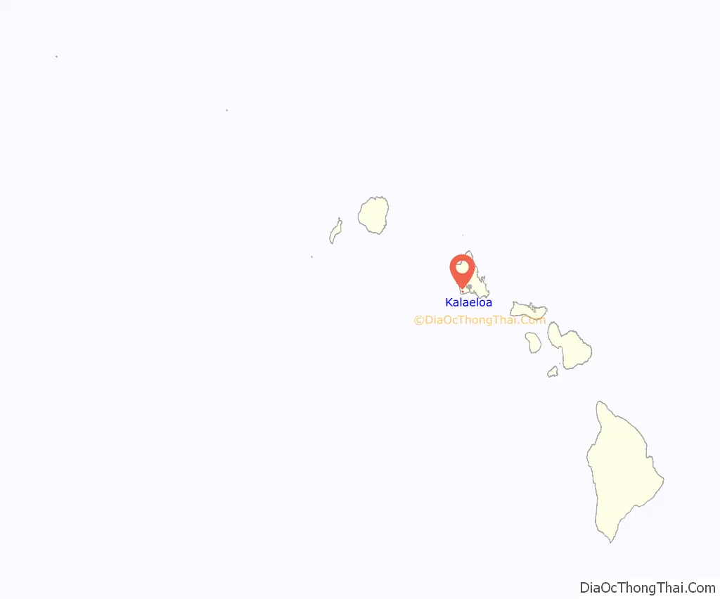
Kalaeloa location map. Where is Kalaeloa CDP?
History
In October 1795, during a trading voyage to China, the ship, the Arthur arrived in Hawaiʻi led by Captain Henry Barber. He set sail for Kauaʻi after stopping for provisions at Waikiki. After passing the entrance to Pearl Harbor, the Arthur wrecked on a reef in high surf and was completely destroyed. Six crew members drowned, but Barber and the other fifteen members of his crew made it ashore in their small boats. The point where the wreck occurred was known thereafter as Barbers Point.
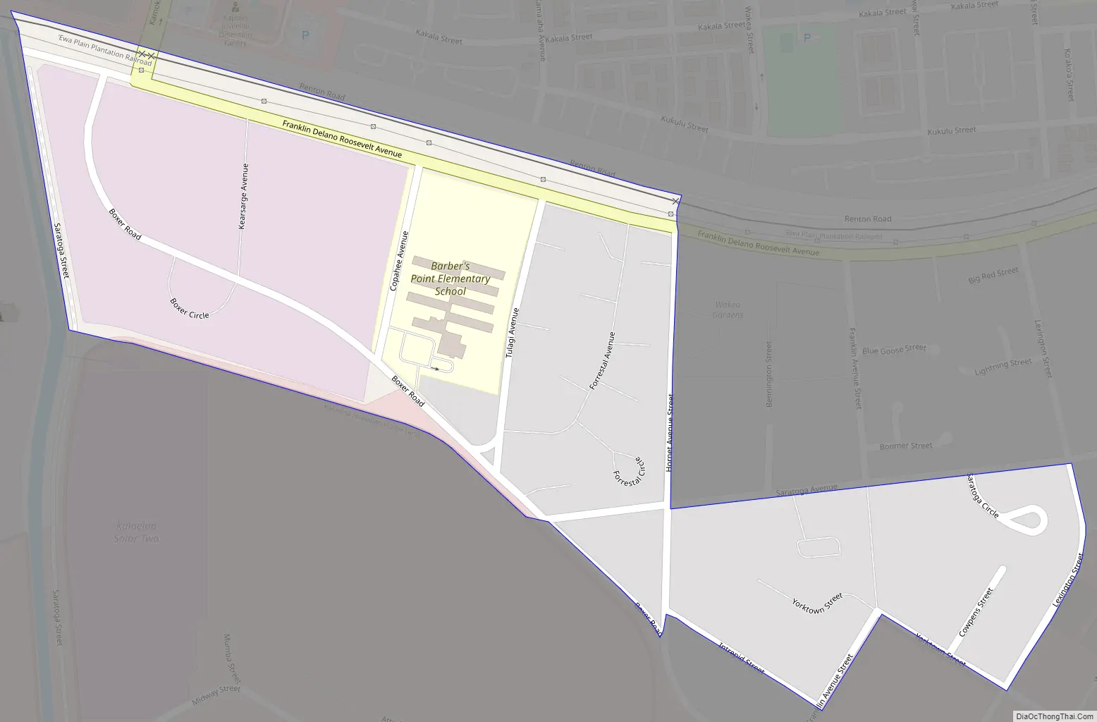
Kalaeloa Road Map
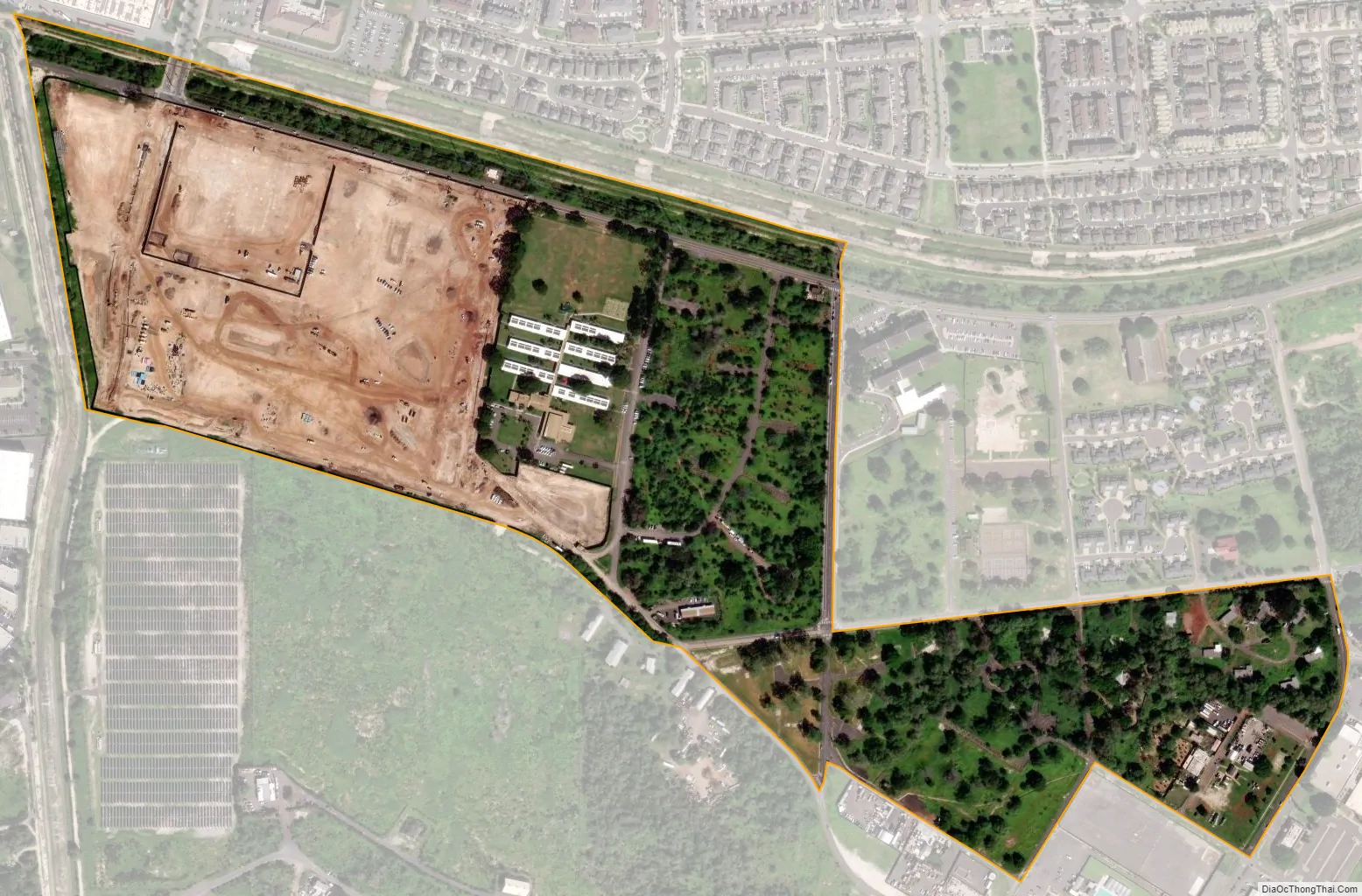
Kalaeloa city Satellite Map
Geography
Kalaeloa is located at 21°19’28” North, 158°4’59” West (21.324550, -158.083156).
Climate
Tropical savanna climates have monthly mean temperature above 18 °C (64 °F) in every month of the year and typically a pronounced dry season, with the driest month having precipitation less than 60mm (2.36 in) of precipitation.
See also
Map of Hawaii State and its subdivision: Map of other states:- Alabama
- Alaska
- Arizona
- Arkansas
- California
- Colorado
- Connecticut
- Delaware
- District of Columbia
- Florida
- Georgia
- Hawaii
- Idaho
- Illinois
- Indiana
- Iowa
- Kansas
- Kentucky
- Louisiana
- Maine
- Maryland
- Massachusetts
- Michigan
- Minnesota
- Mississippi
- Missouri
- Montana
- Nebraska
- Nevada
- New Hampshire
- New Jersey
- New Mexico
- New York
- North Carolina
- North Dakota
- Ohio
- Oklahoma
- Oregon
- Pennsylvania
- Rhode Island
- South Carolina
- South Dakota
- Tennessee
- Texas
- Utah
- Vermont
- Virginia
- Washington
- West Virginia
- Wisconsin
- Wyoming


