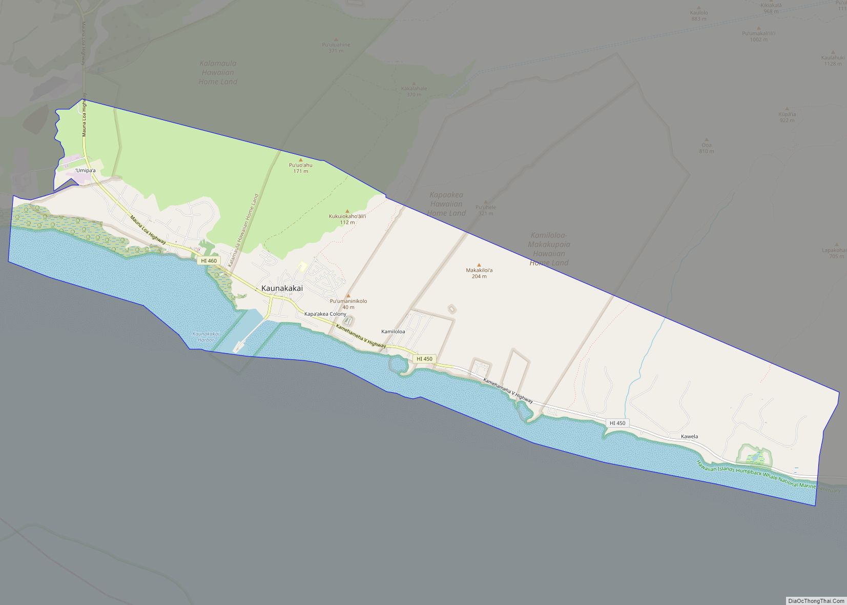
Kaunakakai (Hawaiian pronunciation: [kɐwnəkəˈkɐj]) is a census-designated place (CDP) in Maui County, Hawaiʻi, United States. It is the largest town on the island of Molokaʻi. The population was 3,419 at the 2020 census. It has the largest port on the island and the longest pier in Hawaii. The town was made famous in the 1930s by the song “The Cockeyed Mayor of Kaunakakai”, beginning an ongoing tradition of designating an honorary mayor for the town.
| Name: | Kaunakakai CDP |
|---|---|
| LSAD Code: | 57 |
| LSAD Description: | CDP (suffix) |
| State: | Hawaii |
| County: | Maui County |
| Elevation: | 20 ft (6 m) |
| Total Area: | 16.45 sq mi (42.60 km²) |
| Land Area: | 12.83 sq mi (33.22 km²) |
| Water Area: | 3.62 sq mi (9.37 km²) |
| Total Population: | 3,419 |
| Population Density: | 266.53/sq mi (102.91/km²) |
| ZIP code: | 96748 |
| Area code: | 808 |
| FIPS code: | 1531100 |
| GNISfeature ID: | 0360717 |
Online Interactive Map
Click on ![]() to view map in "full screen" mode.
to view map in "full screen" mode.
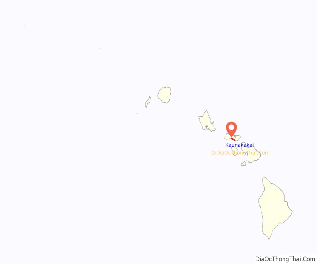
Kaunakakai location map. Where is Kaunakakai CDP?
History
In the mid-1800s, King Kamehameha V sometimes spent his summers on Moloka’i at a home in Kaunakakai. The main street of Kaunakakai, Ala Malama Avenue, was named after the king’s summer home.
Around mid-1935, the song was written for the celebration of the first honorary mayor, ‘The Cockeyed Mayor of Kaunakakai’, during the vacation visit by Academy Award winning Best Actor in 1929, Warner Baxter. The “election” was a seven-day celebration by the locals and Baxter’s vacation party.
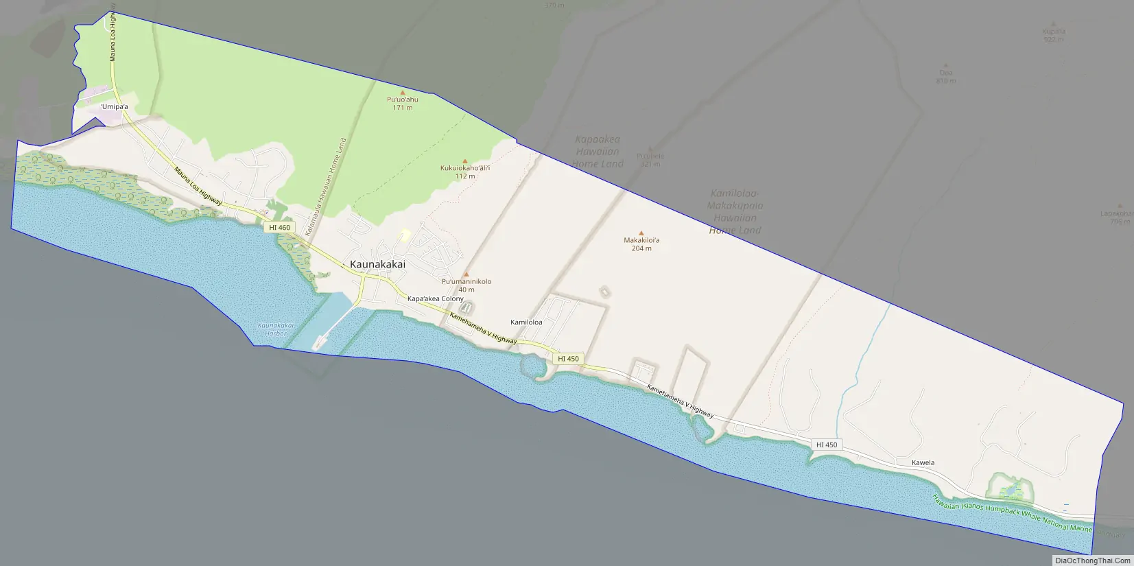
Kaunakakai Road Map
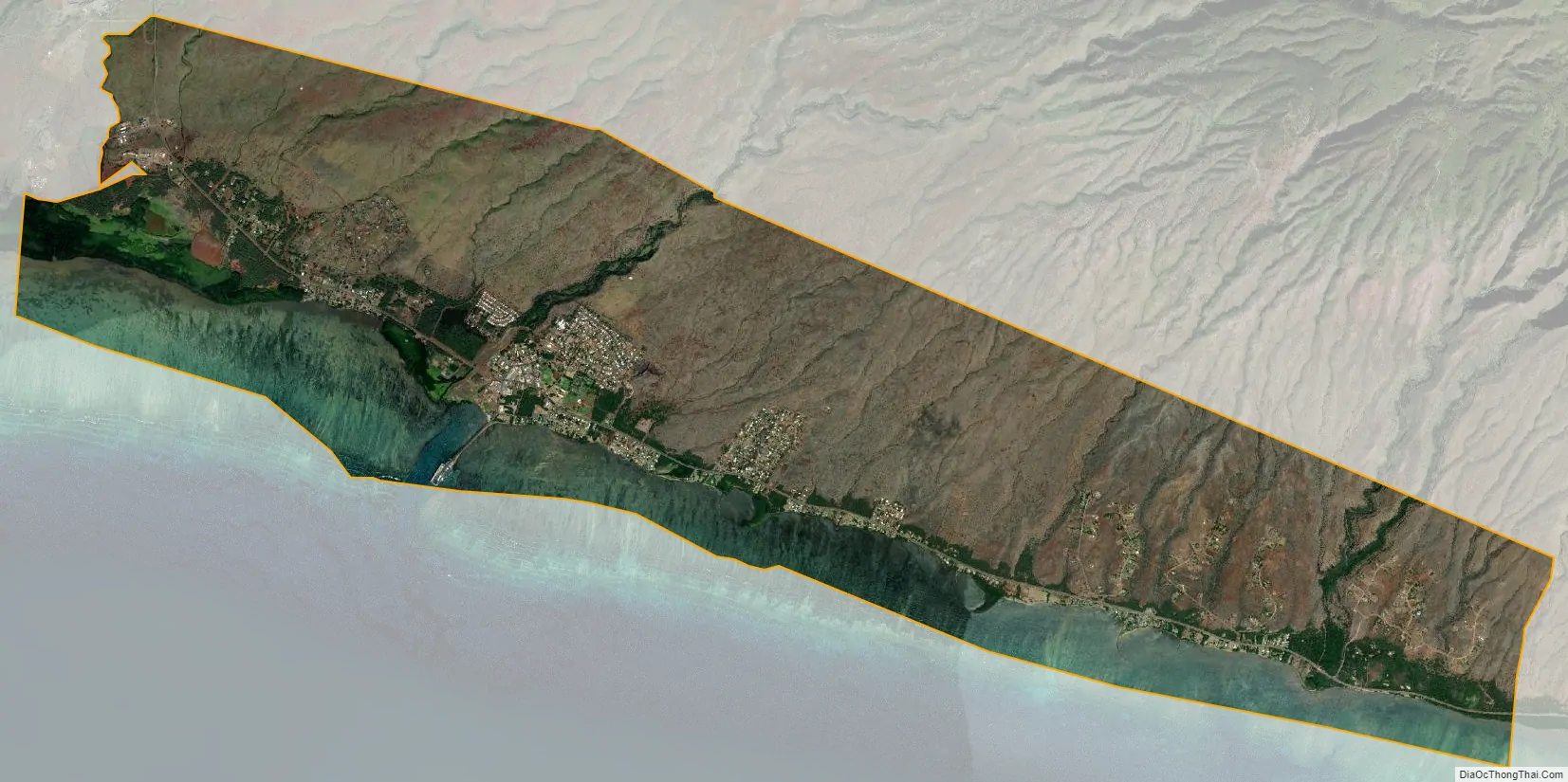
Kaunakakai city Satellite Map
Geography
Kaunakakai is located at 21°5′20″N 157°0′45″W / 21.08889°N 157.01250°W / 21.08889; -157.01250 (21.088968, -157.012542).
According to the United States Census Bureau, the CDP has a total area of 16.4 square miles (42.6 km), of which 12.8 square miles (33.2 km) is land and 3.6 square miles (9.4 km), or 22.00%, is water.
See also
Map of Hawaii State and its subdivision: Map of other states:- Alabama
- Alaska
- Arizona
- Arkansas
- California
- Colorado
- Connecticut
- Delaware
- District of Columbia
- Florida
- Georgia
- Hawaii
- Idaho
- Illinois
- Indiana
- Iowa
- Kansas
- Kentucky
- Louisiana
- Maine
- Maryland
- Massachusetts
- Michigan
- Minnesota
- Mississippi
- Missouri
- Montana
- Nebraska
- Nevada
- New Hampshire
- New Jersey
- New Mexico
- New York
- North Carolina
- North Dakota
- Ohio
- Oklahoma
- Oregon
- Pennsylvania
- Rhode Island
- South Carolina
- South Dakota
- Tennessee
- Texas
- Utah
- Vermont
- Virginia
- Washington
- West Virginia
- Wisconsin
- Wyoming