Lāna‘i City is a census-designated place (CDP) on the island of Lāna‘i, in Maui County, Hawai‘i, United States. The population was 3,332 at the 2020 census. Lāna‘i City is the island’s commercial center. Many of the island’s restaurants and shops are in the town square that surrounds Dole Park, and the only hospital on the island, Lāna‘i Community Hospital, is located near the park.
Lāna‘i City is served by Lāna‘i Airport (LNY).
| Name: | Lanai City CDP |
|---|---|
| LSAD Code: | 57 |
| LSAD Description: | CDP (suffix) |
| State: | Hawaii |
| County: | Maui County |
| Elevation: | 1,644 ft (501 m) |
| Total Area: | 6.77 sq mi (17.53 km²) |
| Land Area: | 6.77 sq mi (17.53 km²) |
| Water Area: | 0.00 sq mi (0.00 km²) |
| Total Population: | 3,332 |
| Population Density: | 492.39/sq mi (190.10/km²) |
| ZIP code: | 96763 |
| Area code: | 808 |
| FIPS code: | 1543700 |
| GNISfeature ID: | 0361713 |
Online Interactive Map
Click on ![]() to view map in "full screen" mode.
to view map in "full screen" mode.
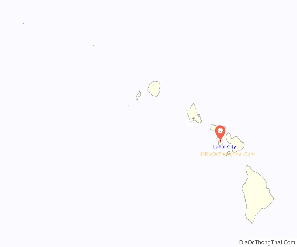
Lanai City location map. Where is Lanai City CDP?
History
Lāna‘i was once the home of the pineapple plantation of entrepreneur James Drummond Dole, which spanned over 20,000 acres (81 km) and employed thousands of workers. Dole owned the entire island for a time, and in the 1920s built Lāna‘i City to house and serve the community of workers. It was the first model city in Hawai‘i. In 1923 several stores, a bank, a hospital, a theater, a church and business headquarters were built around an open park space. In 1930 model homes for couples featuring two bedrooms, a large living room, a kitchen, with running water, electricity and spacious yards were erected. The single men’s houses had three furnished rooms and also running water and electricity.
In 2009, the corporation Castle & Cooke, which had been spun off from the Dole Food Company, announced its intent to demolish much of what remained of the historic district, including homes, a laundromat, and a jailhouse—all dating back to the 1920s—in order to build new commercial structures. The development would have included a supermarket described by the National Trust for Historic Preservation as “oversized” and “out-of-scale”. The intact plantation town is something not found on any of the other Hawaiian Islands.
However, in June 2012, Castle & Cooke sold its island possessions (totaling 98% of the island) to billionaire Larry Ellison for $300 million.
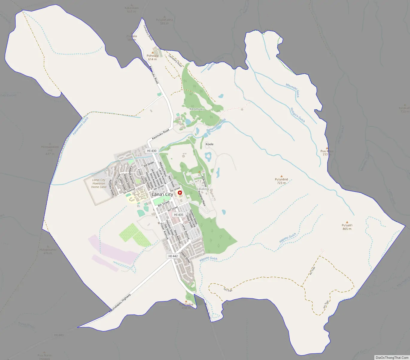
Lanai City Road Map
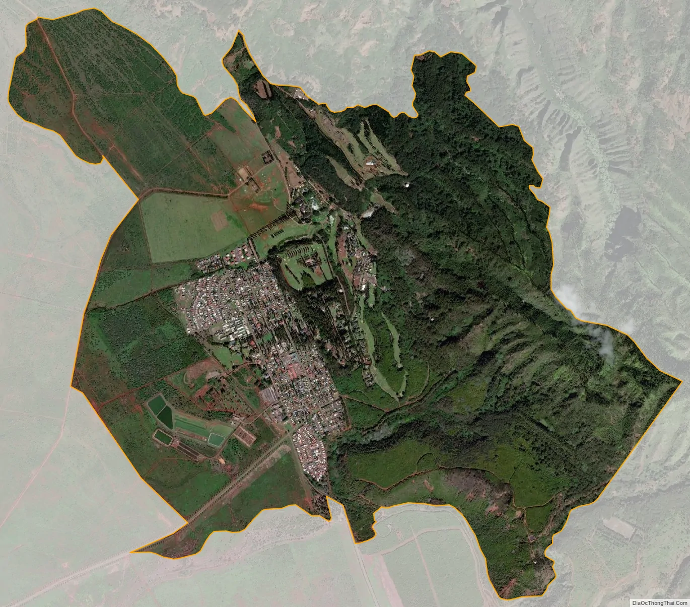
Lanai City city Satellite Map
Geography
According to the United States Census Bureau, the CDP has a total area of 6.9 square miles (17.9 km), all land.
Lāna‘i City experiences a tropical savanna climate (Köppen classification As) with a mostly dry summer season. The average temperature in January is almost cool enough to qualify this climate as a warm-winter form of a Mediterranean climate (Köppen climate classification Csa). An average monthly temperature of 64 °F (18 °C) is the lower limit for tropical climate classification.
See also
Map of Hawaii State and its subdivision: Map of other states:- Alabama
- Alaska
- Arizona
- Arkansas
- California
- Colorado
- Connecticut
- Delaware
- District of Columbia
- Florida
- Georgia
- Hawaii
- Idaho
- Illinois
- Indiana
- Iowa
- Kansas
- Kentucky
- Louisiana
- Maine
- Maryland
- Massachusetts
- Michigan
- Minnesota
- Mississippi
- Missouri
- Montana
- Nebraska
- Nevada
- New Hampshire
- New Jersey
- New Mexico
- New York
- North Carolina
- North Dakota
- Ohio
- Oklahoma
- Oregon
- Pennsylvania
- Rhode Island
- South Carolina
- South Dakota
- Tennessee
- Texas
- Utah
- Vermont
- Virginia
- Washington
- West Virginia
- Wisconsin
- Wyoming