Manele is a census-designated place (CDP) in Maui County, Hawaii, United States, on the island of Lanai. As of the 2020 census, the CDP had a population of 7. Manele is one of only two census-designated places on Lanai, the other being the much larger Lanai City. Manele is the site of Four Seasons Resort Lanai. It is the least populated city in Hawaii.
| Name: | Manele CDP |
|---|---|
| LSAD Code: | 57 |
| LSAD Description: | CDP (suffix) |
| State: | Hawaii |
| County: | Maui County |
| Total Area: | 1.23 sq mi (3.17 km²) |
| Land Area: | 1.23 sq mi (3.17 km²) |
| Water Area: | 0.00 sq mi (0.00 km²) 0% |
| Total Population: | 7 |
| Population Density: | 5.71/sq mi (2.20/km²) |
| FIPS code: | 1549425 |
| GNISfeature ID: | 15-49425 |
Online Interactive Map
Click on ![]() to view map in "full screen" mode.
to view map in "full screen" mode.
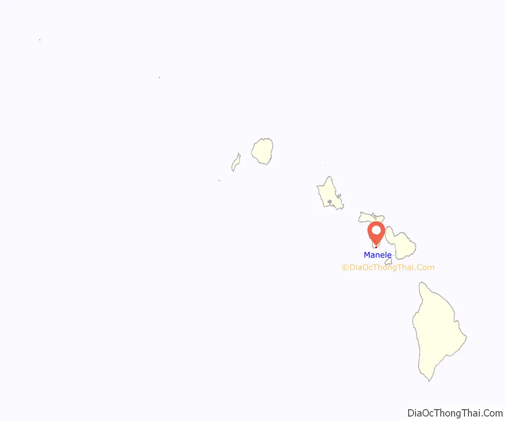
Manele location map. Where is Manele CDP?
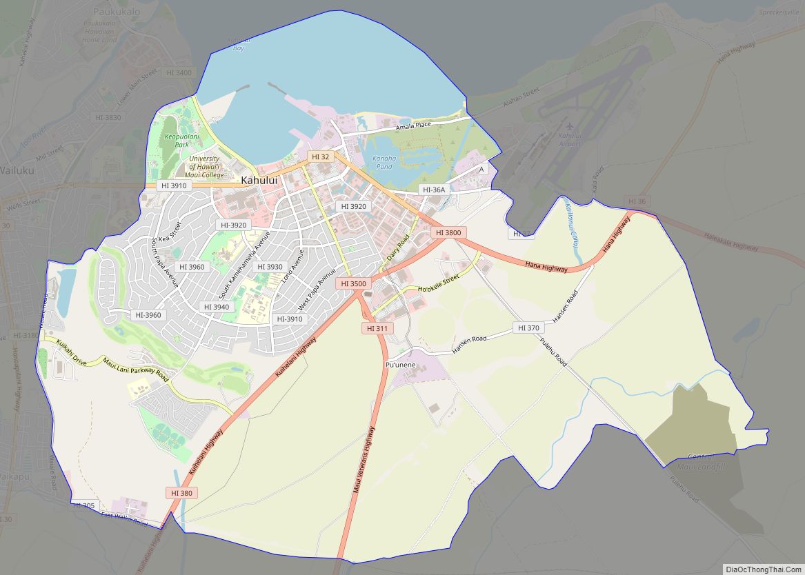
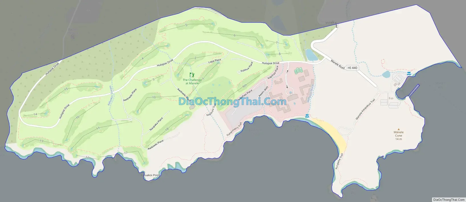
Manele Road Map
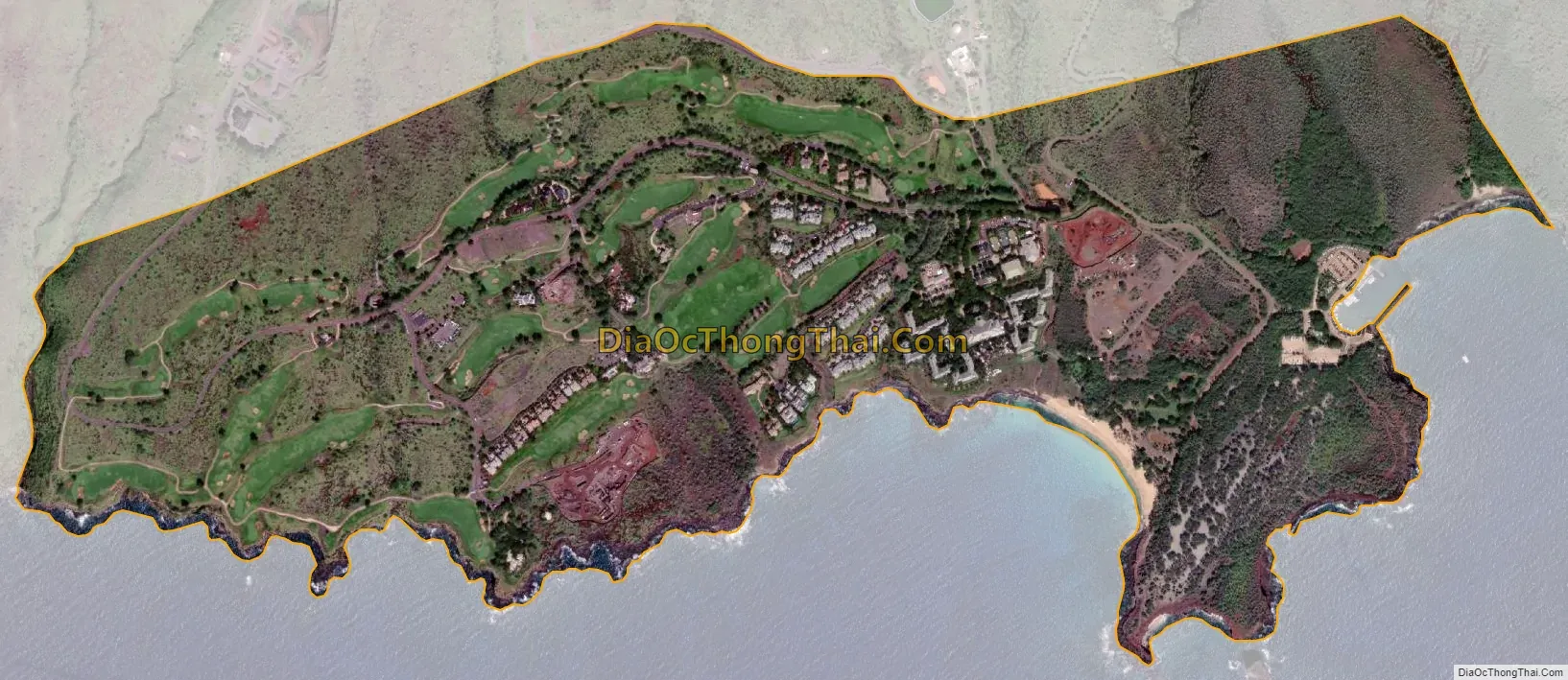
Manele city Satellite Map
See also
Map of Hawaii State and its subdivision: Map of other states:- Alabama
- Alaska
- Arizona
- Arkansas
- California
- Colorado
- Connecticut
- Delaware
- District of Columbia
- Florida
- Georgia
- Hawaii
- Idaho
- Illinois
- Indiana
- Iowa
- Kansas
- Kentucky
- Louisiana
- Maine
- Maryland
- Massachusetts
- Michigan
- Minnesota
- Mississippi
- Missouri
- Montana
- Nebraska
- Nevada
- New Hampshire
- New Jersey
- New Mexico
- New York
- North Carolina
- North Dakota
- Ohio
- Oklahoma
- Oregon
- Pennsylvania
- Rhode Island
- South Carolina
- South Dakota
- Tennessee
- Texas
- Utah
- Vermont
- Virginia
- Washington
- West Virginia
- Wisconsin
- Wyoming