Frostburg is a city in Allegany County, Maryland. It is located at the head of the Georges Creek Valley, 8 miles (13 km) west of Cumberland. The town is one of the first cities on the “National Road”, US 40, and the western terminus of the Western Maryland Scenic Railroad. It is part of the Cumberland MD-WV metropolitan statistical area,
Frostburg was originally called Mount Pleasant until 1820, when the government developed a postal service, and the town was renamed Frostburg. Since 1973, the city has been served by what is now Interstate 68.
The City of Frostburg has an approximate year-round population of 8,075. The total population was 9,002 at the 2010 census. In addition, 5,400 students attend Frostburg State University, a public university within the University System of Maryland.
| Name: | Frostburg city |
|---|---|
| LSAD Code: | 25 |
| LSAD Description: | city (suffix) |
| State: | Maryland |
| County: | Allegany County |
| Incorporated: | 1839 |
| Elevation: | 2,070 ft (631 m) |
| Total Area: | 3.35 sq mi (8.67 km²) |
| Land Area: | 3.34 sq mi (8.66 km²) |
| Water Area: | 0.00 sq mi (0.01 km²) |
| Total Population: | 7,027 |
| Population Density: | 2,101.38/sq mi (811.43/km²) |
| ZIP code: | 21532 |
| Area code: | 301, 240 |
| FIPS code: | 2430900 |
| GNISfeature ID: | 0584526 |
| Website: | www.frostburgcity.com |
Online Interactive Map
Click on ![]() to view map in "full screen" mode.
to view map in "full screen" mode.
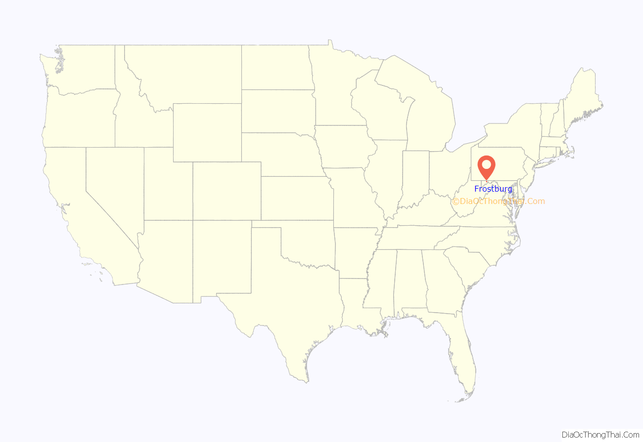
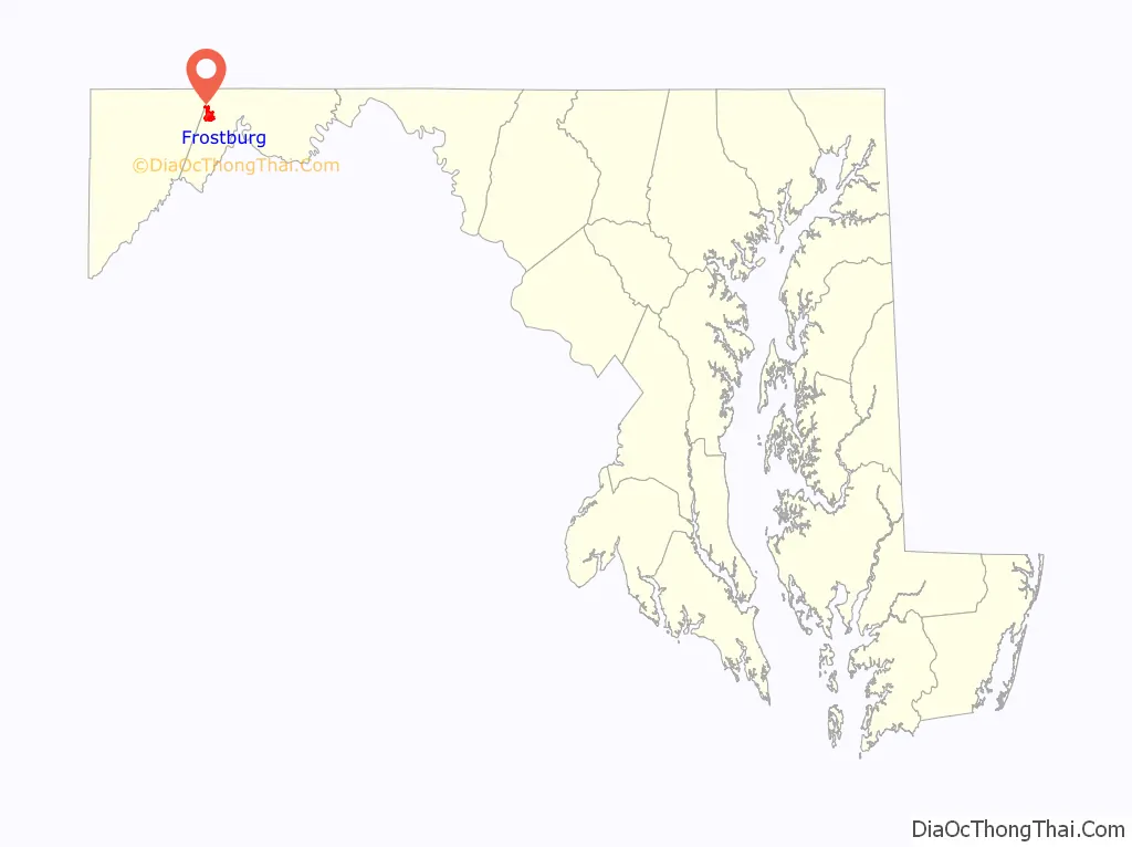
Frostburg location map. Where is Frostburg city?
History
19th century
Frostburg had its beginnings back in 1811 when surveying began for the National Pike, a road used to transport crops and raw materials to East Coast markets. President Thomas Jefferson had authorized construction of the road in 1806. Meshach Frost built the first house in present-day Frostburg in 1812 and named it Highland Hall (on the present-day the site of St. Michael’s Church and Rectory). This building was a popular stopping point for celebrities and dignitaries who traveled the National Pike. This would be followed by the Franklin Hotel and other hotels.
The Baltimore and Ohio Railroad (B&O) and the Chesapeake and Ohio Canal reached Cumberland in 1842 and 1850, respectively. Consequently, travel on the National Pike saw a steady decline, although travel through Frostburg did not. Coal mining was the first major economic draw, but the industry faced problems in its early manifestation. The mountains of western Maryland and Frostburg proved to make transportation of coal very difficult. Not until the completion of the railroads did the coal industry in Frostburg began to flourish. The first major coal producer was Meshech Frost, who owned a significant amount of land for mining and founded the Frostburg Coal Company. This eventually was sold to the much larger Consolidated Coal Company.
Structures from the coal industry’s dominant period still remain. One of the major freight depots for coal is located at 19 Depot St. in Frostburg and is one of the few remaining depots in western Maryland. The Mount Savage Railroad was the first to build a rail line to Frostburg in 1852, and it connected to the B&O Railroad in Cumberland, as well as the C&O Canal. The Cumberland and Pennsylvania Railroad (C&P) took over the Mount Savage line in 1854, and expanded with the construction of a tunnel under Frostburg, and a rail line southward to Piedmont, West Virginia. This railroad and tunnel were used to transport coal between Frostburg and George’s Creek. Another major economic turn for Frostburg was the manufacture of fire brick beginning in 1864, utilizing the high-grade fire clays which are found in the area. One of the main businesses that formed was the Big Savage Fire Brick Company, still one of the main suppliers of fire bricks on the East Coast.
In 1898, the Maryland General Assembly authorized State Normal School #2 and a $20,000 appropriation to construct a building, though no money to buy land. The money for the land was collected among local citizens, many of them coal miners and their families.
Two years later the first building, Old Main, opened. Two years after that, the first classes were held. The only available course of study at that point was a two-year elementary-education program. In 1904, the first class graduated.
In 1934, State Normal School #2 introduced its first four-year program. Nearly 30 years later (1963), the school finally was renamed Frostburg State College. In the next ten years more programs sprouted, including the university’s first graduate program (Master’s of Science in management).
In 1987, Frostburg State College joined the University System of Maryland and was renamed Frostburg State University. FSU celebrated its centennial in 1998.
Major events
The Hocking House was listed on the National Register of Historic Places in 1982. The Frostburg Historic District was listed in 1983 and the Borden Mines Superintendent’s House in 1984.
On June 2, 1998, an F4 tornado struck Frostburg and the adjacent Eckhart Mines valley, damaging more than 125 homes and Frost Elementary School. This tornado refutes the myth that tornadoes do not occur in rough terrain.
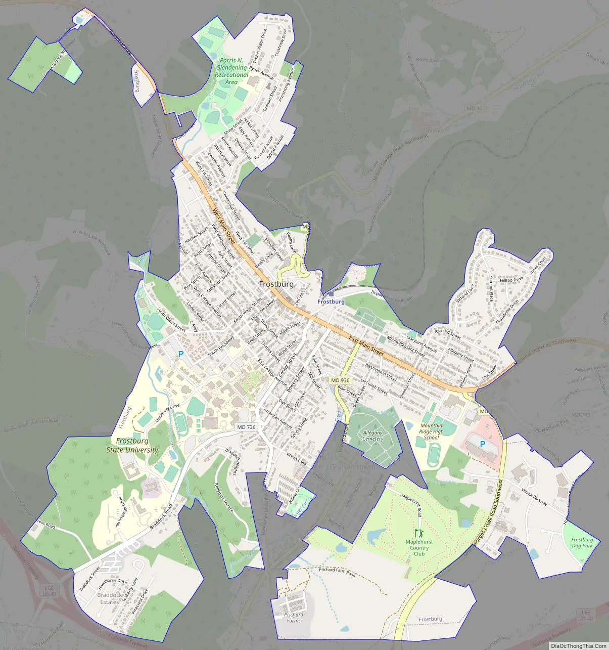
Frostburg Road Map
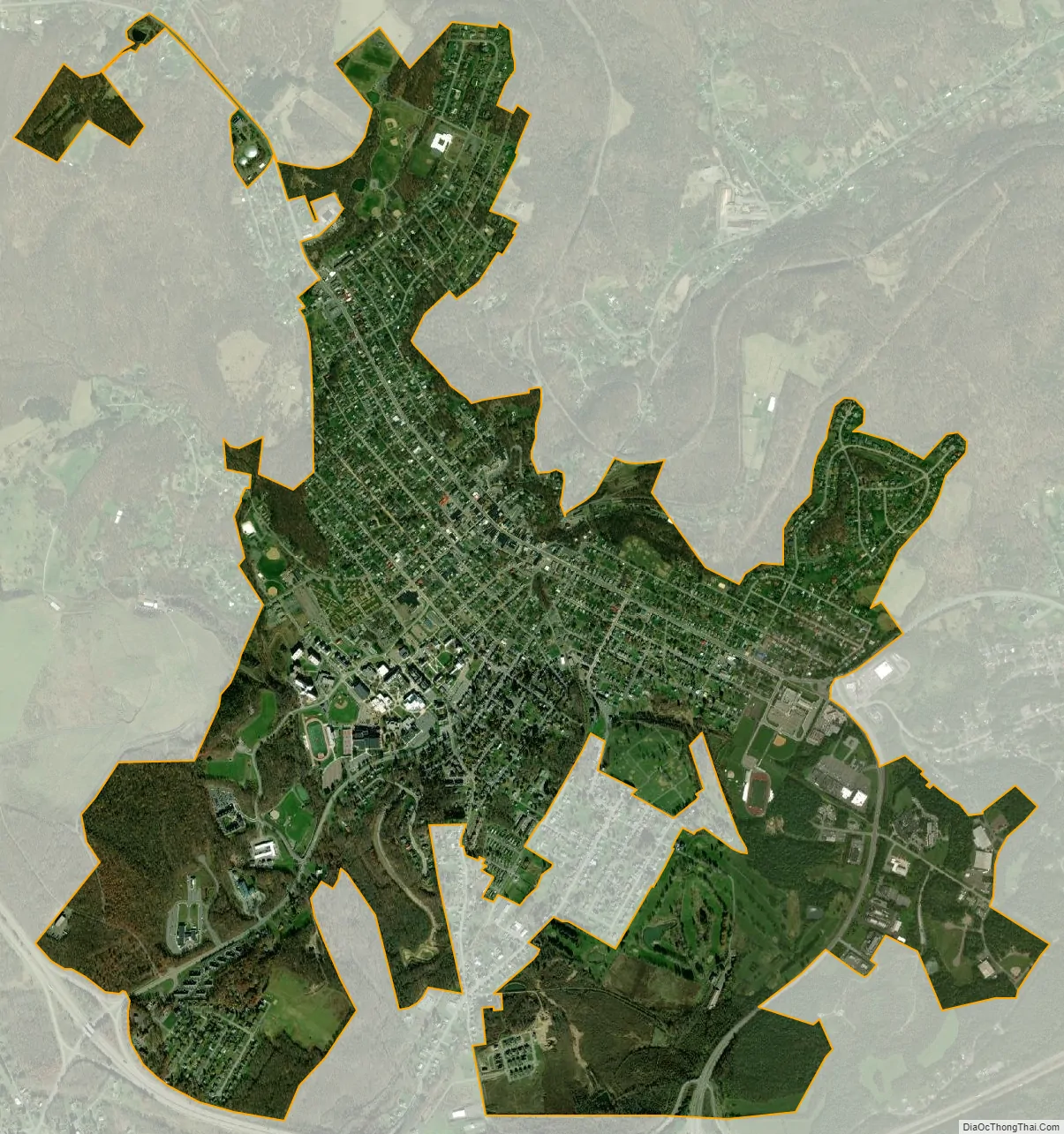
Frostburg city Satellite Map
Geography
According to the U.S. Census Bureau, the city has a total area of 3.42 square miles (8.86 km), all land.
Frostburg is located in the Allegheny Mountains on the eastern slope of Big Savage Mountain. The closest cities to Frostburg are Cumberland, 8 miles (13 km) to the east, and Morgantown, West Virginia, 62 miles (100 km) to the west.
Climate
Due to its average elevation of 2,000 feet (610 m) above sea level and location near the Allegheny Front, Frostburg has a colder, wetter climate than much of the rest of the state, and falls in USDA hardiness zone 6b. Under the Köppen climate classification, it has a humid continental climate (Dfb), with cold, snowy winters, and warm, humid summers. The daily mean temperature ranges from 26.0 °F (−3.3 °C) in January to 69.0 °F (20.6 °C) in July. Sub-0 °F (−18 °C) occur on 3.8 nights per year, while, on average, there are 1.4 days with 90 °F (32 °C)+ highs, though these are not recorded every year. Due to orographic lift, driving conditions on I-68 and US 40 can be very hazardous despite timely state and local road maintenance services, and the town averages just over 80 inches (200 cm) of snowfall a season; significant falls can occur as early as October and as late as May. Frostburg’s greatest one-month snowfall was 67 inches (170 cm) in January 1978, and Frostburg is second in Maryland for the greatest single-season snowfall with a total of 180 inches (460 cm) in the winter of 1995−96.
See also
Map of Maryland State and its subdivision: Map of other states:- Alabama
- Alaska
- Arizona
- Arkansas
- California
- Colorado
- Connecticut
- Delaware
- District of Columbia
- Florida
- Georgia
- Hawaii
- Idaho
- Illinois
- Indiana
- Iowa
- Kansas
- Kentucky
- Louisiana
- Maine
- Maryland
- Massachusetts
- Michigan
- Minnesota
- Mississippi
- Missouri
- Montana
- Nebraska
- Nevada
- New Hampshire
- New Jersey
- New Mexico
- New York
- North Carolina
- North Dakota
- Ohio
- Oklahoma
- Oregon
- Pennsylvania
- Rhode Island
- South Carolina
- South Dakota
- Tennessee
- Texas
- Utah
- Vermont
- Virginia
- Washington
- West Virginia
- Wisconsin
- Wyoming


