Cumberland is a city in and the county seat of Allegany County, Maryland, United States. At the 2020 census, the city had a population of 19,076. Located on the Potomac River, Cumberland is a regional business and commercial center for Western Maryland and the Potomac Highlands of West Virginia. It is the primary city of the Cumberland metropolitan area, which had 95,044 residents in 2020.
Historically, Cumberland was known as the “Queen City” as it was once the second largest in the state. Because of its strategic location on what became known as the Cumberland Road through the Appalachians, after the American Revolution it served as a historical outfitting and staging point for westward emigrant trail migrations throughout the first half of the 1800s. In this role, it supported the settlement of the Ohio Country and the lands in that latitude of the Louisiana Purchase. It also became an industrial center, served by major roads, railroads, and the Chesapeake and Ohio Canal, which connected Cumberland to Washington, D.C. and is now a national historical park. Today, Interstate 68 bisects the town.
Industry declined after World War II, leading urban, business, and technological development in the state to be concentrated in eastern coastal cities. Today, the Cumberland metropolitan area is one of the poorest in the United States, ranking 305th out of 318 metropolitan areas in per capita income.
| Name: | Cumberland city |
|---|---|
| LSAD Code: | 25 |
| LSAD Description: | city (suffix) |
| State: | Maryland |
| County: | Allegany County |
| Founded: | 1787 |
| Incorporated: | January 23, 1815 |
| Elevation: | 627 ft (191 m) |
| Total Area: | 10.12 sq mi (26.22 km²) |
| Land Area: | 10.06 sq mi (26.04 km²) |
| Water Area: | 0.07 sq mi (0.18 km²) |
| Total Population: | 19,076 |
| Population Density: | 1,896.98/sq mi (732.43/km²) |
| ZIP code: | 21501-21505 |
| Area code: | 301, 240 |
| FIPS code: | 2421325 |
| GNISfeature ID: | 0590057 |
| Website: | www.cumberlandmd.gov |
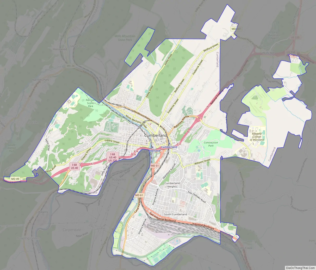
Online Interactive Map
Click on ![]() to view map in "full screen" mode.
to view map in "full screen" mode.
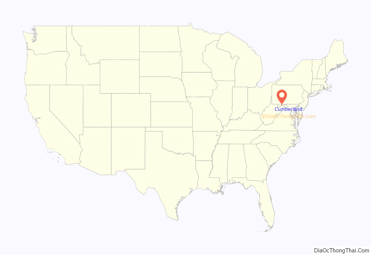
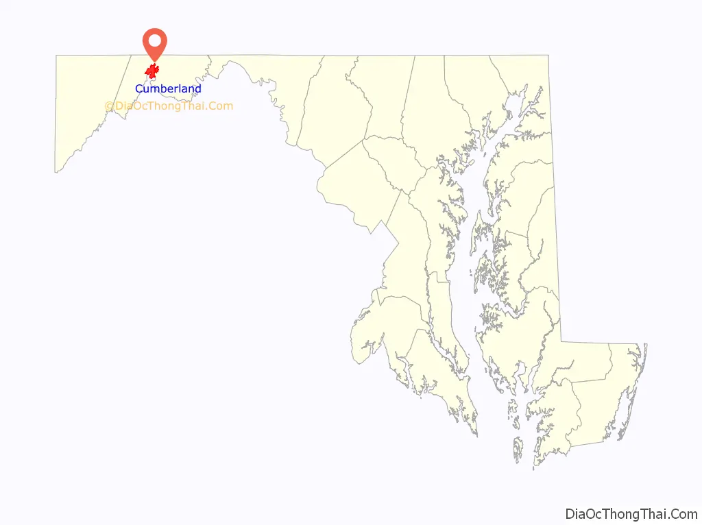
Cumberland location map. Where is Cumberland city?
History
Cumberland was named by English colonists after the son of King George II, Prince William, the Duke of Cumberland. It is built on the site of the mid-18th century Fort Cumberland, the starting point for British General Edward Braddock’s ill-fated attack on the French stronghold of Fort Duquesne (present-day Pittsburgh) during the French and Indian War, the North American front of the Seven Years’ War between the French and the British. (See Braddock expedition.) This area had been settled for thousands of years by indigenous peoples. The fort was developed along the Great Indian Warpath which tribes used to travel the backcountry.
Cumberland also served as an outpost of Colonel George Washington during the French and Indian War, and his first military headquarters was built here. Washington returned as President of the United States in 1794 to Cumberland to review troops assembled to thwart the Whiskey Rebellion.
During the 19th century, Cumberland was a key road, railroad and canal junction. It became the second-largest city in Maryland after the port city of Baltimore. It was nicknamed “The Queen City”. Cumberland was the terminus, and namesake, of the Cumberland Road (begun in 1811) that extended westward to the Ohio River at Wheeling, West Virginia. This was the first portion of what would be constructed as the National Road, which eventually reached Ohio, Indiana, and Illinois. In the 1850s, many black fugitives reached their final stop on the underground railroad beneath the floor of the Emmanuel Episcopal Church. A maze of tunnels beneath and an abolitionist pastor above provided refuge before the final five mile trip to freedom in Pennsylvania.
The surrounding hillsides were mined for coal and iron ore, and harvested for timber that helped supply the Industrial Revolution. The Chesapeake and Ohio Canal had its western terminus here; it was built to improve the movement of goods between the Midwest and Washington, DC, the eastern terminus. Construction of railroads superseded use of the canal, as trains were faster and could carry more freight. The city developed as a major manufacturing center, with industries in glass, breweries, fabrics, tires, and tinplate.
With the restructuring of heavy industry in the Northeast and Mid-Atlantic states following World War II, the city lost many jobs. As a result, its population has declined by nearly half, from 39,483 in the 1940 census to fewer than 20,000 today.
Cumberland Road Map
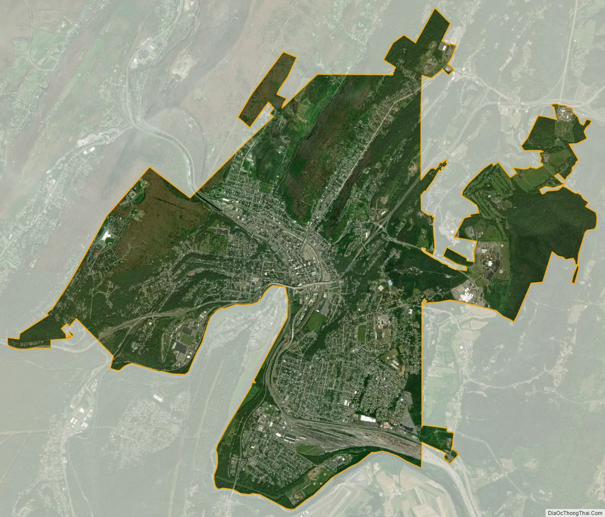
Cumberland city Satellite Map
Geography
Cumberland is in the Ridge-and-Valley Appalachians at the junction of the North Branch Potomac River and Wills Creek. The majority of the land within the city lies in a valley created by the junction of these two streams. Interstate 68 runs through the city in an east–west direction, as does Alternate U.S. 40, the Old National Road. U.S. Highway 220 runs north–south. Parts of Wills Mountain, Haystack Mountain, and Shriver Ridge are also within the city limits. Opposite Cumberland along the Potomac River is Ridgeley, West Virginia.
The abandoned Chesapeake and Ohio Canal is now part of the Chesapeake and Ohio Canal National Historical Park. The canal’s towpath is maintained, allowing travel by foot, horse or bicycle between Cumberland and Washington, D.C., a distance of approximately 185 miles (298 km). In recent years, a separate trail/path extension, called the Great Allegheny Passage, has been developed that leads to Pittsburgh as its western terminus. Cumberland is the only city of at least 20,000 residents, outside of the Pittsburgh and DC metro areas, that lies on this combined 300+ mile stretch.
According to the United States Census Bureau, the city has a total area of 10.15 square miles (26.29 km), of which 10.08 square miles (26.11 km) is land and 0.07 square miles (0.18 km) is water.
Climate
Cumberland lies at the beginning of the transition from a humid continental climate (Köppen Dfa) to a humid subtropical climate (Cfa), although bearing far more characteristics of the former, with a range of temperatures significantly lower than those in the central and eastern part of Maryland, mostly in the form of depressed nighttime lows.
The region has four distinct seasons, with hot, humid summers, and moderate winters (compared to surrounding communities, Cumberland receives milder winters and less snow). Monthly daily mean temperatures range from 31.9 °F (−0.1 °C) in January to 76.8 °F (24.9 °C) in July, with temperatures exceeding 90 °F (32 °C) on 34.5 days of the year and dipping to 10 °F (−12 °C) or below on 7 nights per winter. Average seasonal snowfall totals 30.3 inches (77 cm). The record high is 109 °F (43 °C) set in July 1936 and August 1918, both of which are state record highs, while the record low is −14 °F (−26 °C) set at the current site on January 18–19 1994 and January 20–21, 1985.
See also
Map of Maryland State and its subdivision: Map of other states:- Alabama
- Alaska
- Arizona
- Arkansas
- California
- Colorado
- Connecticut
- Delaware
- District of Columbia
- Florida
- Georgia
- Hawaii
- Idaho
- Illinois
- Indiana
- Iowa
- Kansas
- Kentucky
- Louisiana
- Maine
- Maryland
- Massachusetts
- Michigan
- Minnesota
- Mississippi
- Missouri
- Montana
- Nebraska
- Nevada
- New Hampshire
- New Jersey
- New Mexico
- New York
- North Carolina
- North Dakota
- Ohio
- Oklahoma
- Oregon
- Pennsylvania
- Rhode Island
- South Carolina
- South Dakota
- Tennessee
- Texas
- Utah
- Vermont
- Virginia
- Washington
- West Virginia
- Wisconsin
- Wyoming


