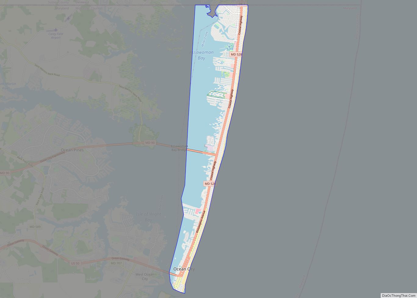
Ocean City, officially the Town of Ocean City, is an Atlantic resort town in Worcester County, Maryland, along the East Coast of the United States. The population was 6,844 at the 2020 U.S. census, although during summer weekends the city hosts between 320,000 and 345,000 vacationers and up to eight million visitors annually. During the summer, Ocean City becomes the second most populated municipality in Maryland, after Baltimore. It is part of the Salisbury metropolitan area, as defined by the United States Census Bureau.
| Name: | Ocean City town |
|---|---|
| LSAD Code: | 43 |
| LSAD Description: | town (suffix) |
| State: | Maryland |
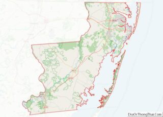
| County: | Worcester County |
| Founded: | 1875 |
| Incorporated: | 1880 |
| Elevation: | 7 ft (2 m) |
| Total Area: | 9.65 sq mi (24.99 km²) |
| Land Area: | 4.53 sq mi (11.73 km²) |
| Water Area: | 5.12 sq mi (13.25 km²) 53.05% |
| Total Population: | 6,844 |
| Population Density: | 1,510.48/sq mi (583.22/km²) |
| Area code: | 410, 443, and 667 |
| FIPS code: | 2458225 |
| GNISfeature ID: | 0586284 |
| Website: | www.oceancitymd.gov |
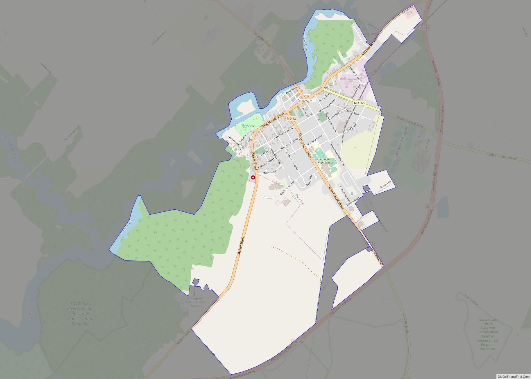
Online Interactive Map
Click on ![]() to view map in "full screen" mode.
to view map in "full screen" mode.
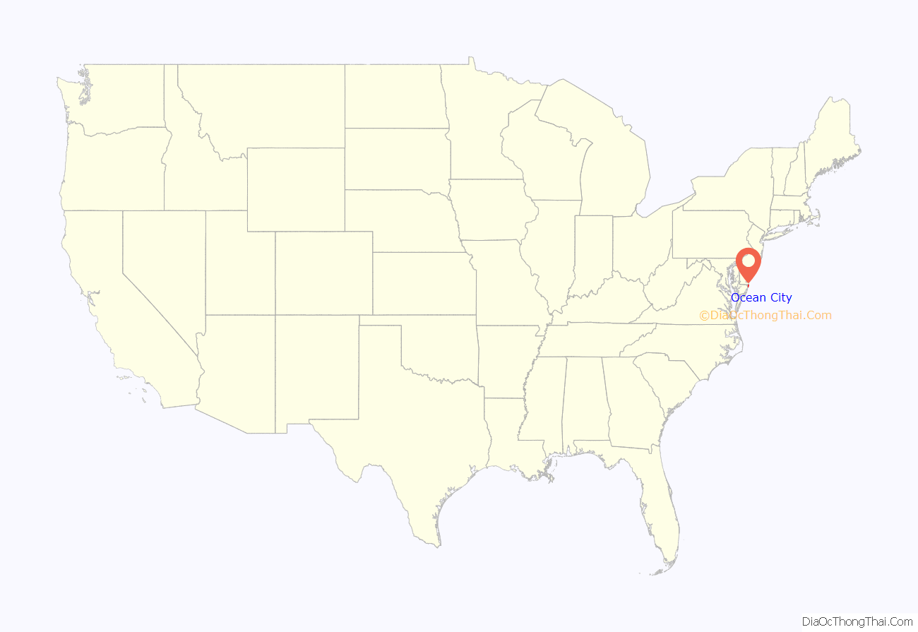
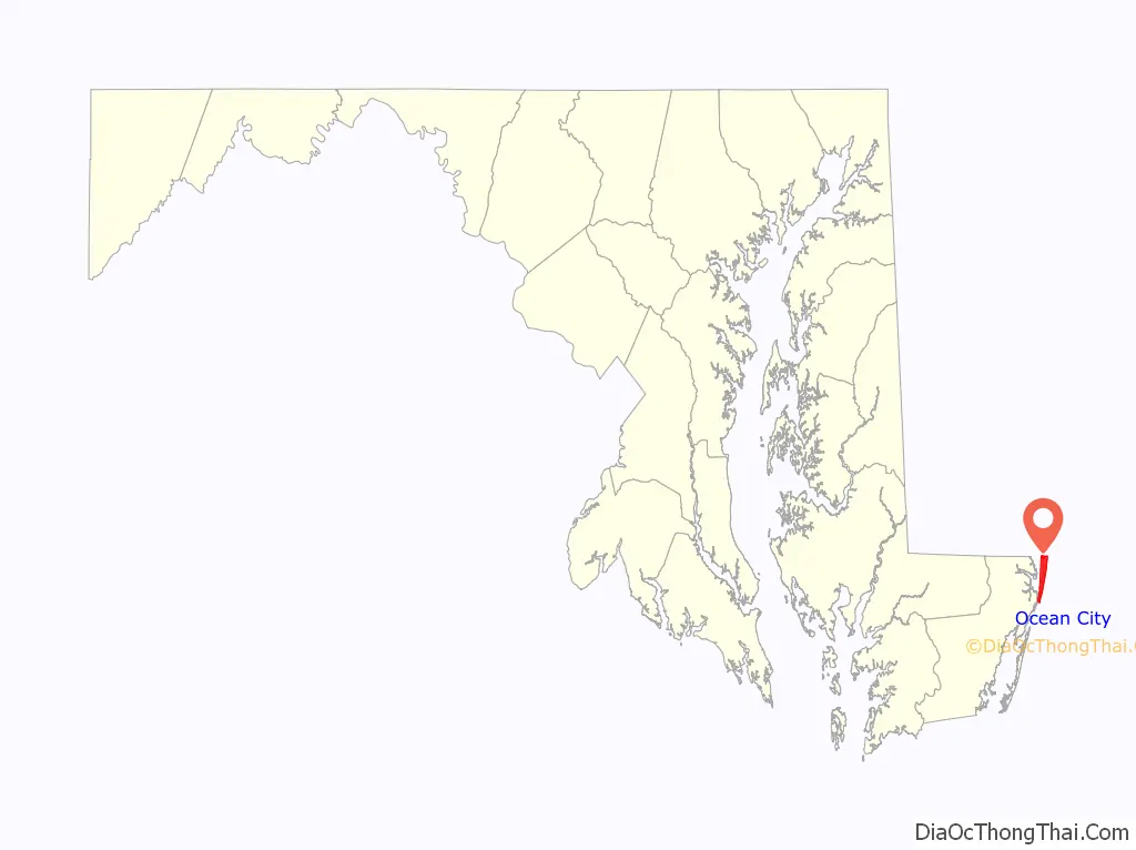
Ocean City location map. Where is Ocean City town?
History
19th century
The land on which the city was built and much of the surrounding area was obtained by Thomas Fenwick, an Englishman, from the Native Americans. In 1869, businessman Isaac Coffin built the first beach-front cottage to receive paying guests. During those days, people arrived by stagecoach and ferry.
Soon after, other simple boarding houses were built on the strip of sand, with the activity attracting prominent businessmen from the Maryland Eastern Shore, Baltimore, Philadelphia, and Wilmington. They came not so much to visit as to survey the spit. A decision was made to develop it and 250 lots were cut into it, and a corporation was formed to help with the development of the land. The corporation stock of 4,000 shares sold for $25 each.
Prior to 1870, what is now Ocean City was known as “The Ladies’ Resort to the Ocean”.
The Atlantic Hotel, the first major hotel in the town, opened July 4, 1875. The Atlantic Hotel was originally owned by the Atlantic Hotel Company, but eventually Charles W. Purnell bought it in 1923. As of 2014, it is still owned and operated by the Purnell family. Besides the beach and ocean, it offered dancing and billiard rooms to the visitors of its more than 400 rooms, and for years it was the northernmost attraction in Ocean City. By 1878, tourists could come by the Wicomico & Pocomoke Railroad from Berlin to the shores of Sinepuxent Bay across from the town. By 1881, a line was completed across Sinepuxent Bay to the shore, bringing rail passengers on the Baltimore, Chesapeake and Atlantic Railroad directly into the town to a train station on Philadelphia Avenue and returning to larger city markets with locally caught fish from Ocean City.
20th century
In 1930, Ocean City Beach Patrol was formed in order to better protect the bathers that now frequented the shoreline. It was done in collaboration with Mayor William W. McCabe and Coast Guard Captain William Purnell. The first guard, Edward Lee Carey, watched over bathers who swam out of sight from the original Coast Guard tower on Caroline Street.
The Ocean City Inlet was formed during a significant hurricane in 1933, which also destroyed the train tracks across the Sinepuxent Bay. The inlet separated what is now Ocean City from Assateague Island. The Army Corps of Engineers took advantage of nature’s intervention and made permanent the inlet at the south end of Ocean City. The inlet eventually helped establish Ocean City as an important Mid-Atlantic fishing port, as it offered easy access to the Atlantic Ocean fishing grounds.
In the late 1930s, the Army Corps of Engineers dredged a new channel on the bayside of Ocean City to allow larger boats to have access to Sinepuxent Bay. The dredge was pumped back onto the western shore of Ocean City allowing the creation of Chicago Avenue and St. Louis Avenue, leading to new development where previously only marshland had been.
Ocean City has undergone a fairly rapid expansion that took place during the post-World War II boom. In 1952, with the completion of the Chesapeake Bay Bridge, Ocean City became easily accessible to people in the Baltimore–Washington metropolitan area. In 1964, with the completion of the Chesapeake Bay Bridge-Tunnel, a whole new pathway to the south was opened. This tunnel connects Northhampton County on the Delmarva Peninsula to Southeast Virginia. Ocean City has become one of the largest vacation areas on the East Coast.
By the 1970s, big business flourished and gave birth to the construction of more than 15,000 condominium units, creating high-rise condominiums that gave investors a glimpse of the ocean and pounding surf. However, throughout the 1980s and into the 1990s, the width of the beach began to shrink, prompting the first of a series of beach replenishment projects.
A fire during the annual Sunfest destroyed five boardwalk businesses in 1994. There was a small water park and giant walk-through haunted house with live actors near the end of the pier and a New Orleans-style Hollywood in Wax Museum on the boardwalk side. In the late 1980s, the wax museum was turned into a Photon laser tag arena. The building now houses the Ripley’s Believe it or Not! museum.
21st century
In 2002, Ocean City undertook the most recent of many, multimillion-dollar, beach restoration programs, in an attempt to slow the westward migration of its beaches. The program pumped tons of sand from offshore and deposited it onto the beach. A dune line was also re-established in front of Ocean City’s building line. Another similar project began after the 2006 tourist season closed.
Ocean City continues to sprawl westward across the bay, toward Berlin and Ocean Pines. It was part of the Ocean Pines micropolitan statistical area until that was subsumed by the Salisbury metropolitan area. The resort area accommodates approximately 8 million visitors per year.
The town supports a year-round population of an estimated 6,900 according to the 2020 census, with the town itself a major employer. In the summer, businesses and government agencies are augmented with approximately 100 seasonal police officers, plus extra firefighters, and other workers. Numerous events take place within the town during the shoulder-season, including Sunfest, Springfest, Bike Week, Cruisin’ Weekend, Winterfest of Lights and Reach the Beach, which take place on the Boardwalk and/or in the Roland E. Powell Convention Center. In 2022, the Town of Ocean City announced the inaugural Oceans Calling Festival, a four-day music event drawing major artists such as the Dave Mathews Band, Cyndi Lauper, The Lumineers, and Alannis Morrisette. However, Tropical Storm Ian forced cancellation of the event, which has been re-scheduled for the fall of 2023.
In 2006, the city erected the Ocean City Firefighter’s Memorial to honor local firefighters as well as firefighters who died in the September 11 attacks. In addition to a statue of a firefighter, the monument incorporates a piece of steel beam from one of the towers destroyed at the World Trade Center. Ocean City is home to the annual Maryland State Firefighters Convention. This is a week-long event in June, that honors the state’s firefighters with events and contests at the Convention Center, and ends with a parade.
Ocean City Road Map

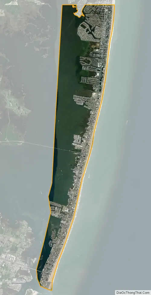
Ocean City city Satellite Map
Geography
According to the U.S. Census Bureau, the town has a total area of 36.37 square miles (94.20 km), of which 4.41 square miles (11.42 km) is land and 31.96 square miles (82.78 km) is water.
Ocean City is on the barrier spit called Fenwick Island, which encompasses Ocean City, as well as South Bethany and Fenwick Island, Delaware. Ocean City’s southern point is an inlet formed by the 1933 Chesapeake–Potomac hurricane. Rainfall and tides swelled the rivers and bays surrounding Ocean City until the overflowing water cut a 50-foot crevasse from the bay to the ocean. Ocean City businessmen had long sought funding to create an inlet to support a harbor, so residents seized upon the opportunity and built jetties to ensure the city’s land remained divided from what is now Assateague Island.
Climate
According to the Köppen climate classification system, Ocean City, Maryland has a humid subtropical climate with long, warm to hot and humid summers, cool winters and year-round precipitation. Ocean City receives 2300 hours of sunshine annually (higher than the USA average). Temperatures are moderated in Ocean City due to its location on the Atlantic coast. During the summer months, a cooling afternoon sea breeze is present on most days with an average of only 10 days annually reaching 90 °F (32 °C). However, in 2010 the temperature rose to 103 °F (39 °C) which was the hottest air temperature on record, and episodes of extreme heat combined with tropical humidity can occur with heat index values ≥ 100 °F (37.8 °C). The prominence of the Outer Banks of North Carolina to the south means direct hits from tropical storms and hurricanes are rare, although they sometimes brush the area. The Atlantic hurricane season extends from June 1 through November 30, sharply peaking from late August through September.
During the winter months, Ocean City has cool weather with an average high of 45 F (7.5 C), however periods of mild temperatures in the 50 to 60 F range are common. The air temperature fails to rise above freezing 5.8 days on average and the plant hardiness zone is 7b with an average annual extreme minimum air temperature of 9.1 °F (−12.7 °C). On rare occasion, episodes of extreme cold and wind can occur with wind chill values under 5 °F (−15 °C). The coldest temperature on record was −6 °F (−21 °C). The average seasonal (Dec-Mar) snowfall total is small, with 6 to 12 in (15 to 30 cm), and the average snowiest month is February which corresponds with the annual peak in nor’easter activity.
See also
Map of Maryland State and its subdivision: Map of other states:- Alabama
- Alaska
- Arizona
- Arkansas
- California
- Colorado
- Connecticut
- Delaware
- District of Columbia
- Florida
- Georgia
- Hawaii
- Idaho
- Illinois
- Indiana
- Iowa
- Kansas
- Kentucky
- Louisiana
- Maine
- Maryland
- Massachusetts
- Michigan
- Minnesota
- Mississippi
- Missouri
- Montana
- Nebraska
- Nevada
- New Hampshire
- New Jersey
- New Mexico
- New York
- North Carolina
- North Dakota
- Ohio
- Oklahoma
- Oregon
- Pennsylvania
- Rhode Island
- South Carolina
- South Dakota
- Tennessee
- Texas
- Utah
- Vermont
- Virginia
- Washington
- West Virginia
- Wisconsin
- Wyoming