Oaklyn is a borough in Camden County, in the U.S. state of New Jersey. As of the 2020 United States census, the borough’s population was 3,930, a decrease of 108 (−2.7%) from the 2010 census count of 4,038, which in turn reflected a decline of 150 (−3.6%) from the 4,188 counted in the 2000 census.
The borough had the 28th-highest property tax rate in New Jersey, with an equalized rate of 4.134% in 2020, compared to 3.470% in the county as a whole and a statewide average of 2.279%.
| Name: | Oaklyn borough |
|---|---|
| LSAD Code: | 21 |
| LSAD Description: | borough (suffix) |
| State: | New Jersey |
| County: | Camden County |
| Incorporated: | March 13, 1905 |
| Elevation: | 26 ft (8 m) |
| Total Area: | 0.70 sq mi (1.81 km²) |
| Land Area: | 0.63 sq mi (1.62 km²) |
| Water Area: | 0.07 sq mi (0.18 km²) 8.70% |
| Total Population: | 3,930 |
| Population Density: | 6,265.7/sq mi (2,419.2/km²) |
| ZIP code: | 08107 |
| Area code: | 856 |
| FIPS code: | 3453880 |
| GNISfeature ID: | 0885331 |
| Website: | www.oaklyn-nj.net |
Online Interactive Map
Click on ![]() to view map in "full screen" mode.
to view map in "full screen" mode.
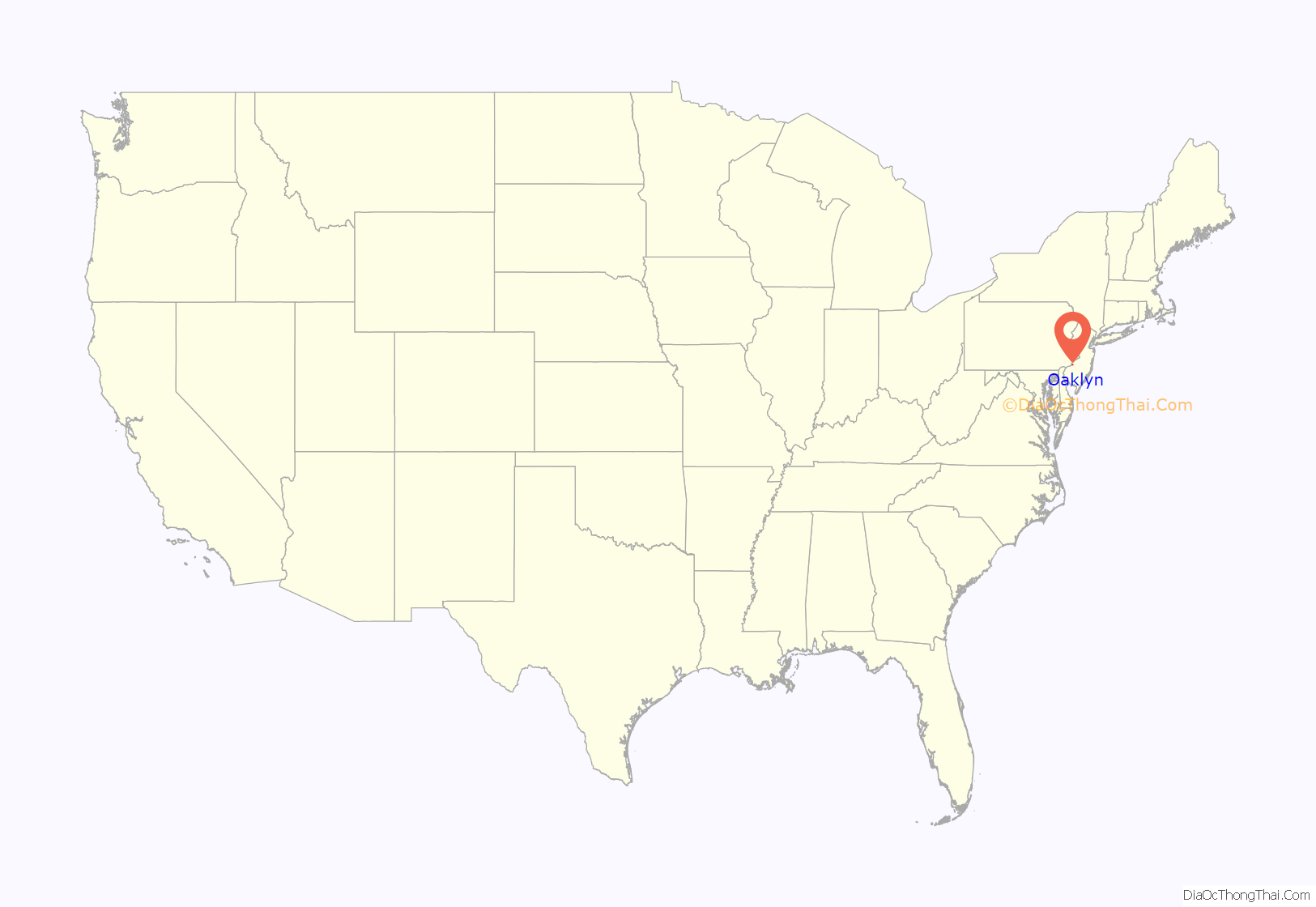
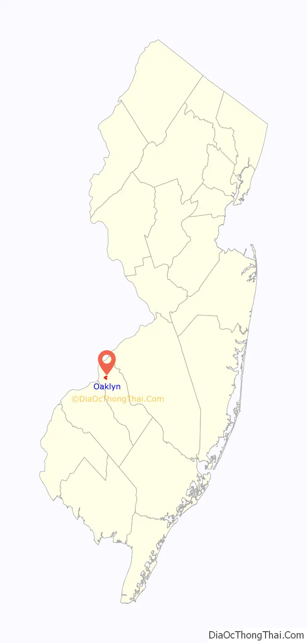
Oaklyn location map. Where is Oaklyn borough?
History
Before European settlement began, Oaklyn was dense forest land which was inhabited by Lenape Native Americans. In 1681, a group of Quakers seeking religious freedom sailed from Ireland to Fenwick’s Colony at Salem, New Jersey, where they spent the winter. In 1682, they sailed up the Delaware River and settled on Newton Creek. William Bates, their leader, purchased 250 acres (1.0 km) on the south side of Newton Creek from the local Native Americans. The original Quaker settlement, known as Newton Colony, was located in The Manor section of today’s Oaklyn.
The Colony began to grow rapidly and the land was cleared for farming. Eventually two highways were laid out. One, from the Delaware River to Egg Harbor, followed an old Native American trail, which is today the Black Horse Pike. The other was known as the Long-a-coming trail, which extended from Atlantic City to Berlin and then from Berlin to Camden. This trail is now known as the White Horse Pike.
After the American Revolutionary War, a group of Virginia sportsmen built a racetrack on the east side of the White Horse Pike. Future president Ulysses S. Grant visited this track as a young man before it closed in 1846. Samuel Bettle bought the land which was formerly the racetrack and eventually, the land was deeded to Haddon Township.
As the years passed, the farms along Newton Creek were divided into lots and the development called “Oakland the Beautiful”, for the many trees in the area. The name was changed to Oaklyn in 1894 to avoid confusion with another Oakland in North Jersey.
Oaklyn was incorporated as a borough by an act of the New Jersey Legislature on March 13, 1905, from portions of Haddon Township.
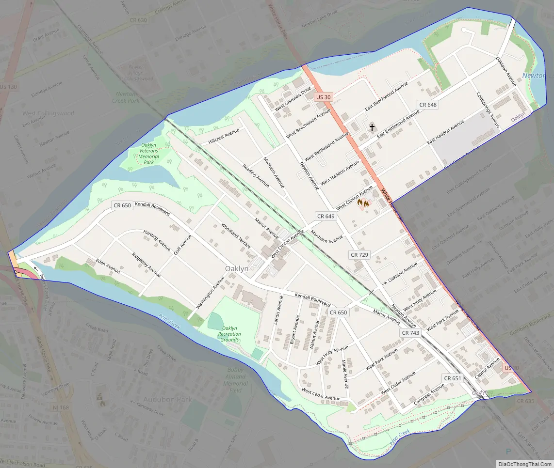
Oaklyn Road Map
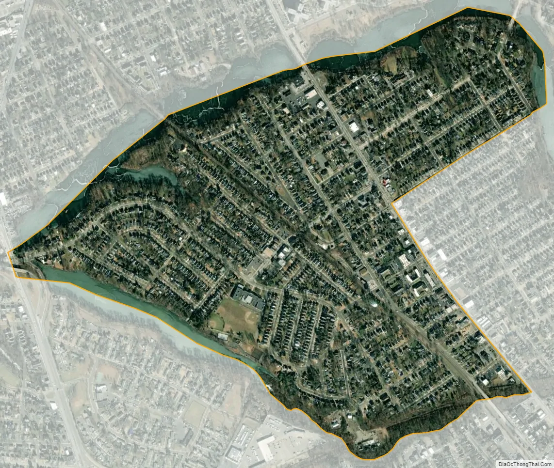
Oaklyn city Satellite Map
Geography
According to the U.S. Census Bureau, the borough had a total area of 0.69 square miles (1.78 km), including 0.63 square miles (1.62 km) of land and 0.06 square miles (0.15 km) of water (8.70%).
Oaklyn borders the Camden County municipalities of Audubon, Audubon Park, Camden, Collingswood, and Haddon Township.
See also
Map of New Jersey State and its subdivision: Map of other states:- Alabama
- Alaska
- Arizona
- Arkansas
- California
- Colorado
- Connecticut
- Delaware
- District of Columbia
- Florida
- Georgia
- Hawaii
- Idaho
- Illinois
- Indiana
- Iowa
- Kansas
- Kentucky
- Louisiana
- Maine
- Maryland
- Massachusetts
- Michigan
- Minnesota
- Mississippi
- Missouri
- Montana
- Nebraska
- Nevada
- New Hampshire
- New Jersey
- New Mexico
- New York
- North Carolina
- North Dakota
- Ohio
- Oklahoma
- Oregon
- Pennsylvania
- Rhode Island
- South Carolina
- South Dakota
- Tennessee
- Texas
- Utah
- Vermont
- Virginia
- Washington
- West Virginia
- Wisconsin
- Wyoming


