Oakland is a borough in Bergen County, in the U.S. state of New Jersey and a suburb of New York City. As of the 2020 United States census, the borough’s population was 12,748, a decrease of six people from the 2010 census count of 12,754, which in turn reflected an increase of 288 (+2.3%) from the 12,466 counted in the 2000 census.
Oakland was incorporated as a borough by an act of the New Jersey Legislature on April 8, 1902, from portions of Franklin Township (now Wyckoff). The name comes from the white oak trees in the area.
| Name: | Oakland borough |
|---|---|
| LSAD Code: | 21 |
| LSAD Description: | borough (suffix) |
| State: | New Jersey |
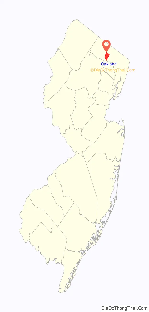
| County: | Bergen County |
| Incorporated: | April 8, 1902 |
| Elevation: | 233 ft (71 m) |
| Total Area: | 8.77 sq mi (22.71 km²) |
| Land Area: | 8.50 sq mi (22.02 km²) |
| Water Area: | 0.27 sq mi (0.69 km²) 3.06% |
| Total Population: | 12,748 |
| Population Density: | 1,499.4/sq mi (578.9/km²) |
| ZIP code: | 07436 |
| Area code: | 201 |
| FIPS code: | 3453850 |
| GNISfeature ID: | 0885330 |
| Website: | www.oakland-nj.org |
Online Interactive Map
Click on ![]() to view map in "full screen" mode.
to view map in "full screen" mode.
Oakland location map. Where is Oakland borough?

History
The Van Allen House was built in 1748 and was a stop for George Washington and his troops in 1777.
From the 1940s through the end of the 1960s a summer bungalow colony was developed in a valley in West Oakland on the Ramapo River. This was a refuge for a close-knit group of several score families from the summer heat of New York City and urban New Jersey. During the summer months, the New York, Susquehanna and Western Railroad provided service at a West Oakland passenger station. This colony was located on the road between Oakland and Pompton Lakes, near a training camp for boxers. In the early morning, a resident could see Joe Louis or Sugar Ray Robinson, among others, running past the summer homes.
One section of streets in the town are named after Native American tribes and Native American first names. Now considered politically incorrect, the borough had a wooden sign posted downtown that read “Once there was [sic] Indians all over this place” which had been donated by a resident who insisted on the wording of the sign as having been a quotation from an author.
FRG Park shootout
On August 4, 1985, a gun shootout occurred at the FRG Sports Complex—formerly known as Muller’s Park—directly next to Oakland’s former swimming park located along the Ramapo River called Pleasureland. At a Jamaican Independence Day celebration attended by nearly 2,000 people bused in from New York City, gunfire broke out between rival Jamaican gangs, resulting in two deaths and about 20 injuries. Before the incident, Pleasureland and Muller’s Park were popular summer destinations that had since the 1950s and earlier (Muller’s was built in 1935) attracted families from across the Tri-state area. Pleasureland remained open for a brief period after the shooting incident at FRG, but FRG/Muller’s Park never reopened after that day. While the shootout did not occur at Pleasureland, due to the park’s popularity the events remain to this day known as the “Pleasureland Shootout” and “Pleasureland Massacre” among people outside of Oakland. The pools and buildings having since been demolished and filled in, but the properties have begun a major restoration. The properties are united and are now called Great Oak Park, which was named after a town wide election where over 2,000 people cast a ballot. The park is being developed as a passive recreation park. The borough, led by a group of volunteers has been working on bringing the 40-acre park back to life since January 2012. The borough purchased the property from building developers in 2009.
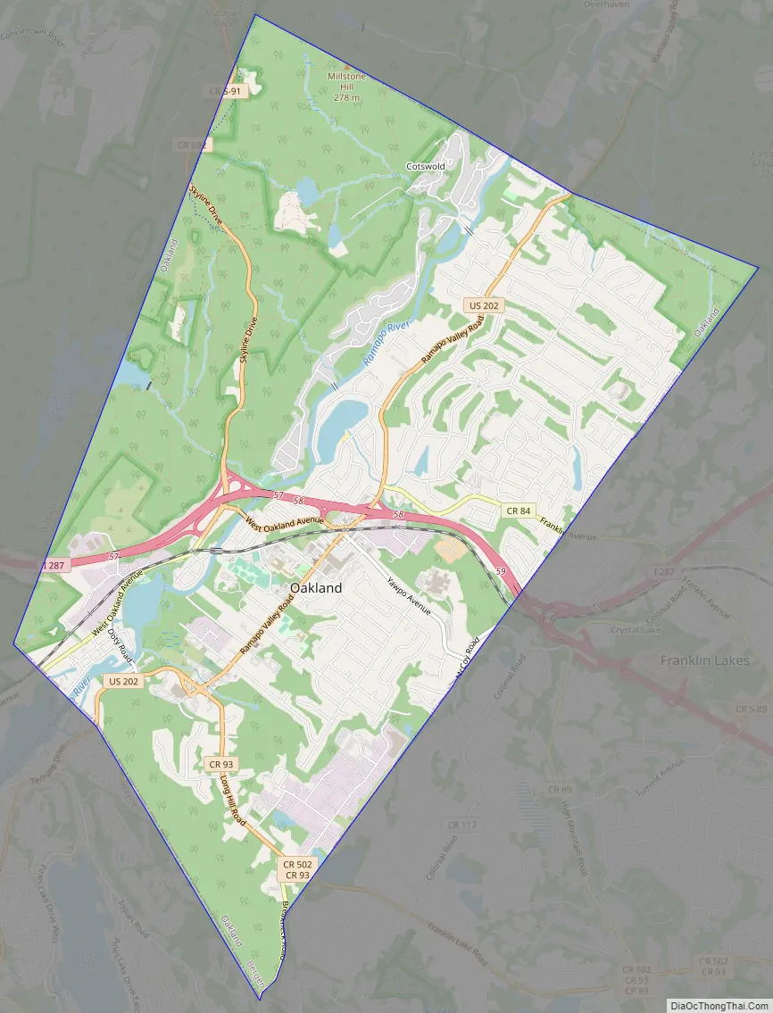
Oakland Road Map
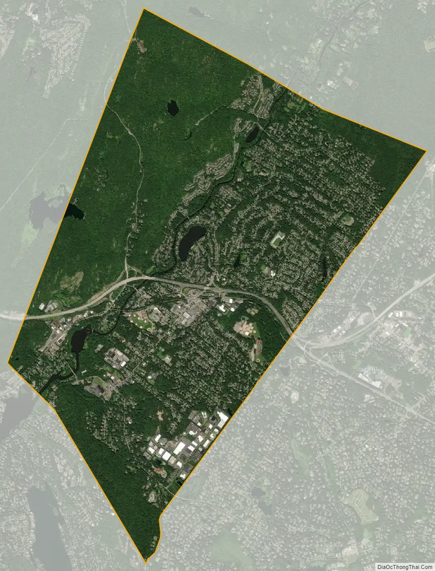
Oakland city Satellite Map
Geography
According to the United States Census Bureau, the borough had a total area of 8.77 square miles (22.71 km), including 8.50 square miles (22.02 km) of land and 0.27 square miles (0.69 km) of water (3.06%).
Unincorporated communities, localities and place names located partially or completely within the borough include Ramapo Lake and Rotten Pond.
The borough borders Franklin Lakes and Mahwah in Bergen County; and Pompton Lakes, Ringwood, Wanaque and Wayne in Passaic County.
See also
Map of New Jersey State and its subdivision: Map of other states:- Alabama
- Alaska
- Arizona
- Arkansas
- California
- Colorado
- Connecticut
- Delaware
- District of Columbia
- Florida
- Georgia
- Hawaii
- Idaho
- Illinois
- Indiana
- Iowa
- Kansas
- Kentucky
- Louisiana
- Maine
- Maryland
- Massachusetts
- Michigan
- Minnesota
- Mississippi
- Missouri
- Montana
- Nebraska
- Nevada
- New Hampshire
- New Jersey
- New Mexico
- New York
- North Carolina
- North Dakota
- Ohio
- Oklahoma
- Oregon
- Pennsylvania
- Rhode Island
- South Carolina
- South Dakota
- Tennessee
- Texas
- Utah
- Vermont
- Virginia
- Washington
- West Virginia
- Wisconsin
- Wyoming


