Whitefield is a town in northwestern Haskell County, Oklahoma, United States. The population was 391 at the 2010 census, compared with the figure of 231 recorded in 2000. It was named for Methodist bishop George Whitefield (1714 – 1770).
| Name: | Whitefield town |
|---|---|
| LSAD Code: | 43 |
| LSAD Description: | town (suffix) |
| State: | Oklahoma |
| County: | Haskell County |
| Elevation: | 561 ft (171 m) |
| Total Area: | 1.87 sq mi (4.85 km²) |
| Land Area: | 1.71 sq mi (4.42 km²) |
| Water Area: | 0.16 sq mi (0.42 km²) |
| Total Population: | 371 |
| Population Density: | 217.21/sq mi (83.89/km²) |
| ZIP code: | 74472 |
| Area code: | 539/918 |
| FIPS code: | 4080800 |
| GNISfeature ID: | 1099723 |
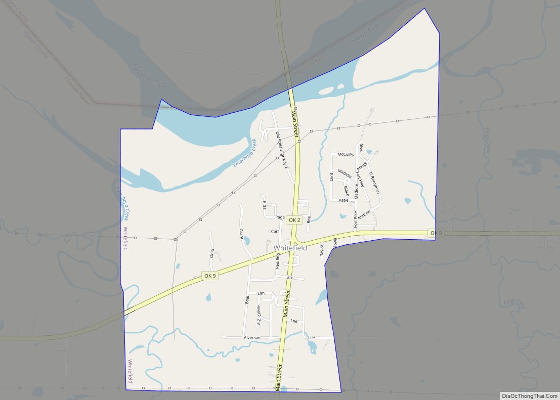
Online Interactive Map
Click on ![]() to view map in "full screen" mode.
to view map in "full screen" mode.
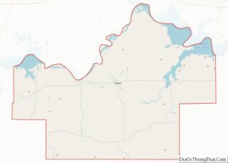
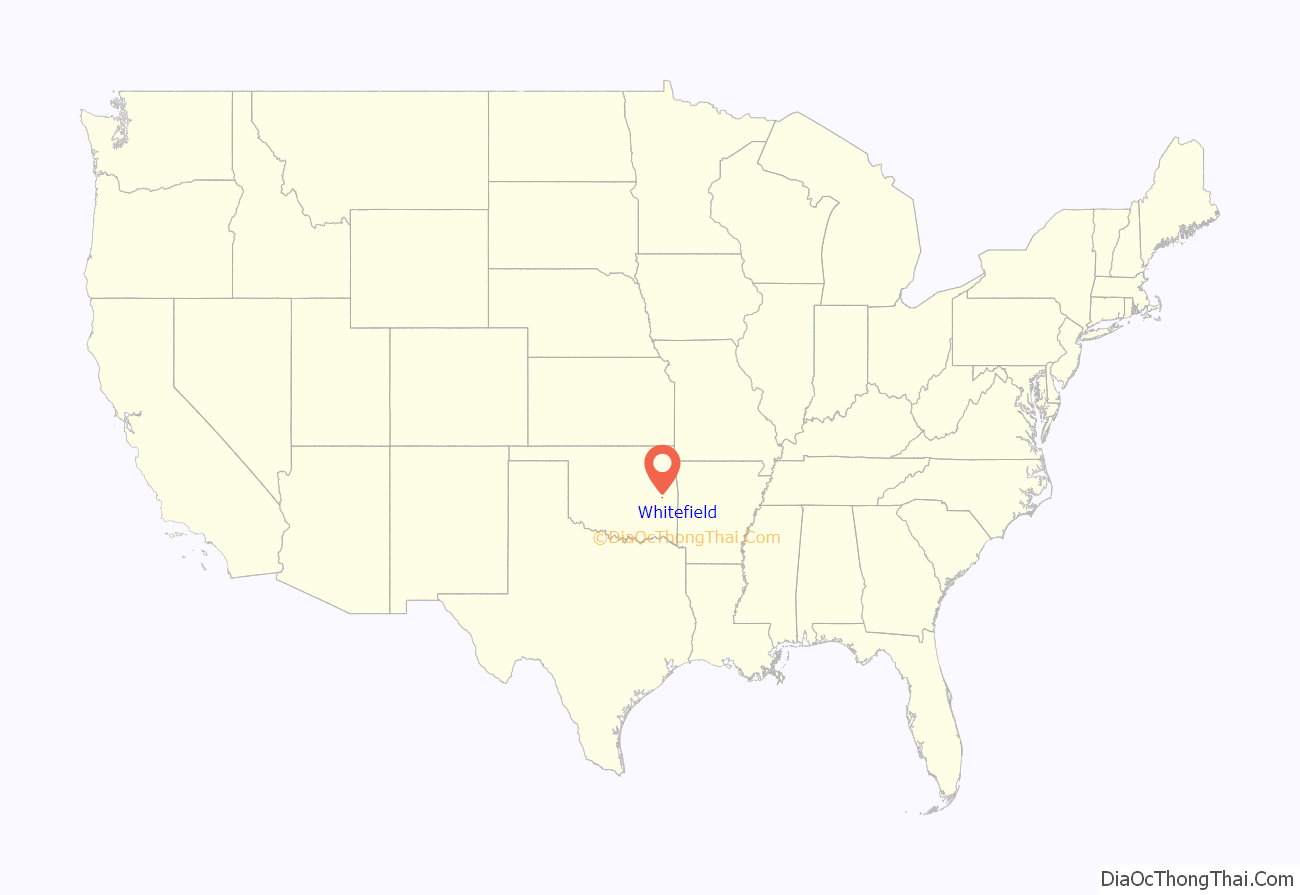
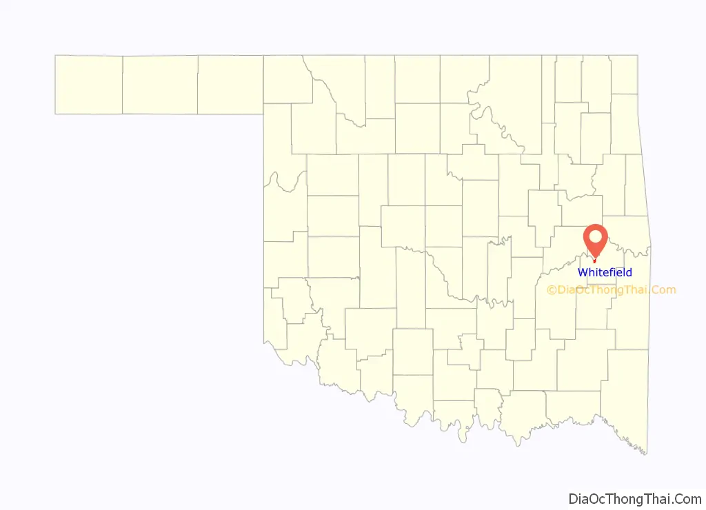
Whitefield location map. Where is Whitefield town?
History
At the time of its founding, the community that became Whitefield was located in the Moshulatubbee District of the Choctaw Nation, in the Indian Territory.
Whitefield’s history can be traced to the American Civil War, when the Confederate Army established Camp Pike for two thousand Confederate soldiers in 1861. The camp was named for Confederate Brigadier General Albert Pike, who had persuaded the Five Civilized Tribes to ally with the Confederacy.
After the end of the Civil War, Camp Pike became a Choctaw trading post. The trading post and the adjacent community were renamed as Oklahoma, Indian Territory. Its clientele were not only members of the Choctaw tribe, but also white settlers who had permits from the tribe to farm land in the Choctaw Nation. Occasionally, it was patronized by white outlaws such as Belle Starr, who were hiding from the law in the mountains of southern Oklahoma.The Post Office wanted to change the name because of confusion with another post office already known as Oklahoma Station. In 1888, the local residents voted to accept Whitfield as the name of the settlement and post office. The post office at Whitefield, Indian Territory, which had originally been established as Oklahoma, Indian Territory on December 21, 1881, was reestablished on November 27, 1888. It was named for Bishop George Whitefield, an early-day Methodist leader.
Whitefield existed primarily as a town to support the nearby farms. By 1911, it counted approximately 500 residents. Improvements included two groceries, two general stores, a cotton gin and mill, a drugstore, a doctor, and a blacksmith. It had about 300 residents by 1920. Reportedly, the population declined sharply with the onset of the Great Depression. Whitfield incorporated in 1978, so its first Federal Census in 1980 recorded 240 people. The population has trended upward since that year.
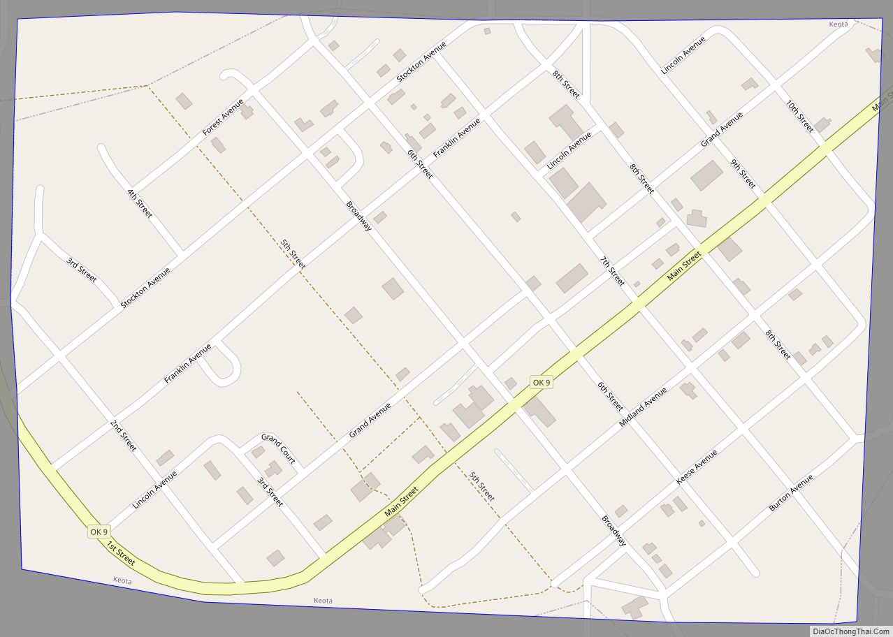
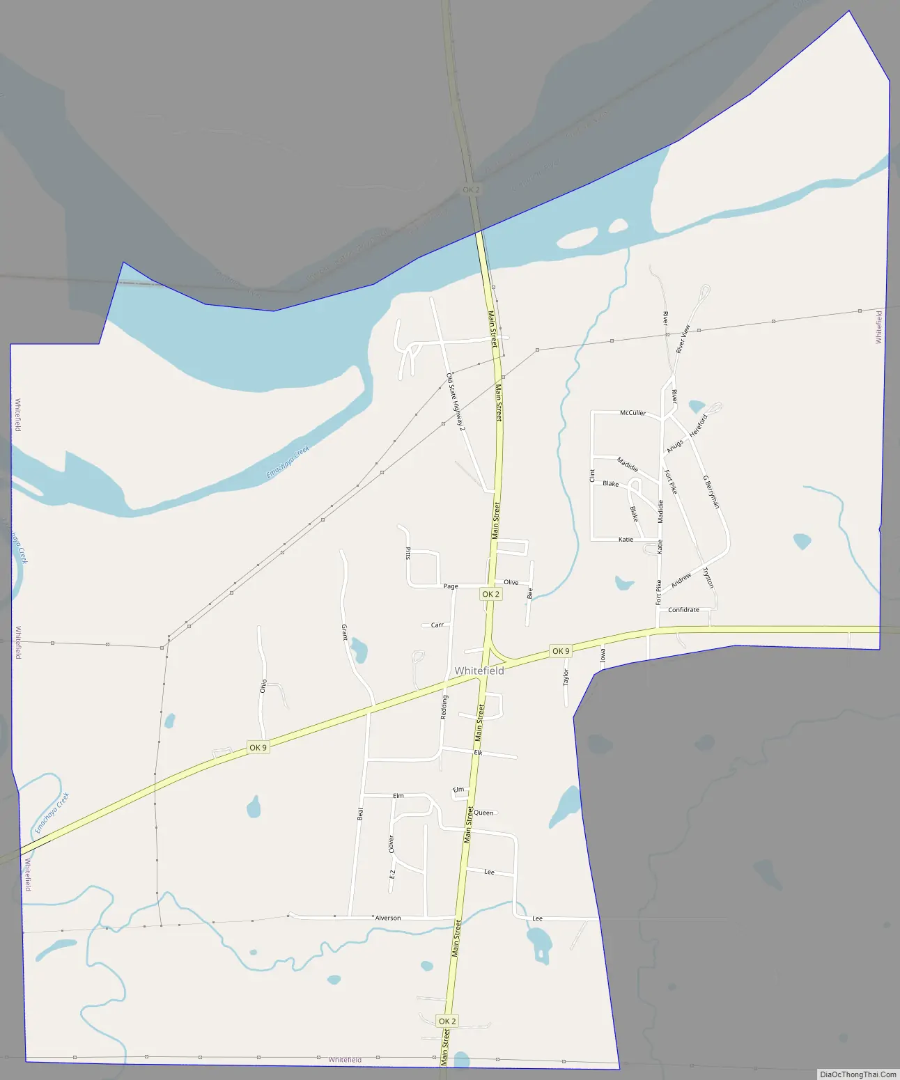
Whitefield Road Map
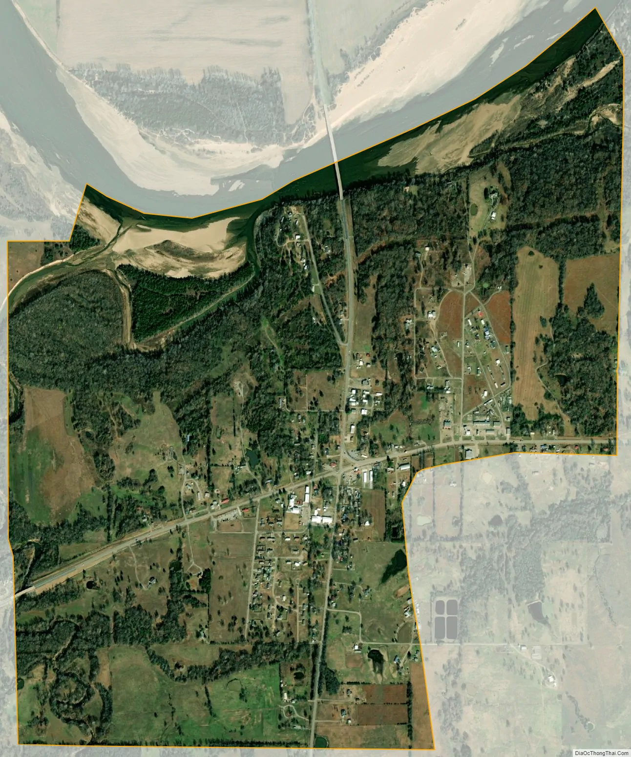
Whitefield city Satellite Map
Geography
Whitefield is located in northwestern Haskell County at 35°15′12″N 95°14′16″W / 35.25333°N 95.23778°W / 35.25333; -95.23778 (35.253403, -95.237879), on high ground south of the Canadian River. According to the United States Census Bureau, the town has a total area of 1.9 square miles (4.8 km), of which 1.7 square miles (4.4 km) are land and 0.2 square miles (0.4 km), or 8.81%, are water.
Oklahoma State Highways 2 and 9 intersect in the center of Whitefield. OK-2 leads north 16 miles (26 km) to Interstate 40 near Warner and south 10 miles (16 km) to Kinta, while OK-9 leads east 6 miles (10 km) to Stigler, the Haskell county seat, and west 23 miles (37 km) to Eufaula.
See also
Map of Oklahoma State and its subdivision:- Adair
- Alfalfa
- Atoka
- Beaver
- Beckham
- Blaine
- Bryan
- Caddo
- Canadian
- Carter
- Cherokee
- Choctaw
- Cimarron
- Cleveland
- Coal
- Comanche
- Cotton
- Craig
- Creek
- Custer
- Delaware
- Dewey
- Ellis
- Garfield
- Garvin
- Grady
- Grant
- Greer
- Harmon
- Harper
- Haskell
- Hughes
- Jackson
- Jefferson
- Johnston
- Kay
- Kingfisher
- Kiowa
- Latimer
- Le Flore
- Lincoln
- Logan
- Love
- Major
- Marshall
- Mayes
- McClain
- McCurtain
- McIntosh
- Murray
- Muskogee
- Noble
- Nowata
- Okfuskee
- Oklahoma
- Okmulgee
- Osage
- Ottawa
- Pawnee
- Payne
- Pittsburg
- Pontotoc
- Pottawatomie
- Pushmataha
- Roger Mills
- Rogers
- Seminole
- Sequoyah
- Stephens
- Texas
- Tillman
- Tulsa
- Wagoner
- Washington
- Washita
- Woods
- Woodward
- Alabama
- Alaska
- Arizona
- Arkansas
- California
- Colorado
- Connecticut
- Delaware
- District of Columbia
- Florida
- Georgia
- Hawaii
- Idaho
- Illinois
- Indiana
- Iowa
- Kansas
- Kentucky
- Louisiana
- Maine
- Maryland
- Massachusetts
- Michigan
- Minnesota
- Mississippi
- Missouri
- Montana
- Nebraska
- Nevada
- New Hampshire
- New Jersey
- New Mexico
- New York
- North Carolina
- North Dakota
- Ohio
- Oklahoma
- Oregon
- Pennsylvania
- Rhode Island
- South Carolina
- South Dakota
- Tennessee
- Texas
- Utah
- Vermont
- Virginia
- Washington
- West Virginia
- Wisconsin
- Wyoming