Warwick (/ˈwɔːrwɪk/ WOR-wik or /ˈwɒrɪk/ WORR-ik) is a city in Kent County, Rhode Island, the third largest city in the state with a population of 82,823 at the 2020 census. It is located approximately 12 miles (19 km) south of downtown Providence, Rhode Island, 63 miles (101 km) southwest of Boston, Massachusetts, and 171 miles (275 km) northeast of New York City.
Warwick was founded by Samuel Gorton in 1642 and has witnessed major events in American history. It was decimated during King Philip’s War (1675–1676) and was the site of the Gaspee Affair, the first act of armed resistance against the British, preceding even the Boston Tea Party, and a significant prelude to the American Revolution. Warwick was also the home of Revolutionary War General Nathanael Greene, George Washington’s second-in-command, and Civil War General George S. Greene, a hero of the Battle of Gettysburg. Today, it is home to Rhode Island’s main airport, T. F. Green Airport, which serves the Providence area and also functions as a reliever for Logan International Airport in Boston, Massachusetts.
| Name: | Warwick city |
|---|---|
| LSAD Code: | 25 |
| LSAD Description: | city (suffix) |
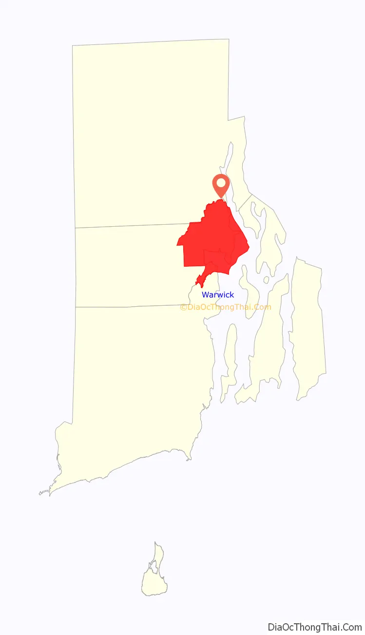
| State: | Rhode Island |
| County: | Kent County |
| Founded: | 1642 |
| Elevation: | 20 ft (6 m) |
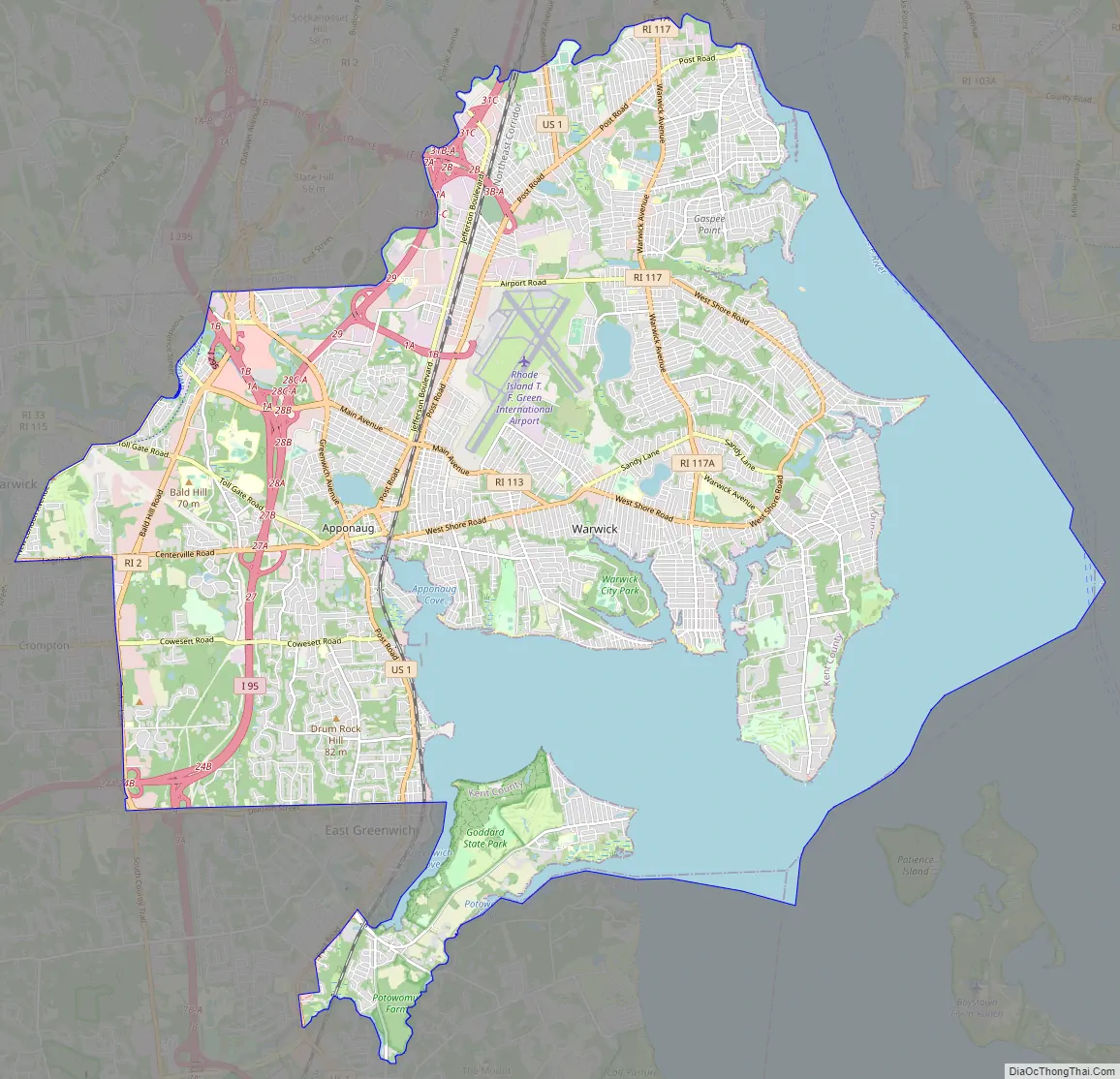
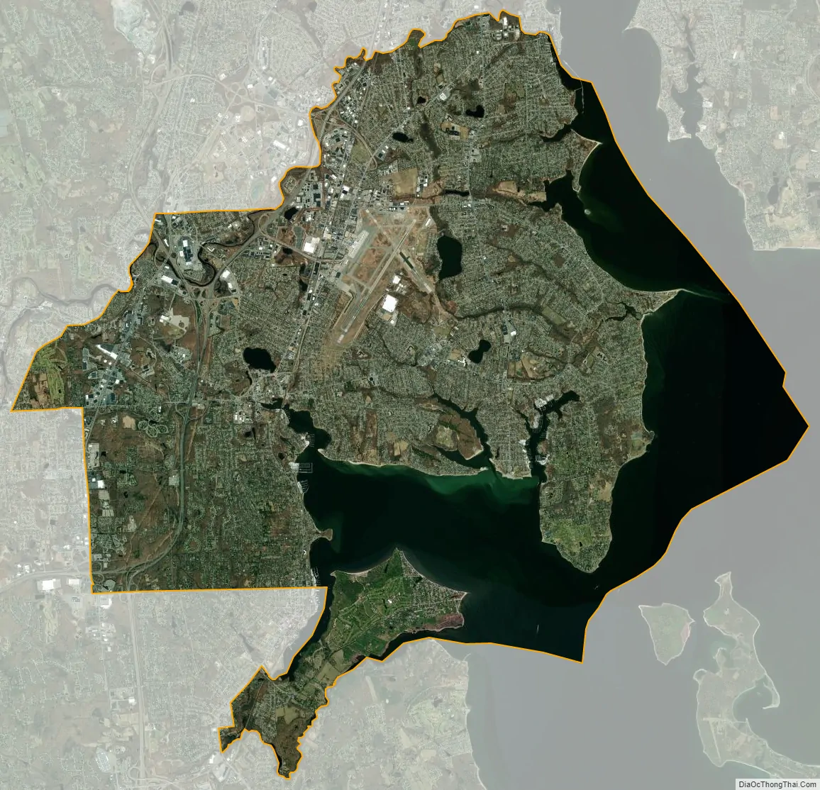
| Total Area: | 49.75 sq mi (128.85 km²) |
| Land Area: | 35.00 sq mi (90.65 km²) |
| Water Area: | 14.75 sq mi (38.20 km²) |
| Total Population: | 82,823 |
| Population Density: | 2,366.30/sq mi (913.64/km²) |
| Area code: | 401 |
| FIPS code: | 4474300 |
| Website: | www.warwickri.gov |
Online Interactive Map
Click on ![]() to view map in "full screen" mode.
to view map in "full screen" mode.
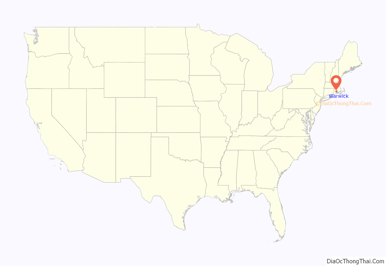
Warwick location map. Where is Warwick city?
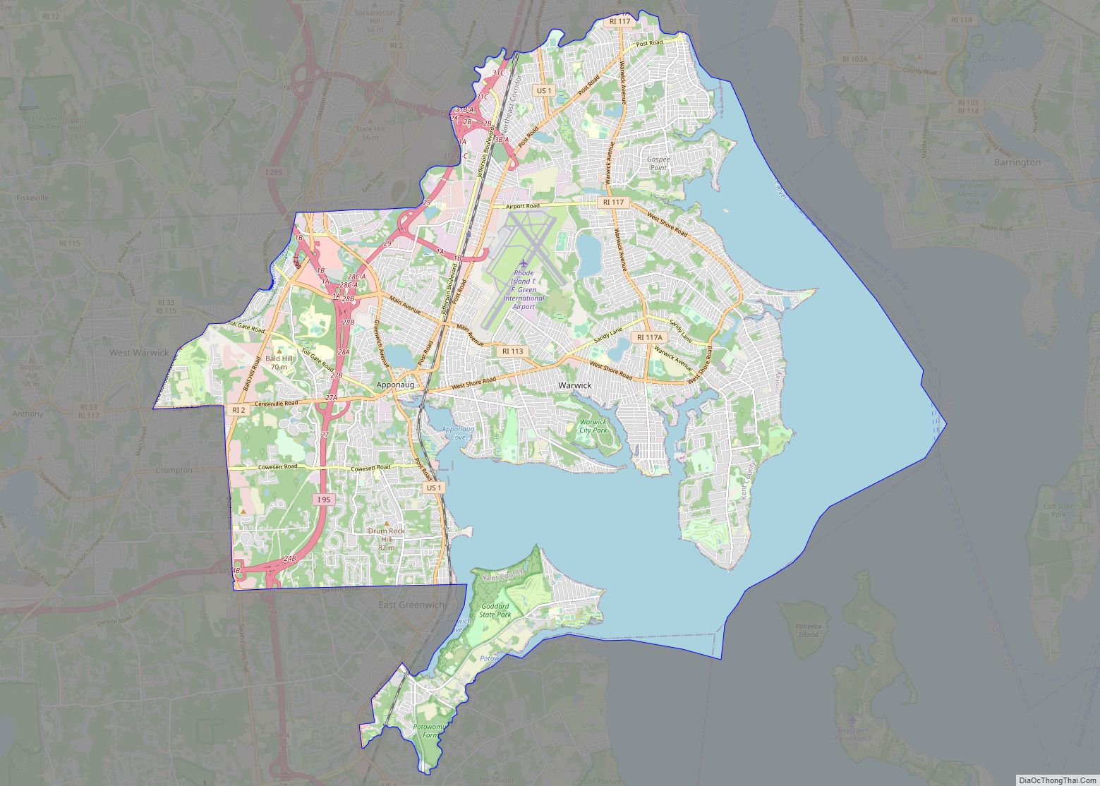
Warwick Road Map
Warwick city Satellite Map
Geography
Warwick is located at 41°43′N 71°25′W / 41.717°N 71.417°W / 41.717; -71.417 (41.7181, −71.4152).
According to the United States Census Bureau, the city has a total area of 49.6 square miles (128 km), of which 35.5 square miles (92 km) of it is land and 14.1 square miles (37 km) of it (28.46%) is water.
The following villages are located in Warwick:
- Apponaug
- Arnold’s Neck
- Brush Neck Cove
- Buttonwoods
- Cedar Tree Point
- Chepiwanoxet
- Coles
- Conimicut
- Cowesett
- Duby Grove
- East Natick
- Gaspee Point
- Greenwood
- Governor Francis Farms
- Hillsgrove
- Hoxsie
- Lakewood
- Lincoln Park
- Nausauket
- Natick
- Norwood
- Oakland Beach
- Old Buttonwoods
- Pawtuxet Village (also in Cranston)
- Pocasset
- Pontiac (also in Cranston)
- Potowomut
- Riverview
- Shawomet
- Warwick Neck
- Wildes Corner
See also
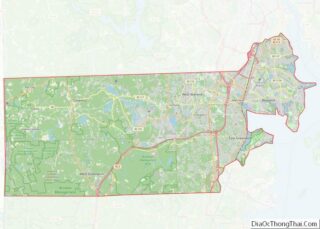
Map of Rhode Island State and its subdivision: Map of other states:- Alabama
- Alaska
- Arizona
- Arkansas
- California
- Colorado
- Connecticut
- Delaware
- District of Columbia
- Florida
- Georgia
- Hawaii
- Idaho
- Illinois
- Indiana
- Iowa
- Kansas
- Kentucky
- Louisiana
- Maine
- Maryland
- Massachusetts
- Michigan
- Minnesota
- Mississippi
- Missouri
- Montana
- Nebraska
- Nevada
- New Hampshire
- New Jersey
- New Mexico
- New York
- North Carolina
- North Dakota
- Ohio
- Oklahoma
- Oregon
- Pennsylvania
- Rhode Island
- South Carolina
- South Dakota
- Tennessee
- Texas
- Utah
- Vermont
- Virginia
- Washington
- West Virginia
- Wisconsin
- Wyoming