Mulvane is a city in Sedgwick and Sumner counties in the U.S. state of Kansas. As of the 2020 census, the population of the city was 6,286.
| Name: | Mulvane city |
|---|---|
| LSAD Code: | 25 |
| LSAD Description: | city (suffix) |
| State: | Kansas |
| County: | Sedgwick County, Sumner County |
| Founded: | 1870s |
| Incorporated: | 1883 |
| Elevation: | 1,237 ft (377 m) |
| Total Area: | 4.47 sq mi (11.58 km²) |
| Land Area: | 4.46 sq mi (11.56 km²) |
| Water Area: | 0.01 sq mi (0.02 km²) |
| Total Population: | 6,286 |
| Population Density: | 1,400/sq mi (540/km²) |
| ZIP code: | 67110 |
| Area code: | 316 |
| FIPS code: | 2049100 |
| Website: | mulvanekansas.com |
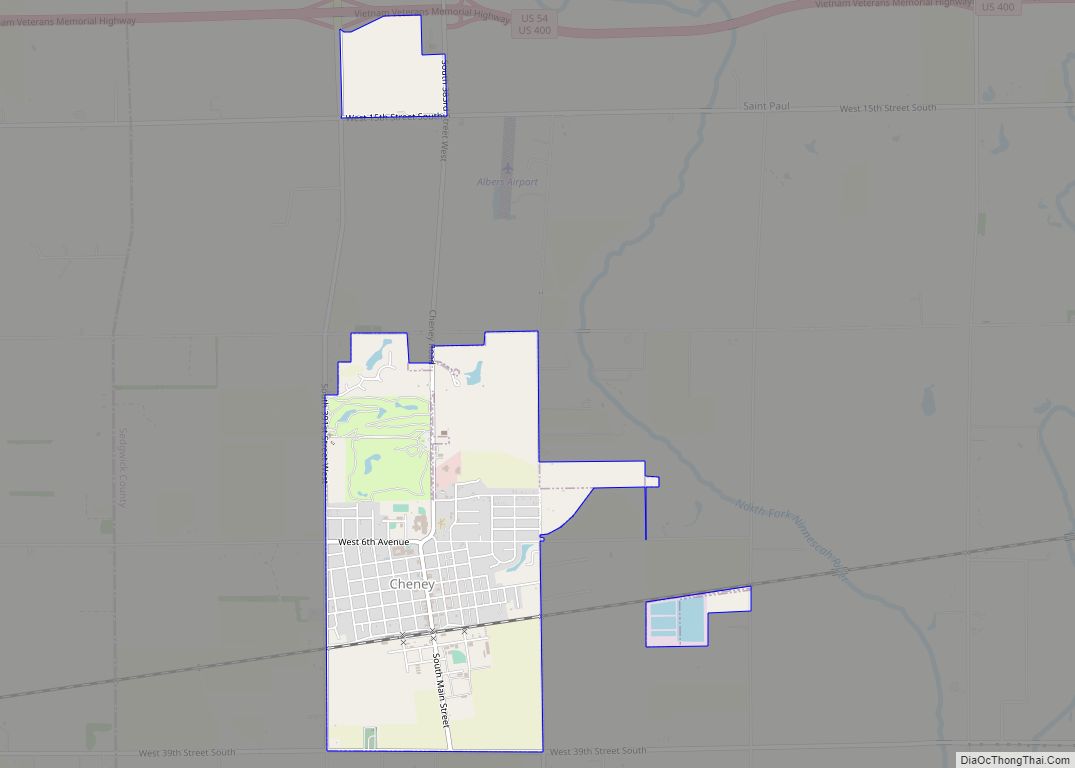
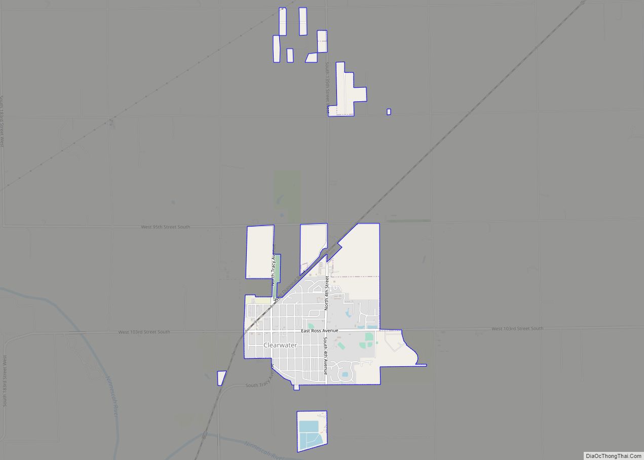
Online Interactive Map
Click on ![]() to view map in "full screen" mode.
to view map in "full screen" mode.
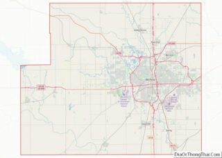
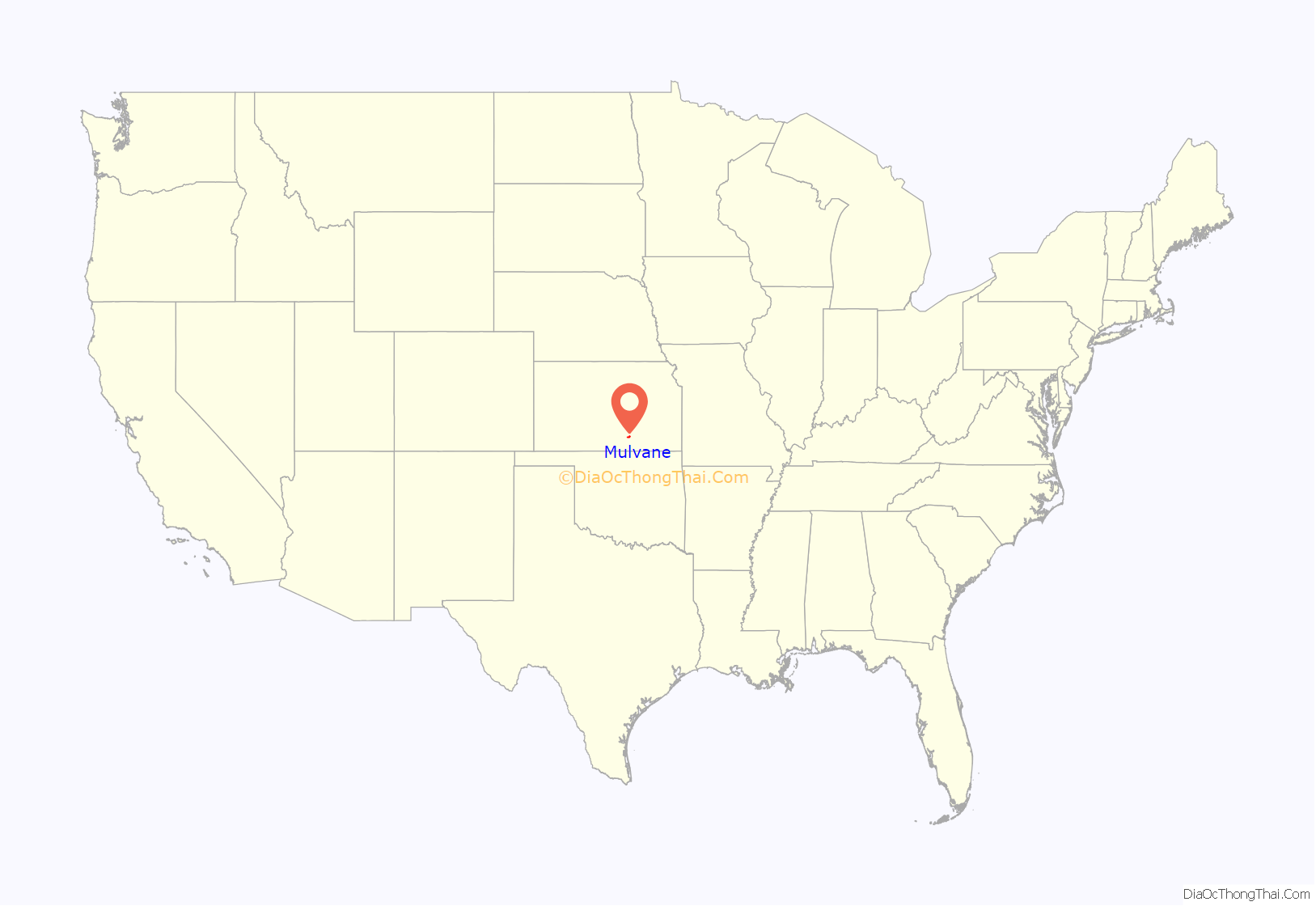
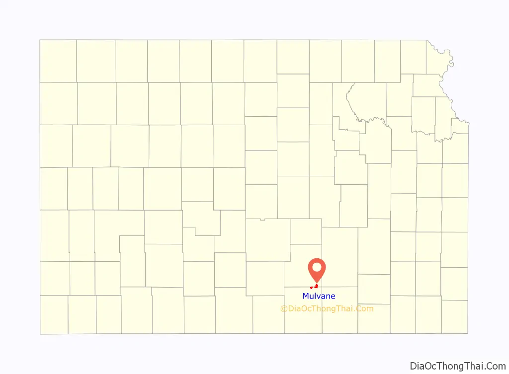
Mulvane location map. Where is Mulvane city?
History
Mulvane was laid out in 1879 at the junction of five Santa Fe rail lines. It is named for Joab R. Mulvane, a railroad official who was instrumental in bringing the Atchison, Topeka, and Santa Fe Railroad to Mulvane.
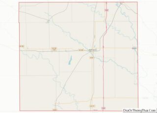
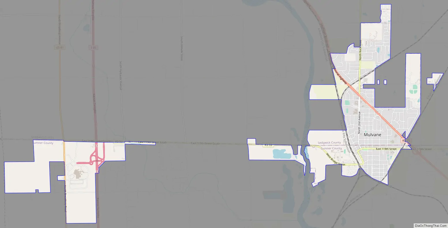
Mulvane Road Map
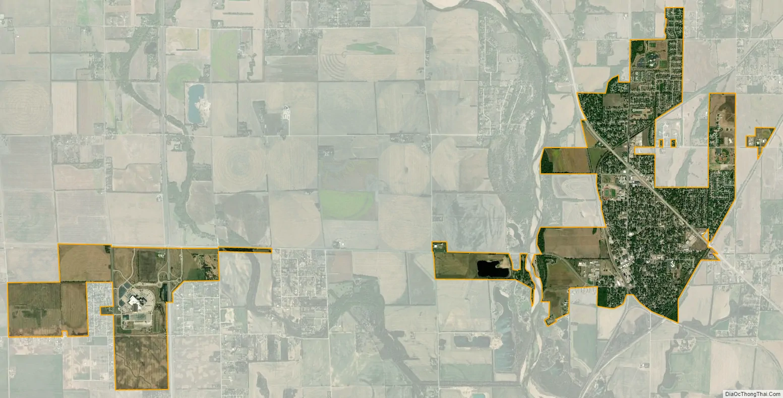
Mulvane city Satellite Map
Geography
Mulvane is located at 37°28′47″N 97°14′32″W / 37.47972°N 97.24222°W / 37.47972; -97.24222 (37.479746, -97.242309). According to the United States Census Bureau, the city has a total area of 4.52 square miles (11.71 km), of which, 4.50 square miles (11.65 km) is land and 0.02 square miles (0.05 km) is water.
Mulvane’s Main Street follows part of the Sedgwick and Sumner county lines, and the town center is about five miles west of the spot where Sedgwick, Sumner, Butler and Cowley counties meet.
See also
Map of Kansas State and its subdivision:- Allen
- Anderson
- Atchison
- Barber
- Barton
- Bourbon
- Brown
- Butler
- Chase
- Chautauqua
- Cherokee
- Cheyenne
- Clark
- Clay
- Cloud
- Coffey
- Comanche
- Cowley
- Crawford
- Decatur
- Dickinson
- Doniphan
- Douglas
- Edwards
- Elk
- Ellis
- Ellsworth
- Finney
- Ford
- Franklin
- Geary
- Gove
- Graham
- Grant
- Gray
- Greeley
- Greenwood
- Hamilton
- Harper
- Harvey
- Haskell
- Hodgeman
- Jackson
- Jefferson
- Jewell
- Johnson
- Kearny
- Kingman
- Kiowa
- Labette
- Lane
- Leavenworth
- Lincoln
- Linn
- Logan
- Lyon
- Marion
- Marshall
- McPherson
- Meade
- Miami
- Mitchell
- Montgomery
- Morris
- Morton
- Nemaha
- Neosho
- Ness
- Norton
- Osage
- Osborne
- Ottawa
- Pawnee
- Phillips
- Pottawatomie
- Pratt
- Rawlins
- Reno
- Republic
- Rice
- Riley
- Rooks
- Rush
- Russell
- Saline
- Scott
- Sedgwick
- Seward
- Shawnee
- Sheridan
- Sherman
- Smith
- Stafford
- Stanton
- Stevens
- Sumner
- Thomas
- Trego
- Wabaunsee
- Wallace
- Washington
- Wichita
- Wilson
- Woodson
- Wyandotte
- Alabama
- Alaska
- Arizona
- Arkansas
- California
- Colorado
- Connecticut
- Delaware
- District of Columbia
- Florida
- Georgia
- Hawaii
- Idaho
- Illinois
- Indiana
- Iowa
- Kansas
- Kentucky
- Louisiana
- Maine
- Maryland
- Massachusetts
- Michigan
- Minnesota
- Mississippi
- Missouri
- Montana
- Nebraska
- Nevada
- New Hampshire
- New Jersey
- New Mexico
- New York
- North Carolina
- North Dakota
- Ohio
- Oklahoma
- Oregon
- Pennsylvania
- Rhode Island
- South Carolina
- South Dakota
- Tennessee
- Texas
- Utah
- Vermont
- Virginia
- Washington
- West Virginia
- Wisconsin
- Wyoming