Wichita (/ˈwɪtʃɪtɑː/ WITCH-i-tah) is the largest city in the U.S. state of Kansas and the county seat of Sedgwick County. As of the 2020 census, the population of the city was 397,532. The Wichita metro area had a population of 647,610 in 2020. It is located in south-central Kansas on the Arkansas River.
Wichita began as a trading post on the Chisholm Trail in the 1860s and was incorporated as a city in 1870. It became a destination for cattle drives traveling north from Texas to Kansas railroads, earning it the nickname “Cowtown”. Wyatt Earp served as a police officer in Wichita for around one year before going to Dodge City.
In the 1920s and 1930s, businessmen and aeronautical engineers established aircraft manufacturing companies in Wichita, including Beechcraft, Cessna, and Stearman Aircraft. The city became an aircraft production hub known as “The Air Capital of the World”. Textron Aviation, Learjet, Airbus, and Boeing/Spirit AeroSystems continue to operate design and manufacturing facilities in Wichita, and the city remains a major center of the American aircraft industry. Several airports located within the city of Wichita include McConnell Air Force Base, Colonel James Jabara Airport, and Wichita Dwight D. Eisenhower National Airport, the largest airport in Kansas.
As an industrial hub, Wichita is a regional center of culture, media, and trade. It hosts several universities, large museums, theaters, parks, shopping centers, and entertainment venues, most notably Intrust Bank Arena and Century II Performing Arts & Convention Center. The city’s Old Cowtown Museum maintains historical artifacts and exhibits the city’s early history. Wichita State University is the third-largest post-secondary institution in the state.
| Name: | Wichita city |
|---|---|
| LSAD Code: | 25 |
| LSAD Description: | city (suffix) |
| State: | Kansas |
| County: | Sedgwick County |
| Founded: | 1868 |
| Incorporated: | 1870 |
| Elevation: | 1,303 ft (397 m) |
| Land Area: | 161.99 sq mi (419.55 km²) |
| Water Area: | 4.53 sq mi (11.73 km²) |
| Population Density: | 2,454.05/sq mi (947.52/km²) |
| Area code: | 316 |
| FIPS code: | 2079000 |
| Website: | wichita.gov |
Explore Wichita with our map collection
Our Wichita map collection displays the city in three unique ways – a road map, things to do, and a reference map. Download our Wichita city map to help you navigate and play in Wichita, Kansas.
The road map displays the main streets and highways, as well as the city’s top attractions and points of interest. The things to do map shows all the activities available in the city, from museums to parks and resorts. Lastly, the reference map is a comprehensive guide to the city’s layout, including its neighborhoods, parks, and major landmarks.
Discover the best of Wichita, Kansas
The city of Wichita is located in the center of Kansas, in the middle of the Great Plains. It’s a small but fast-growing city with a population of approximately 390,000 people. That makes it the largest city in the state of Kansas.
Wichita, Kansas is known for aircraft production and Pizza Hut. From museums to parks and resorts, explore our Wichita map collection to discover the city’s top sights and activities.
Online Interactive Map
Click on ![]() to view map in "full screen" mode.
to view map in "full screen" mode.
Explore Wichita, KS from the comfort of your home. This interactive map has the most accurate and up-to-date information on Wichita, Kansas available today. Discover the best of Wichita, Kansas from the best restaurants, coffee shops, parks, and more. It will show you the way to find attractions and local businesses in Wichita.
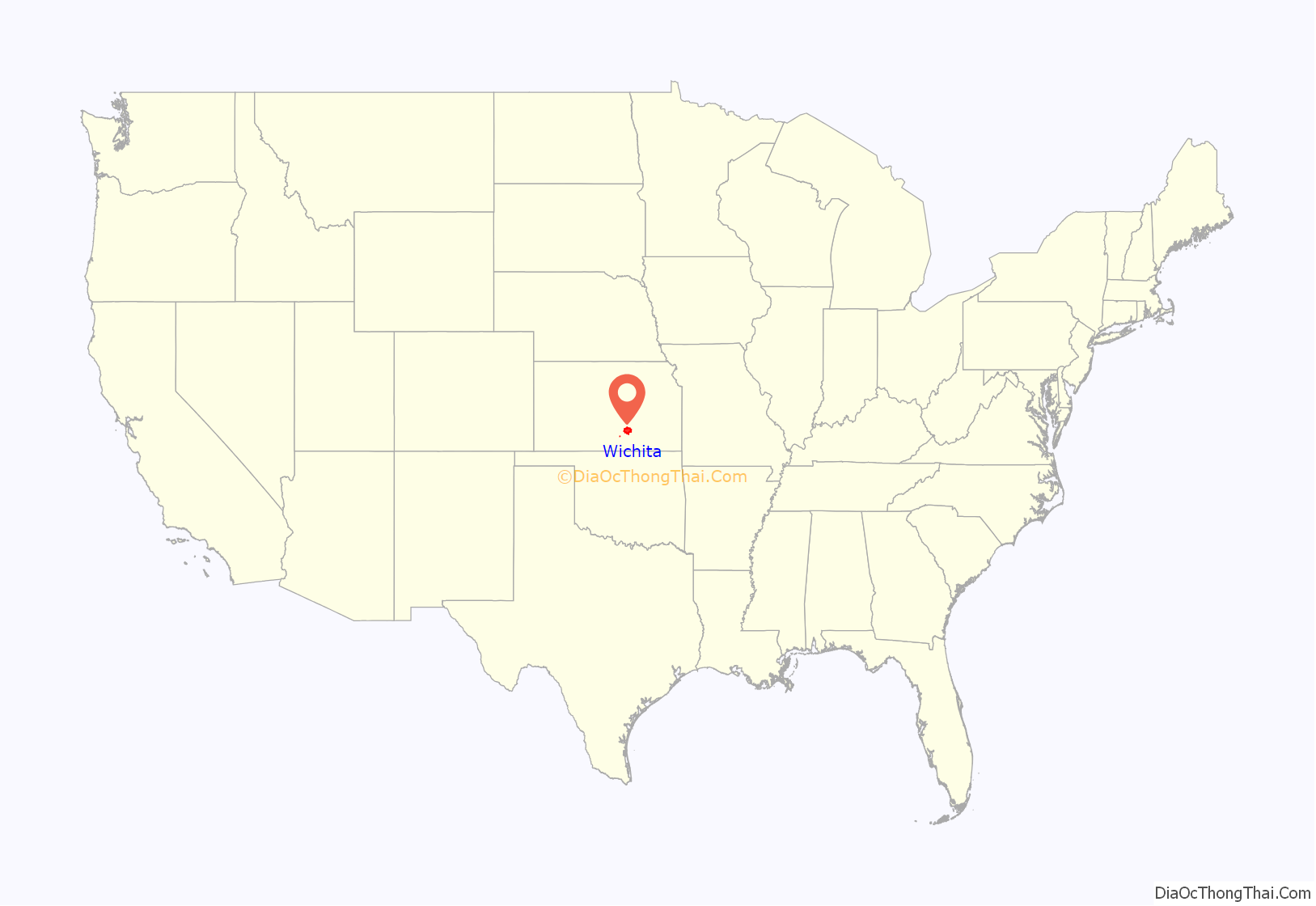
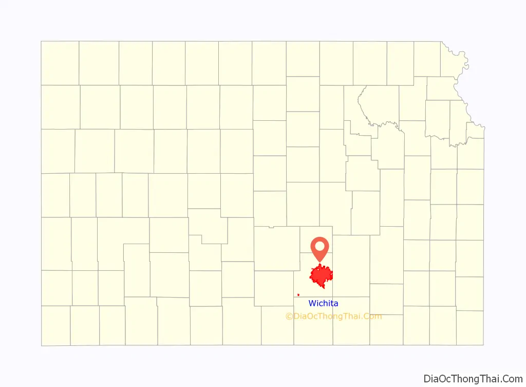
Wichita location map. Where is Wichita city?
History
Early history
Archaeological evidence indicates human habitation near the confluence of the Arkansas and Little Arkansas Rivers, the site of present-day Wichita, as early as 3000 BC. In 1541, a Spanish expedition led by explorer Francisco Vázquez de Coronado found the area populated by the Quivira, or Wichita, people. Conflict with the Osage in the 1750s drove the Wichita further south. Prior to European settlement of the region, the site was in the territory of the Kiowa.
19th century
Claimed first by France as part of Louisiana and later acquired by the United States with the Louisiana Purchase in 1803, it became part of Kansas Territory in 1854 and then the state of Kansas in 1861.
The Wichita people returned in 1863, driven from their land in Indian Territory by Confederate forces in the American Civil War, and established a settlement on the banks of the Little Arkansas. During this period, trader Jesse Chisholm established a trading post at the site, one of several along a trail extending south to Texas which became known as the Chisholm Trail. In 1867, after the war, the Wichita returned to Indian Territory.
In 1868, trader James R. Mead was among a group of investors who established a town company, and surveyor Darius Munger built a log structure for the company to serve as a hotel, community center, and post office. Business opportunities attracted area hunters and traders, and a new settlement began to form. That summer, Mead and others organized the Wichita Town Company, naming the settlement after the Wichita tribe. In 1870, Munger and German immigrant William “Dutch Bill” Greiffenstein filed plats laying out the city’s first streets. Wichita formally incorporated as a city on July 21, 1870.
Wichita’s position on the Chisholm Trail made it a destination for cattle drives traveling north from Texas to access railroads, which led to markets in eastern U.S. cities. The Atchison, Topeka and Santa Fe Railway reached the city in 1872. As a result, Wichita became a railhead for the cattle drives, earning it the nickname “Cowtown”. Across the Arkansas River, the town of Delano became an entertainment destination for cattlemen thanks to its saloons, brothels, and lack of law enforcement.
James Earp ran a brothel with his wife Nellie “Bessie” Ketchum. His brother Wyatt was likely a pimp, although historian Gary L. Roberts believes that he was an enforcer or bouncer. Local arrest records show that Earp’s common-law wife Sally and James’ wife Nellie managed a brothel there from early 1874 to the middle of 1876. The area had a reputation for violence until lawmen like Wyatt stepped up enforcement, who officially joined the Wichita marshal’s office on April 21, 1875. He was hired after the election of Mike Meagher as city marshal, making $100 per month. By the middle of the decade, the cattle trade had moved west to Dodge City. Wichita annexed Delano in 1880.
Rapid immigration resulted in a speculative land boom in the late 1880s, stimulating further expansion of the city. Fairmount College, which eventually grew into Wichita State University, opened in 1886; Garfield University, which eventually became Friends University, opened in 1887. By 1890, Wichita had become the third-largest city in the state after Kansas City, Kansas, and Topeka, with a population of nearly 24,000. After the boom, however, the city entered an economic recession, and many of the original settlers went bankrupt.
20th century
In 1914 and 1915, deposits of oil and natural gas were discovered in nearby Butler County. This triggered another economic boom in Wichita as producers established refineries, fueling stations, and headquarters in the city. By 1917, five operating refineries were in Wichita, with another seven built in the 1920s. The careers and fortunes of future oil moguls Archibald Derby, who later founded Derby Oil, and Fred C. Koch, who established what would become Koch Industries, both began in Wichita during this period.
The money generated by the oil boom enabled local entrepreneurs to invest in the nascent airplane-manufacturing industry. In 1917, Clyde Cessna built his Cessna Comet in Wichita, the first aircraft built in the city. In 1920, two local oilmen invited Chicago aircraft builder Emil “Matty” Laird to manufacture his designs in Wichita, leading to the formation of the Swallow Airplane Company. Two early Swallow employees, Lloyd Stearman and Walter Beech, went on to found two prominent Wichita-based companies, Stearman Aircraft in 1926 and Beechcraft in 1932, respectively. Cessna, meanwhile, started his own company in Wichita in 1927. The city became such a center of the industry that the Aeronautical Chamber of Commerce dubbed it the “Air Capital of the World” in 1929.
Over the following decades, aviation and aircraft manufacturing continued to drive expansion of the city. In 1934, Stearman’s Wichita facilities became part of Boeing, which would become the city’s largest employer. Initial construction of Wichita Municipal Airport finished southeast of the city in 1935. During World War II, the site hosted Wichita Army Airfield and Boeing Airplane Company Plant No. 1. The city experienced a population explosion during the war when it became a major manufacturing center for the Boeing B-29 bomber. The wartime city quickly grew from 110,000 to 184,000 residents, drawing aircraft workers from throughout the central U.S. In 1951, the U.S. Air Force announced plans to assume control of the airport to establish McConnell Air Force Base. By 1954, all nonmilitary air traffic had shifted to the new Wichita Mid-Continent Airport west of the city. In 1962, Lear Jet Corporation opened with its plant adjacent to the new airport.
Throughout the late 19th and 20th centuries, several other prominent businesses and brands had their origins in Wichita. A. A. Hyde founded health-care products maker Mentholatum in Wichita in 1889. Sporting goods and camping-gear retailer Coleman started in the city in the early 1900s. A number of fast-food franchises started in Wichita, beginning with White Castle in 1921 and followed by many more in the 1950s and 1960s including Pizza Hut in 1958. In the 1970s and 1980s, the city became a regional center of health care and medical research.
Wichita has been a focal point of national political controversy multiple times in its history. In 1900, famous temperance extremist Carrie Nation struck in Wichita upon learning the city was not enforcing Kansas’s prohibition ordinance. The Dockum Drug Store sit-in took place in the city in 1958 with protesters pushing for desegregation. In 1991, thousands of anti-abortion protesters blockaded and held sit-ins at Wichita abortion clinics, particularly the clinic of George Tiller. Tiller was later murdered in Wichita by Scott Roeder in 2009.
21st century
Except for a slow period in the 1970s, Wichita has continued to grow steadily into the 21st century. In the late 1990s and 2000s, the city government and local organizations began collaborating to redevelop downtown Wichita and older neighborhoods in the city. Intrust Bank Arena opened downtown in 2010.
Boeing ended its operations in Wichita in 2014. However, the city remains a national center of aircraft manufacturing with other companies including Spirit AeroSystems and Airbus maintaining facilities in Wichita.
Wichita Mid-Continent Airport was officially renamed Wichita Dwight D. Eisenhower National Airport after the Kansas native and U.S. President in 2015.
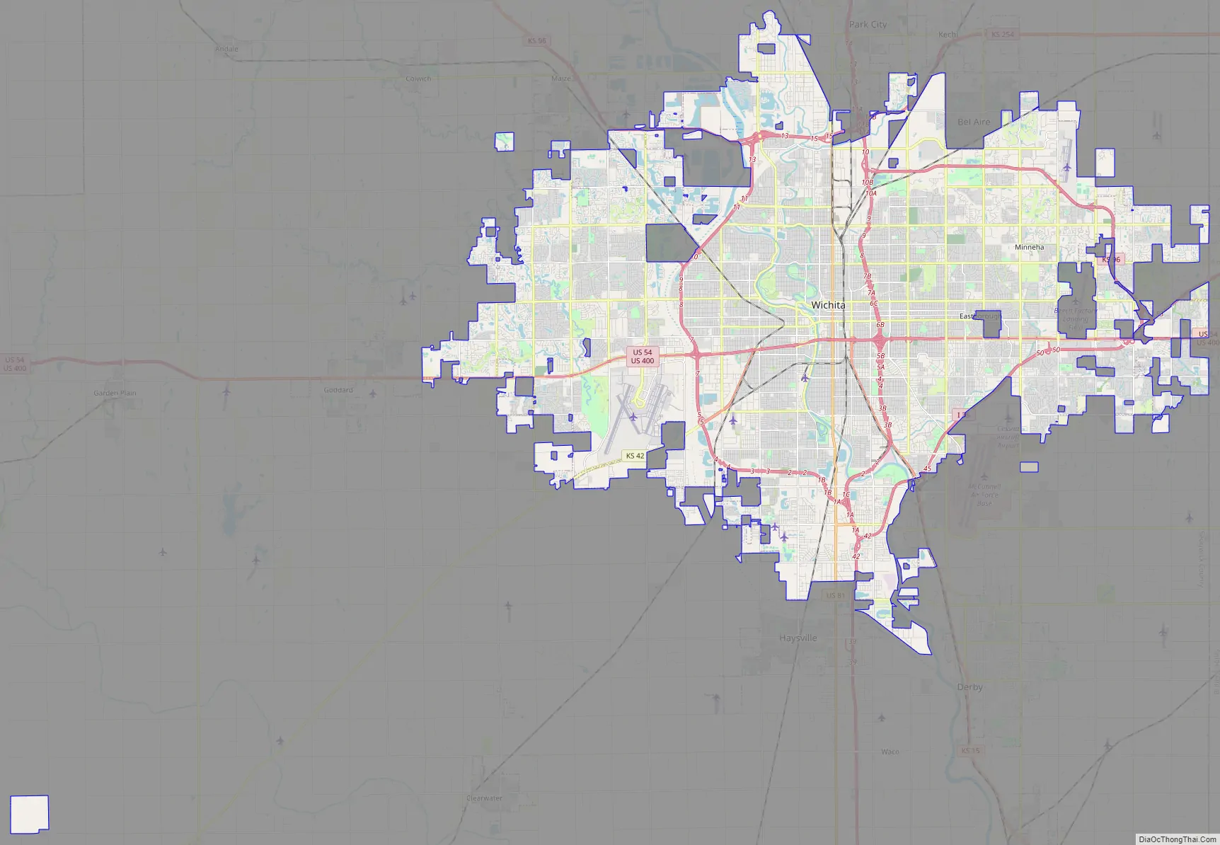
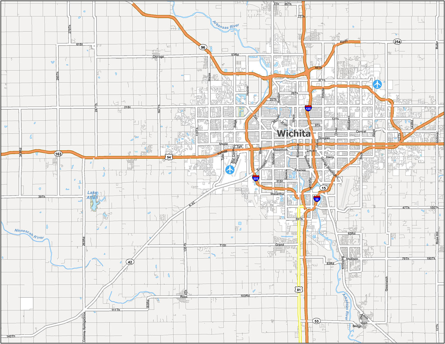
Wichita Road Map
If you are looking for a map, then this is the Wichita road map you need. Find your way around the city, or search for points of interest. Whether it is for business or pleasure, there is so much to see and do in Wichita. It’s great for anyone who is new to the area or is just plain lost. But if you’re planning a road trip outside the city, download and print our Kansas road map for statewide highway information.
Interstate Highways: I-35, I-135, I-235
US Highways: 15, 42, 54, 81, 96, 254, K42 Hwy
Major Roads: 13th St, 47th St, Amidon Ave, Broadway St, Central Ave, Douglas Ave, Edwards St, Harry St, Kellogg St, Lincoln St, McCormick St, Meridian Ave, Murdock St, Pawnee St, Southeast Blvd, Southwest Blvd, Washington St
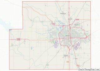
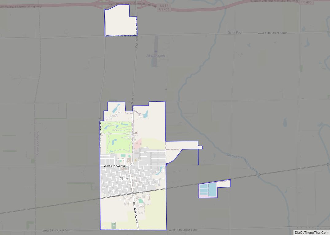
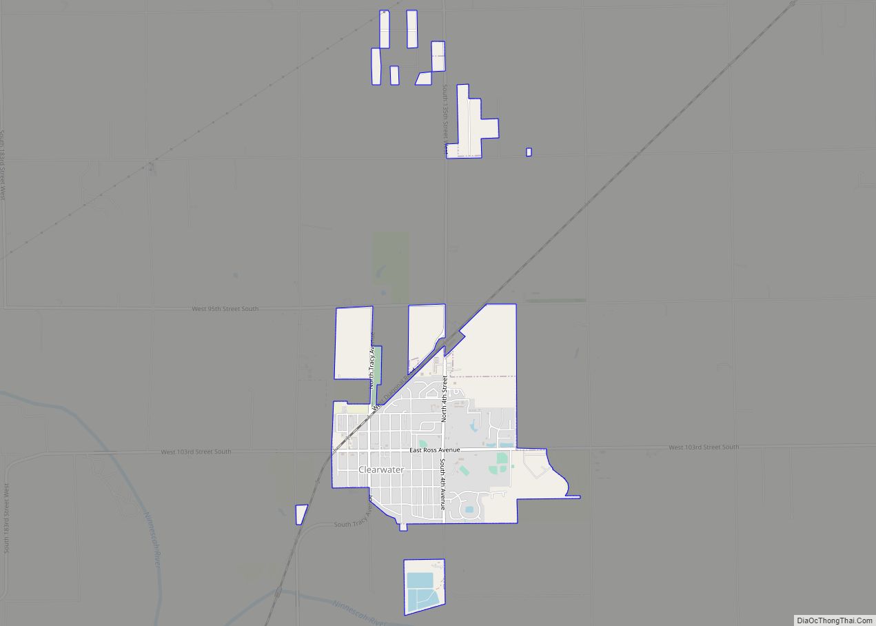
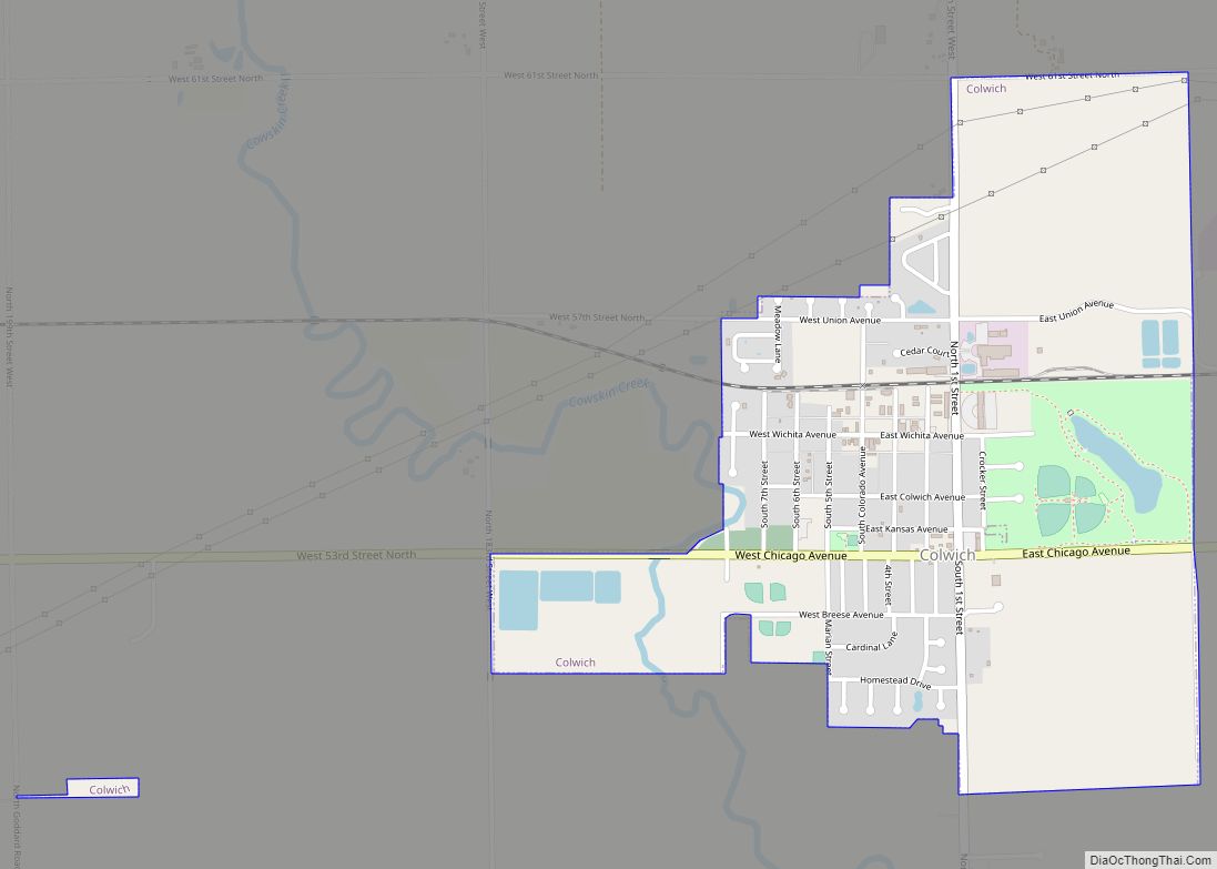
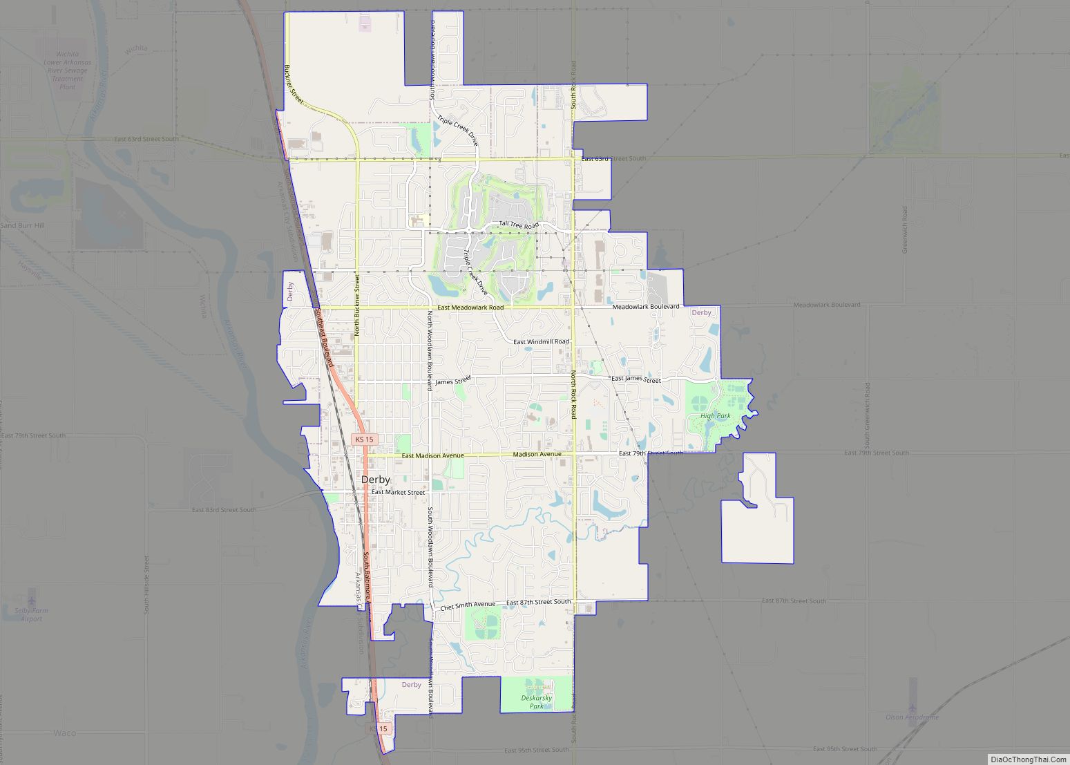
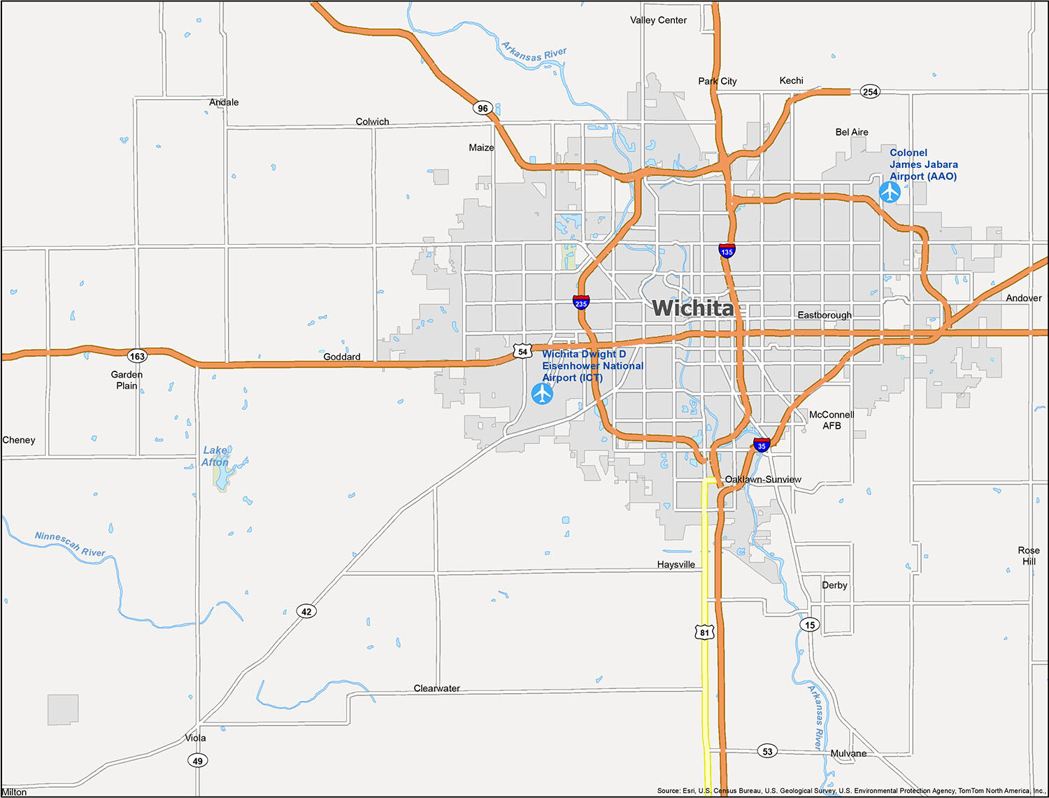
Plan your trip to Wichita and find the best attractions with this reference map. Start by pinpointing the attractions you want to visit, then explore the city with an at-a-glance overview of all the notable points of interest in the area. Find your way around Wichita for sightseeing and exploring, with information on airports, cities, and Census-designated places (CDPs). The airports in the area include Wichita Dwight D Eisenhower National Airport (ICT) and Colonel James Jabara Airport (AAO). The cities include Andale, Andover, Bel Aire, Cheney, Clearwater, Colwich, Derby, Eastborough, Garden Plain, Goddard, Haysville, Kechi, Maize, Mulvane, Park City, Rose Hill, Valley Center, Viola, and Wichita. The CDPs are McConnell AFB, Milton, and Oaklawn-Sunview.
10 things to do in Wichita city
Ready to explore the city of Wichita? Download this map of Wichita Kansas and get out and explore all the great places the city has to offer.
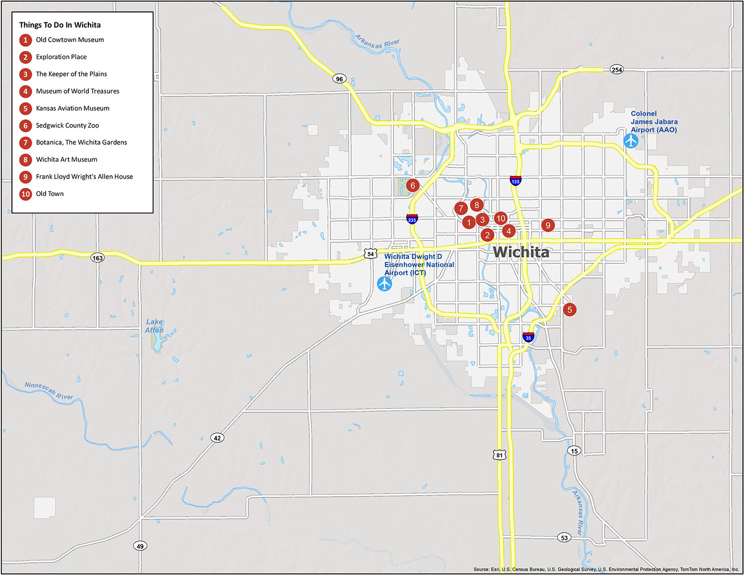
Wichita, Kansas is a great city to explore and it has a lot to offer. With this map of Wichita Kansas, you can explore all the important places in Wichita, like the Old Cowtown Museum, Exploration Place, The Keeper of the Plains, Museum of World Treasures, Kansas Aviation Museum, Sedgwick County Zoo, Botanica, The Wichita Gardens, Wichita Art Museum, Frank Lloyd Wright’s Allen House, and Old Town. Download this map and get out and explore the city of Wichita and all the great things it has to offer.
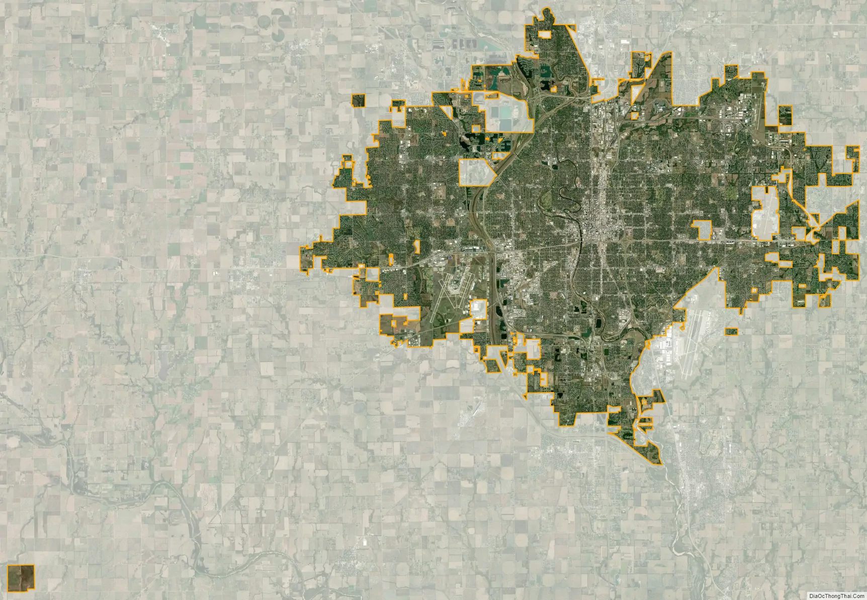
Wichita city Satellite Map
Geography
Wichita is in south-central Kansas at the junction of Interstate 35 and U.S. Route 54. Part of the Midwestern United States, it is 157 mi (253 km) north of Oklahoma City, 181 mi (291 km) southwest of Kansas City, and 439 mi (707 km) east-southeast of Denver.
The city lies on the Arkansas River near the western edge of the Flint Hills in the Wellington-McPherson Lowlands region of the Great Plains. The area’s topography is characterized by the broad alluvial plain of the Arkansas River valley and the moderately rolling slopes that rise to the higher lands on either side.
The Arkansas follows a winding course, south-southeast through Wichita, roughly bisecting the city. It is joined along its course by several tributaries, all of which flow generally south. The largest is the Little Arkansas River, which enters the city from the north and joins the Arkansas immediately west of downtown. Further east lies Chisholm Creek, which joins the Arkansas in the far southern part of the city. The Chisholm’s own tributaries drain much of the city’s eastern half; these include the creek’s West, Middle, and East Forks, as well as further south, Gypsum Creek. The Gypsum is fed by its own tributary, Dry Creek. Two more of the Arkansas’s tributaries lie west of its course; from east to west, these are Big Slough Creek and Cowskin Creek. Both run south through the western part of the city. Fourmile Creek, a tributary of the Walnut River, flows south through the far eastern part of the city.
According to the United States Census Bureau, the city has a total area of 163.59 sq mi (423.70 km), of which 4.30 sq mi (11.14 km) are covered by water.
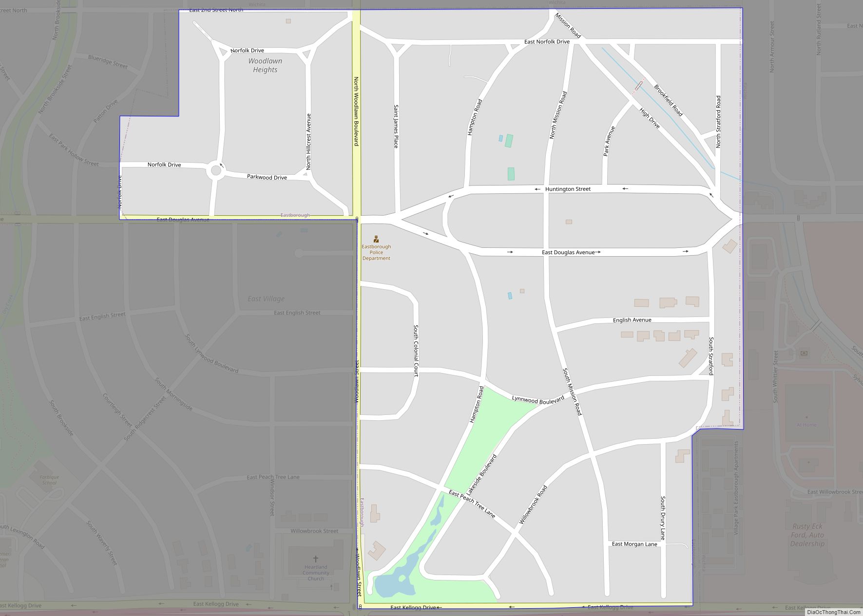
As the core of the Wichita metropolitan area, the city is surrounded by suburbs. Bordering Wichita on the north are, from west to east, Valley Center, Park City, Kechi, and Bel Aire. Enclosed within east-central Wichita is Eastborough. Adjacent to the city’s east side is Andover. McConnell Air Force Base is in the extreme southeast corner of the city. To the south, from east to west, lie Derby and Haysville. Goddard and Maize border Wichita to the west and northwest, respectively.
Climate
Wichita lies within the humid subtropical climate zone (Köppen Cfa), typically experiencing hot, humid summers and cold, dry winters. Located on the Great Plains, far from any large moderating influences such as mountains or large bodies of water, Wichita often experiences severe weather with thunderstorms occurring frequently during the spring and summer. These occasionally bring large hail and frequent lightning. Particularly destructive ones have struck the Wichita area several times in the course of its history – in September 1965, during the Andover, Kansas tornado outbreak of April 1991, and during the Oklahoma tornado outbreak of May 1999. Winters are cold and dry; since Wichita is roughly midway between Canada and the Gulf of Mexico, cold spells and warm spells are equally frequent. Warm air masses from the Gulf of Mexico can raise midwinter temperatures into the 50s and even 60s (°F), while cold-air masses from the Arctic can occasionally plunge the temperature below 0 °F. Wind speed in the city averages 13 mph (21 km/h). On average, January is the coldest month (and the driest), July the hottest, and May the wettest.
The average temperature in the city is 57.7 °F (14.3 °C). Over the course of a year, the monthly daily average temperature ranges from 33.2 °F (0.7 °C) in January to 81.5 °F (27.5 °C) in July. The high temperature reaches or exceeds 90 °F (32 °C) an average of 65 days a year and 100 °F (38 °C) an average of 12 days a year. The minimum temperature falls to or below 10 °F (−12 °C) on an average 7.7 days a year. The hottest temperature recorded in Wichita was 114 °F (46 °C) in 1936; the coldest temperature recorded was −22 °F (−30 °C) on February 12, 1899. Readings as low as −17 °F (−27 °C) and as high as 111 °F (44 °C) occurred as recently as February 16, 2021 and July 29–30, 2012, respectively. Wichita receives on average about 34.31 inches (871 mm) of precipitation a year, most of which falls in the warmer months, and experiences 87 days of measurable precipitation. The average relative humidity is 80% in the morning and 49% in the evening. Annual snowfall averages 12.7 inches (32 cm). Measurable snowfall occurs an average of nine days per year with at least an inch of snow falling on four of those days. Snow depth of at least an inch occurs an average of 12 days per year. The average window for freezing temperatures is October 25 through April 9.
Wichita is consistently ranked as one of the worst major cities in the nation for seasonal allergies, due largely to tree and grass pollen (partly from surrounding open plains and pastureland), and smoke from frequent burning of fields by the region’s farmers and ranchers, driven by the strong Kansas winds. The Asthma and Allergy Foundation of America, ranked Wichita—out of the nation’s 100 largest cities—6th worst for allergy sufferers in 2016, 3rd worst in 2021, 2nd worst in 2022, and #1 worst nationwide in 2023.
Neighborhoods
Wichita has several recognized areas and neighborhoods. The downtown area is generally considered to be east of the Arkansas River, west of Washington Street, north of Kellogg, and south of 13th Street. It contains landmarks such as Century II, the Garvey Center, and the Epic Center. Old Town is also part of downtown; this 50-acre (0.20 km) area is home to a cluster of nightclubs, bars, restaurants, a movie theater, shops, and apartments and condominiums, many of which make use of historical warehouse-type spaces.
Two notable residential areas of Wichita are Riverside and College Hill. Riverside is northwest of downtown, across the Arkansas River, and surrounds the 120-acre (0.49 km) Riverside Park. College Hill is east of downtown and south of Wichita State University. It is one of the more historic neighborhoods, along with Delano on the west side and Midtown in the north-central city.
Four other historic neighborhoods—developed in southeast Wichita (particularly near Boeing, Cessna and Beech aircraft plants) — are among the nation’s few remaining examples of U.S. government-funded temporary World War II housing developments to support war factory personnel: Beechwood (now mostly demolished), Oaklawn, Hilltop (the city’s highest-density large neighborhood), and massive Planeview (where over 30 languages are spoken) — in all, home to about a fifth of the city’s population at their peak. Though designed as temporary housing, all have remained occupied into the 21st century, most becoming low-income neighborhoods.
See also
Map of Kansas State and its subdivision:- Allen
- Anderson
- Atchison
- Barber
- Barton
- Bourbon
- Brown
- Butler
- Chase
- Chautauqua
- Cherokee
- Cheyenne
- Clark
- Clay
- Cloud
- Coffey
- Comanche
- Cowley
- Crawford
- Decatur
- Dickinson
- Doniphan
- Douglas
- Edwards
- Elk
- Ellis
- Ellsworth
- Finney
- Ford
- Franklin
- Geary
- Gove
- Graham
- Grant
- Gray
- Greeley
- Greenwood
- Hamilton
- Harper
- Harvey
- Haskell
- Hodgeman
- Jackson
- Jefferson
- Jewell
- Johnson
- Kearny
- Kingman
- Kiowa
- Labette
- Lane
- Leavenworth
- Lincoln
- Linn
- Logan
- Lyon
- Marion
- Marshall
- McPherson
- Meade
- Miami
- Mitchell
- Montgomery
- Morris
- Morton
- Nemaha
- Neosho
- Ness
- Norton
- Osage
- Osborne
- Ottawa
- Pawnee
- Phillips
- Pottawatomie
- Pratt
- Rawlins
- Reno
- Republic
- Rice
- Riley
- Rooks
- Rush
- Russell
- Saline
- Scott
- Sedgwick
- Seward
- Shawnee
- Sheridan
- Sherman
- Smith
- Stafford
- Stanton
- Stevens
- Sumner
- Thomas
- Trego
- Wabaunsee
- Wallace
- Washington
- Wichita
- Wilson
- Woodson
- Wyandotte
- Alabama
- Alaska
- Arizona
- Arkansas
- California
- Colorado
- Connecticut
- Delaware
- District of Columbia
- Florida
- Georgia
- Hawaii
- Idaho
- Illinois
- Indiana
- Iowa
- Kansas
- Kentucky
- Louisiana
- Maine
- Maryland
- Massachusetts
- Michigan
- Minnesota
- Mississippi
- Missouri
- Montana
- Nebraska
- Nevada
- New Hampshire
- New Jersey
- New Mexico
- New York
- North Carolina
- North Dakota
- Ohio
- Oklahoma
- Oregon
- Pennsylvania
- Rhode Island
- South Carolina
- South Dakota
- Tennessee
- Texas
- Utah
- Vermont
- Virginia
- Washington
- West Virginia
- Wisconsin
- Wyoming