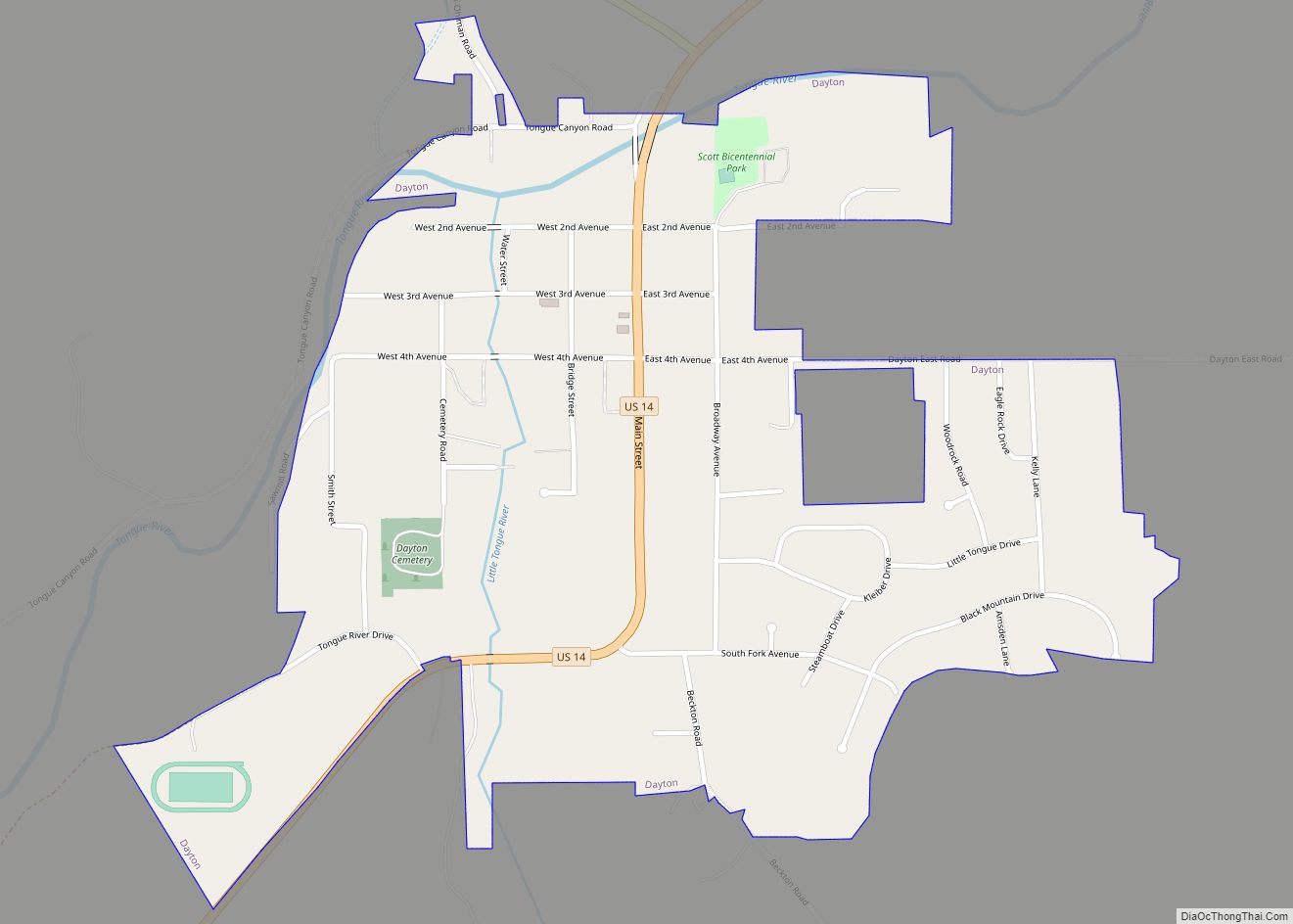
Dayton is a town in Sheridan County, Wyoming, United States. The population was 822 at the 2020 census.
| Name: | Dayton town |
|---|---|
| LSAD Code: | 43 |
| LSAD Description: | town (suffix) |
| State: | Wyoming |
| County: | Sheridan County |
| Elevation: | 3,921 ft (1,195 m) |
| Total Area: | 0.55 sq mi (1.42 km²) |
| Land Area: | 0.55 sq mi (1.42 km²) |
| Water Area: | 0.00 sq mi (0.00 km²) |
| Total Population: | 757 |
| Population Density: | 1,400/sq mi (530/km²) |
| ZIP code: | 82836 |
| Area code: | 307 |
| FIPS code: | 5619385 |
| GNISfeature ID: | 1587386 |
| Website: | www.daytonwyoming.org |
Online Interactive Map
Click on ![]() to view map in "full screen" mode.
to view map in "full screen" mode.
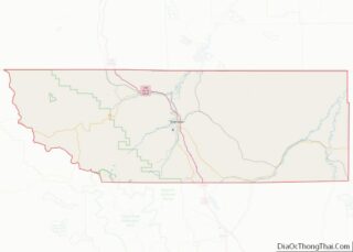
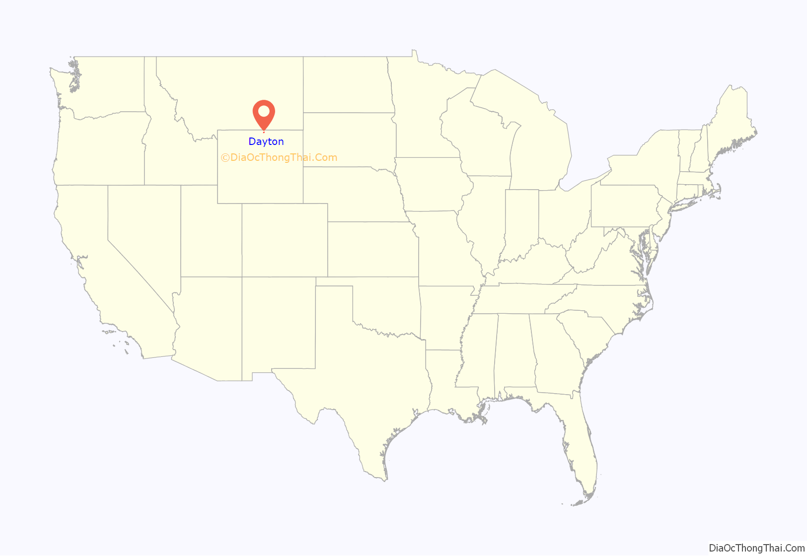
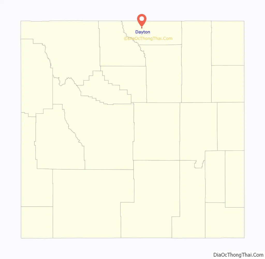
Dayton location map. Where is Dayton town?
History
Dayton was named after Joe Dayton Thorn in 1882 because he was one of the founding fathers of the city. Wyoming’s first rodeo was held here in the 1890s and Dayton elected the first female mayor in Wyoming.
Dayton was home to the San Benito Monastery, a Roman Catholic monastery associated with the Benedictine Sisters of Perpetual Adoration, from 1989 to 2014.
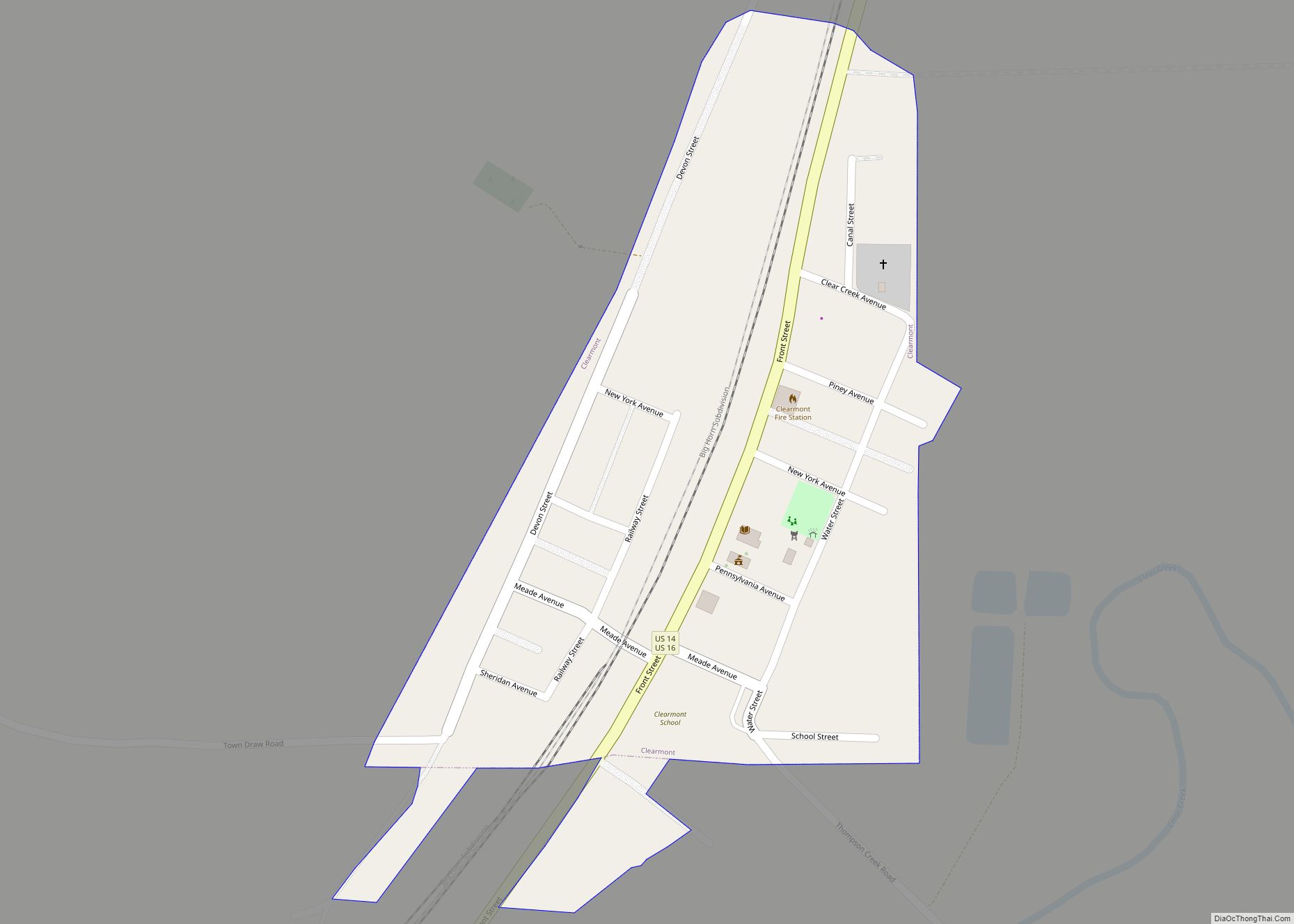
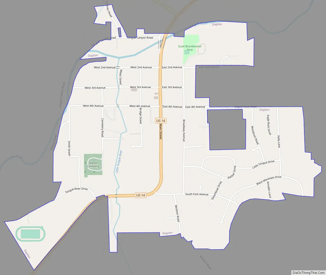
Dayton Road Map
Dayton city Satellite Map

Geography
Dayton is at the confluence of the Tongue and Little Tongue Rivers. It is on U.S. Route 14, just east of the Big Horn Mountains.
According to the United States Census Bureau, the town has an area of 0.53 square miles (1.37 km), all land.
See also
Map of Wyoming State and its subdivision: Map of other states:- Alabama
- Alaska
- Arizona
- Arkansas
- California
- Colorado
- Connecticut
- Delaware
- District of Columbia
- Florida
- Georgia
- Hawaii
- Idaho
- Illinois
- Indiana
- Iowa
- Kansas
- Kentucky
- Louisiana
- Maine
- Maryland
- Massachusetts
- Michigan
- Minnesota
- Mississippi
- Missouri
- Montana
- Nebraska
- Nevada
- New Hampshire
- New Jersey
- New Mexico
- New York
- North Carolina
- North Dakota
- Ohio
- Oklahoma
- Oregon
- Pennsylvania
- Rhode Island
- South Carolina
- South Dakota
- Tennessee
- Texas
- Utah
- Vermont
- Virginia
- Washington
- West Virginia
- Wisconsin
- Wyoming