Esterbrook is a village, and the locus of a same-named census-designated place (CDP), in Converse County, Wyoming, United States in the Medicine Bow National Forest. The population was 52 at the 2010 census.
| Name: | Esterbrook CDP |
|---|---|
| LSAD Code: | 57 |
| LSAD Description: | CDP (suffix) |
| State: | Wyoming |
| County: | Converse County |
| Elevation: | 6,516 ft (1,986 m) |
| Total Area: | 3.4 sq mi (8.8 km²) |
| Land Area: | 3.4 sq mi (8.8 km²) |
| Water Area: | 0.0 sq mi (0.0 km²) |
| Total Population: | 52 |
| Population Density: | 15/sq mi (5.9/km²) |
| Area code: | 307 |
| FIPS code: | 5625185 |
| GNISfeature ID: | 1599634 |
Online Interactive Map
Click on ![]() to view map in "full screen" mode.
to view map in "full screen" mode.
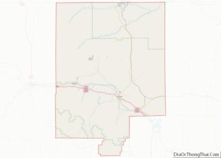
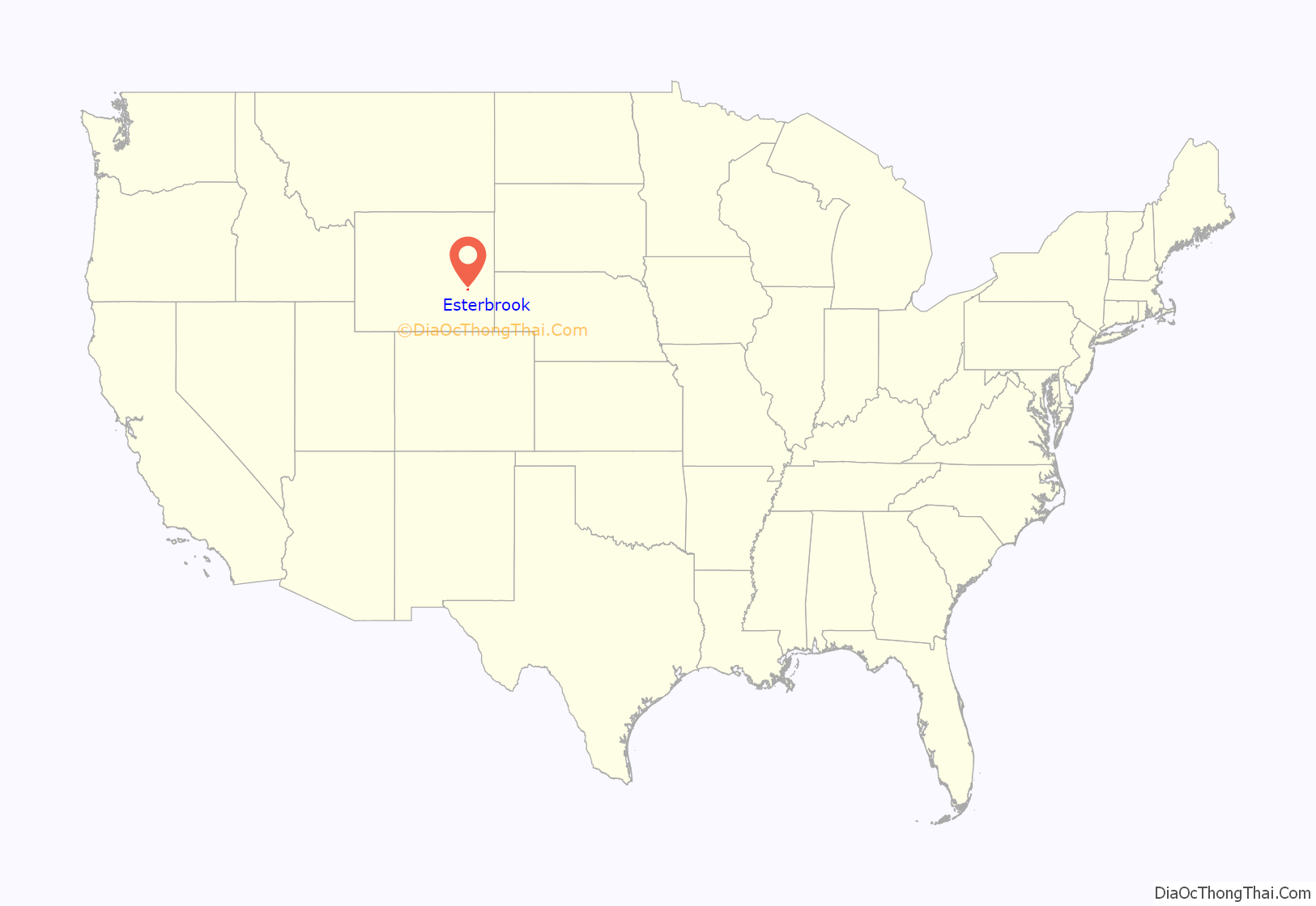
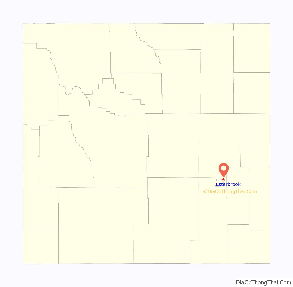
Esterbrook location map. Where is Esterbrook CDP?
History
Esterbrook, founded in 1896 as a mining city, is named after Esterbrook Creek, which was named after Mrs. Esther Cooper, a local settler. In 1946 the Esterbrook Community Church (one of 29 mission churches in the Episcopal Missionary District of Wyoming) was built with a window behind the altar having a view to Laramie Peak.
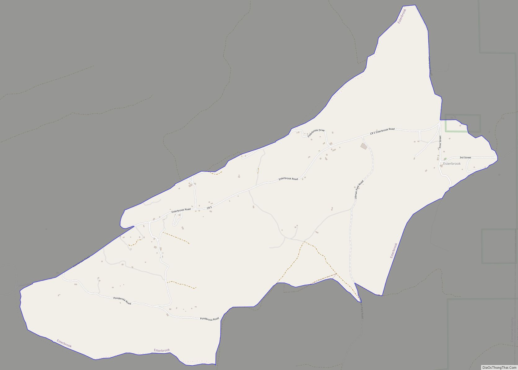
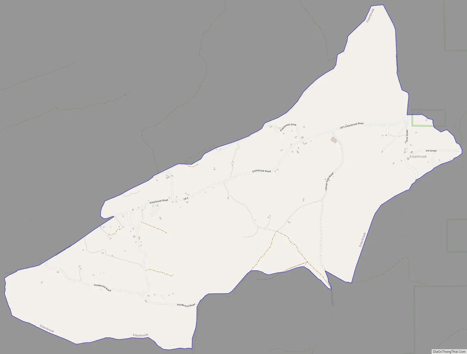
Esterbrook Road Map
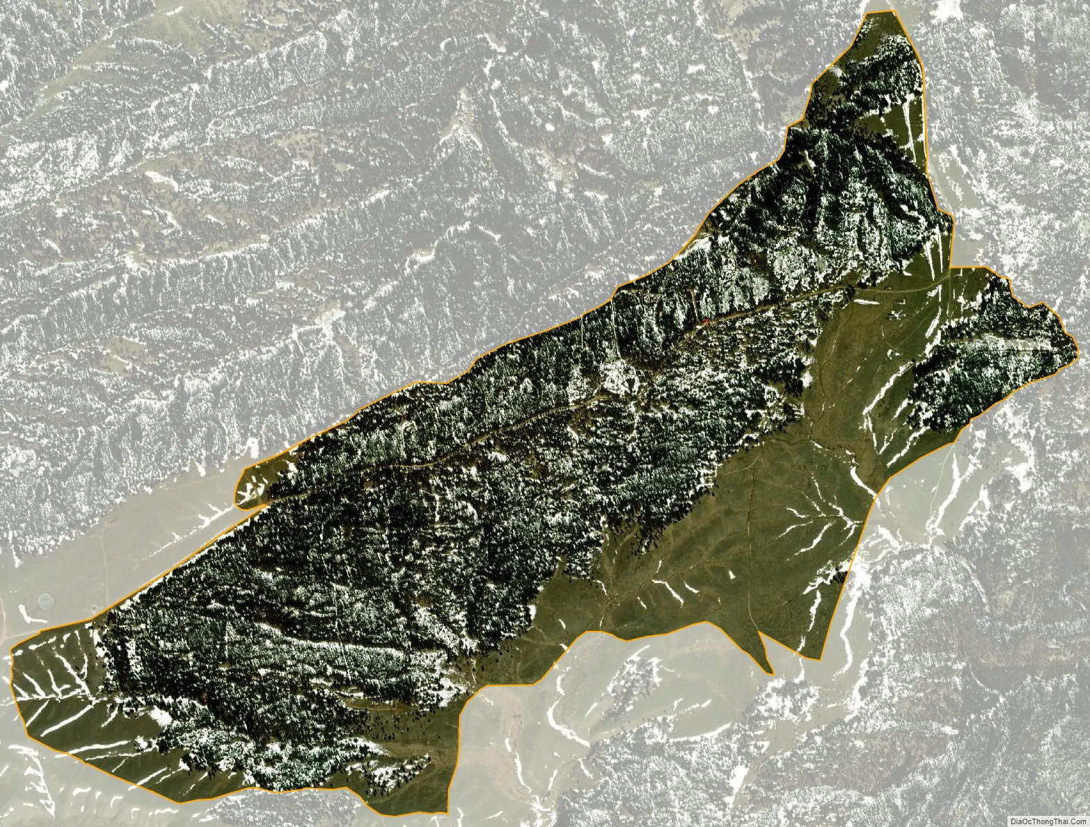
Esterbrook city Satellite Map
Geography
According to the United States Census Bureau, the CDP has a total area of 3.4 square miles (8.8 km), all land.
See also
Map of Wyoming State and its subdivision: Map of other states:- Alabama
- Alaska
- Arizona
- Arkansas
- California
- Colorado
- Connecticut
- Delaware
- District of Columbia
- Florida
- Georgia
- Hawaii
- Idaho
- Illinois
- Indiana
- Iowa
- Kansas
- Kentucky
- Louisiana
- Maine
- Maryland
- Massachusetts
- Michigan
- Minnesota
- Mississippi
- Missouri
- Montana
- Nebraska
- Nevada
- New Hampshire
- New Jersey
- New Mexico
- New York
- North Carolina
- North Dakota
- Ohio
- Oklahoma
- Oregon
- Pennsylvania
- Rhode Island
- South Carolina
- South Dakota
- Tennessee
- Texas
- Utah
- Vermont
- Virginia
- Washington
- West Virginia
- Wisconsin
- Wyoming