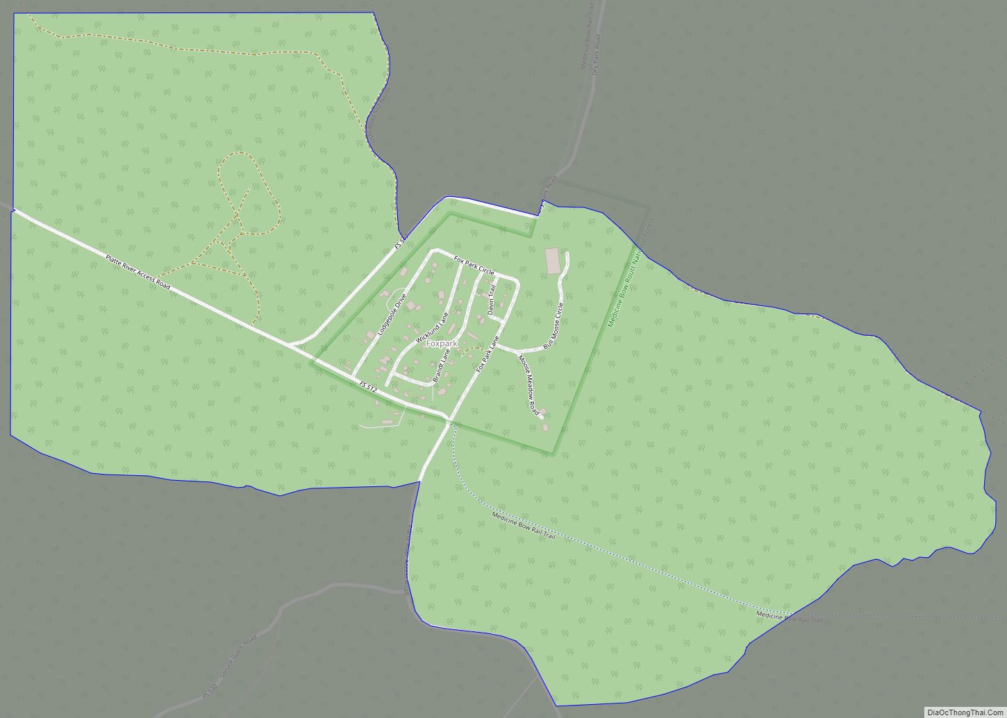
Fox Park is a census-designated place (CDP) in Albany County, Wyoming, United States. The population was 22 at the 2010 census.
| Name: | Fox Park CDP |
|---|---|
| LSAD Code: | 57 |
| LSAD Description: | CDP (suffix) |
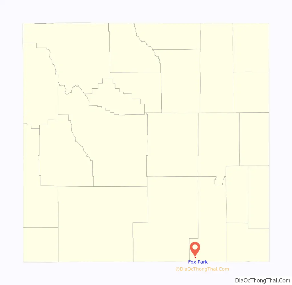
| State: | Wyoming |
| County: | Albany County |
| Elevation: | 9,062 ft (2,762 m) |
| Total Area: | 1.0 sq mi (3 km²) |
| Land Area: | 1.0 sq mi (3 km²) |
| Water Area: | 0 sq mi (0 km²) |
| Total Population: | 22 |
| Population Density: | 22/sq mi (8.5/km²) |
| Area code: | 307 |
| FIPS code: | 5629400 |
| GNISfeature ID: | 1599838 |
Online Interactive Map
Click on ![]() to view map in "full screen" mode.
to view map in "full screen" mode.
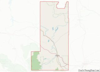
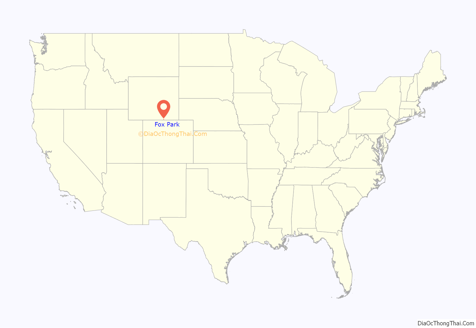
Fox Park location map. Where is Fox Park CDP?
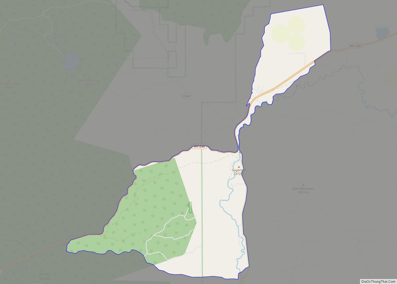
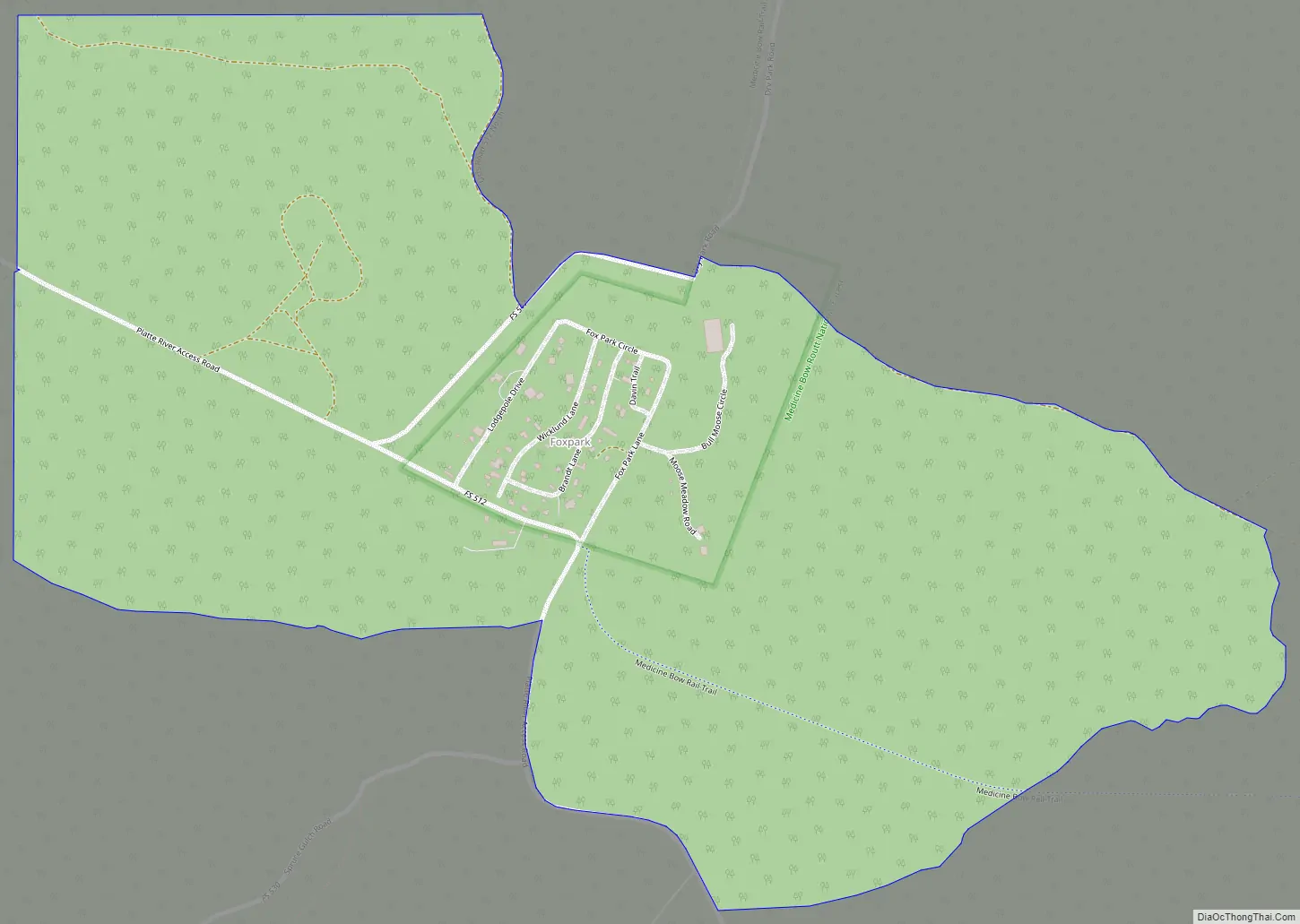
Fox Park Road Map
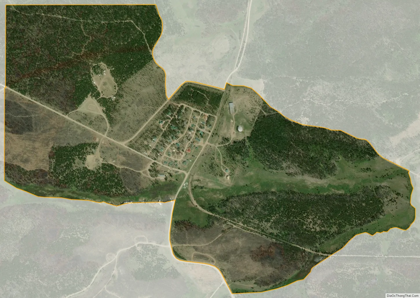
Fox Park city Satellite Map
Geography
According to the United States Census Bureau, the CDP has a total area of 1.0 square mile (28.5 km), all land.
The CDP is located entirely within the Medicine Bow National Forest.
Fox Park experiences a subarctic climate (Köppen climate classification Dfc) due to its elevation. Winters are long and cold, with highs usually remaining at or below freezing, and lows often dropping below zero. Summers are refreshingly warm, but with lows still dropping to freezing. Snowfall is very heavy, averaging 180 inches per year, mostly falling between October and May, but snow during the months of September and June is not rare, and usually happens every couple of years. Usually no month of the year is frost free. Fox Park is the highest community in the state of Wyoming, at an elevation of 9,062 ft, as well as one of the coldest settlements.
See also
Map of Wyoming State and its subdivision: Map of other states:- Alabama
- Alaska
- Arizona
- Arkansas
- California
- Colorado
- Connecticut
- Delaware
- District of Columbia
- Florida
- Georgia
- Hawaii
- Idaho
- Illinois
- Indiana
- Iowa
- Kansas
- Kentucky
- Louisiana
- Maine
- Maryland
- Massachusetts
- Michigan
- Minnesota
- Mississippi
- Missouri
- Montana
- Nebraska
- Nevada
- New Hampshire
- New Jersey
- New Mexico
- New York
- North Carolina
- North Dakota
- Ohio
- Oklahoma
- Oregon
- Pennsylvania
- Rhode Island
- South Carolina
- South Dakota
- Tennessee
- Texas
- Utah
- Vermont
- Virginia
- Washington
- West Virginia
- Wisconsin
- Wyoming