Lost Springs is a town in Converse County, Wyoming, United States. As of the 2020 census, the population was 6.
| Name: | Lost Springs town |
|---|---|
| LSAD Code: | 43 |
| LSAD Description: | town (suffix) |
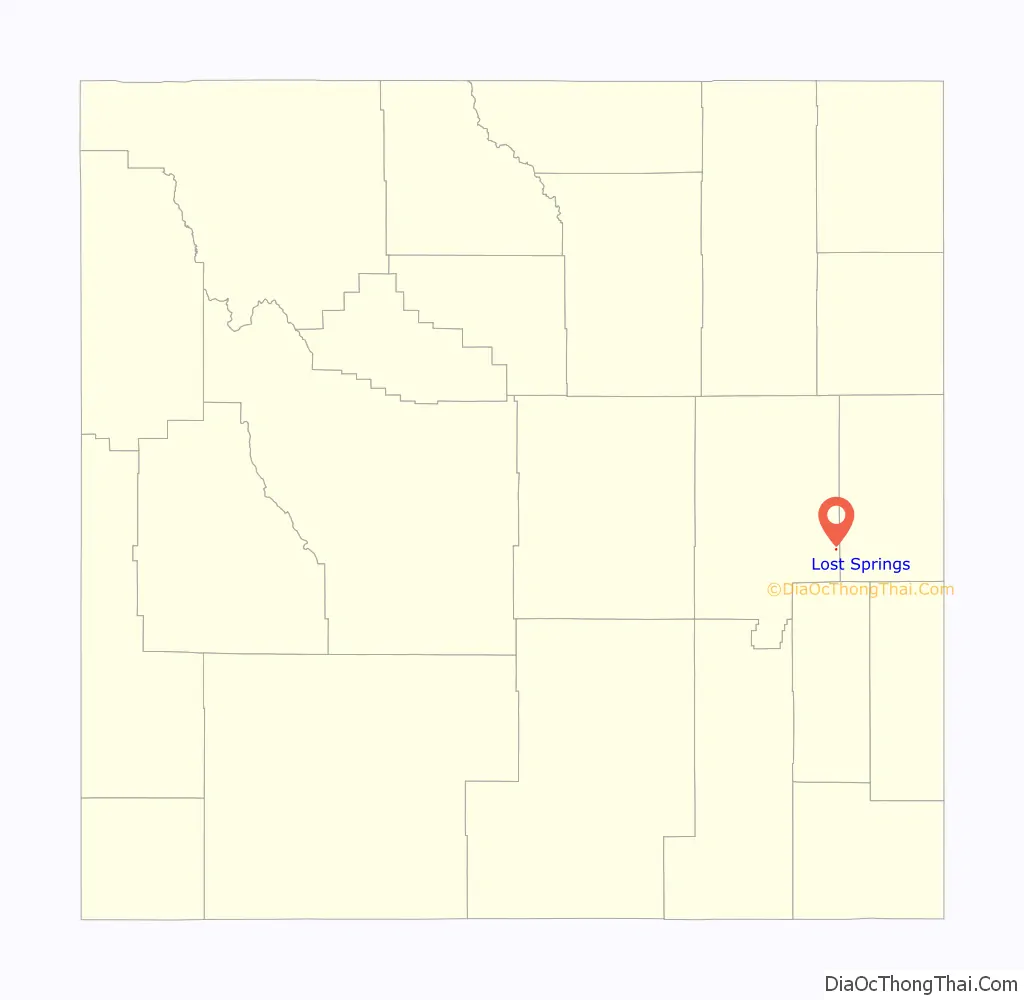
| State: | Wyoming |
| County: | Converse County |
| Elevation: | 4,997 ft (1,523 m) |
| Total Area: | 0.09 sq mi (0.23 km²) |
| Land Area: | 0.09 sq mi (0.23 km²) |
| Water Area: | 0.00 sq mi (0.00 km²) |
| Total Population: | 6 |
| Population Density: | 44.44/sq mi (17.18/km²) |
| ZIP code: | 82224 |
| Area code: | 307 |
| FIPS code: | 5647805 |
| GNISfeature ID: | 1597388 |
Online Interactive Map
Click on ![]() to view map in "full screen" mode.
to view map in "full screen" mode.
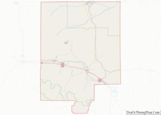
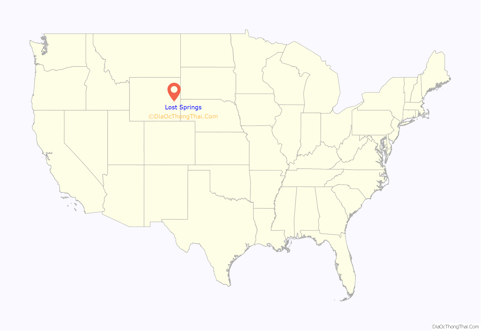
Lost Springs location map. Where is Lost Springs town?
History
Lost Springs was first inhabited in the 1880s, when it received its name from railroad workers who could not find the springs shown on survey maps of the area. The town was incorporated in 1911, and it originally had 200 residents, most of whom worked at the nearby Rosin coal mine. After the coal mine closed around 1930, the population of Lost Springs steadily declined.
Edward John Sanmann of York, Nebraska, and his wife, Lauretta Mae (Rogers) of Bloomington, Nebraska, moved to Lost Springs in 1948 where they lived and worked in the general store and assisted with running the town’s post office. Sanmann was a member of the American Sunday School Union and Bible Class at Shawnee. The couple had a daughter who died in infancy, Virginia Arlene, and an adopted daughter, Louise Marie. Sanmann and his wife died 17 days apart in September 1967.
By 1960, the population of the town had dropped to five. In 1976, both the state of Wyoming and the U.S. Bicentennial Commission designated Lost Springs as the smallest incorporated town in America; its population was then eleven.
In 1983, Lost Springs became involved in a court battle with the Chicago and North Western Transportation Company. The railroad, which ran adjacent to the town, attempted to seize 5.2 acres (2.1 ha) of land to build a 22-foot (6.7 m) railway embankment. Lost Springs Mayor Leda Price alleged that the embankment, which would lie between the town and U.S. Highways 18 and 20, would separate the town from traffic on the highway. A Wyoming district judge ruled in the town’s favor, and the railroad ultimately agreed to build an unobstructing track bed and use its own land for track.
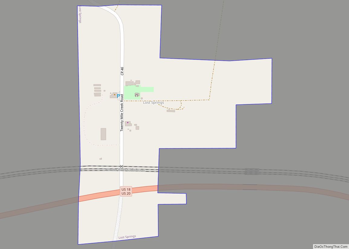
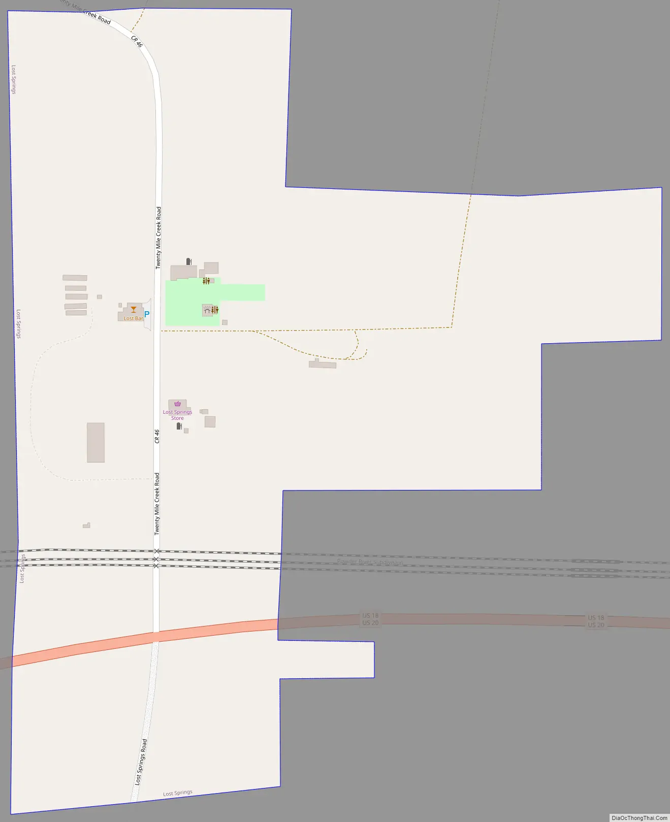
Lost Springs Road Map
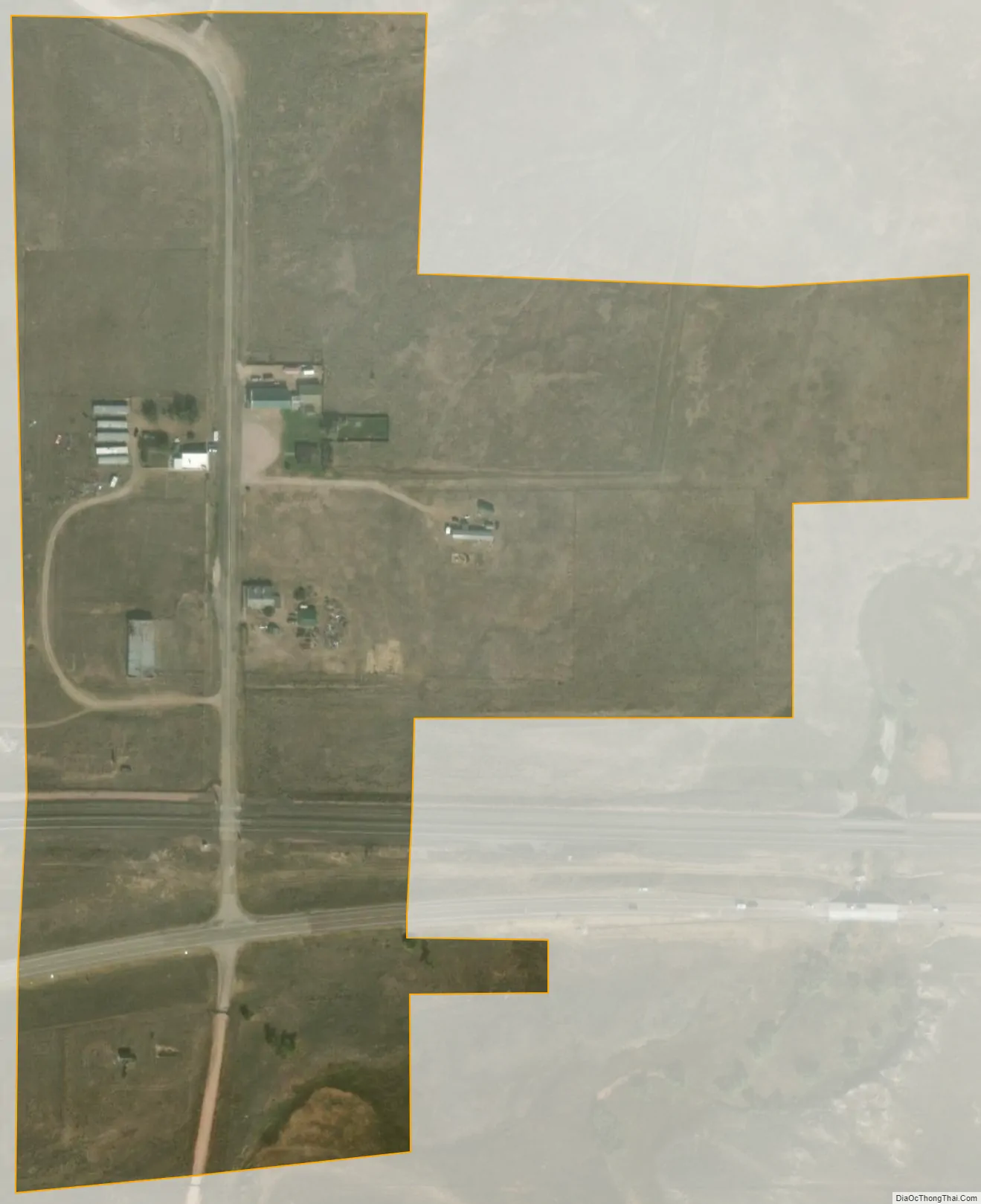
Lost Springs city Satellite Map
Geography
Lost Springs is located on the High Plains. According to the United States Census Bureau, the town has a total area of 0.09 square miles (0.23 km), all land.
Climate
Lost Springs has a semi-arid climate under the Köppen Climate Classification. The town experiences cold, dry winters and warm, slightly wet summers.
See also
Map of Wyoming State and its subdivision: Map of other states:- Alabama
- Alaska
- Arizona
- Arkansas
- California
- Colorado
- Connecticut
- Delaware
- District of Columbia
- Florida
- Georgia
- Hawaii
- Idaho
- Illinois
- Indiana
- Iowa
- Kansas
- Kentucky
- Louisiana
- Maine
- Maryland
- Massachusetts
- Michigan
- Minnesota
- Mississippi
- Missouri
- Montana
- Nebraska
- Nevada
- New Hampshire
- New Jersey
- New Mexico
- New York
- North Carolina
- North Dakota
- Ohio
- Oklahoma
- Oregon
- Pennsylvania
- Rhode Island
- South Carolina
- South Dakota
- Tennessee
- Texas
- Utah
- Vermont
- Virginia
- Washington
- West Virginia
- Wisconsin
- Wyoming