Orin is a hamlet and the locus of a same-named census-designated place (CDP) in Converse County, Wyoming, United States. The population was 46 at the 2010 census.
| Name: | Orin CDP |
|---|---|
| LSAD Code: | 57 |
| LSAD Description: | CDP (suffix) |
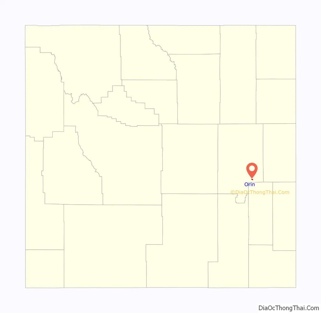
| State: | Wyoming |
| County: | Converse County |
| Elevation: | 4,705 ft (1,434 m) |
| Total Area: | 1.1 sq mi (2.9 km²) |
| Land Area: | 1.0 sq mi (2.6 km²) |
| Water Area: | 0.1 sq mi (.3 km²) |
| Total Population: | 46 |
| Population Density: | 41/sq mi (16/km²) |
| Area code: | 307 |
| FIPS code: | 5658100 |
| GNISfeature ID: | 1592478 |
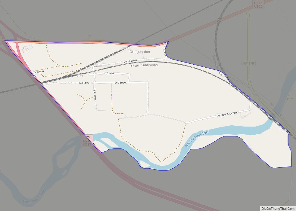
Online Interactive Map
Click on ![]() to view map in "full screen" mode.
to view map in "full screen" mode.
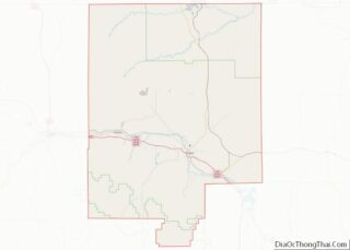
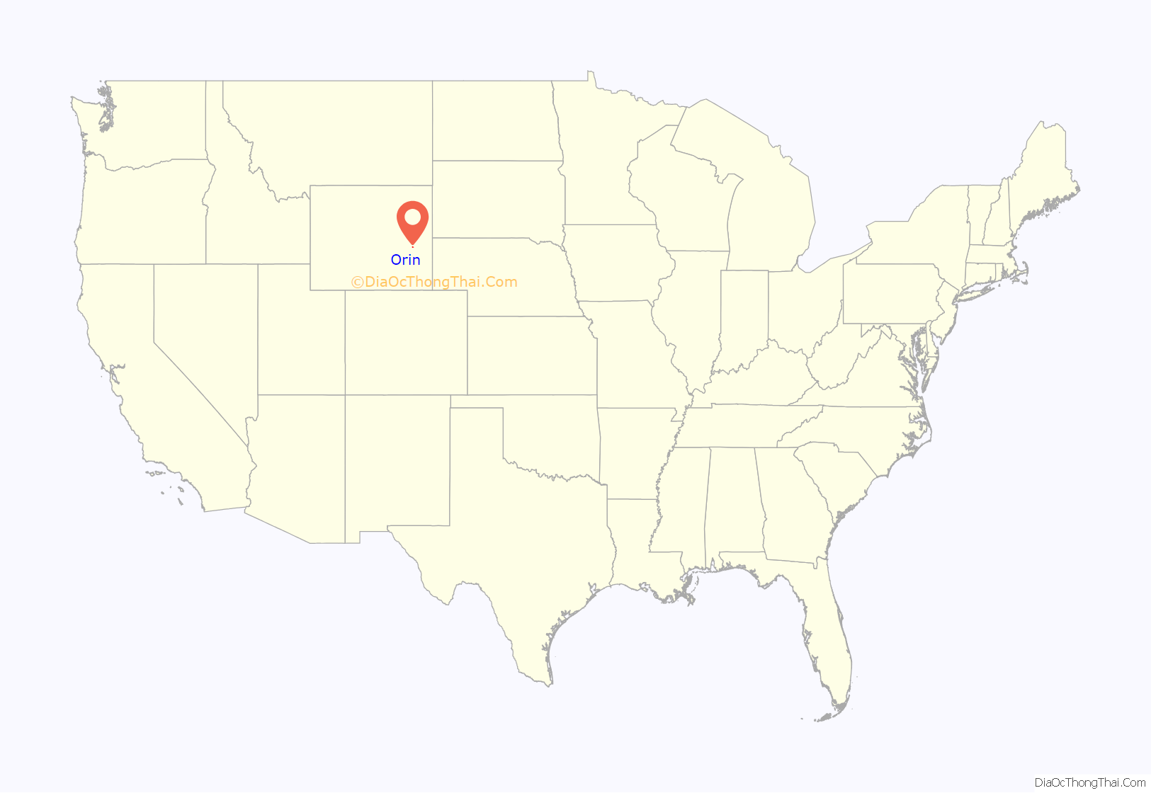
Orin location map. Where is Orin CDP?
History
The community was named for Orin Hughitt, the uncle of a railroad official. A post office was established at the Orin Junction in 1891. The name was changed to Orin in 1895, and the post office closed in about 1962.
Orin was the final place outlaw Doc Middleton owned and operated a saloon, before dying in the local jail in 1913.
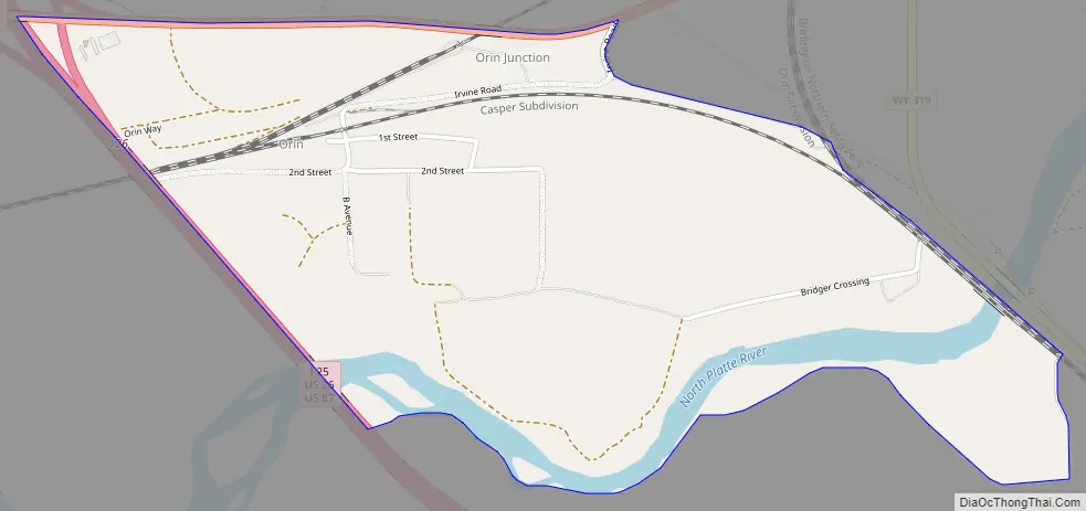
Orin Road Map
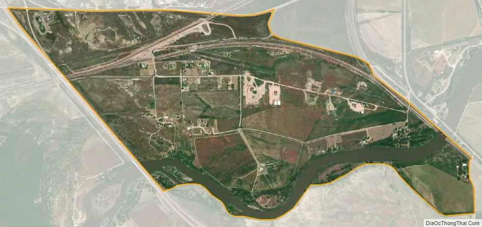
Orin city Satellite Map
Geography
The community is located at the intersection of Interstate 25/U.S. Route 26/U.S. Route 87 and U.S. Route 18/U.S. Route 20. Orin is approximately 10 miles (16 km) southeast of Douglas. A BNSF Railway line runs through the community.
According to the United States Census Bureau, the CDP has a total area of 1.1 square miles (2.9 km), with 1.0 square mile (2.6 km) is land and 0.1 square mile (0.26 km) (9.1%) is water.
See also
Map of Wyoming State and its subdivision: Map of other states:- Alabama
- Alaska
- Arizona
- Arkansas
- California
- Colorado
- Connecticut
- Delaware
- District of Columbia
- Florida
- Georgia
- Hawaii
- Idaho
- Illinois
- Indiana
- Iowa
- Kansas
- Kentucky
- Louisiana
- Maine
- Maryland
- Massachusetts
- Michigan
- Minnesota
- Mississippi
- Missouri
- Montana
- Nebraska
- Nevada
- New Hampshire
- New Jersey
- New Mexico
- New York
- North Carolina
- North Dakota
- Ohio
- Oklahoma
- Oregon
- Pennsylvania
- Rhode Island
- South Carolina
- South Dakota
- Tennessee
- Texas
- Utah
- Vermont
- Virginia
- Washington
- West Virginia
- Wisconsin
- Wyoming