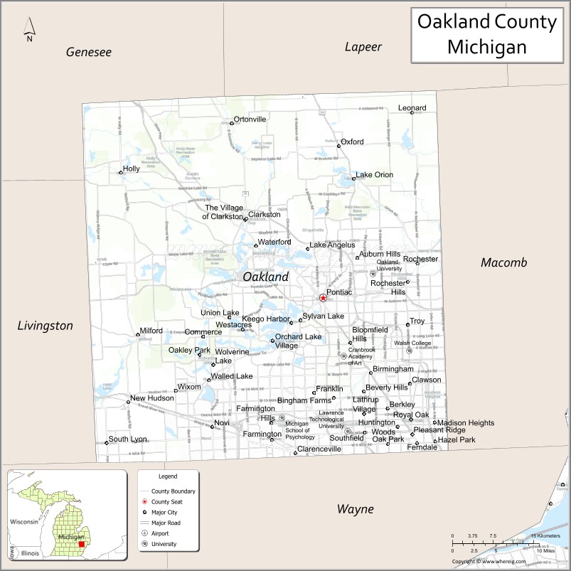
Oakland County is a county in the U.S. state of Michigan. It is part of the metropolitan Detroit area, located northwest of the city. As of the 2020 Census, its population was 1,274,395, making it the second-most populous county in Michigan, behind neighboring Wayne County. It is the largest county in the United States without a city of 100,000 residents. The county seat is Pontiac. The county was founded in 1819 and organized in 1820.
Oakland County is composed of 62 cities, townships, and villages, and is part of the Detroit–Warren–Dearborn, MI Metropolitan Statistical Area. The city of Detroit is in neighboring Wayne County, south of 8 Mile Road. In 2010, Oakland County was among the ten wealthiest counties in the United States to have over one million residents. It is also home to Oakland University, a large public institution that straddles the border between the cities of Auburn Hills and Rochester Hills.
In 1999, Oakland County started the organization Automation Alley, a nonprofit business association for technology and manufacturing businesses in Southeast Michigan. The organization has since expanded into a state-wide, Industry 4.0 knowledge center and home to the US Center for Advanced Manufacturing in partnership with the World Economic Forum.
Major employers include General Motors, Ford, and Chrysler, collectively known as the Big Three.
| Name: | Oakland County |
|---|---|
| FIPS code: | 26-125 |
| State: | Michigan |
| Largest city: | Troy |
| Total Area: | 907 sq mi (2,350 km²) |
| Land Area: | 868 sq mi (2,250 km²) |
| Total Population: | 1,274,395 |
| Time zone: | UTC−5 (Eastern Time Zone) |
| Summer Time Zone (DST): | UTC−4 (Eastern Daylight Time) |
| Website: | www.oakgov.com |
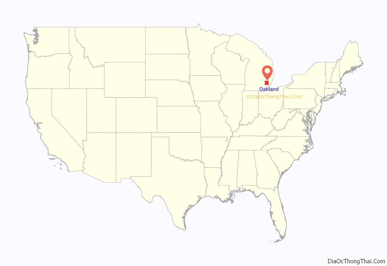
Oakland County location map. Where is Oakland County?
History
Founded by Territorial Governor Lewis Cass in 1819, sparsely settled Oakland was originally twice its current size. As was customary at the time, as populations increased, other counties were organized from its land area. Woodward Avenue and the Detroit and Pontiac Railroad helped draw settlers in the 1840s. By 1840, Oakland had more than fifty lumber mills, processing wood harvested from the region and the Upper Peninsula. Pontiac, located on the Clinton River, was Oakland’s first town and became the county seat. After the Civil War, Oakland was still primarily a rural, agricultural county with numerous isolated villages. By the end of the 19th century, three rail lines served Pontiac, and the city attracted carriage and wagon factories. In the late 1890s streetcars were constructed here and to Detroit.
At that time, developers made southern Oakland County a suburb of Detroit; a Cincinnati firm platted a section of Royal Oak called “Urbanrest.” Migration worked both ways. Several thousand people moved from Oakland County farms to Detroit as the city attracted factories. By 1910, a number of rich Detroiters had summer homes and some year-round residences in what became Bloomfield Hills. The auto age enveloped Pontiac in the early 1900s. The Oakland Motor Car Company was founded in 1907 and became a part of General Motors Corp., which was soon Pontiac’s dominant firm.
In the 1950s, Oakland County’s population boomed as the Detroiters began migrating to the suburbs. Oakland County was for a time the fourth-wealthiest county in the United States, though its position has declined somewhat since the Great Recession. The median price of a home in Oakland County increased to $164,697, more than $30,000 above the national median. Oakland County is home to several super-regional shopping malls such as Somerset Collection, Twelve Oaks Mall, and Great Lakes Crossing Outlets.
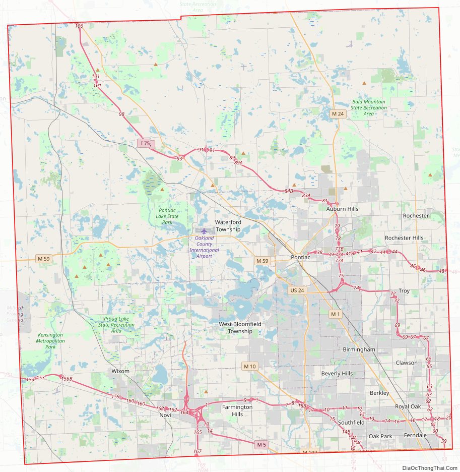
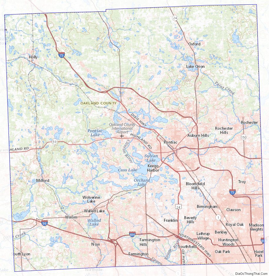
Oakland County Road Map
Geography
According to the U.S. Census Bureau, the county has a total area of 907 square miles (2,350 km), of which 868 square miles (2,250 km) is land and 40 square miles (100 km) (4.4%) is water.
Oakland County was originally divided into 25 separate townships, which are listed below. Each township is roughly equal in size at six miles (10 km) by six miles, for a total township area of 36 square miles (93 km). The roots of this design were born out of the Land Ordinance of 1785 and the subsequent Northwest Ordinance of 1787. Oakland County itself is a prime example of the land policy that was established, as all townships are equal in size (save for slight variations due to waterways). Section 16 in each township was reserved for financing and maintaining public education, and even today many schools in Oakland County townships are located within that section.
Wayne County, where the city of Detroit is located, borders Oakland County to the south. 8 Mile Road, also known as “Baseline Road” in some areas, is the boundary between these counties. The baseline was used during the original surveying for Michigan, and it serves as the northern/southern boundaries for counties from Lake St. Clair to Lake Michigan. As more working and middle-class populations moved to the suburbs from the 1950s on, this divide (8 Mile Road) became historically known as an unofficial racial dividing line between what became the predominantly black city and almost exclusively white suburbs.
Since the late 20th century, however, the patterns of de facto segregation have faded as the suburbs have become more diverse. Middle-class African Americans have left Detroit, settling in inner-ring suburbs, notably Southfield (where the population is 75% Black), west of Woodward Avenue. Based on the 2010 Census, the following cities also have significant non-white populations: Farmington (25.3%), Farmington Hills (31.7%), Novi (30.12%), Oak Park (62.61%), Lathrup Village (72.97%), Orchard Lake Village (16.08%), Rochester Hills (20.94%), Troy (29.4%), Wixom (26.28%), West Bloomfield (24.0%), Bloomfield (18.28%), Bloomfield Hills (14.2%), Ferndale (17.2%), and Madison Heights (17.7%). Ferndale has a concentration of Arab Americans, who also live in nearby areas, and numerous Asian Americans, particularly Indians, have also settled in these areas.
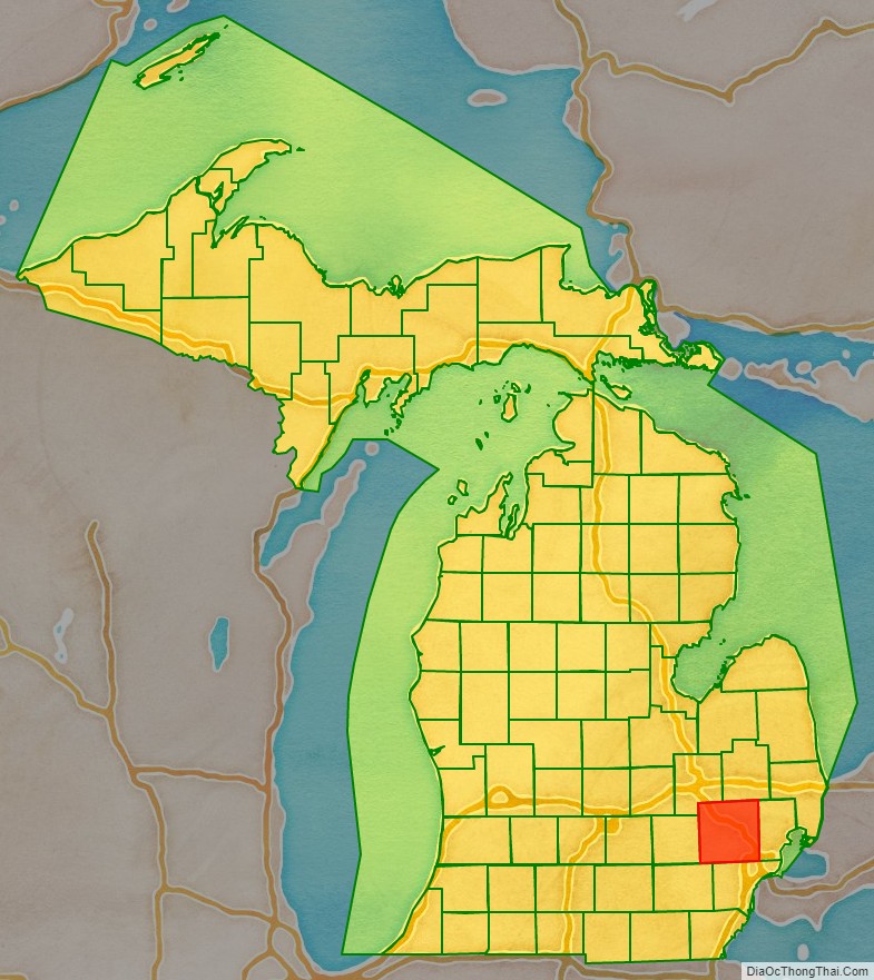
Adjacent counties
- Lapeer County (northeast)
- Genesee County (northwest)
- Macomb County (east)
- Wayne County (southeast)
- Washtenaw County (southwest)
- Livingston County (west)
Oakland County Topographic Map
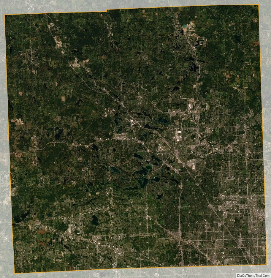
Oakland County Satellite Map
Oakland County Outline Map