Lapeer County (/ləpir/ lə-PEER) is a county located in the U.S. state of Michigan. As of the 2020 Census, the population was 88,619. The county seat is Lapeer. The county was created on September 18, 1822, and was fully organized on February 2, 1835. The name is a corruption of the French la pierre, which means “the stone”. Lapeer County is located north of Detroit and east of Flint.
| Name: | Lapeer County |
|---|---|
| FIPS code: | 26-087 |
| State: | Michigan |
| Founded: | 1822 |
| Seat: | Lapeer |
| Largest city: | Lapeer |
| Total Area: | 663 sq mi (1,720 km²) |
| Land Area: | 643 sq mi (1,670 km²) |
| Total Population: | 88,619 |
| Population Density: | 137/sq mi (53/km²) |
| Time zone: | UTC−5 (Eastern) |
| Summer Time Zone (DST): | UTC−4 (EDT) |
| Website: | lapeercountyweb.org |
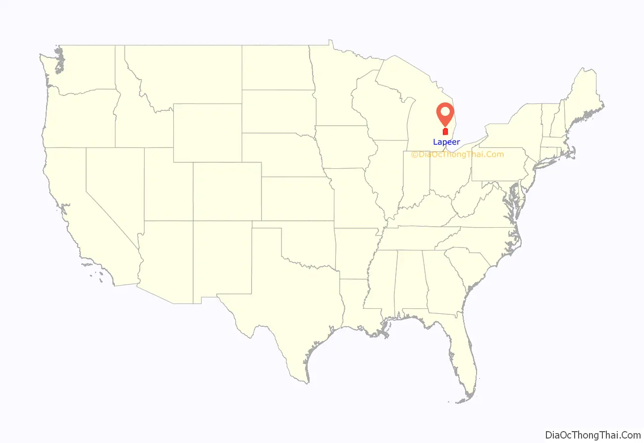
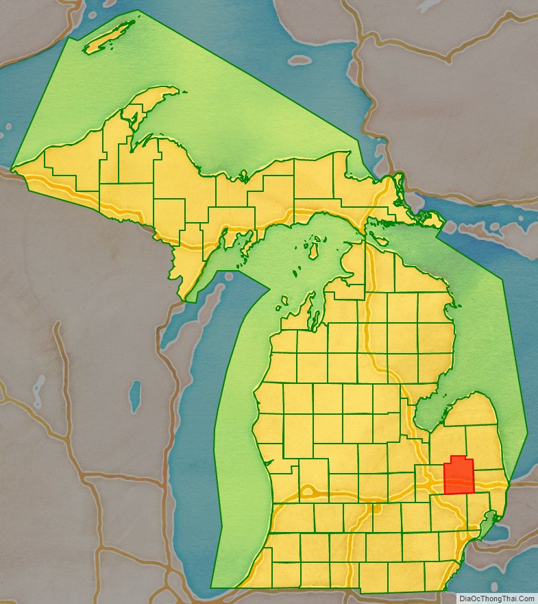
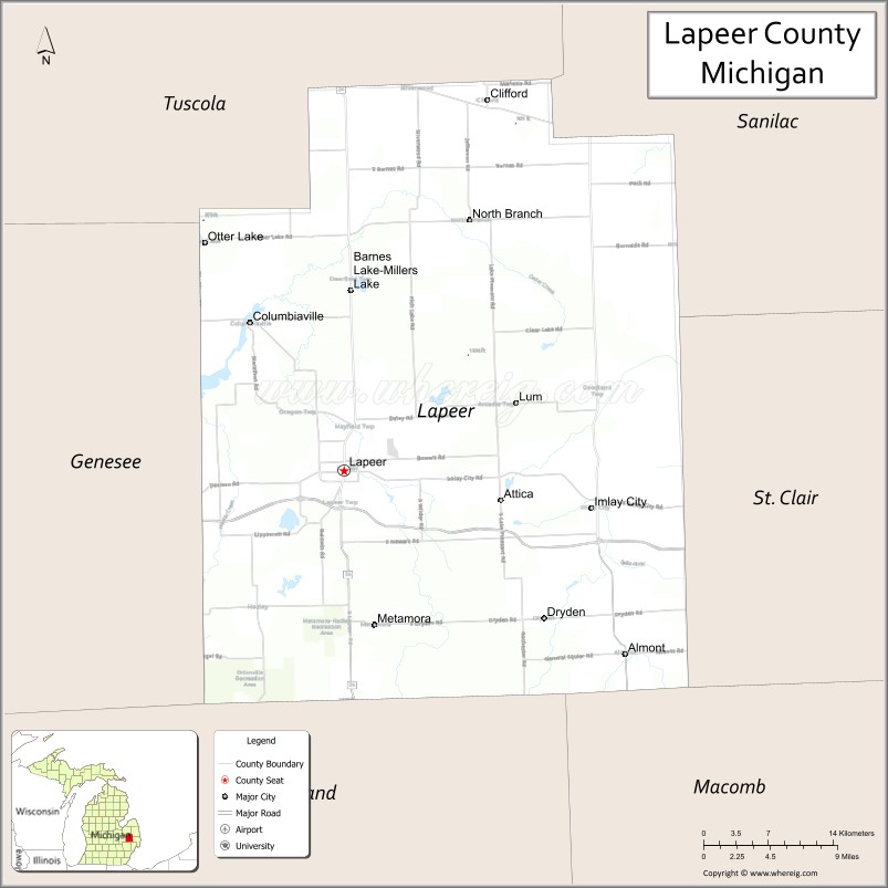
Lapeer County location map. Where is Lapeer County?
History
Lapeer County was part of New France from 1534. As New France gained in population, this area was considered part of the Pays d’en Haut (upper countries) dependency of the Colony of Canada, from its formation as a department of New France in 1712. In 1763 England took possession of all French territory in North America east of the Mississippi River after winning the Seven Years’ War. It renamed the colony and its dependencies as the Province of Quebec. France and England had controlled trading with First Nations in this area by establishing forts as a place for gathering and trading, and to settle disputes and enforce laws. They used the ancient overland and waterborne trade routes of the First Nations, while providing superior tools and weapons in exchange for valuable furs.
Following the American Revolution, Great Britain ceded portions of the Province of Quebec to the newly independent United States of America. By an ordinance of the Congress of the United States passed on July 13, 1787, under the Articles of Confederation, the whole of the territory of the United States lying northwest of the Ohio River and east of the Mississippi River, though still occupied by the British, was organized as the Northwest Territory. The area that is now Lapeer County used to be a part of the County of Wayne, named in the honor of General Anthony Wayne. This original Wayne County was created on August 11, 1796; very large, it included all of the lower peninsula of Michigan, parts of Northern Ohio and Indiana, and also portions of Wisconsin and Illinois. As population increased in the area, new counties were organized in this territory.
What is now Lapeer County, on May 7, 1800, was considered part of the Territory of Indiana, which included all of the lower peninsula of Michigan. After Ohio and Indiana became states, the Territory of Michigan was formed. In 1807 local Indian tribes: the Ottawa, Ojibwa (Chippewa), Wyandot and Potawatomi, ceded the land of Southeast Michigan to the United States in the Treaty of Detroit. They had been under pressure for some time, especially as they had been allied with the British in the Revolutionary War. They were encouraged to move west out of the area, but some remained in Michigan.
In January 1820, the County of Oakland was formed. On September 18, 1822, Governor Lewis Cass set Lapeer County’s boundaries, although it remained a part of Oakland County until it was organized. Lapeer County officially became a county on February 2, 1835. The first recorded elections for county officers, with 520 people voting, occurred in 1837.
The first European-American settler in Lapeer was Alvin N. Hart, who was born in Cornwall, Connecticut on February 11, 1804. He came to Lapeer in 1831 and platted the Village of Lapeer on November 8, 1833. The plat was registered in Pontiac, December 14, 1833, in Oakland County’s Associate Judge Bagley’s court. Alvin Hart became a state senator in 1843, representing Lapeer, Oakland, Genesee, Shiawassee, Tuscola, Saginaw counties and the entire Upper Peninsula. He was instrumental in having the state capital moved from Detroit to Lansing.
On March 9, 1843, a column of townships was removed from westernmost Lapeer County and annexed to Genesee County. From north to south, the townships were Forest, Richfield, Davison and Atlas.
Lumber was the principal industry of the Lapeer County area from the 1830s until 1870. Lumber was in demand with development throughout the Midwest. In addition there was the expectation that clearing much of the county’s forests would attract farmers as settlers. Lapeer’s economy shifted to become primarily agriculturally based.
On October 26, 2010, Lapeer became a founding member of the Karegnondi Water Authority.
Historical markers
Fifteen historical markers have been installed throughout Lapeer County commemorating sites and structures of interest:
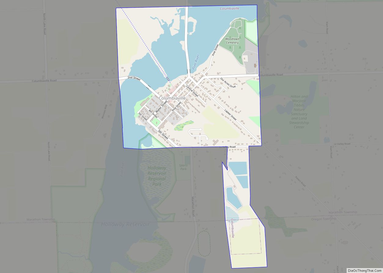
- Columbiaville Depot
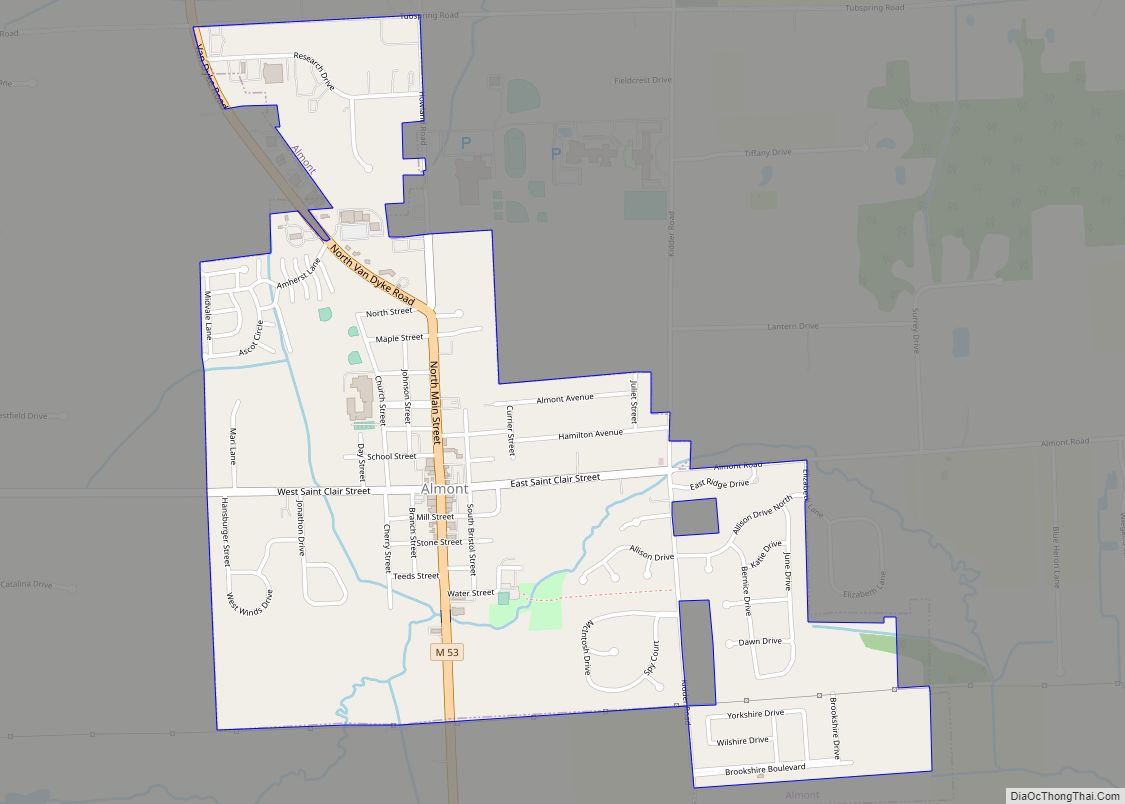
- Currier House (Almont)
- Dryden Depot
- General Squier Memorial Park (Dryden Township)
- Grand Trunk Western Railroad Depot / Imlay City
- Grettenberger Field (Imlay City)
- Henry Stephens Memorial Library (Almont)
- Ladies Library Hall (Dryden)
- Lapeer County (at Lapeer County Courthouse)
- Lapeer Public Library
- Pioneer Bank (North Branch)
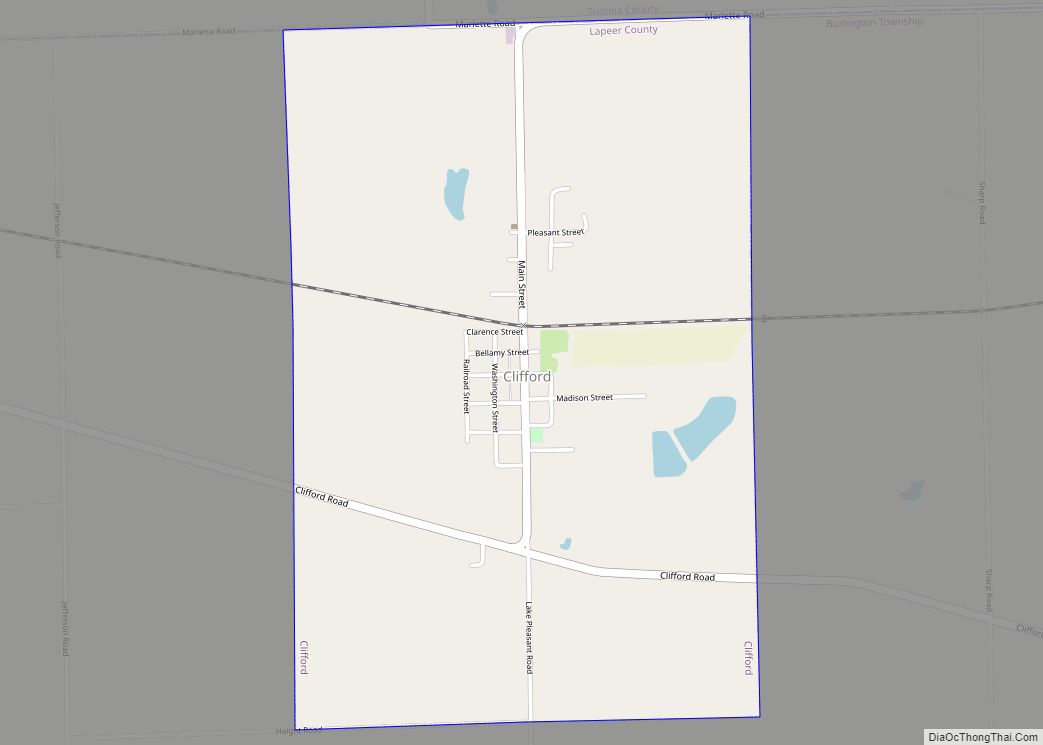
- St. Patrick’s Church (Clifford)
- Tuttle House (Lapeer)
- United Methodist Church (Columbiaville)
- William Peter Mansion (Columbiaville)
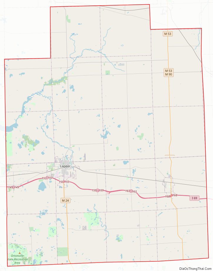
Lapeer County Road Map
Geography
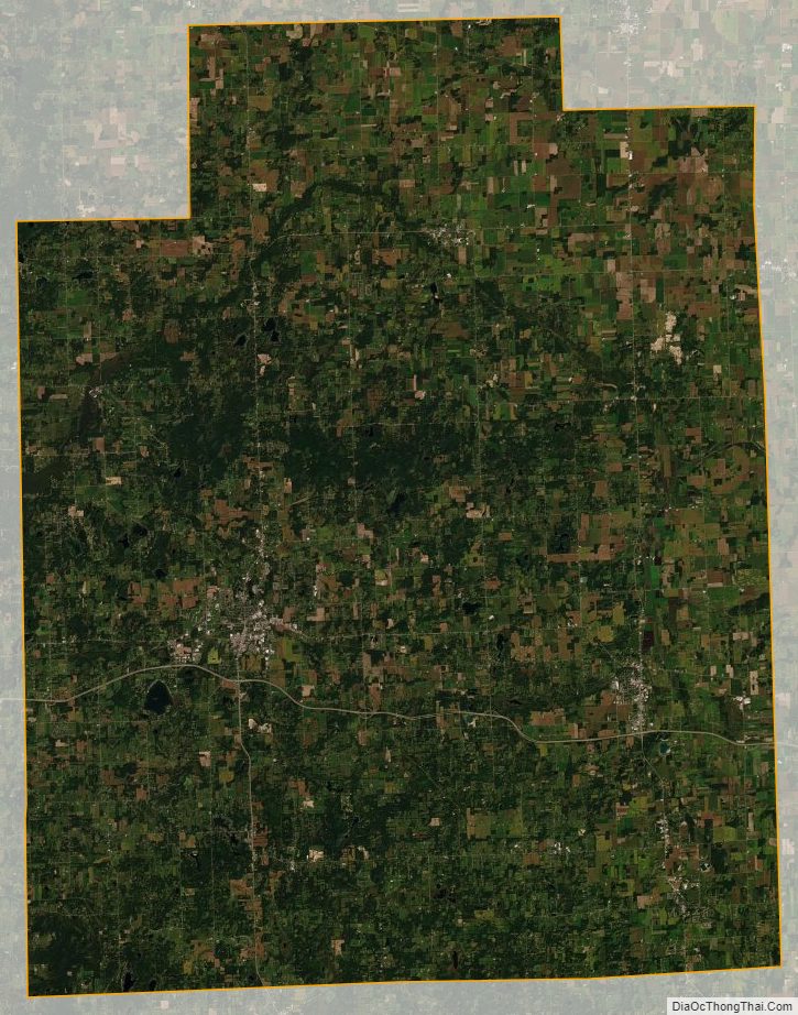
According to the U.S. Census Bureau, the county has a total area of 663 square miles (1,720 km), of which 643 square miles (1,670 km) is land and 20 square miles (52 km) (3.0%) is water. Lapeer County’s geography is very similar to Oakland County, except Lapeer County is more rural. Lapeer is one of the five counties that form the peninsula projecting into Lake Huron known as The Thumb, which in turn is a sub-region of Mid Michigan.
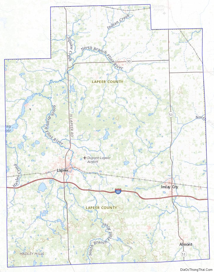
The headwaters of the Flint River are in Columbiaville. It flows through the county toward Genesee. The City of Lapeer straddles it course.
Major highways
- I-69 runs east and west through the county
- M-24 runs north and south through the western part of the county, including the city of Lapeer
- M-53 runs north and south through the eastern part of the county, including Imlay City
- M-90 runs east and west through the county, including the city of North Branch
Adjacent counties
- Sanilac County (northeast)
- Tuscola County (northwest)
- St. Clair County (east)
- Genesee County (west)
- Macomb County (southeast)
- Oakland County (southwest)
Lapeer County Topographic Map
Lapeer County Satellite Map
Lapeer County Outline Map