Rochester Hills is a city in Oakland County in the U.S. state of Michigan. As of the 2020 census, the city had a total population of 76,300. It is the 14th-largest city in Michigan.
The area was first occupied by settlers of European descent in 1817, and organized as Avon Township in 1835. The City of Rochester incorporated in 1967, while the remaining area of Avon Township was incorporated and renamed the City of Rochester Hills in 1984. Considered a northern suburb of Metro Detroit, Rochester Hills is about 12 miles (19.3 km) north of Detroit.
| Name: | Rochester Hills city |
|---|---|
| LSAD Code: | 25 |
| LSAD Description: | city (suffix) |
| State: | Michigan |
| County: | Oakland County |
| Incorporated: | 1984 (City of Rochester Hills) |
| Elevation: | 820 ft (250 m) |
| Land Area: | 32.80 sq mi (84.96 km²) |
| Water Area: | 0.10 sq mi (0.25 km²) |
| Population Density: | 2,325.94/sq mi (898.06/km²) |
| Area code: | 248 and 947 |
| FIPS code: | 2669035 |
| GNISfeature ID: | 1675440 |
Online Interactive Map
Click on ![]() to view map in "full screen" mode.
to view map in "full screen" mode.
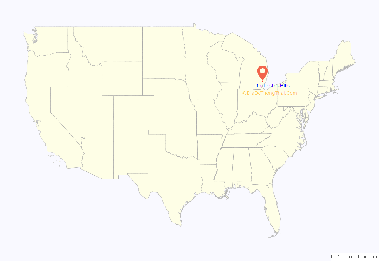
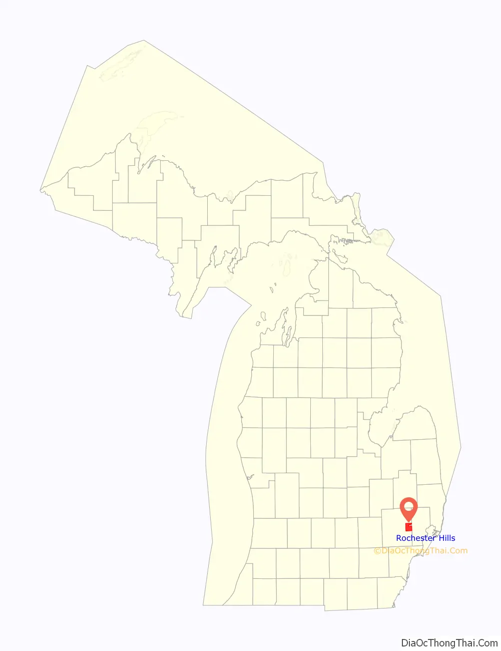
Rochester Hills location map. Where is Rochester Hills city?
History
Prior to European settlement, the area now known as Rochester Hills was inhabited by Native Americans, namely the Potawatomi. The Potawatomi depended on the area’s abundant water sources, such as the Clinton River and Paint Creek, to grow crops, fish, and travel. They resided here until the 1807 Treaty of Detroit caused them, along with the Odawa, Wyandot, and Ojibwe peoples, to cede their land in Southeast Michigan.
The first European settler was James Graham who arrived in 1817. Graham and his family reached the area by following trails created by the Sauk Native Americans. Avon Township was organized in 1835. Rochester incorporated as a village within the township in 1869. The township adopted a charter in 1948 under the Home Rule Act. Also in 1948 a post office was established under the name of Brooklands for the area between Auburn Road and Hamlin Road just to the west of Dequindre Road.
In 1966, village residents voted to become the City of Rochester, effective in February 1967. As a result, Rochester residents no longer had to pay property taxes to the township, as it was now a separate municipality.
In 1967, Avon Township filed a petition to become a city. In January 1968, township voters approved the petition to move forward with seeking city status. Three proposed city charters were voted down by residents, the first in March 1969, the second in May 1970, and the third in September 1971. The city of Rochester then sought to annex all of the township, which was unanimously denied by the Michigan Boundary Commission. In 1972, petitions were filed to consolidate Avon Township and Rochester. In April 1974, the consolidation petition lost by 350 votes in the township, while passing by four votes in Rochester. In May 1974, Rochester’s petition to annex 2.2 square miles (5.7 km) of Avon Township was approved by the Michigan Boundary Commission, depriving Avon Township of its largest taxpayer. The township became Avon Charter Township in August 1978. Court challenges to the 1974 annexation continued until November 1981, when the township was ordered to surrender the annexed property. An impending annexation request from the City of Troy, due south, for 300 acres of southeast Avon Township brought the cityhood question to a crisis.
In May 1984, township voters approved a city charter. On November 20, 1984, Avon Township became the City of Rochester Hills. The name of the new city was put to a vote, with the other choice being “Avon Hills.” The name “Rochester Hills” won by a landslide with voters, based on the area’s historical ties to Rochester and the rolling hills in the area. Township Supervisor Earl E. Borden became the first mayor of Rochester Hills.
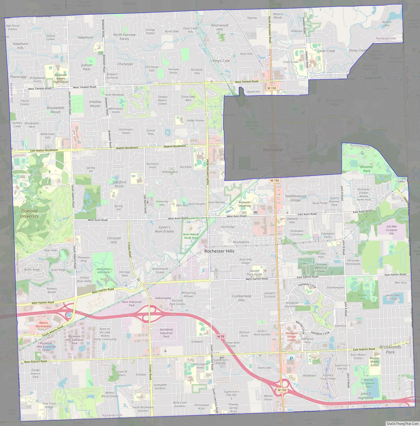
Rochester Hills Road Map
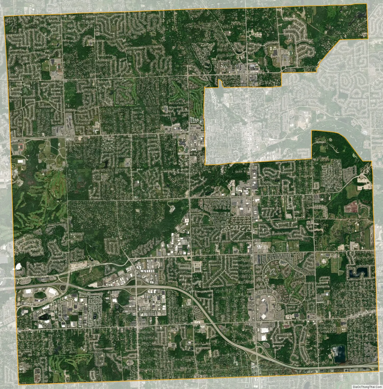
Rochester Hills city Satellite Map
Geography
According to the United States Census Bureau, the city has a total area of 32.91 square miles (85.24 km), of which 32.82 square miles (85.00 km) is land and 0.09 square miles (0.23 km) (0.27%) is water.
Rochester Hills is bordered to the north by Oakland Charter Township along Dutton Road, to the south by the city of Troy along South Boulevard, to the east by Shelby Township in Macomb County along Dequindre Road, and to the west by the city of Auburn Hills along part of Adams Road. Rochester Hills is also partially bordered by the city of Rochester to the east. Elevations in the city range from 690 feet (210 m) above sea level in the southeastern portion of the city to 1,032 feet (315 m) in the northwestern section.
See also
Map of Michigan State and its subdivision:- Alcona
- Alger
- Allegan
- Alpena
- Antrim
- Arenac
- Baraga
- Barry
- Bay
- Benzie
- Berrien
- Branch
- Calhoun
- Cass
- Charlevoix
- Cheboygan
- Chippewa
- Clare
- Clinton
- Crawford
- Delta
- Dickinson
- Eaton
- Emmet
- Genesee
- Gladwin
- Gogebic
- Grand Traverse
- Gratiot
- Hillsdale
- Houghton
- Huron
- Ingham
- Ionia
- Iosco
- Iron
- Isabella
- Jackson
- Kalamazoo
- Kalkaska
- Kent
- Keweenaw
- Lake
- Lake Hurron
- Lake Michigan
- Lake St. Clair
- Lake Superior
- Lapeer
- Leelanau
- Lenawee
- Livingston
- Luce
- Mackinac
- Macomb
- Manistee
- Marquette
- Mason
- Mecosta
- Menominee
- Midland
- Missaukee
- Monroe
- Montcalm
- Montmorency
- Muskegon
- Newaygo
- Oakland
- Oceana
- Ogemaw
- Ontonagon
- Osceola
- Oscoda
- Otsego
- Ottawa
- Presque Isle
- Roscommon
- Saginaw
- Saint Clair
- Saint Joseph
- Sanilac
- Schoolcraft
- Shiawassee
- Tuscola
- Van Buren
- Washtenaw
- Wayne
- Wexford
- Alabama
- Alaska
- Arizona
- Arkansas
- California
- Colorado
- Connecticut
- Delaware
- District of Columbia
- Florida
- Georgia
- Hawaii
- Idaho
- Illinois
- Indiana
- Iowa
- Kansas
- Kentucky
- Louisiana
- Maine
- Maryland
- Massachusetts
- Michigan
- Minnesota
- Mississippi
- Missouri
- Montana
- Nebraska
- Nevada
- New Hampshire
- New Jersey
- New Mexico
- New York
- North Carolina
- North Dakota
- Ohio
- Oklahoma
- Oregon
- Pennsylvania
- Rhode Island
- South Carolina
- South Dakota
- Tennessee
- Texas
- Utah
- Vermont
- Virginia
- Washington
- West Virginia
- Wisconsin
- Wyoming


