Oak Park is a city in Oakland County in the U.S. state of Michigan. As of the 2020 census, the population of Oak Park was 29,560. As a northern suburb of Metro Detroit, Oak Park shares its southern border with the city of Detroit.
| Name: | Oak Park city |
|---|---|
| LSAD Code: | 25 |
| LSAD Description: | city (suffix) |
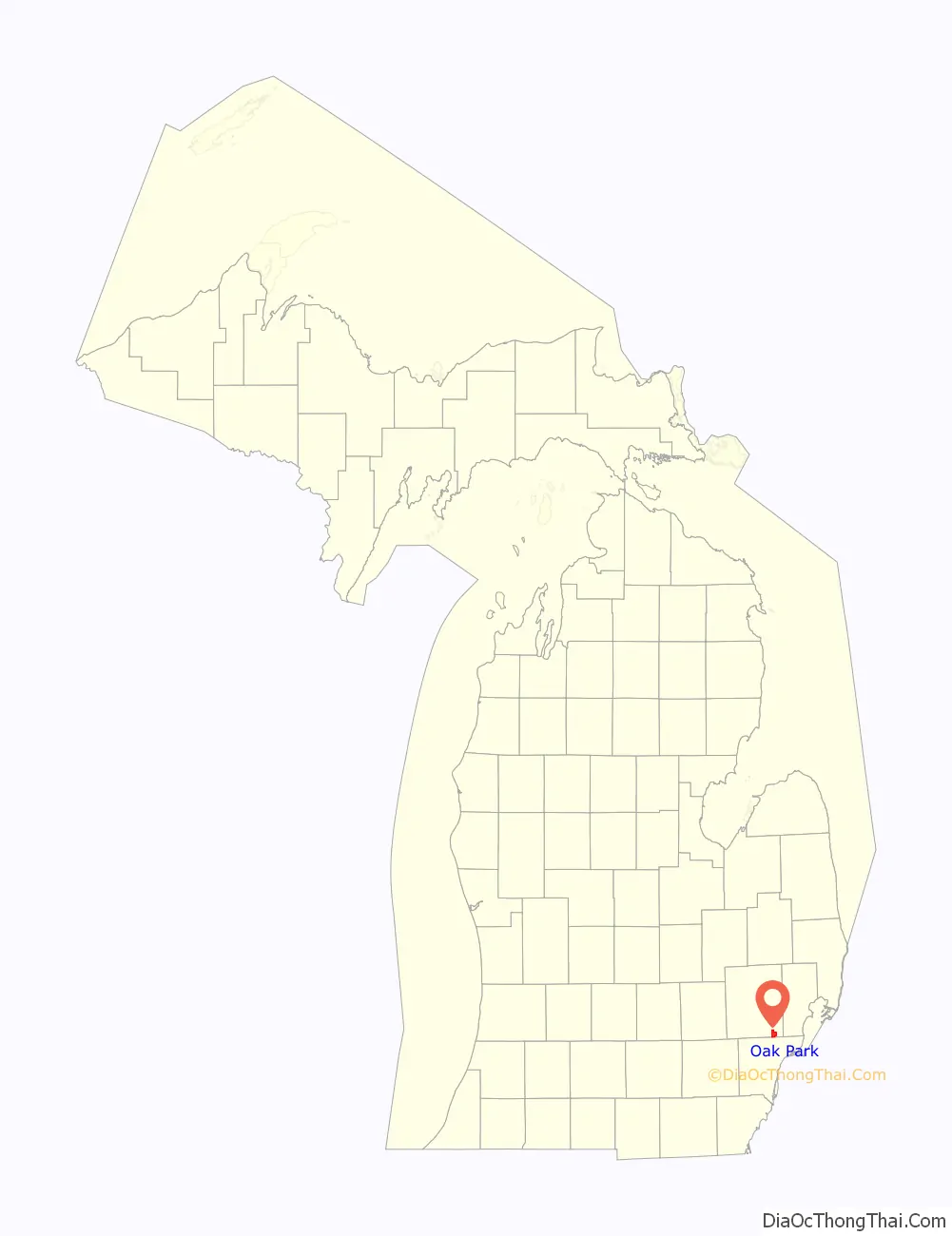
| State: | Michigan |
| County: | Oakland County |
| Incorporated: | 1927 (village) 1945 (city) |
| Elevation: | 666 ft (203 m) |
| Land Area: | 5.15 sq mi (13.33 km²) |
| Water Area: | 0.00 sq mi (0.00 km²) |
| Population Density: | 5,743.15/sq mi (2,217.52/km²) |
| Area code: | 248 and 313 |
| FIPS code: | 2659920 |
| GNISfeature ID: | 0633849 |
Online Interactive Map
Click on ![]() to view map in "full screen" mode.
to view map in "full screen" mode.
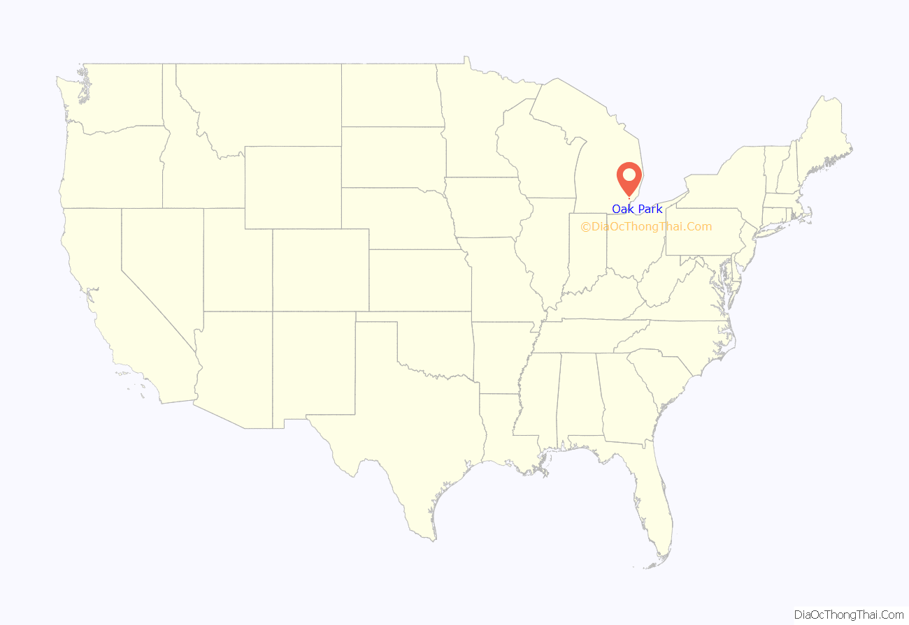
Oak Park location map. Where is Oak Park city?
History
This area was designated as within Royal Oak Township; it was first settled by European Americans in 1840, but remained sparsely populated for many decades following. The first major housing development was constructed in 1914 at the time of World War I, when the township sold land to the Majestic Land Company to be developed as the Oak Park subdivision. The subdivision was incorporated as a village on May 3, 1927. Two petition drives during the Great Depression to dissolve the village government and return it to the township, citing “excessively high cost of village government,” failed in 1931 and 1933. The village incorporated as a city on October 29, 1945, following the end of World War II.
Stimulated by the GI Bill which aided veterans in buying new housing, highways to improve commuting, and planned developments in the late 1950s, Oak Park from 1950 to 1960 was named as “America’s Fastest Growing City”. Its population increased sevenfold, from 5,000 to more than 36,000. Much of its population was second- and third-generation children of European immigrants who had settled in Detroit in the early 20th century. These included many Jewish Americans, many of whom are of the Orthodox faith. Major civic improvements in this period included construction of an outdoor swimming pool and an ice rink in Major Park (now known as Shepherd Park, after former mayor David Shepherd, but long known informally as Oak Park Park).
In 1995, Detroit-based window manufacturer WeatherGard moved its headquarters to Oak Park.
In 2002 and 2004, the city annexed portions of neighboring Royal Oak Township to expand its land and tax base.
On November 8, 2011, the citizens of Oak Park elected a new mayor, Marian McClellan. She was the city’s first new mayor in 22 years, replacing the long-serving Jerry Naftaly.
In April 2015, the city approved the development of a new FedEx distribution center which will be located on a 60-acre plot of land at the site of the former Detroit Artillery Armory. The facility opened on March 31, 2017.
On May 5, 2015, the citizens of Oak Park voted to allow mixed drinks to be sold at businesses within city limits, in addition to beer and wine, which were previously allowed.
On November 3, 2015, the citizens of Oak Park re-elected McClellan, who was running against Aaron Tobin.
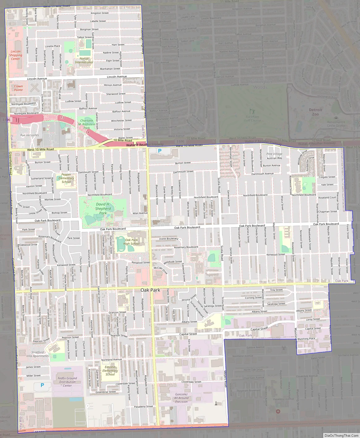
Oak Park Road Map
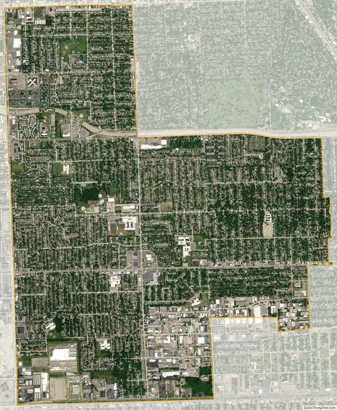
Oak Park city Satellite Map
Geography
According to the United States Census Bureau, the city has a total area of 5.16 square miles (13.36 km), all of it land.
Oak Park is adjacent to the cities of Detroit to the south, Southfield to the west, Pleasant Ridge, Ferndale, and Royal Oak Township to the east, Huntington Woods to the northeast, and Berkley to the north.
Oak Park is bordered to the south by 8 Mile Road (M-102), to the north by 11 Mile Road, to the Northeast by Coolidge Highway and 10 Mile Road/I-696, to the west by Greenfield Road, to the east by Sherman Street and Forest Street, and to the southeast by 9 Mile Road, Republic Street, Northend Avenue, and Meyers Avenue.
See also
Map of Michigan State and its subdivision:- Alcona
- Alger
- Allegan
- Alpena
- Antrim
- Arenac
- Baraga
- Barry
- Bay
- Benzie
- Berrien
- Branch
- Calhoun
- Cass
- Charlevoix
- Cheboygan
- Chippewa
- Clare
- Clinton
- Crawford
- Delta
- Dickinson
- Eaton
- Emmet
- Genesee
- Gladwin
- Gogebic
- Grand Traverse
- Gratiot
- Hillsdale
- Houghton
- Huron
- Ingham
- Ionia
- Iosco
- Iron
- Isabella
- Jackson
- Kalamazoo
- Kalkaska
- Kent
- Keweenaw
- Lake
- Lake Hurron
- Lake Michigan
- Lake St. Clair
- Lake Superior
- Lapeer
- Leelanau
- Lenawee
- Livingston
- Luce
- Mackinac
- Macomb
- Manistee
- Marquette
- Mason
- Mecosta
- Menominee
- Midland
- Missaukee
- Monroe
- Montcalm
- Montmorency
- Muskegon
- Newaygo
- Oakland
- Oceana
- Ogemaw
- Ontonagon
- Osceola
- Oscoda
- Otsego
- Ottawa
- Presque Isle
- Roscommon
- Saginaw
- Saint Clair
- Saint Joseph
- Sanilac
- Schoolcraft
- Shiawassee
- Tuscola
- Van Buren
- Washtenaw
- Wayne
- Wexford
- Alabama
- Alaska
- Arizona
- Arkansas
- California
- Colorado
- Connecticut
- Delaware
- District of Columbia
- Florida
- Georgia
- Hawaii
- Idaho
- Illinois
- Indiana
- Iowa
- Kansas
- Kentucky
- Louisiana
- Maine
- Maryland
- Massachusetts
- Michigan
- Minnesota
- Mississippi
- Missouri
- Montana
- Nebraska
- Nevada
- New Hampshire
- New Jersey
- New Mexico
- New York
- North Carolina
- North Dakota
- Ohio
- Oklahoma
- Oregon
- Pennsylvania
- Rhode Island
- South Carolina
- South Dakota
- Tennessee
- Texas
- Utah
- Vermont
- Virginia
- Washington
- West Virginia
- Wisconsin
- Wyoming


