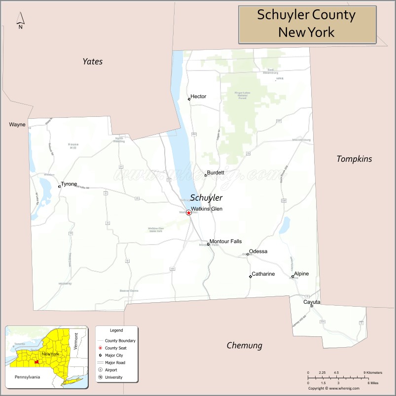
Schuyler County is a county in the U.S. state of New York. As of the 2020 census, the population was 17,898, making it the second-least populous county in New York. The county seat is the village of Watkins Glen. The name is in honor of General Philip Schuyler, one of the four major generals in the Continental Army in the American Revolutionary War.
| Name: | Schuyler County |
|---|---|
| FIPS code: | 36-097 |
| State: | New York |
| Founded: | 1854 |
| Named for: | Philip Schuyler |
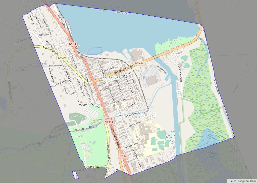
| Seat: | Watkins Glen |
| Total Area: | 342 sq mi (890 km²) |
| Land Area: | 328 sq mi (850 km²) |
| Total Population: | 17,898 |
| Population Density: | 54.5/sq mi (21.0/km²) |
| Time zone: | UTC−5 (Eastern) |
| Summer Time Zone (DST): | UTC−4 (EDT) |
| Website: | www.schuylercounty.us |
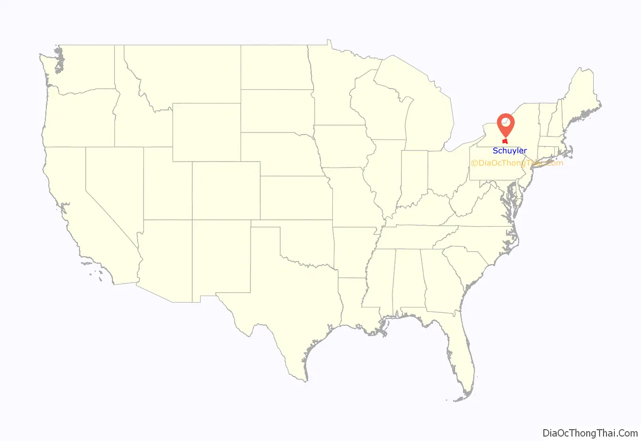
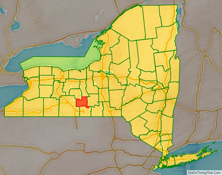
Schuyler County location map. Where is Schuyler County?
History
When counties were established in New York State in 1683, the present Schuyler County was part of Albany County. This was an enormous county, including the northern part of New York State as well as all of the present State of Vermont and, in theory, extending westward to the Pacific Ocean. This county was reduced in size on July 3, 1766, by the creation of Cumberland County, and further on March 16, 1770, by the creation of Gloucester County, both containing territory now in Vermont.
On March 12, 1772, what was left of Albany County was split into three parts, one remaining under the name Albany County. One of the other pieces, Tryon County, contained the western portion (and thus, since no western boundary was specified, theoretically still extended west to the Pacific). Tryon County’s eastern boundary was approximately five miles west of the present city of Schenectady, and the county included the western part of the Adirondack Mountains and the area west of the West Branch of the Delaware River. The area then designated as Tryon County now includes 37 counties of New York State. The county was named for William Tryon, colonial governor of New York.
In the years prior to 1776, most of the Loyalists in Tryon County fled to Canada. In 1784, following the peace treaty that ended the American Revolutionary War, Tryon County’s name was changed to Montgomery County in honor of the general, Richard Montgomery, who had captured several places in Canada and died attempting to capture the city of Quebec, replacing the name of the hated British governor.
In 1789, Ontario County was split off from Montgomery. The actual area split off from Montgomery County was much larger than the present county, also including the present Allegany, Cattaraugus, Chautauqua, Erie, Genesee, Livingston, Monroe, Niagara, Orleans, Steuben, Wyoming, Yates, and part of Schuyler and Wayne counties.
Herkimer and Tioga counties were two of three counties split off from Montgomery County (the other being Otsego County) in 1791.
In 1794, Onondaga County was formed by the splitting of Herkimer County. This county was larger than the present Onondaga County, however, including the present Cayuga, Seneca, and Tompkins counties.
On March 8, 1796, Steuben County was created, split off from Ontario County. It was larger than the present county, however.
In 1798, Chemung County was formed from Tioga County, but the county at that time was rather larger than the present county, containing a portion of what would later become Schuyler County.
In 1799, Cayuga County was formed by the splitting of Onondaga County. This county was, however, much larger than the present Cayuga County. It then included the present Seneca and Tompkins counties, as well as part of what would become Schuyler County.
In 1804, Seneca County was formed by the splitting of Cayuga County. Then in 1817, in turn, a portion of Seneca County was combined with a piece of the remainder of Cayuga County to form Tompkins County.
In 1823, Steuben County was reduced in size by the combination of a portion of the county with a portion of Ontario County to form Yates County.
On April 17, 1854, portions of Steuben, Chemung and Tompkins counties were combined to form Schuyler County.
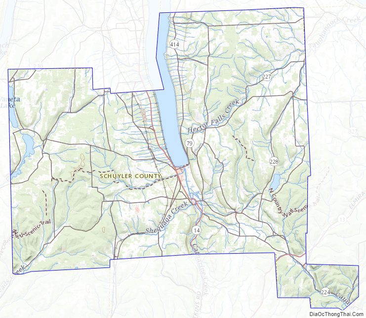
Schuyler County Road Map
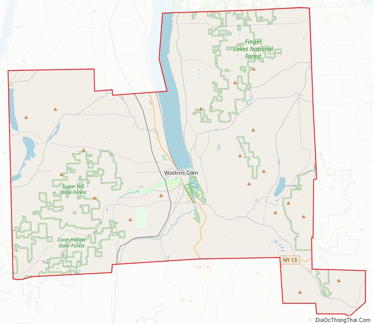
Geography
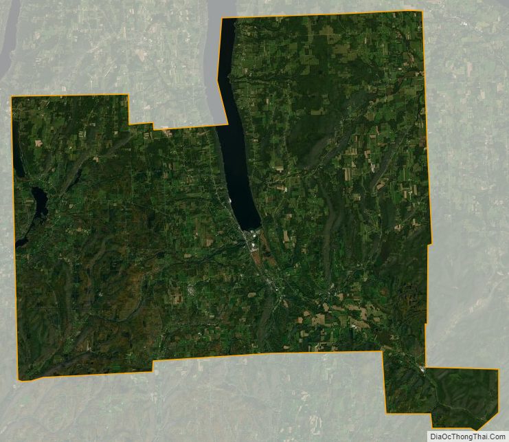
According to the U.S. Census Bureau, the county has a total area of 342 square miles (890 km), of which 328 square miles (850 km) is land and 14 square miles (36 km) (4.1%) is water.
Schuyler County is in the western part of New York State, west of Ithaca at the southern end of Seneca Lake.
The Finger Lakes National Forest is in the north part of the county.
Adjacent counties
- Seneca County – north
- Tompkins County – east
- Chemung County – south
- Steuben County – west
- Yates County – northwest
Major highways
- New York State Route 14
- New York State Route 79
- New York State Route 224
- New York State Route 226
- New York State Route 414
National protected area
- Finger Lakes National Forest (part)
Schuyler County Topographic Map
Schuyler County Satellite Map
Schuyler County Outline Map