Chester is a town in Middlesex County, Connecticut, United States. The town is part of the Lower Connecticut River Valley Planning Region. The population was 3,749 at the 2020 census. The town center is defined by the U.S. Census Bureau as a census-designated place (CDP). The name is a transfer from Chester, in England.
| Name: | Chester Center CDP |
|---|---|
| LSAD Code: | 57 |
| LSAD Description: | CDP (suffix) |
| State: | Connecticut |
| County: | Middlesex County |
| Incorporated: | 1836 |
| Elevation: | 377 ft (115 m) |
| Total Area: | 16.8 sq mi (43.5 km²) |
| Land Area: | 16.0 sq mi (41.5 km²) |
| Water Area: | 0.8 sq mi (2.1 km²) |
| Total Population: | 3,749 |
| Population Density: | 220/sq mi (86/km²) |
| ZIP code: | 06412 |
| Area code: | 860/959 |
| FIPS code: | 0914370 |
| GNISfeature ID: | 0213407 |
| Website: | www.chesterct.com |
Online Interactive Map
Click on ![]() to view map in "full screen" mode.
to view map in "full screen" mode.
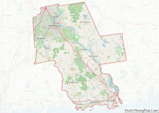
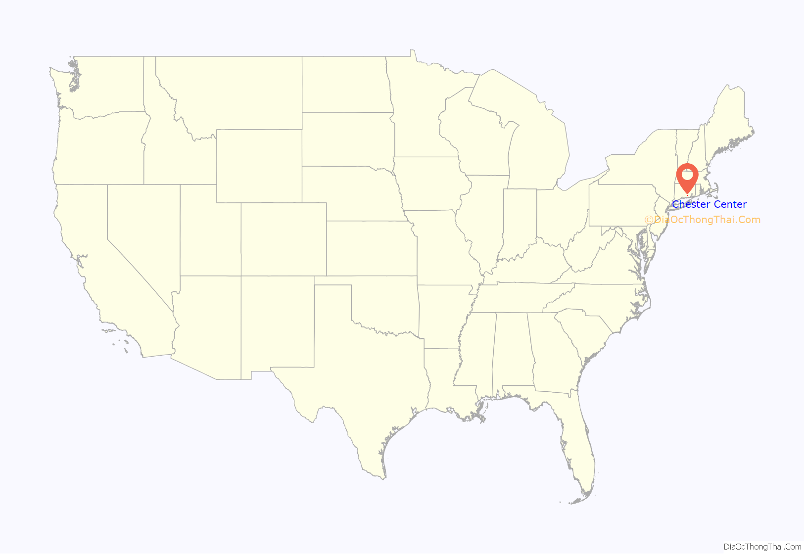
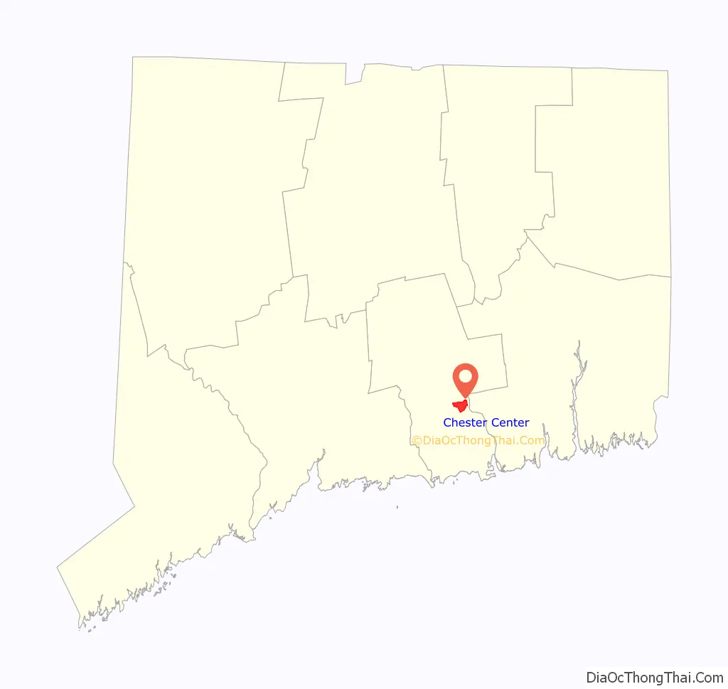
Chester Center location map. Where is Chester Center CDP?
History
The Wangunks, a river tribe of Native Americans, occupied the land called Pattaconk prior to English settlement of the area in 1692. The town was formed from the northern quarter of Saybrook and incorporated in 1836.
In 1769, Jonathan Warner was granted permission to operate a ferry across the Connecticut River that became the Chester-Hadlyme Ferry, the second-oldest continuously operating ferry service in Connecticut. Its location is currently a state historical landmark.
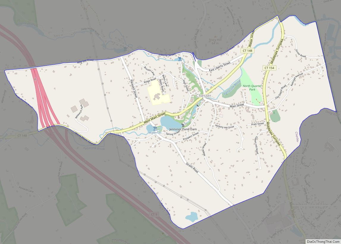
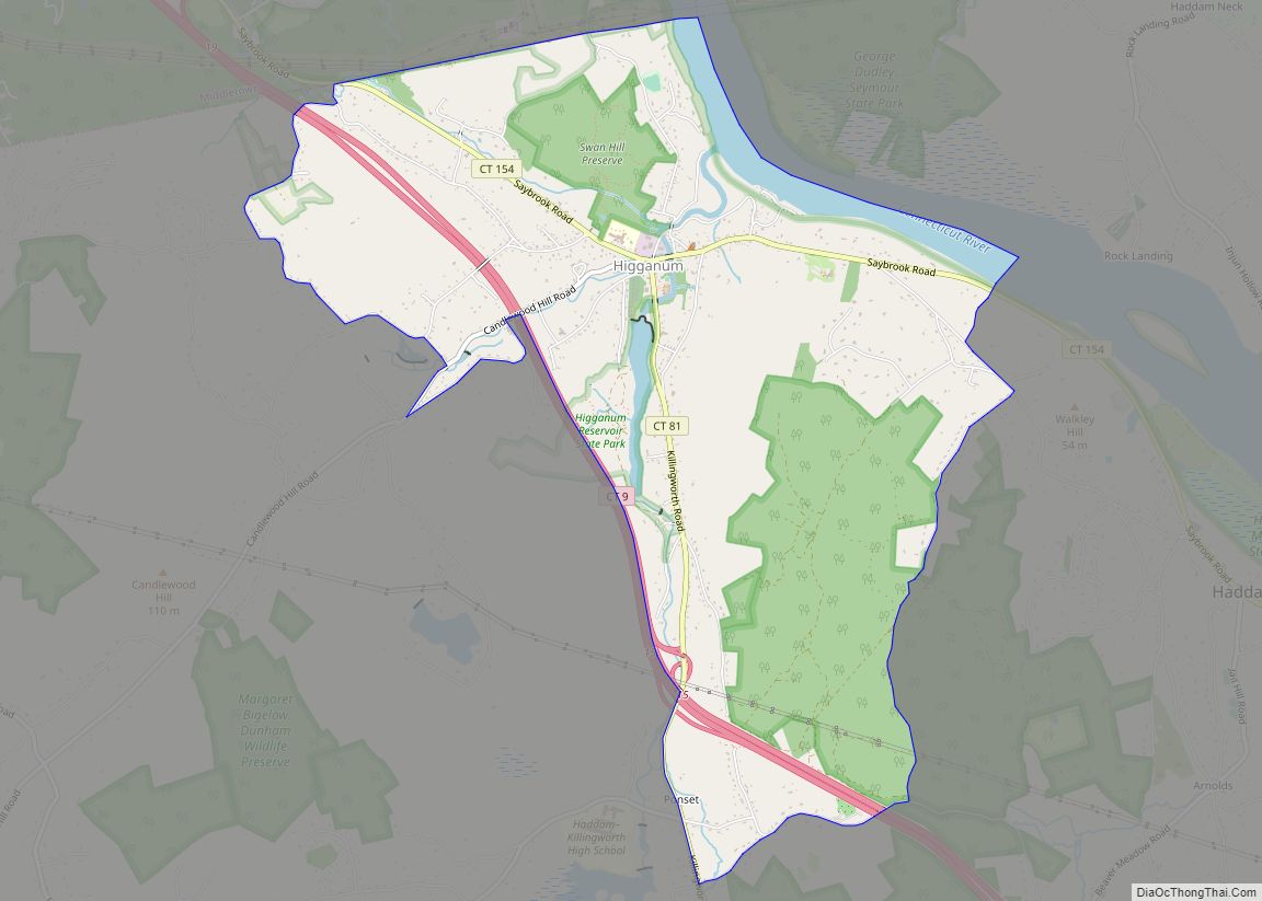
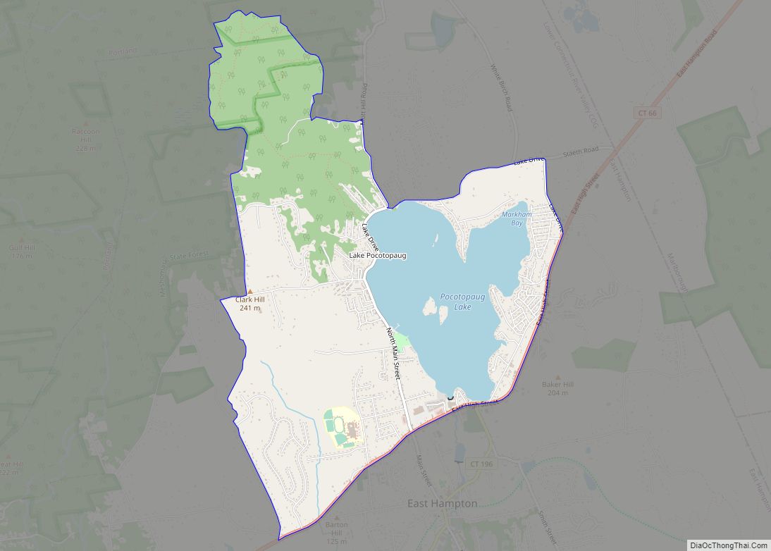
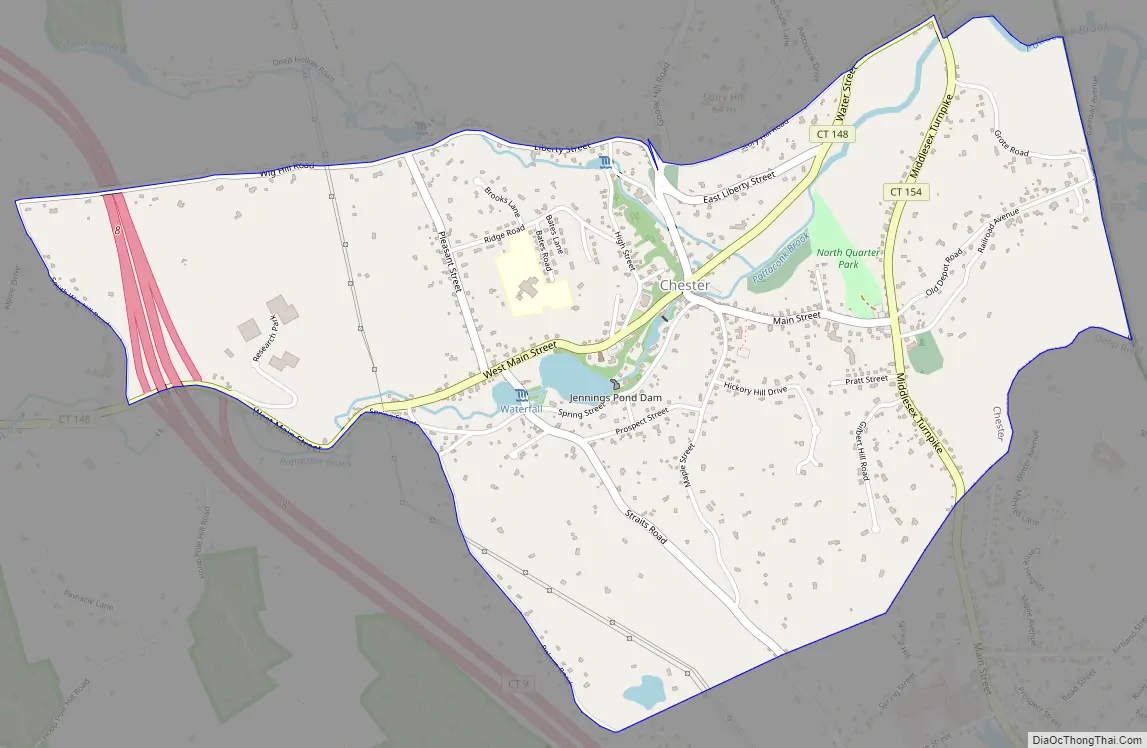
Chester Center Road Map
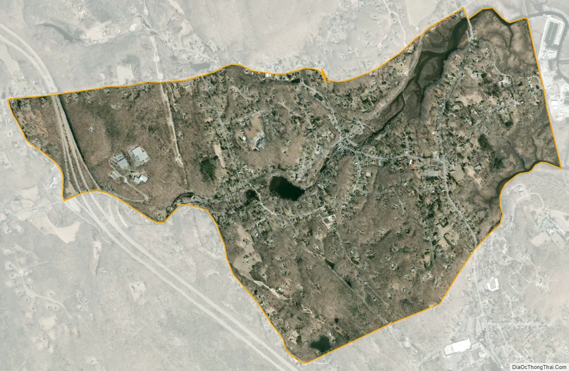
Chester Center city Satellite Map
Geography
According to the United States Census Bureau, the town has a total area of 16.8 square miles (44 km), of which, 16.0 square miles (41 km) is land and 0.8 square miles (2.1 km) (4.75%) is water. The CDP has a total area of 2.1 square miles (5.4 km) of which 1.46% is water.
See also
Map of Connecticut State and its subdivision: Map of other states:- Alabama
- Alaska
- Arizona
- Arkansas
- California
- Colorado
- Connecticut
- Delaware
- District of Columbia
- Florida
- Georgia
- Hawaii
- Idaho
- Illinois
- Indiana
- Iowa
- Kansas
- Kentucky
- Louisiana
- Maine
- Maryland
- Massachusetts
- Michigan
- Minnesota
- Mississippi
- Missouri
- Montana
- Nebraska
- Nevada
- New Hampshire
- New Jersey
- New Mexico
- New York
- North Carolina
- North Dakota
- Ohio
- Oklahoma
- Oregon
- Pennsylvania
- Rhode Island
- South Carolina
- South Dakota
- Tennessee
- Texas
- Utah
- Vermont
- Virginia
- Washington
- West Virginia
- Wisconsin
- Wyoming