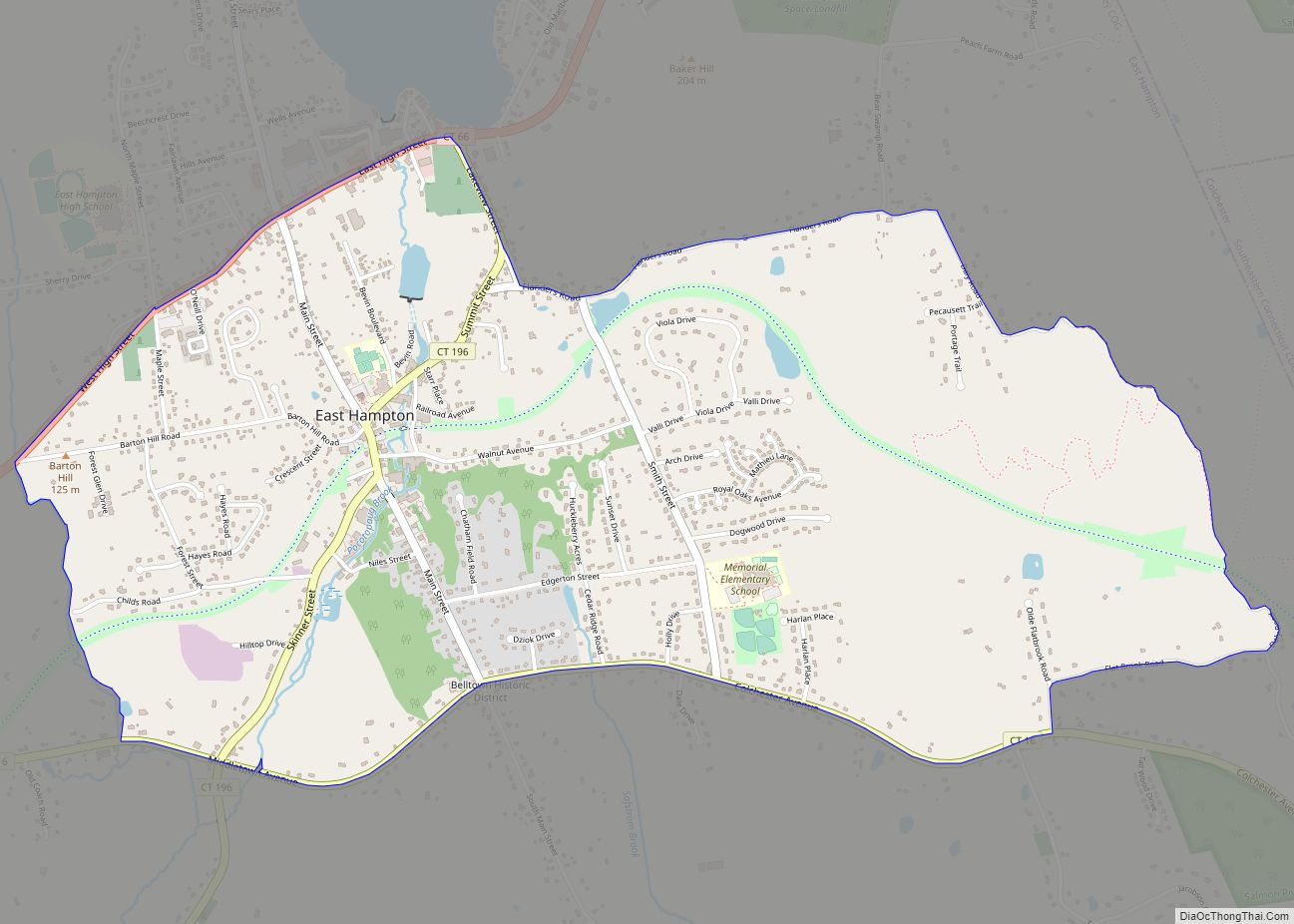
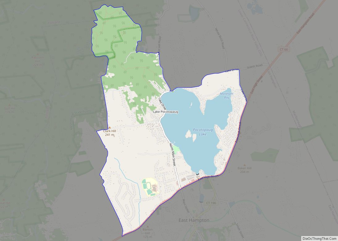
East Hampton is a census-designated place (CDP) comprising the primary village and adjacent residential and rural land in the town of East Hampton, Middlesex County, Connecticut, United States. It is in the central and eastern portions of the town, bordered to the north by the East Hampton community of Lake Pocotopaug and to the east by the town of Colchester in New London County and the town of Marlborough in Hartford County. As of the 2020 census, the East Hampton CDP had a population of 2,960, out of 12,717 in the entire town of East Hampton.
| Name: | East Hampton CDP |
|---|---|
| LSAD Code: | 57 |
| LSAD Description: | CDP (suffix) |
| State: | Connecticut |
| County: | Middlesex County |
| Elevation: | 121 m (398 ft) |
| Total Area: | 10.54 km² (4.07 sq mi) |
| Land Area: | 10.49 km² (4.05 sq mi) |
| Water Area: | 0.05 km² (0.02 sq mi) |
| Total Population: | 2,960 |
| Population Density: | 282.2/km² (731/sq mi) |
| ZIP code: | 06424 |
| Area code: | 860/959 |
| FIPS code: | 0922420 |
| GNISfeature ID: | 2377817 |
Online Interactive Map
Click on ![]() to view map in "full screen" mode.
to view map in "full screen" mode.
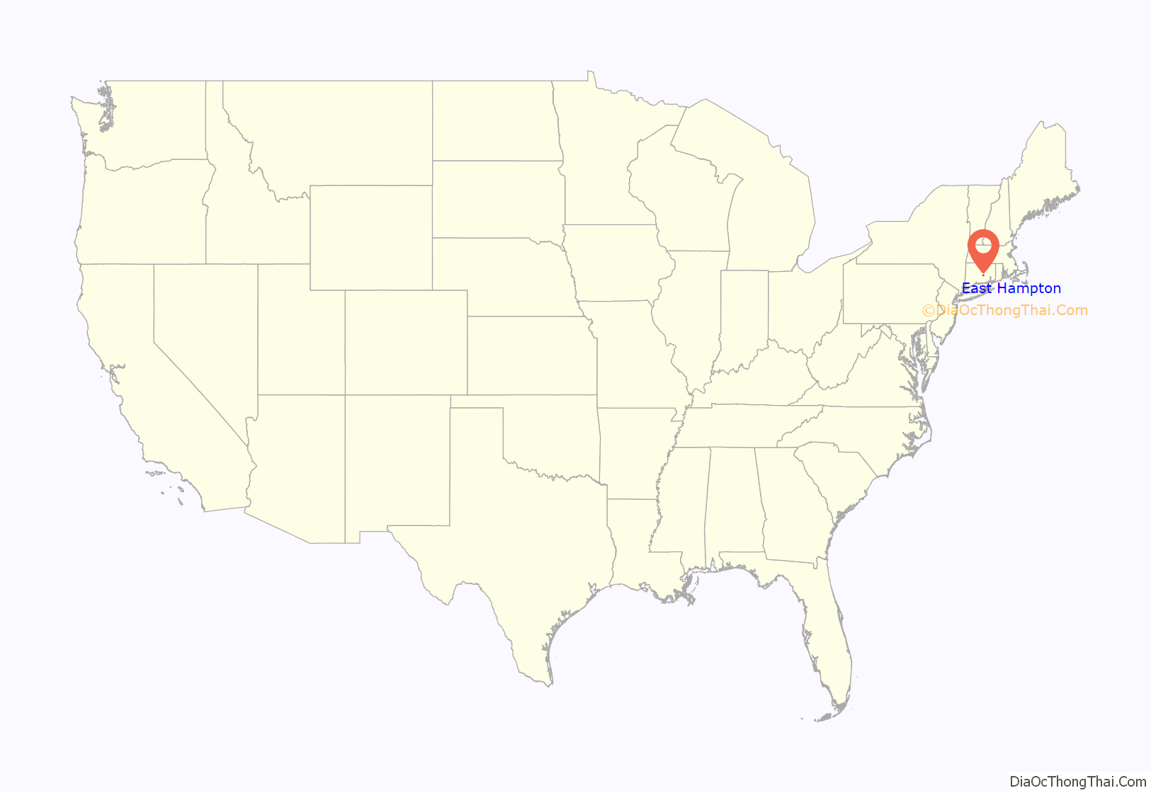
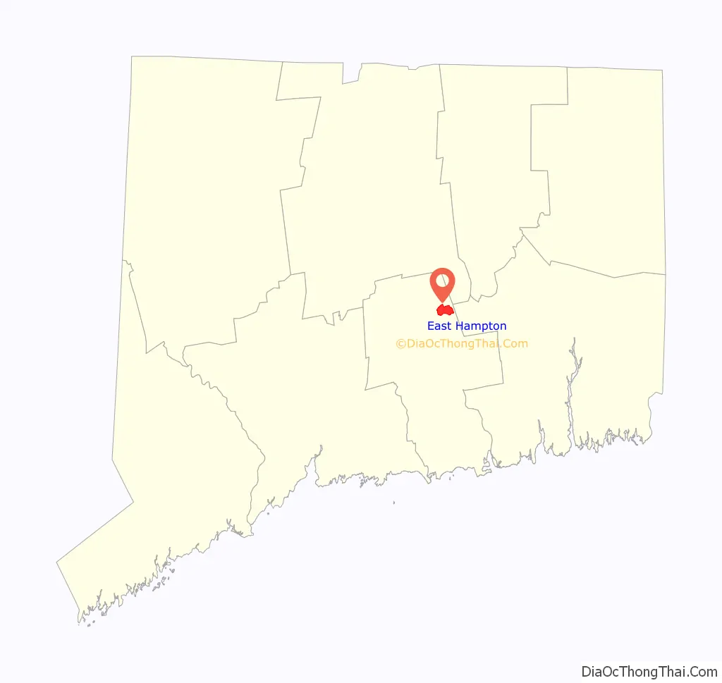
East Hampton location map. Where is East Hampton CDP?
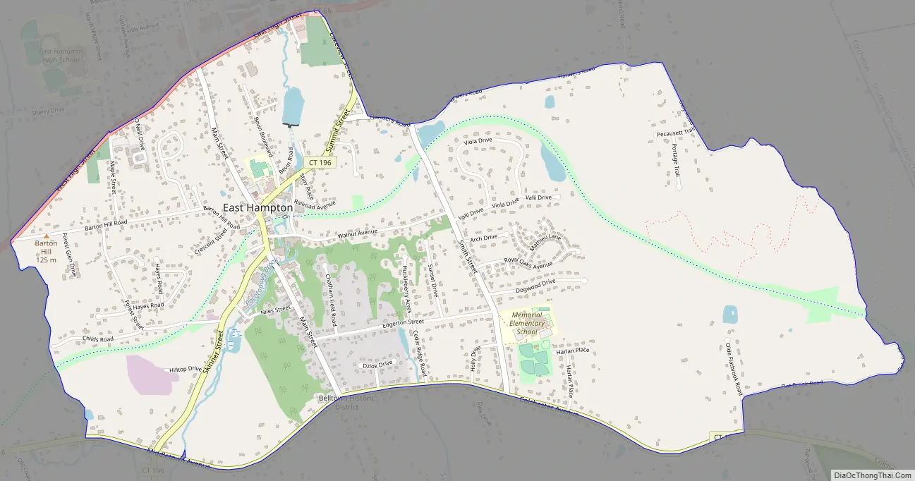
East Hampton Road Map
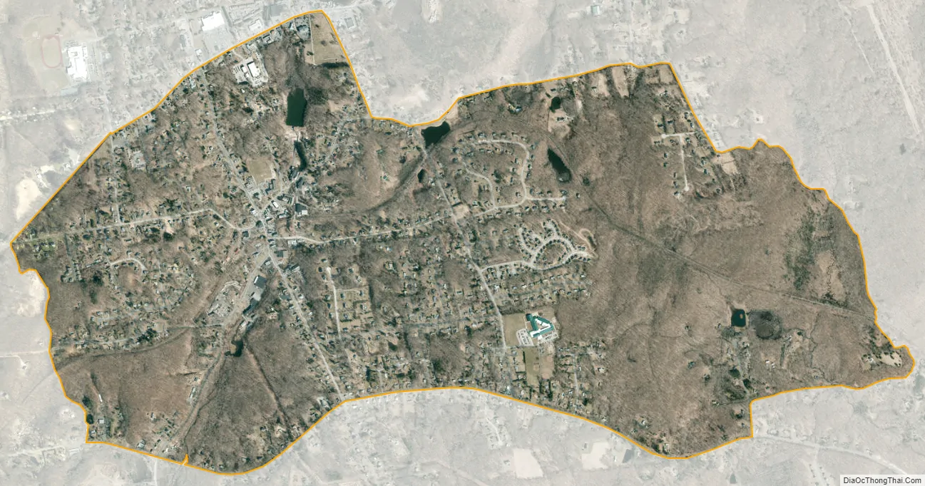
East Hampton city Satellite Map
See also
Map of Connecticut State and its subdivision: Map of other states:- Alabama
- Alaska
- Arizona
- Arkansas
- California
- Colorado
- Connecticut
- Delaware
- District of Columbia
- Florida
- Georgia
- Hawaii
- Idaho
- Illinois
- Indiana
- Iowa
- Kansas
- Kentucky
- Louisiana
- Maine
- Maryland
- Massachusetts
- Michigan
- Minnesota
- Mississippi
- Missouri
- Montana
- Nebraska
- Nevada
- New Hampshire
- New Jersey
- New Mexico
- New York
- North Carolina
- North Dakota
- Ohio
- Oklahoma
- Oregon
- Pennsylvania
- Rhode Island
- South Carolina
- South Dakota
- Tennessee
- Texas
- Utah
- Vermont
- Virginia
- Washington
- West Virginia
- Wisconsin
- Wyoming