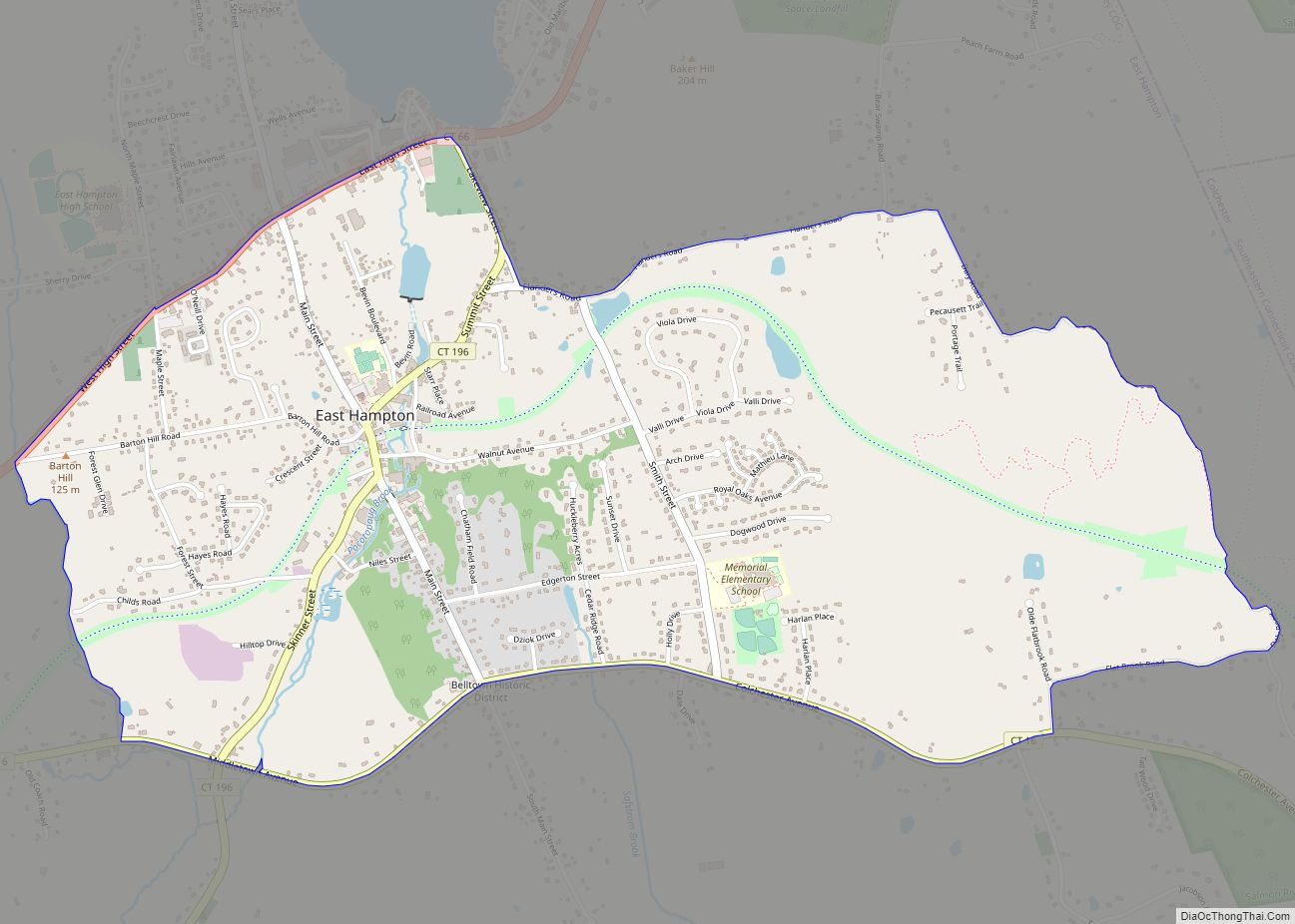
Lake Pocotopaug is an unincorporated village and census-designated place (CDP) in the town of East Hampton in Middlesex County, Connecticut, United States. As of the 2020 census, it had a population of 4,901, up from 3,436 in 2010.
It is named for the large local lake, which for years has been a popular resort area. The lake is surrounded by numerous homes. Most are year-round residences, although some summer cottages dot the shore. It is especially noted for two islands in its center, separated by a narrow, shallow strait (both of which have cabins).
| Name: | Lake Pocotopaug CDP |
|---|---|
| LSAD Code: | 57 |
| LSAD Description: | CDP (suffix) |
| State: | Connecticut |
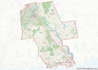
| County: | Middlesex County |
| Elevation: | 140 m (470 ft) |
| Total Area: | 16.30 km² (6.293 sq mi) |
| Land Area: | 14.22 km² (5.491 sq mi) |
| Water Area: | 2.08 km² (0.802 sq mi) |
| Total Population: | 4,901 |
| Population Density: | 344.6/km² (892.6/sq mi) |
| ZIP code: | 06424 (East Hampton) |
| Area code: | 860/959 |
| FIPS code: | 0941410 |
| GNISfeature ID: | 2377828 |
Online Interactive Map
Click on ![]() to view map in "full screen" mode.
to view map in "full screen" mode.
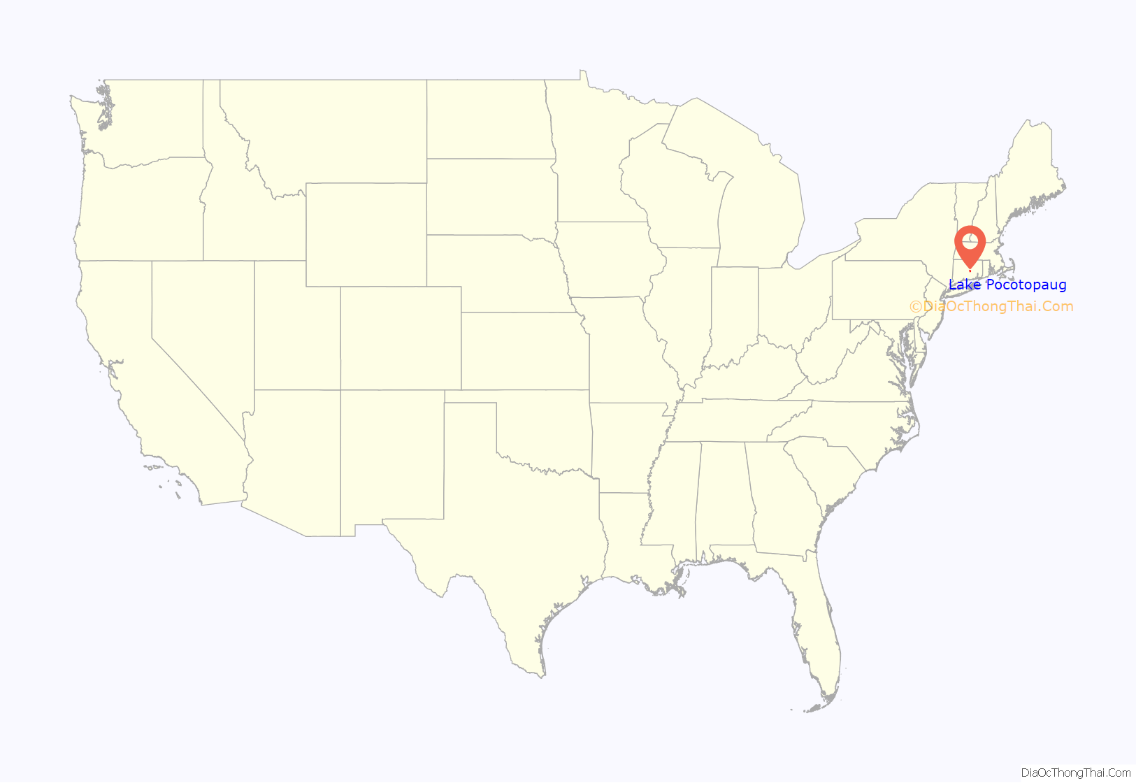
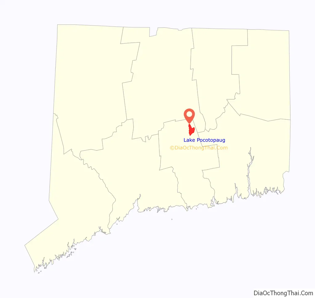
Lake Pocotopaug location map. Where is Lake Pocotopaug CDP?
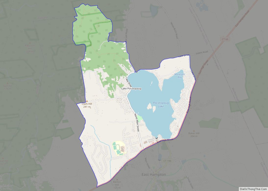
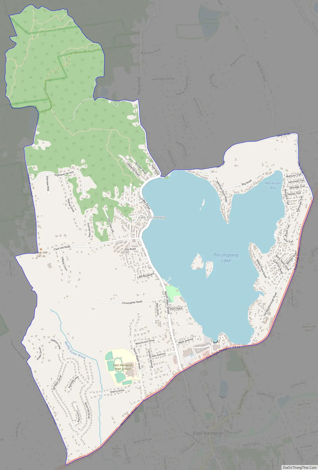
Lake Pocotopaug Road Map
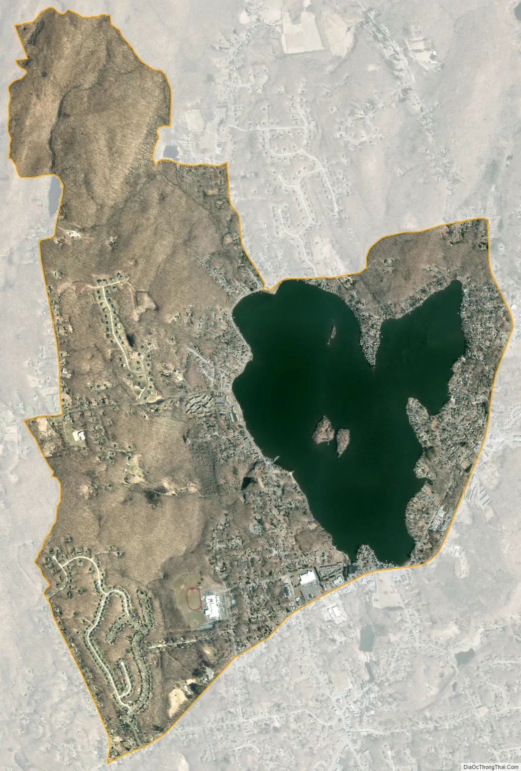
Lake Pocotopaug city Satellite Map
Geography
Lake Pocotopaug is in northeastern Middlesex County, in the northern part of the town of East Hampton. The Lake Pocotopaug CDP covers the lake and includes the surrounding highlands. It is bordered to the south by the village of East Hampton and to the west by Meshomasic State Forest.
According to the United States Census Bureau, the Lake Pocotopaug CDP has a total area of 6.3 square miles (16 km). 5.5 square miles (14 km) of it are land and 0.8 square miles (2.1 km) of it (12.74%) are water. The lake drains to the south into the village of East Hampton and continues down Pocotopaug Creek and Pine Brook into the Salmon River, a tributary of the Connecticut River.
See also
Map of Connecticut State and its subdivision: Map of other states:- Alabama
- Alaska
- Arizona
- Arkansas
- California
- Colorado
- Connecticut
- Delaware
- District of Columbia
- Florida
- Georgia
- Hawaii
- Idaho
- Illinois
- Indiana
- Iowa
- Kansas
- Kentucky
- Louisiana
- Maine
- Maryland
- Massachusetts
- Michigan
- Minnesota
- Mississippi
- Missouri
- Montana
- Nebraska
- Nevada
- New Hampshire
- New Jersey
- New Mexico
- New York
- North Carolina
- North Dakota
- Ohio
- Oklahoma
- Oregon
- Pennsylvania
- Rhode Island
- South Carolina
- South Dakota
- Tennessee
- Texas
- Utah
- Vermont
- Virginia
- Washington
- West Virginia
- Wisconsin
- Wyoming