Bethany Beach is an incorporated town in Sussex County, Delaware, United States. According to the 2010 Census Bureau figures, the population of the town is 1,060; however, during the summer months some 15,000 more populate the town as vacationers. It is part of the Salisbury, MD-DE Metropolitan Statistical Area.
Bethany Beach, South Bethany and Fenwick Island are popularly known as “The Quiet Resorts”. Contributing to Bethany Beach’s reputation as a “quiet” place is the presence of Delaware Seashore State Park immediately to the north of the town.
Despite its small size, Bethany Beach contains the usual attractions of a summer seaside resort, including the short Joseph Olson Boardwalk, a broad, sandy beach, motels, restaurants, and vacation homes. Because Bethany Beach does not sit on a barrier island, residential areas continue some distance to the west of the town’s limits.
| Name: | Bethany Beach town |
|---|---|
| LSAD Code: | 43 |
| LSAD Description: | town (suffix) |
| State: | Delaware |
| County: | Sussex County |
| Incorporated: | July 1, 1901 |
| Elevation: | 7 ft (2 m) |
| Total Area: | 1.16 sq mi (3.01 km²) |
| Land Area: | 1.15 sq mi (2.97 km²) |
| Water Area: | 0.01 sq mi (0.04 km²) |
| Total Population: | 954 |
| Population Density: | 831.01/sq mi (320.78/km²) |
| ZIP code: | 19930 |
| Area code: | 302 |
| FIPS code: | 1005690 |
| GNISfeature ID: | 213638 |
| Website: | http://www.townofbethanybeach.com |
Online Interactive Map
Click on ![]() to view map in "full screen" mode.
to view map in "full screen" mode.
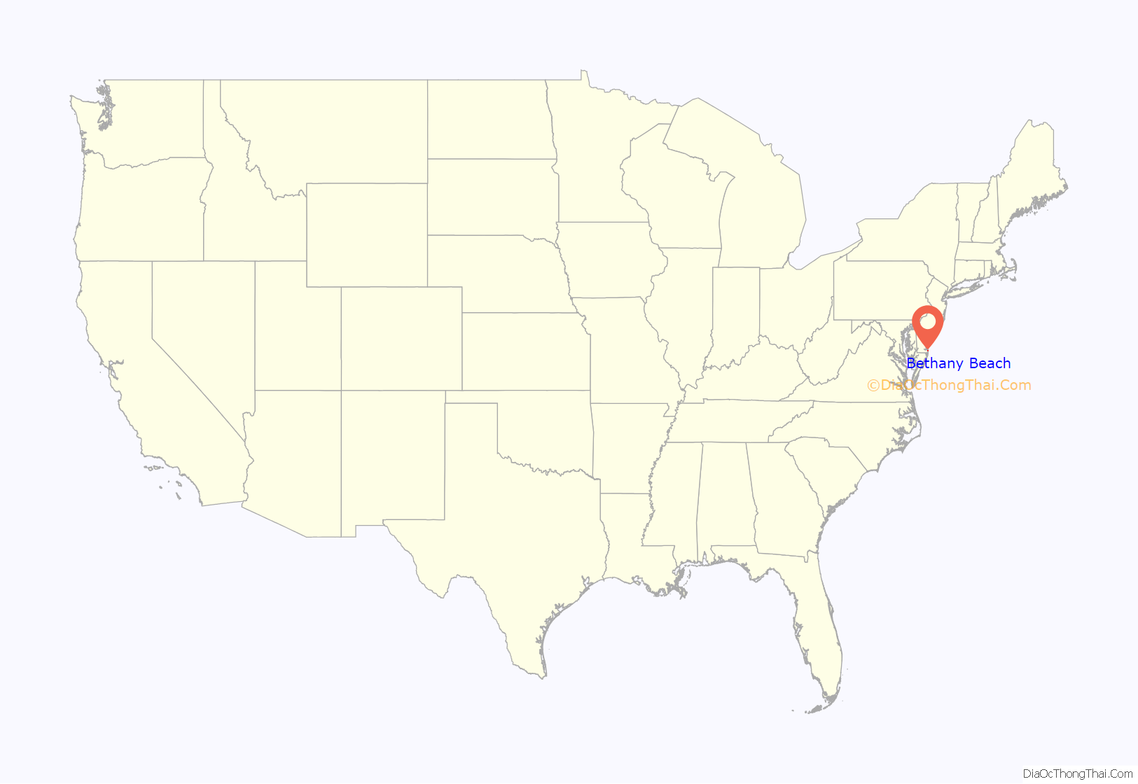
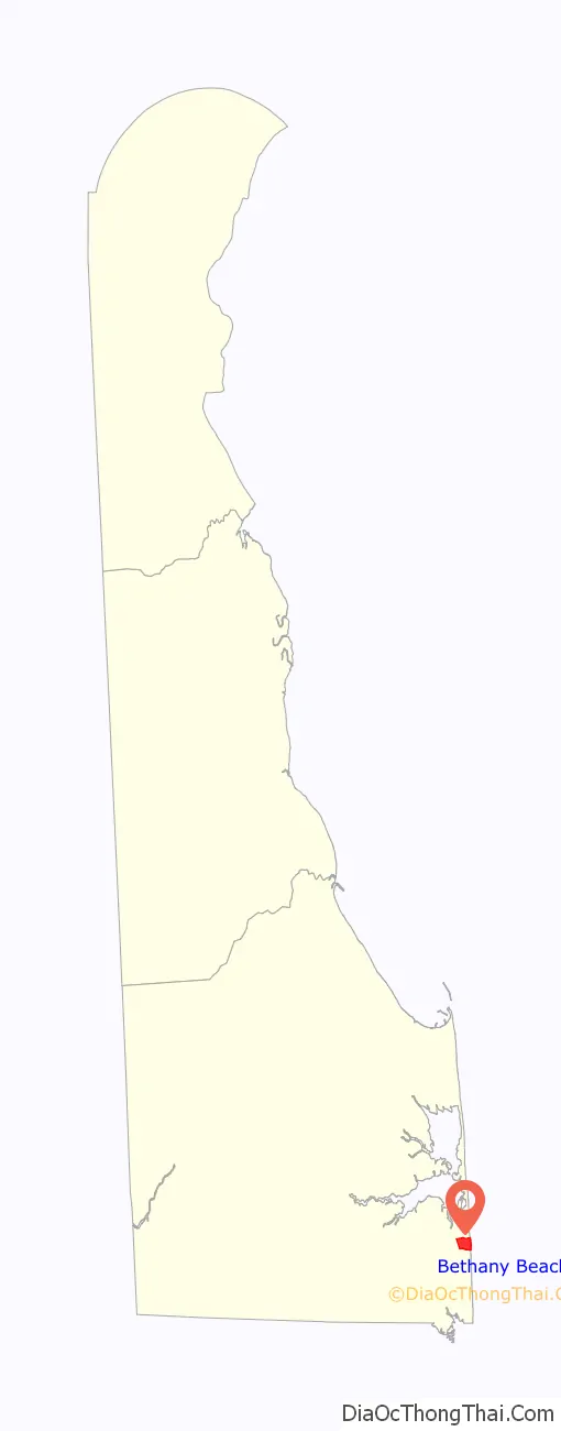
Bethany Beach location map. Where is Bethany Beach town?
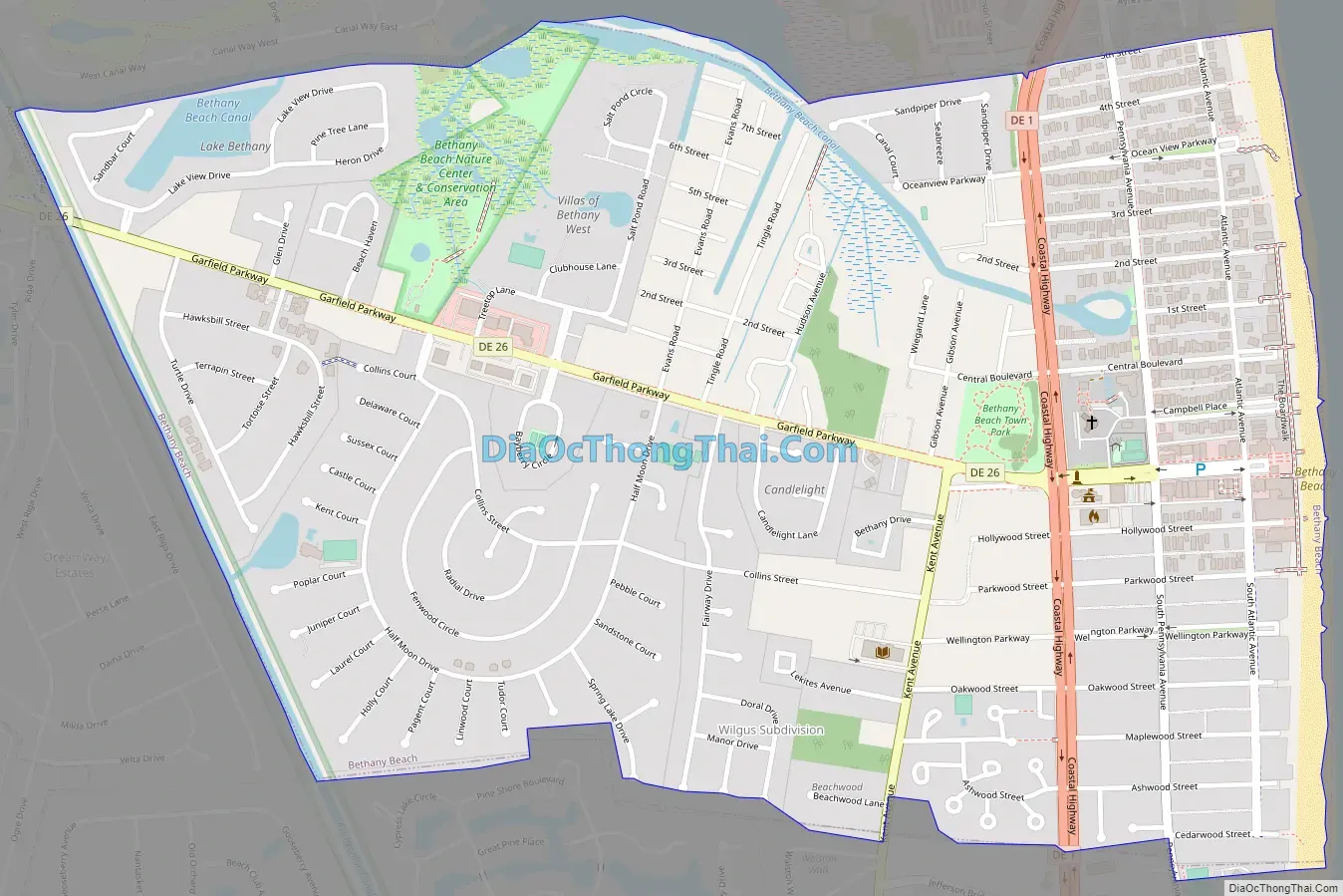
Bethany Beach Road Map
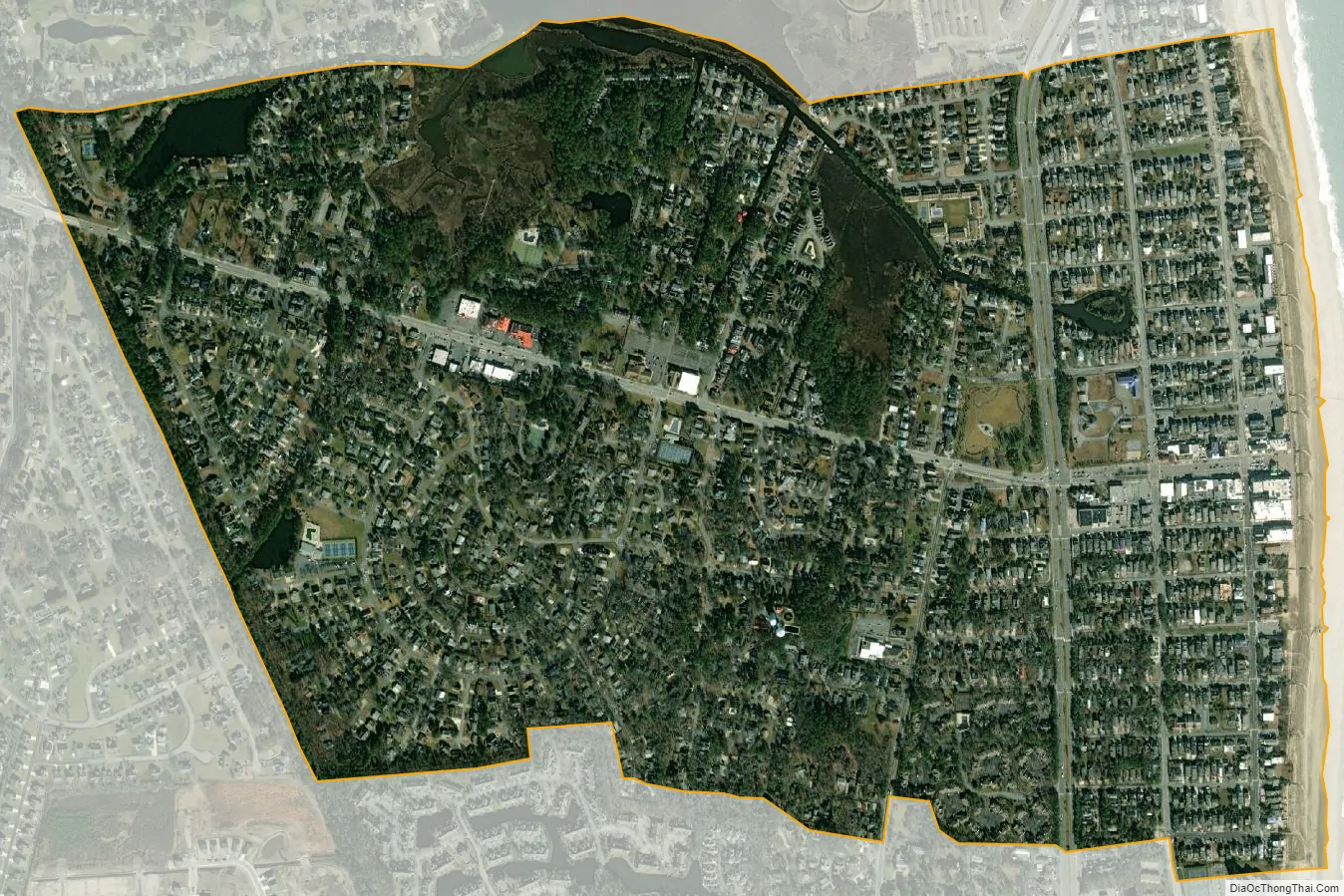
Bethany Beach city Satellite Map
Geography
Bethany Beach is located at 38°32′22″N 75°03′19″W / 38.53944°N 75.05528°W / 38.53944; -75.05528 (38.5395564, −75.0551807). The town is bordered to the north by the Delaware Seashore State Park and by Salt Pond, to the east by the Atlantic Ocean, to the south by South Bethany, and to the west by Ocean View.
According to the United States Census Bureau, the town has a total area of 1.2 square miles (3.1 km), of which 1.1 square miles (2.8 km) is land and 0.04 square miles (0.10 km) (1.71%) is water.
Beaches
The town is bordered to the east completely by free public beaches, all guarded seasonally by professional lifeguards known as the Bethany Beach Patrol. The beach patrol, which consists of 30 members, is on duty daily from Memorial Day weekend to Labor Day and on weekends in September. Within Bethany Beach, there is a half-mile area of private beachfront owned by Sea Colony.
Bethany Beach contains many forms of wildlife, including sand sharks
A view of the beach in Bethany Beach
Climate
The climate in this area is characterized by hot, humid summers and generally mild to cool winters. According to the Köppen Climate Classification system, Bethany Beach has a humid subtropical climate, abbreviated “Cfa” on climate maps.
Communities
- Cotton Patch Hills
See also
Map of Delaware State and its subdivision: Map of other states:- Alabama
- Alaska
- Arizona
- Arkansas
- California
- Colorado
- Connecticut
- Delaware
- District of Columbia
- Florida
- Georgia
- Hawaii
- Idaho
- Illinois
- Indiana
- Iowa
- Kansas
- Kentucky
- Louisiana
- Maine
- Maryland
- Massachusetts
- Michigan
- Minnesota
- Mississippi
- Missouri
- Montana
- Nebraska
- Nevada
- New Hampshire
- New Jersey
- New Mexico
- New York
- North Carolina
- North Dakota
- Ohio
- Oklahoma
- Oregon
- Pennsylvania
- Rhode Island
- South Carolina
- South Dakota
- Tennessee
- Texas
- Utah
- Vermont
- Virginia
- Washington
- West Virginia
- Wisconsin
- Wyoming


