Ellendale is a town in Sussex County, Delaware, United States. The population was 487 at the 2020 census, an increase of 27.8% since the 2010 census, and a 48.9% increase since the year 2000. It is part of the Salisbury, Maryland-Delaware Metropolitan Statistical Area. Ellendale is the “Gateway to Delaware’s Resort Beaches” because it is the town located on U.S. Route 113, the resort area’s westernmost border, and Delaware Route 16, the resort area’s northernmost border with the eastern border being the Delaware Bay and Atlantic Ocean and the southern border being the state line with Maryland.
| Name: | Ellendale town |
|---|---|
| LSAD Code: | 43 |
| LSAD Description: | town (suffix) |
| State: | Delaware |
| County: | Sussex County |
| Incorporated: | March 30, 1905 |
| Elevation: | 49 ft (15 m) |
| Total Area: | 0.42 sq mi (1.10 km²) |
| Land Area: | 0.42 sq mi (1.10 km²) |
| Water Area: | 0.00 sq mi (0.00 km²) |
| Total Population: | 487 |
| Population Density: | 1,145.88/sq mi (442.65/km²) |
| ZIP code: | 19941 |
| Area code: | 302 |
| FIPS code: | 1024020 |
| GNISfeature ID: | 213934 |
| Website: | ellendale.delaware.gov |
Online Interactive Map
Click on ![]() to view map in "full screen" mode.
to view map in "full screen" mode.
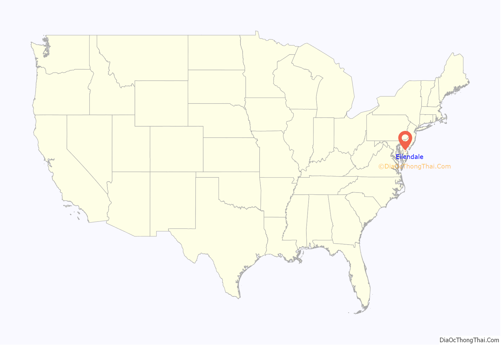
Ellendale location map. Where is Ellendale town?

History
Early history
Ellendale started as a forest and swamp on the divide between the Chesapeake Bay and Delaware Bay. The swamp was the hunting grounds of the Nanticoke Indian Tribe until they were driven out by the Lenni Lenape Tribe on the Battle Green near Chestnut Ridge, a hill on Ellendale’s north side. The Lenape Trace, a main thoroughfare of a trail, passed through Ellendale as a Native American trade route from Pocomoke City, Maryland to Marcus Hook, Pennsylvania. With the arrival of Europeans, the Ellendale area was a province of fur traders and hunters. Early in the 18th century, farming and timbering pushed back the swamp that once covered the area. The tract of land on which the town would later be built was originally deeded in 1740 as “Bennett’s Pleasure”.
The Black Camp Insurrection
The “Nanticoke Swamp,” as the Ellendale Swamp was then called, was depicted as a place where criminals routinely hid from the law in the depositions of a 1759 murder that occurred. One of the main causes being the issue of jurisdiction as both Maryland and Delaware were in a boundary dispute and claimed the area. The Ellendale Swamp became a refuge for Loyalists at the time of the 1780 Black Camp Insurrection during the American Revolution. Harold Hancock describes the insurrection in his History of Sussex County: “With the removal of the British from Philadelphia in the spring of 1778, the number of enemy vessels in Delaware Bay decreased, and the activities of Sussex County Tories diminished. Only one other insurrection in Sussex County occurred – the famous Black Camp Rebellion of 1780. The insurrectionists were mainly from Cedar Creek and Slaughter Neck Hundred, and their headquarters were in a swamp about six miles (10 km) north of Georgetown. Their leaders, Bartholomew Banynum (Banum) and William Dutton, had about 400 men formed in “Associations” or militia companies. An investigator reported the causes as follows: ‘Some of these ignorant people were for opposing all law, others for establishing what they called the King’s Laws – and others for opposing the payment of taxes – but generally seem to have believed that all to the southward of Chesapeake Bay had laid down their arms and submitted to the King’s Laws – and that they should very easy make Sussex County do the same.’
Militia from Kent County dispersed the insurrectionists. Some were sent off to serve in the Continental Army, and thirty-seven were indicted for treason in the State Supreme Court. Eight were ordered to be hanged ‘by the neck but not till you be dead, for then your bowels must be taken out and burnt before your face, then your head must be severed from your body, and your body divided into four Quarters, and these must be at the disposal of the Supreme Authority in the State. Fortunately this sentence which was customary for treason was not carried out, and all the participants were pardoned by the General Assembly on November 4, 1780.”
There were two small villages in the area of Ellendale’s current location by 1790. They were Fleatown (or Federalsburg) to the north, and New Market to the east, both of which later became ghost towns with the establishment of Ellendale.
19th Century
In the Federal era, the Old State Road was built to connect the newly founded county seat of Georgetown with the state capital of Dover. With emancipation, African Americans took up free lives in the area and the railroads came after the American Civil War. Ellendale was founded in the early 19th century and surveyed in 1866–1867. Ellendale was first settled near the Morris Tavern Crossroads, near the current Old State Road and Main Street intersection, by a handful of families. The town is rumored to be named after either the daughter of Whig Republican Alfred Short, a state legislator, the wife of Dr. John S. Prettyman who laid out the town, or the daughter of Mr. Thomas William Dale, the chief engineer of the railroad survey team. Ellendale’s current site was established in 1866 when the families moved east to settle around the Junction and Breakwater Railroad Depot. On July 16, 1873 the Ellendale Methodist Episcopal Church purchased land to erect a church, parsonage, and school. Ellendale’s economy rapidly advanced as the RJ Clendaniel Sawmill, the Jester & Reed Canning Company, a brick yard, several peach evaporating and canning companies, basket factory, the Phillip J Ritter Ketchup Company, Ellendale Excelsior Company, and button factory opened in the town. The railroad was purchased by the Pennsylvania Railroad in 1905 and that same year the town was formally incorporated. In February 1895, the Queen Anne’s Railroad was authorized by the Delaware legislature to extend its rail lines across the state to Lewes. The goal of the company was to establish a direct link between Baltimore and Delaware’s coastal resorts. This additional rail line passed through Ellendale and provided passenger, freight, and mail services as far west as Queenstown, Maryland (with links to Baltimore via steamship) and east to Rehoboth Beach (with links to Cape May, New Jersey via steamship) with the first passenger trains passing through in 1897. A post office was erected, with a large second floor room that was used by the Independent Order of Red Men, a break off group of the Improved Order of Red Men that was established in the town, at the site of what is now the Town Hall.
20th Century to Present
In 1918, the DuPont Highway (now known as DuPont Boulevard and U.S. 113) was completed. While this was seen as a great boon to the town, it would eventually lead to the decline of the railroad and the town’s economy, leading to the closing of all the towns factories. In May 1920, after several fires in the town, the Town Council met to establish a fire department to protect the citizens and businesses of Ellendale and surrounding communities. The newly formed fire department purchased a Ford Model T fire truck for $1400 from the Viscose Silk Company in Marcus Hook, Pennsylvania. The formation of a police department followed soon after with the town of Ellendale hiring its first police officer, William Bennett, in June 1921.
New schools were built in the 1920s. In 1920, the Ellendale School 125 was built in the International style on Main Street on the towns west side, and the Ellendale Colored School 195C, was built between 1922-1925 on North Old State Road after funding was provided by the DuPont family. By the middle of the 1920s, with profits declining and competition for its other lines increasing, the Pennsylvania Railroad decided to abandon a large portion of the railway. The Denton, Maryland to Lewes section was purchased by the Maryland & Delaware Coast Railway, but with the decline of the locomotive as vehicle traffic increased, the line was again scheduled to be abandoned in 1931. The state of Delaware eventually purchased the portion of the line from Ellendale to Milton to maintain a freight link, making this section the last operable section of one that once spanned over 100 miles (160 km). Over sixty residents of Ellendale served in World War I, World War II, the Korean War, and Vietnam War.
In 1927 the Lincoln and Ellendale Electric Company was established bringing electricity to the residents of the town for the first time. Also in 1927 the Ellendale State Forest was established by the State Highway Department. When it was turned over to the State Forestry Department in 1932, it totalled 40 acres (160,000 m), today it has been expanded and combined with the Redden State Forest to well over 5,000 acres (20 km). The Appenzeller Tract in Ellendale, a small 45-acre (180,000 m) section, was a gift to the state from the DuPont family. A large woods fire between Ellendale, Georgetown, and Milton burned over 38,000 acres (150 km) in 1930 and forced the General Assembly to pass a series of forest protection laws establishing a fire control system which included building a 120-foot (37 m) fire tower just outside Ellendale to alert people of fires.
In the 1950s, numerous school districts in Kent and Sussex Counties, including Ellendale, continued to fight against desegregation after the ruling of Brown v. Board of Education. The protests which begin at the Milford School District, eventually bringing about a lawsuit that went to the Delaware Supreme Court which ruled that while segregation was unconstitutional, it did not require immediate desegregation. This was further bolstered by the findings of Griffin v. County School Board of Prince Edward County. Bryant Bowles, President of the National Association for the Advancement of White People led several anti-desegregation rallies and boycotts in the area, including Ellendale, that resulted in decreased attendance at the schools. Ellendale School 125 and Ellendale Colored School 195C reached an agreement on consolidation, but attorney Louis L. Redding complained to the Department of Public Instruction that black teachers were being subjected to scrutiny that their white counterparts were not. After desegregation, all students were educated at Ellendale School 125.
The Ellendale Town Council reorganized a police department in the 1970s. Due to fiscal constraints, the department was shut down again in the 1980s. After being restarted in the 1990s, the economic crash that started with the housing crisis caused Congress to cut funding to community policing grants and the town was forced to cut its department down to one part-time officer.
On September 27, 2008 the town of Ellendale passed its first annexation vote, 69 for to 37 against, since the town was incorporated in 1905. The 5-acre (20,000 m) parcel at the corner of Main Street and South Old State Road will be used for commercial purposes.
The Ellendale State Forest Picnic Facility and Teddy’s Tavern are listed on the National Register of Historic Places.
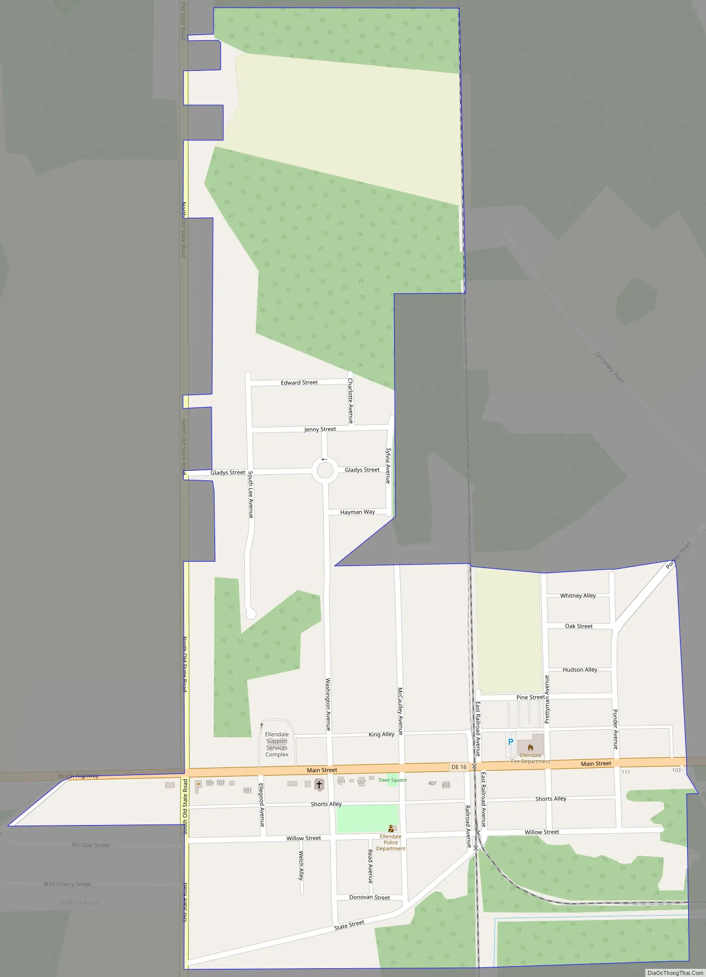
Ellendale Road Map
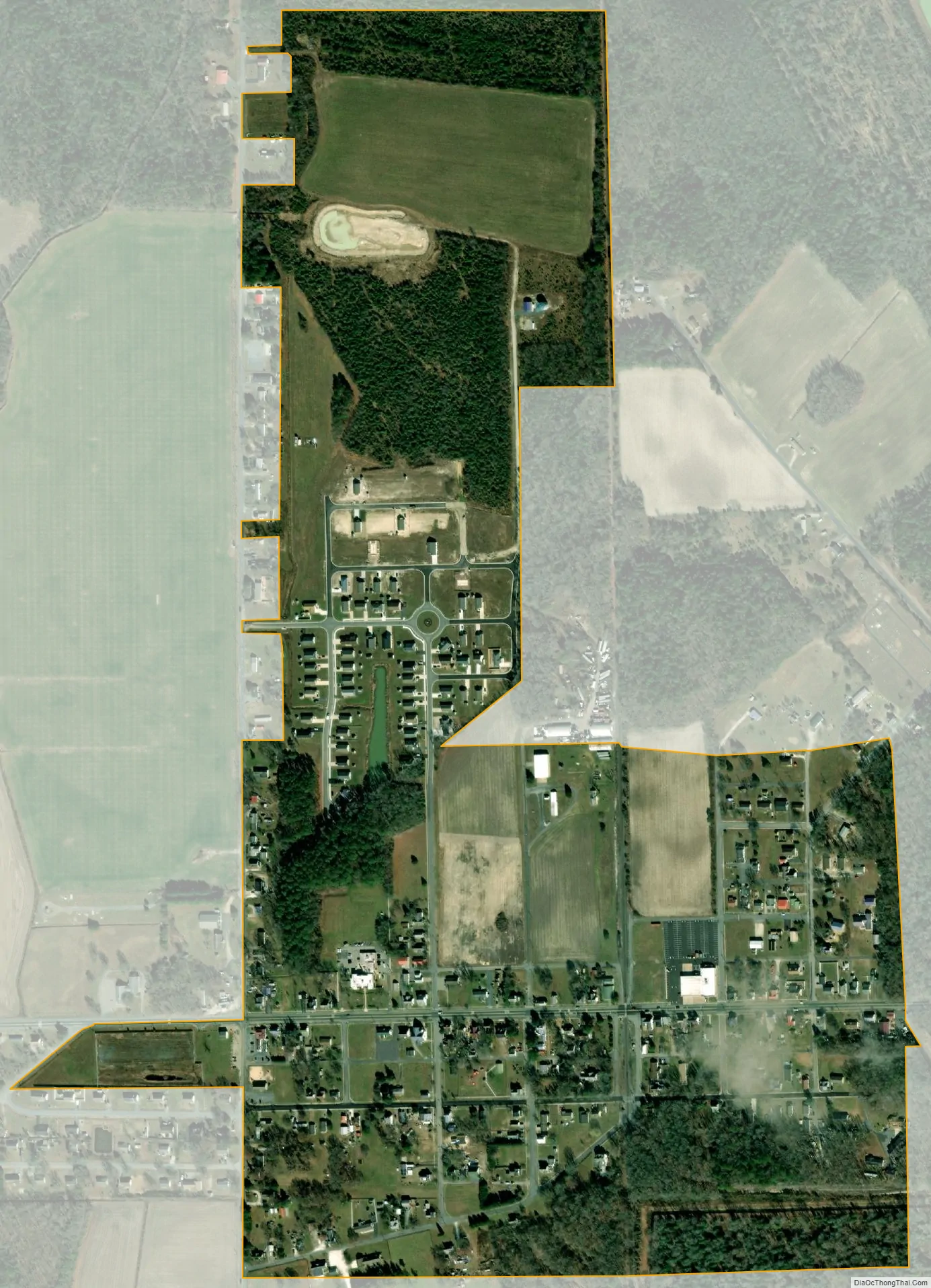
Ellendale city Satellite Map
Geography
Ellendale is located at 38°48′25″N 75°25′22″W / 38.8070575°N 75.4226971°W / 38.8070575; -75.4226971.
According to the United States Census Bureau, the town has a total area of 0.2 square mile (0.6 km), all land.
See also
Map of Delaware State and its subdivision: Map of other states:- Alabama
- Alaska
- Arizona
- Arkansas
- California
- Colorado
- Connecticut
- Delaware
- District of Columbia
- Florida
- Georgia
- Hawaii
- Idaho
- Illinois
- Indiana
- Iowa
- Kansas
- Kentucky
- Louisiana
- Maine
- Maryland
- Massachusetts
- Michigan
- Minnesota
- Mississippi
- Missouri
- Montana
- Nebraska
- Nevada
- New Hampshire
- New Jersey
- New Mexico
- New York
- North Carolina
- North Dakota
- Ohio
- Oklahoma
- Oregon
- Pennsylvania
- Rhode Island
- South Carolina
- South Dakota
- Tennessee
- Texas
- Utah
- Vermont
- Virginia
- Washington
- West Virginia
- Wisconsin
- Wyoming


