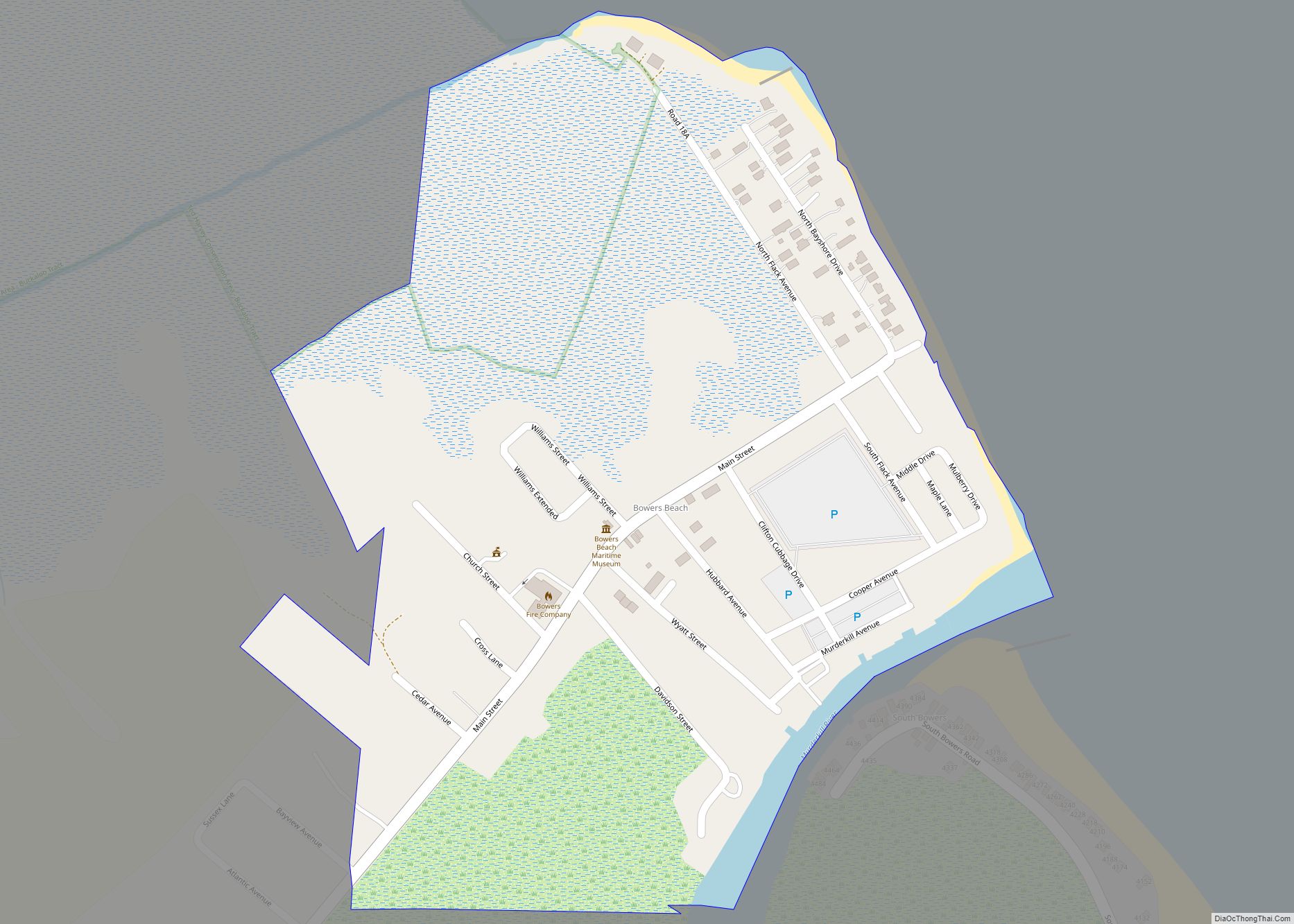
Bowers (commonly known as Bowers Beach) is a town in Kent County, Delaware, United States. It is part of the Dover, Delaware Metropolitan Statistical Area. According to the 2020 census, its population was 278.
| Name: | Bowers town |
|---|---|
| LSAD Code: | 43 |
| LSAD Description: | town (suffix) |
| State: | Delaware |
| County: | Kent County |
| Elevation: | 3 ft (0.9 m) |
| Total Area: | 0.32 sq mi (0.83 km²) |
| Land Area: | 0.31 sq mi (0.81 km²) |
| Water Area: | 0.01 sq mi (0.02 km²) |
| Total Population: | 278 |
| Population Density: | 893.89/sq mi (344.63/km²) |
| ZIP code: | 19946 |
| Area code: | 302 |
| FIPS code: | 1007250 |
| GNISfeature ID: | 213692 |
| Website: | bowersbeach.delaware.gov |
Online Interactive Map
Click on ![]() to view map in "full screen" mode.
to view map in "full screen" mode.
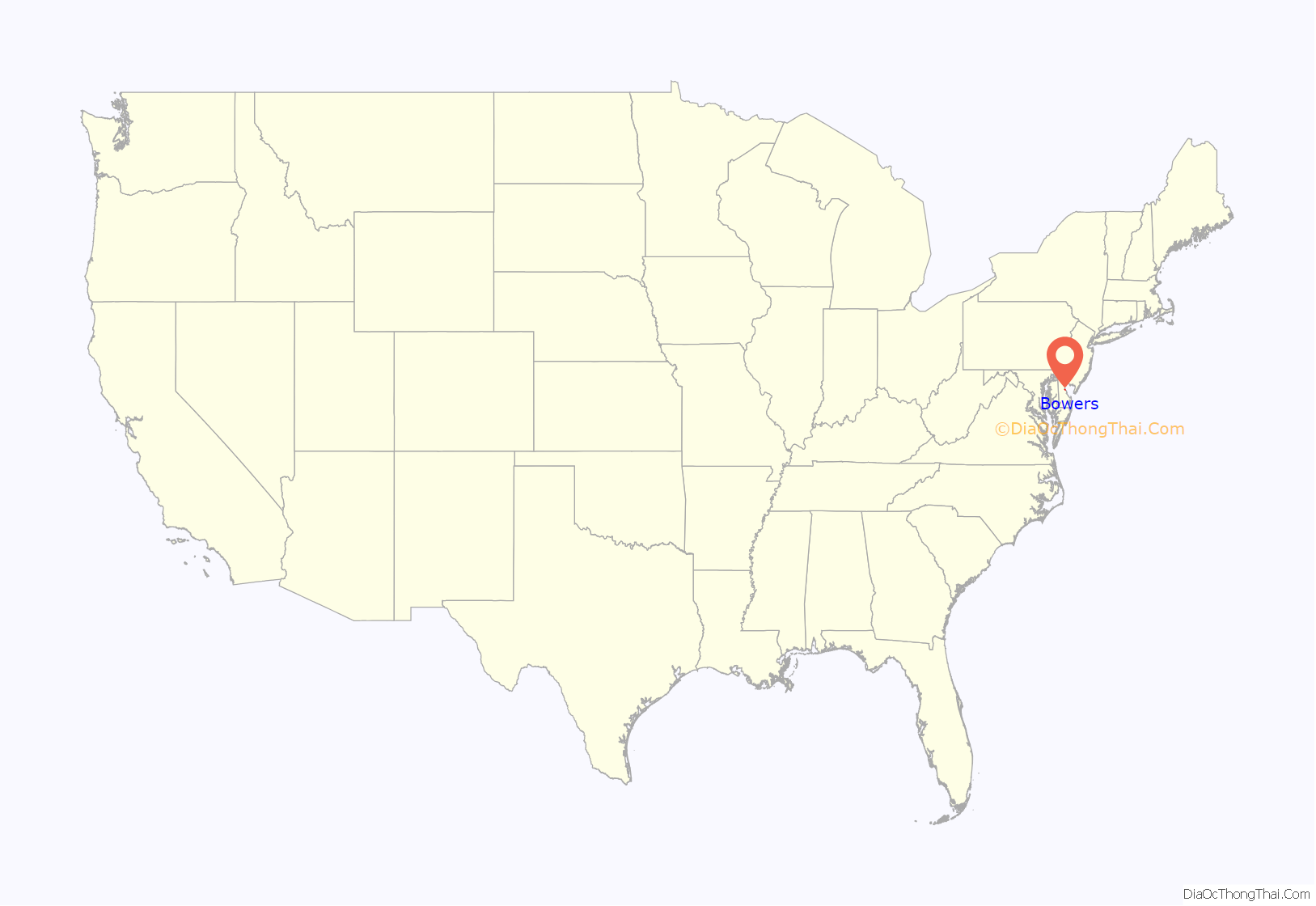
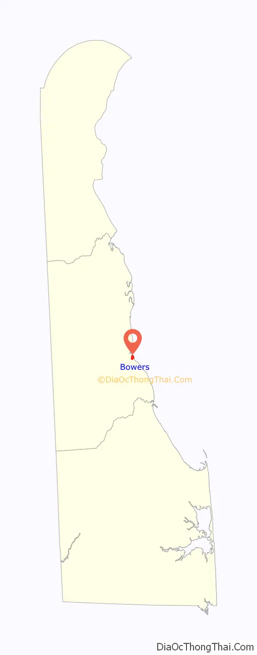
Bowers location map. Where is Bowers town?
History
Bowers Beach was originally settled in the late 1600s and was named Whitwell’s Delight by Francis Whitwell. The land was acquired by William Frampton in 1685 and was called Dover Peers. After Frampton died, the land was sold to William Bassett. Eventually, 420 acres of Whitwell’s Delight belonged to Nathaniel and Mary Hunn. After Nathaniel Hunn died in 1734, his children sold the land to John Bowers and the land along the Delaware Bay between the St. Jones River and Murderkill River became known as Bowers Beach starting on August 16, 1734. The land later belonged to John Bowers’ son and then his granddaughter, with the latter being the last person in the Bowers family to own the land. Part of the land was acquired by John Booth in 1750, who sold it later in the year to Benjamin Chew. By the 1800s, the properties in Bowers Beach were owned by Joseph Wood. The properties were later sold to multiple owners.
Bowers’ population was 150 in 1890, and was 146 in 1900.
On March 9, 1907, Bowers was incorporated. In 1962, the settlement was reincorporated as the Town of Bowers.
Throughout its history, Bowers Beach was a major fishing town along the Delaware Bay and once saw an average of 300 boats at the docks. Today, people come to Bowers Beach for fishing, swimming, birdwatching, kayaking, sailing, and the beaches along the Delaware Bay.
The Fourteen Foot Bank Light and Saxton United Methodist Church are listed on the National Register of Historic Places.
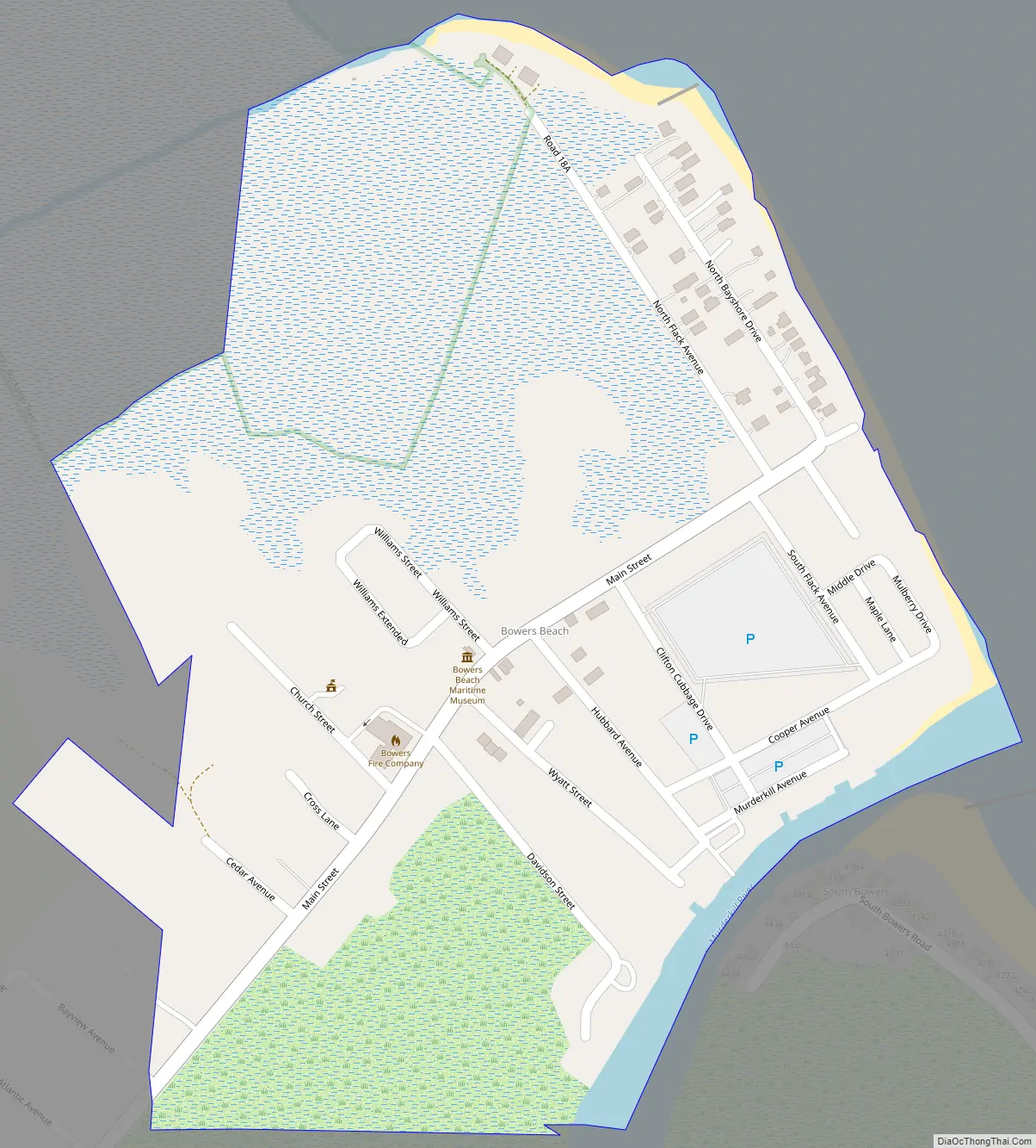
Bowers Road Map
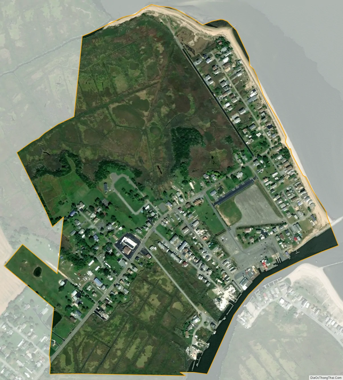
Bowers city Satellite Map
Geography
According to the United States Census Bureau, the town has a total area of 0.3 square miles (0.78 km), of which 0.3 square miles (0.78 km) is land and 3.33% is water.
Bowers Beach is situated along the Delaware Bay between the St. Jones River to the north and the Murderkill River to the south.
See also
Map of Delaware State and its subdivision: Map of other states:- Alabama
- Alaska
- Arizona
- Arkansas
- California
- Colorado
- Connecticut
- Delaware
- District of Columbia
- Florida
- Georgia
- Hawaii
- Idaho
- Illinois
- Indiana
- Iowa
- Kansas
- Kentucky
- Louisiana
- Maine
- Maryland
- Massachusetts
- Michigan
- Minnesota
- Mississippi
- Missouri
- Montana
- Nebraska
- Nevada
- New Hampshire
- New Jersey
- New Mexico
- New York
- North Carolina
- North Dakota
- Ohio
- Oklahoma
- Oregon
- Pennsylvania
- Rhode Island
- South Carolina
- South Dakota
- Tennessee
- Texas
- Utah
- Vermont
- Virginia
- Washington
- West Virginia
- Wisconsin
- Wyoming